|
Meuse
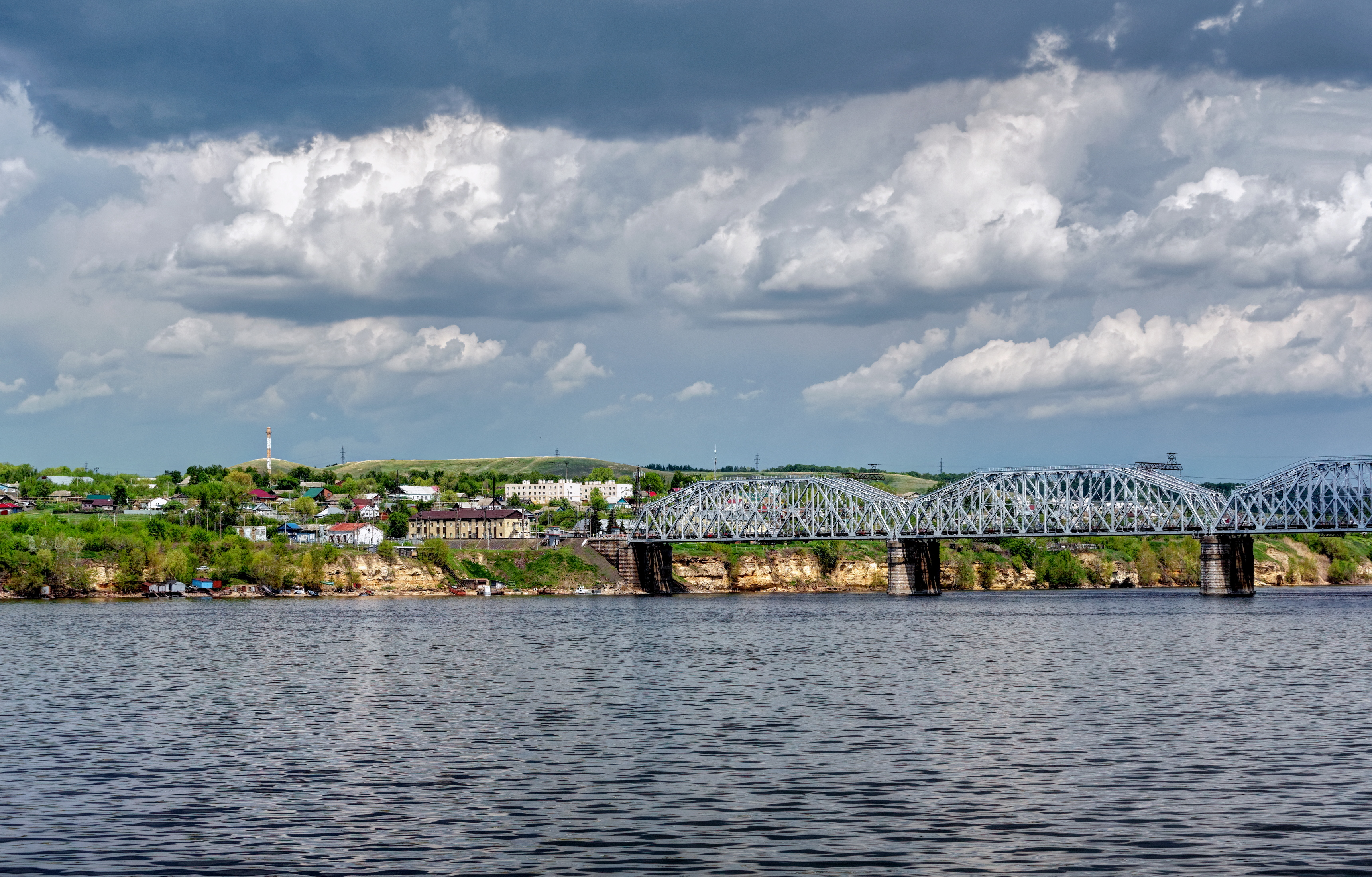
The Meuse or Maas is a major European river, rising in France and flowing through Belgium and the Netherlands before draining into the North Sea from the Rhine–Meuse–Scheldt delta. It has a total length of . History From 1301, the upper Meuse roughly marked the western border of the Holy Roman Empire with the France in the Middle Ages, Kingdom of France, after Count Henry III, Count of Bar, Henry III of Bar had to receive the western part of the County of Bar (''Barrois mouvant'') as a French fief from the hands of King Philip IV of France, Philip IV. In 1408, a Burgundian army led by John the Fearless went to the aid of John III, Duke of Bavaria, John III against the citizens of Liège, who were in open revolt. After the Battle of Othée, battle, which saw the men from Liège defeated, John ordered the drowning in the Meuse of burghers and noblemen in Liège whose loyalties he suspected. The border remained relatively stable until the annexation of the Three Bishoprics ... [...More Info...] [...Related Items...] OR: [Wikipedia] [Google] [Baidu] |
Maastricht
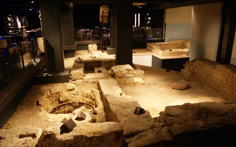
Maastricht ( , , ; ; ; ) is a city and a Municipalities of the Netherlands, municipality in the southeastern Netherlands. It is the capital city, capital and largest city of the province of Limburg (Netherlands), Limburg. Maastricht is located on both sides of the Meuse (), at the point where the river is joined by the Jeker. Mount Saint Peter (''Sint-Pietersberg'') is largely situated within the city's municipal borders. Maastricht is adjacent to the border with Belgium and is part of the Meuse-Rhine Euroregion, an international metropolis with a population of about 3.9 million, which includes the nearby German and Belgian cities of Aachen, Liège, and Hasselt. Maastricht developed from a Roman Republic, Roman settlement (''Trajectum ad Mosam'') to a medieval river trade and religious centre. In the 16th century it became a garrison town and in the 19th century an early industrial centre. Today, the city is a thriving cultural and regional hub. It became well known through ... [...More Info...] [...Related Items...] OR: [Wikipedia] [Google] [Baidu] |
Rhine–Meuse–Scheldt Delta
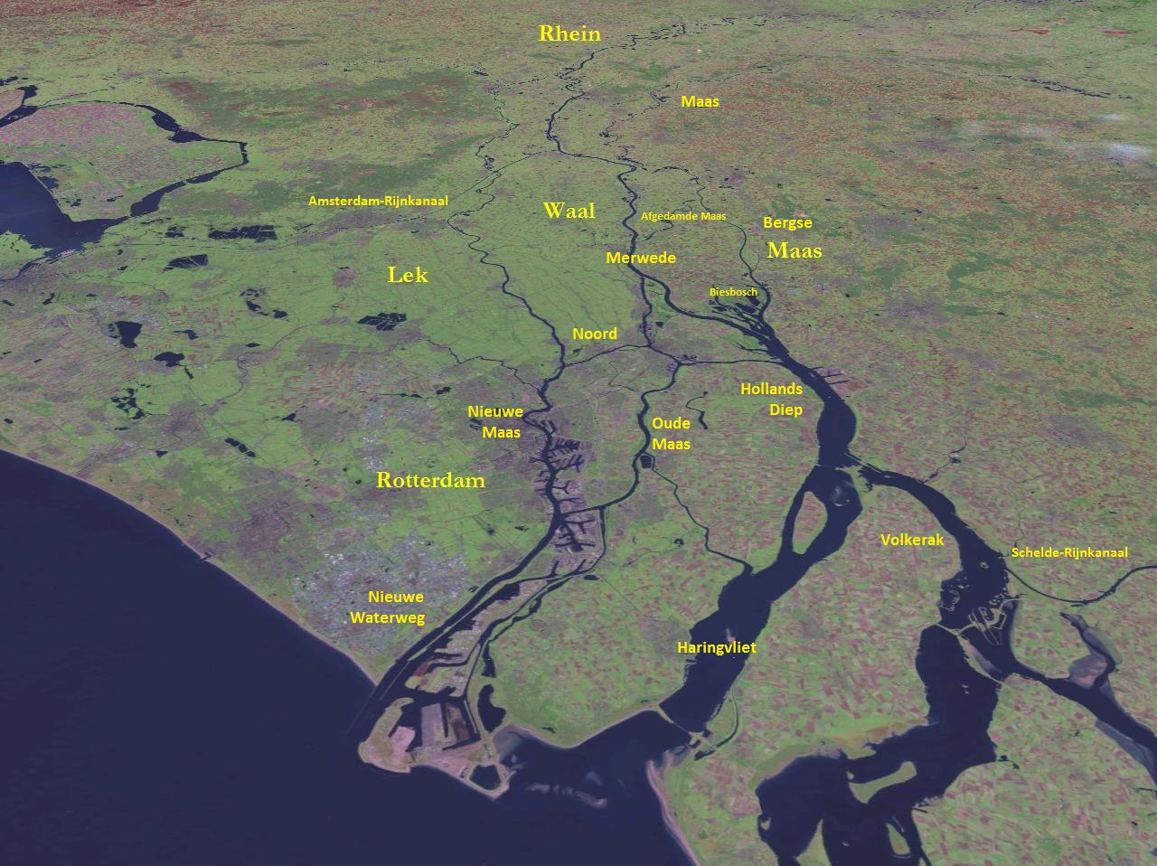
The Rhine–Meuse–Scheldt delta is a river delta in the Netherlands formed by the confluence of the Rhine, the Meuse () and the Scheldt rivers. In some cases, the Scheldt delta is considered a separate delta to the Rhine–Meuse delta. The result is a multitude of islands, branches and branch names, in which a waterway that appears to be one continuous stream may have numerous separate names for different sections, e.g. Rhine → Bijlands Kanaal → Pannerdens Kanaal → Nederrijn → Lek → Nieuwe Maas → Het Scheur → Nieuwe Waterweg. Since the Rhine contributes most of the water, the term "Rhine Delta" is commonly used, although this name is also used for the delta where the Alpine Rhine flows into Lake Constance. By some calculations, the Rhine–Meuse–Scheldt delta covers , making it the largest in Europe. The Rhine–Meuse–Scheldt delta is economically extremely important, since the three rivers are major navigable waterways. The delta is the entrance f ... [...More Info...] [...Related Items...] OR: [Wikipedia] [Google] [Baidu] |
Verdun (Meuse)
Verdun ( , ; ; ; official name before 1970: Verdun-sur-Meuse) is a city in the Meuse department in Grand Est, northeastern France. It is an arrondissement of the department. In 843, the Treaty of Verdun, which divided the Carolingian Empire into three kingdoms—considered the foundation of Germany and France—was signed there. An episcopal principality of the Holy Roman Empire since the 10th century, Verdun was subjugated by France in 1552, during the "Voyage to Austrasia". Along with the other free cities of the Empire, Metz and Toul, it formed the province of the Three Bishoprics, which was attached to the Kingdom of France in 1648 by the Treaty of Münster. Verdun is the biggest city in Meuse, although the capital of the department is Bar-le-Duc, which is slightly smaller than Verdun. It is well known for giving its name to the longest battle in modern history in the First World War. Geography Verdun is situated on both banks of the river Meuse, in the northern par ... [...More Info...] [...Related Items...] OR: [Wikipedia] [Google] [Baidu] |
Liège
Liège ( ; ; ; ; ) is a City status in Belgium, city and Municipalities in Belgium, municipality of Wallonia, and the capital of the Liège Province, province of Liège, Belgium. The city is situated in the valley of the Meuse, in the east of Belgium, not far from borders with the Netherlands (Maastricht is about to the north) and with Germany (Aachen is about north-east). In Liège, the Meuse meets the river Ourthe. The city is part of the ''sillon industriel'', the former industrial backbone of Wallonia. It still is the principal economic and cultural centre of the region. The municipality consists of the following Deelgemeente, sub-municipalities: Angleur, Bressoux, Chênée, Glain, Grivegnée, Jupille-sur-Meuse, Liège proper, Rocourt, Liège, Rocourt, and Wandre. In November 2012, Liège had 198,280 inhabitants. The metropolitan area, including the outer commuter zone, covers an area of 1,879 km2 (725 sq mi) and had a total population of 749,110 on 1 January 2008. ... [...More Info...] [...Related Items...] OR: [Wikipedia] [Google] [Baidu] |
Dinant
Dinant () is a City status in Belgium, city and Municipalities in Belgium, municipality of Wallonia located in the Namur Province, province of Namur, Belgium. On the shores of river Meuse, in the Ardennes, it lies south-east of Brussels, south-east of Charleroi and south of the city of Namur. Dinant is situated north of the border with France. The municipality consists of the following Deelgemeente#Belgium, districts: Anseremme, Bouvignes-sur-Meuse, Dinant, Dréhance, Falmagne, Falmignoul, Foy-Notre-Dame, Furfooz, Lisogne, Sorinnes and Thynes. Geography Dinant is positioned in the Upper Meuse valley, at a point where the river cuts deeply into the western Condroz, Condroz plateau. Sited in a steep-sided valley, between the rock face and the river, the original settlement had little space in which to grow away from the river, and it therefore expanded into a long, thin town, on a north–south axis, along the river shore. During the 19th century, the former ''Île des Batteu ... [...More Info...] [...Related Items...] OR: [Wikipedia] [Google] [Baidu] |
Namur
Namur (; ; ) is a city and municipality in Wallonia, Belgium. It is the capital both of the province of Namur and of Wallonia, hosting the Parliament of Wallonia, the Government of Wallonia and its administration. Namur stands at the confluence of the rivers Sambre and Meuse and straddles three different regions – Hesbaye to the north, Condroz to the south-east, and Entre-Sambre-et-Meuse to the south-west. The city of Charleroi is located to the west. The language spoken is French. The municipality consists of the following sub-municipalities: Beez, Belgrade, Boninne, Bouge, Champion, Cognelée, Daussoulx, Dave, Erpent, Flawinne, Gelbressée, Jambes, Lives-sur-Meuse, Loyers, Malonne, Marche-les-Dames, Namur proper, Naninne, Saint-Servais, Saint-Marc, Suarlée, Temploux, Vedrin, Wépion, and Wierde. History Early history The town began as an important trading settlement in Celtic times, straddling east–west and north–south trade rout ... [...More Info...] [...Related Items...] OR: [Wikipedia] [Google] [Baidu] |
Netherlands
, Terminology of the Low Countries, informally Holland, is a country in Northwestern Europe, with Caribbean Netherlands, overseas territories in the Caribbean. It is the largest of the four constituent countries of the Kingdom of the Netherlands. The Netherlands consists of Provinces of the Netherlands, twelve provinces; it borders Germany to the east and Belgium to the south, with a North Sea coastline to the north and west. It shares Maritime boundary, maritime borders with the United Kingdom, Germany, and Belgium. The official language is Dutch language, Dutch, with West Frisian language, West Frisian as a secondary official language in the province of Friesland. Dutch, English_language, English, and Papiamento are official in the Caribbean Netherlands, Caribbean territories. The people who are from the Netherlands is often referred to as Dutch people, Dutch Ethnicity, Ethnicity group, not to be confused by the language. ''Netherlands'' literally means "lower countries" i ... [...More Info...] [...Related Items...] OR: [Wikipedia] [Google] [Baidu] |
European River
This article lists the principal rivers of Europe with their main tributaries. Scope The border of Europe and Asia is here defined as from the Kara Sea, along the Ural Mountains and Ural River to the Caspian Sea. While the crest of the Caucasus Mountains is the geographical border with Asia in the south, Georgia, and to a lesser extent Armenia and Azerbaijan, are politically and culturally often associated with Europe; rivers in these countries are therefore included. The list is at the outset limited to those rivers that are at least 250 km long from the most distant source, have a drainage basin (catchment area, watershed) of at least , or have a mean discharge (volume, flow) of at least . Also included are a number of rivers (currently 47) that do not meet these criteria, but are very well known and/or nearly make the mark. Examples of these are the Arno, Ruhr, Saar, and Clyde. See the lists of rivers for individual countries linked to at the bottom of the page for ... [...More Info...] [...Related Items...] OR: [Wikipedia] [Google] [Baidu] |
Rotterdam
Rotterdam ( , ; ; ) is the second-largest List of cities in the Netherlands by province, city in the Netherlands after the national capital of Amsterdam. It is in the Provinces of the Netherlands, province of South Holland, part of the North Sea mouth of the Rhine–Meuse–Scheldt delta, via the Nieuwe Maas, New Meuse inland shipping channel, dug to connect to the Meuse at first and now to the Rhine. Rotterdam's history goes back to 1270, when a dam was constructed in the Rotte (river), Rotte. In 1340, Rotterdam was granted city rights by William II, Count of Hainaut, William IV, Count of Holland. The Rotterdam–The Hague metropolitan area, with a population of approximately 2.7 million, is the List of urban areas in the European Union, 10th-largest in the European Union and the most populous in the country. A major logistic and economic centre, Rotterdam is Port of Rotterdam, Europe's largest seaport. In 2022, Rotterdam had a population of 655,468 and is home to over 1 ... [...More Info...] [...Related Items...] OR: [Wikipedia] [Google] [Baidu] |
Grand Est
Grand Est (; ) is an Regions of France, administrative region in northeastern France. It superseded three former administrative regions, Alsace, Champagne-Ardenne and Lorraine, on 1 January 2016 under the provisional name of Alsace-Champagne-Ardenne-Lorraine (; ACAL or, less commonly, ALCALIA), as a result of territorial reform which had been passed by the French Parliament in 2014. The region sits astride three water basins (Seine, Meuse and Rhine), spanning an area of , the fifth largest in France; it includes two mountain ranges (Vosges and Ardennes). It shares borders with Belgium, Luxembourg, Germany and Switzerland. As of 2021, it had a population of 5,561,287 inhabitants. The Prefectures in France, prefecture and largest city is Strasbourg. The East of France has a rich and diverse culture, being situated at a crossroads between the Gallo-Romance languages, Gallic-Latin and Germanic languages, Germanic worlds. This history is reflected in the variety of languages spoken ... [...More Info...] [...Related Items...] OR: [Wikipedia] [Google] [Baidu] |
Hollands Diep
The Hollands Diep ( pre-1947 spelling: Hollandsch Diep) is a river in the Netherlands, and an estuary of the Rhine and Meuse rivers. Through the Scheldt-Rhine Canal it connects to the Scheldt river and Antwerp. The Bergse Maas river and the Nieuwe Merwede river join near Lage Zwaluwe to form the Hollands Diep. The Dordtsche Kil connects to it near Moerdijk. Near Numansdorp it splits into the Haringvliet and the Volkerak. History The Hollands Diep was formed as a result of the extensive flood of 1216, which breached the dunes of Voorne and created a deep saltwater inlet (the current Haringvliet). During a second flood, the 1421 St. Elizabeth floods, this inlet connected to the Merwede and became an important estuary of the Rhine and Meuse rivers. From that moment on, the freshwater part of the estuary (east of the Hellegatsplein) was renamed Hollands Diep. The former river Striene, that used to connect the Meuse with the Scheldt, was completely destroyed by these floo ... [...More Info...] [...Related Items...] OR: [Wikipedia] [Google] [Baidu] |
Le Châtelet-sur-Meuse
Le Châtelet-sur-Meuse (, literally ''Le Châtelet on Meuse'') is a commune in the Haute-Marne department in north-eastern France. It contains the source of the River Meuse, which is very close to the commune's village of Pouilly-en-Bassigny. References See also *Communes of the Haute-Marne department The following is a list of the 426 communes in the French department of Haute-Marne. The communes cooperate in the following intercommunalities (as of 2025):Chateletsurmeuse {{HauteMarne-geo-stub ... [...More Info...] [...Related Items...] OR: [Wikipedia] [Google] [Baidu] |


