|
Kasagh (river)
Kasagh () is a river in the west-central region of modern Armenia which flows north to south. It originates near Mount Aragats in Aragatsotn province Aragatsotn ( hy, Արագածոտն, ) is a province ('' marz'') of Armenia. It is located in the western part of the country. The capital and largest city of the province is the town of Ashtarak. The Statistical Committee of Armenia reported ..., flows south into Armavir (province), Armavir province and into the Metsamor (river), Metsamor, which itself is a tributary of the Aras (river), Aras. Sites along the river From north to south: * the town of Aparan * the Aparan reservoir * Saghmosavank, an Armenian monastic complex * Hovhannavank, a 13th-century Armenian monastic complex * the town of Ashtarak * the town of Oshakan * the city of Vagharshapat Gallery See also *List of lakes of Armenia *Geography of Armenia References Rivers of Armenia {{Armenia-river-stub ... [...More Info...] [...Related Items...] OR: [Wikipedia] [Google] [Baidu] |
Armenia
Armenia (), , group=pron officially the Republic of Armenia,, is a landlocked country in the Armenian Highlands of Western Asia.The UNbr>classification of world regions places Armenia in Western Asia; the CIA World Factbook , , and ''Oxford Reference Online'' also place Armenia in Asia. It is a part of the Caucasus region; and is bordered by Turkey to the west, Georgia to the north, the Lachin corridor (under a Russian peacekeeping force) and Azerbaijan to the east, and Iran and the Azerbaijani exclave of Nakhchivan to the south. Yerevan is the capital, largest city and the financial center. Armenia is a unitary, multi-party, democratic nation-state with an ancient cultural heritage. The first Armenian state of Urartu was established in 860 BC, and by the 6th century BC it was replaced by the Satrapy of Armenia. The Kingdom of Armenia reached its height under Tigranes the Great in the 1st century BC and in the year 301 became the first state in the world to adopt ... [...More Info...] [...Related Items...] OR: [Wikipedia] [Google] [Baidu] |
Aparan
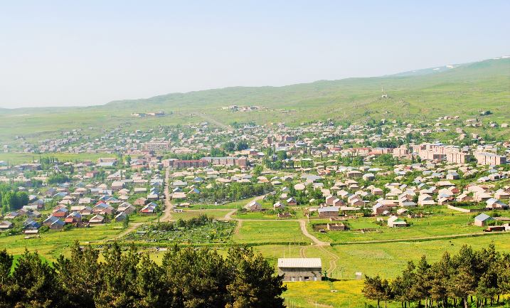
Aparan (Armenian: ), is a town and urban municipal community in Armenia, located in the Aragatsotn Province, about 50 kilometers northwest of the capital Yerevan. As of the 2011 census, the population of the town was 6,451. As per the 2016 official estimate, Aparan had a population of around 5,300. Etymology It is commonly believed that the name of Aparan is derived from the Armenian word of ''Aparank''; meaning a royal palace. However, throughout the history, the town was known with different names including ''Kasagh'', ''Paraznavert'', ''Abaran'' and ''Abaran Verin''. Later, it was known as ''Bash Aparan'' () until 1935, when the name was finally changed to Aparan. History Early history and Middle Ages The first reference to the town of Aparan was made by Ptolemy during the 2nd century. Ptolemy referred to the settlement as ''Casala''; the Hellenized version of the Armenian name of ''Kasagh''. It was the centre of ''Nig'' canton of the Ayrarat province of ancient Armenia. Kasa ... [...More Info...] [...Related Items...] OR: [Wikipedia] [Google] [Baidu] |
List Of Lakes Of Armenia ...
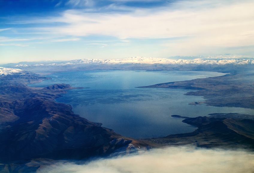
This is a list of lakes of Armenia. Lake Sevan, in Gegharkunik Province, is the largest body of water in Armenia and the entire Caucasus region. Armenia has one very large lake called Lake Sevan and more than 100 small mountain lakes. None of them, except Sevan and Lake Arpi, have yet been extensively studied. The water resources of the lakes amount to about , Sevan holding most of this, nearly (before the drainage it had almost ). Within the country's capital, Yerevan, it is possible to find small lakes, often in amusement parks. List See also * Geography of Armenia * List of rivers of Armenia References {{Asia topic, List of lakes of * lakes Armenia Armenia (), , group=pron officially the Republic of Armenia,, is a landlocked country in the Armenian Highlands of Western Asia.The UNbr>classification of world regions places Armenia in Western Asia; the CIA World Factbook , , and ''Ox ... [...More Info...] [...Related Items...] OR: [Wikipedia] [Google] [Baidu] |
Vagharshapat
Vagharshapat ( hy, Վաղարշապատ ) is the 4th-largest city in Armenia and the most populous municipal community of Armavir Province, located about west of the capital Yerevan, and north of the closed Turkish-Armenian border. It is commonly known as Ejmiatsin (also spelled Echmiadzin or Etchmiadzin, , ), which was its official name between 1945 and 1995. It is still commonly used colloquially and in official bureaucracy (dual naming). The city is best known as the location of Etchmiadzin Cathedral and Mother See of Holy Etchmiadzin, the center of the Armenian Apostolic Church. It is thus unofficially known in Western sources as a "holy city" and in Armenia as the country's "spiritual capital" (). It was one of the major cities and a capital of the ancient Kingdom of Greater Armenia. Reduced to a small town by the early 20th century, it experienced large expansion during the Soviet period becoming, effectively, a suburb of Yerevan. Its population stands just over 37,000 ... [...More Info...] [...Related Items...] OR: [Wikipedia] [Google] [Baidu] |
Oshakan
Oshakan ( hy, Օշական) is a major village in the Aragatsotn Province of Armenia located 8 kilometers southwest from Ashtarak. It is well known to historians and pilgrims of the Armenian Apostolic Church as the site of the grave of Mesrop Mashtots, the inventor of the Armenian alphabet. History During the Arsacid Dynasty of the Kingdom of Armenia, it served as the main town of Ayrarat province and the capital of its Aragatsotn canton from which the Amatuni noble family ruled. However, Oshakan is best known for the Saint Mesrop Mashtots Church which is the burial place of Saint Mesrop Mashtots, the creator of the Armenian alphabet. The church houses his grave and was rebuilt by Catholicos George IV in 1875. Wall paintings on the interior were done in 1960 by the artist H. Minasian. Saint Mesrop Cathedral is the seat of the Aragatsotn Diocese of the Armenian Apostolic Church. Just to the south of the town is the Didikond Hill, where excavations have uncovered a fort and five ... [...More Info...] [...Related Items...] OR: [Wikipedia] [Google] [Baidu] |
Ashtarak
Ashtarak (Armenian language, Armenian: ), is a town and urban municipal community in the Aragatsotn Province of Armenia, located on the left bank of Kasagh River along the gorge, northwest of the capital Yerevan. It is the administrative centre of the Aragatsotn province. Ashtarak is an important crossroad of routes for the Yerevan–Gyumri–Vanadzor triangle. The town plays a great role in the national economy as well as the cultural life of Armenia through several industrial enterprises and cultural institutions. It has developed as a satellite town of Yerevan. The nearby village of Mughni is part of the Ashtarak municipality. As of the 2011 census, the population of the town was 18,834. However, as per the 2016 official estimate, the population of Ashtarak is 18,000. The prelacy of the Diocese of Aragatsotn of the Armenian Apostolic Church is headquartered in Ashtarak. Etymology The name of "Ashtarak" is the Armenian language, Armenian word for ''tower'' or ''fortres ... [...More Info...] [...Related Items...] OR: [Wikipedia] [Google] [Baidu] |
Hovhannavank
Hovhannavank ( hy, Հովհաննավանք) is a medieval monastery located in the village of Ohanavan in the Aragatsotn Province of Armenia. The monastery stands on the edge of the Kasagh River canyon, and its territory is adjacent to the village of Ohanavan. The deep gorge is carved by the Kasagh River. History and architecture The oldest part of the monastery is the single nave basilica of St. Karapet (i.e. Holy Forerunner, John the Baptist) that was founded at the beginning of the fourth century by St. Gregory the Enlightener, who baptized Armenia into the world's first Christian nation. The wooden roof of the early church was replaced in 554 AD with a thatch cover, and the basilica itself underwent profound renovation between 1652 and 1734. The centerpiece of the monastery is the Cathedral built between 1216 and 1221 through the donation of Prince Vache I Vachutian Amberdtsi (Վաչե Ա). The Cathedral has a cruciform floor plan, with two storey sacristies in each of ... [...More Info...] [...Related Items...] OR: [Wikipedia] [Google] [Baidu] |
Saghmosavank
The Saghmosavank ( hy, Սաղմոսավանք, lit. "monastery of the Psalms") is a 13th-century Armenian monastic complex located in the village of Saghmosavan in the Aragatsotn Province of Armenia. Like the Hovhannavank monastery which is five kilometers south, Saghmosavank is situated atop the precipitous gorge carved by the Kasagh river. Their silhouettes dominate the adjacent villages and rise sharp against the background of the mountains crowned by Mount Aragats Mount Aragats ( hy, Արագած, ) is an isolated four-peaked volcano massif in Armenia. Its northern summit, at above sea level, is the highest point of the Lesser Caucasus and Armenia. It is also one of the highest points in the Armenian ....Architectural Ensembles of Armenia" O. Khalpakhchian, published in Moscow by Iskusstvo Publishers in 1980 The main structures of the monasteries erected by Prince Vache Vachutyan—the Church of Zion in Saghmosavank (1215) and the Church of Karapet in Hovhannavank (12 ... [...More Info...] [...Related Items...] OR: [Wikipedia] [Google] [Baidu] |
Aparan Reservoir
Aparan (Armenian: ), is a town and urban municipal community in Armenia, located in the Aragatsotn Province, about 50 kilometers northwest of the capital Yerevan. As of the 2011 census, the population of the town was 6,451. As per the 2016 official estimate, Aparan had a population of around 5,300. Etymology It is commonly believed that the name of Aparan is derived from the Armenian word of ''Aparank''; meaning a royal palace. However, throughout the history, the town was known with different names including ''Kasagh'', ''Paraznavert'', ''Abaran'' and ''Abaran Verin''. Later, it was known as ''Bash Aparan'' () until 1935, when the name was finally changed to Aparan. History Early history and Middle Ages The first reference to the town of Aparan was made by Ptolemy during the 2nd century. Ptolemy referred to the settlement as ''Casala''; the Hellenized version of the Armenian name of ''Kasagh''. It was the centre of ''Nig'' canton of the Ayrarat province of ancient Armenia. Kasa ... [...More Info...] [...Related Items...] OR: [Wikipedia] [Google] [Baidu] |
Great Soviet Encyclopedia
The ''Great Soviet Encyclopedia'' (GSE; ) is one of the largest Russian-language encyclopedias, published in the Soviet Union from 1926 to 1990. After 2002, the encyclopedia's data was partially included into the later ''Bolshaya rossiyskaya entsiklopediya'' (or '' Great Russian Encyclopedia'') in an updated and revised form. The GSE claimed to be "the first Marxist–Leninist general-purpose encyclopedia". Origins The idea of the ''Great Soviet Encyclopedia'' emerged in 1923 on the initiative of Otto Schmidt, a member of the Russian Academy of Sciences. In early 1924 Schmidt worked with a group which included Mikhail Pokrovsky, (rector of the Institute of Red Professors), Nikolai Meshcheryakov (Former head of the Glavit, the State Administration of Publishing Affairs), Valery Bryusov (poet), Veniamin Kagan (mathematician) and Konstantin Kuzminsky to draw up a proposal which was agreed to in April 1924. Also involved was Anatoly Lunacharsky, People's Commissar of Education ... [...More Info...] [...Related Items...] OR: [Wikipedia] [Google] [Baidu] |
Metsamor (river)
Metsamor ( hy, Մեծամոր, ), is a town and urban municipal community in the Armavir Province of Armenia. It is famous for being home to Armenia's Metsamor Nuclear Power Plant, the only nuclear plant in the Transcaucasian region. As of the 2011 census, the town had a population of 9,191. As per the 2016 official estimate, Metsamor has a population of around 8,000. Etymology The name of the town is derived from the nearby river of Metsamor. It is composed of 2 Armenian words: ''mets'' ( hy, մեծ) meaning ''great'', and ''mor'' ( hy, մոր) meaning ''mother's'', being the genitive singular form of the word ''mayr'' ( hy, մայր) meaning ''mother''. The name is most probably refers to the Virgin Mary as the Great Mother of God. History The construction of the settlement of Metsamor was launched in 1969, within the ''Hoktemberyan'' raion of the Armenian Soviet Socialist Republic. It was mainly founded as the residential settlement of the employees of the Metsamor Nuclear P ... [...More Info...] [...Related Items...] OR: [Wikipedia] [Google] [Baidu] |
Federal Research Division
The Federal Research Division (FRD) is the research and analysis unit of the United States Library of Congress. The Federal Research Division provides directed research and analysis on domestic and international subjects to agencies of the United States government, the District of Columbia, and authorized federal contractors. As expert users of the vast English and foreign-language collections of the Library of Congress, the Division's area and subject specialists employ the resources of the world's largest library and other information sources worldwide to produce impartial and comprehensive studies on a cost-recovery basis. The Federal Research Program is run by the Federal Research Division (FRD), the fee-for-service research and analysis unit within the Library of Congress. The Federal Research Program of the Library of Congress was authorized by the United States Congress in accordance with the Library of Congress Fiscal Operations Improvement Act of 2000 (2 U.S.C. 182c). FR ... [...More Info...] [...Related Items...] OR: [Wikipedia] [Google] [Baidu] |


