|
Oshakan
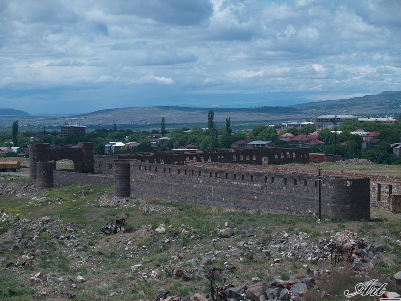
Oshakan ( hy, Օշական) is a major village in the Aragatsotn Province of Armenia located 8 kilometers southwest from Ashtarak. It is well known to historians and pilgrims of the Armenian Apostolic Church as the site of the grave of Mesrop Mashtots, the inventor of the Armenian alphabet. History During the Arsacid Dynasty of the Kingdom of Armenia, it served as the main town of Ayrarat province and the capital of its Aragatsotn canton from which the Amatuni noble family ruled. However, Oshakan is best known for the Saint Mesrop Mashtots Church which is the burial place of Saint Mesrop Mashtots, the creator of the Armenian alphabet. The church houses his grave and was rebuilt by Catholicos George IV in 1875. Wall paintings on the interior were done in 1960 by the artist H. Minasian. Saint Mesrop Cathedral is the seat of the Aragatsotn Diocese of the Armenian Apostolic Church. Just to the south of the town is the Didikond Hill, where excavations have uncovered a fort and five ... [...More Info...] [...Related Items...] OR: [Wikipedia] [Google] [Baidu] |
Saint Mesrop Mashtots Cathedral
Saint Mesrop Mashtots Church ( hy, Սուրբ Մեսրոպ Մաշտոց եկեղեցի) is an Armenian Apostolic church in Oshakan that contains the grave of Mesrop Mashtots, the inventor of the Armenian alphabet. It is one of Armenia's better known churches and a pilgrimage site. Pilgrims visit the church on the Feast of the Holy Translators in October. Mashtots was buried at the site in 440, where a martyrium was built three years later. The current church dates to 1873–79, when an entirely new building was built on the grave of Mashtots, located under the altar. It has been the seat of the Diocese of Aragatsotn since 1996. Early history According to Movses Khorenatsi, when Mesrop Mashtots died (c. 440), three locations were considered for his burial place: his native Taron region; Goghtn, where he had begun his missionary work; and Vagharshapat, Armenia's political and religious capital, next to the graves of other saints. His body was eventually taken by Hmayeak Mamikonia ... [...More Info...] [...Related Items...] OR: [Wikipedia] [Google] [Baidu] |
Saint Mesrop Mashtots Church
Saint Mesrop Mashtots Church ( hy, Սուրբ Մեսրոպ Մաշտոց եկեղեցի) is an Armenian Apostolic church in Oshakan that contains the grave of Mesrop Mashtots, the inventor of the Armenian alphabet. It is one of Armenia's better known churches and a pilgrimage site. Pilgrims visit the church on the Feast of the Holy Translators in October. Mashtots was buried at the site in 440, where a martyrium was built three years later. The current church dates to 1873–79, when an entirely new building was built on the grave of Mashtots, located under the altar. It has been the seat of the Diocese of Aragatsotn since 1996. Early history According to Movses Khorenatsi, when Mesrop Mashtots died (c. 440), three locations were considered for his burial place: his native Taron region; Goghtn, where he had begun his missionary work; and Vagharshapat, Armenia's political and religious capital, next to the graves of other saints. His body was eventually taken by Hmayeak Mamikonia ... [...More Info...] [...Related Items...] OR: [Wikipedia] [Google] [Baidu] |
Aragatsotn Province
Aragatsotn ( hy, Արագածոտն, ) is a province ('' marz'') of Armenia. It is located in the western part of the country. The capital and largest city of the province is the town of Ashtarak. The Statistical Committee of Armenia reported its population was 132,925 in the 2011 census. Etymology Literally meaning "the foot of Aragats" (the highest mountain of Armenia), it is named after the Aragatsotn canton of the historic Ayrarat province of Ancient Armenia, ruled by the Amatuni noble family under the reign of the Arsacid Dynasty. Geography Aragatsotn Province occupies the northwestern part of Armenia and covers an area of 2,756 km2 (9.3% of the total area of Armenia). It has internal borders with Shirak Province from the north, Lori Province from the northeast, Kotayk Province from the east, Armavir Province from the south and the city of Yerevan from the southwest. The Akhurian River at the west separates Aragatsotn from the Kars Province of Turkey. Historica ... [...More Info...] [...Related Items...] OR: [Wikipedia] [Google] [Baidu] |
Amatuni
Amatuni ( hy, Ամատունի) is an ancient Armenian noble family, known from the 4th century in the canton of Artaz, between lakes Van and Urmia, with its center at Shavarshan (latter-day Maku), and subsequently also at Aragatsotn, west of Lake Sevan, with the residence at Oshakan.Toumanoff, CyrilAmatuni. Encyclopaedia Iranica Online Edition. Retrieved on December 25, 2007. Medieval dynasty The Amatuni who was of Caspio-Median or Matianian- Mannaean origin, is given a specious Jewish ancestry from descendants of Samson by the early Armenian tradition (''Moses of Chorene 2.57''). Their forefather's name ''Manue'' suggests a possible connection with the royal Assyrian house of Adiabene. They were variously attributed a descent from Astyages of Media and a Hebrew descent. Also, Armenian princely family of Amatuni believed to be descendants of the kings (chieftains) of the Matienian tribes Apparently, starting from 336 A.D. the Amatuni princes were in charge of the tax serv ... [...More Info...] [...Related Items...] OR: [Wikipedia] [Google] [Baidu] |
Tukh Manuk Shrine Of Oshakan
The Tukh Manuk Shrine of Oshakan is located in the town of Oshakan in Aragatsotn Marz, Armenia. ''Tukh Manuk Tukh Manuk (or Tux Manuk, (Armenian Թուխ Մանուկ), "Dark-skinned Youth") refers to archaic rural shrines in Armenia. Their origin is regarded to be pre-Christian or pagan, but are now a part of a folk tradition existing within the Armenian ...'' literally translates to "dark baby" or "dark-skinned youth." References * External links About the Tukh Manuk Cult {{coord missing, Armenia Tourist attractions in Aragatsotn Province Buildings and structures in Aragatsotn Province Religious buildings and structures in Armenia ... [...More Info...] [...Related Items...] OR: [Wikipedia] [Google] [Baidu] |
Ashtarak
Ashtarak (Armenian language, Armenian: ), is a town and urban municipal community in the Aragatsotn Province of Armenia, located on the left bank of Kasagh River along the gorge, northwest of the capital Yerevan. It is the administrative centre of the Aragatsotn province. Ashtarak is an important crossroad of routes for the Yerevan–Gyumri–Vanadzor triangle. The town plays a great role in the national economy as well as the cultural life of Armenia through several industrial enterprises and cultural institutions. It has developed as a satellite town of Yerevan. The nearby village of Mughni is part of the Ashtarak municipality. As of the 2011 census, the population of the town was 18,834. However, as per the 2016 official estimate, the population of Ashtarak is 18,000. The prelacy of the Diocese of Aragatsotn of the Armenian Apostolic Church is headquartered in Ashtarak. Etymology The name of "Ashtarak" is the Armenian language, Armenian word for ''tower'' or ''fortres ... [...More Info...] [...Related Items...] OR: [Wikipedia] [Google] [Baidu] |
Parpi
Parpi ( hy, Փարպի) is a village in the Aragatsotn Province of Armenia. It is home to the 5th-century Tsiranavor Church, with 7th- and 10th-century modifications. There is also S. Grigor or S. Grigor Lusavorich (''Gregory the Illuminator'') Church and the 7th-century (rebuilt 10th-11th century) Targmanchats (''Holy Translator'') Church located in a medieval-modern cemetery on a hill to the east. Nearby is a cave with a working door, used as a place of refuge between the 16th and 18th centuries. History The 5th- to 6th-century Armenian chronicler and historian Ghazar Parpetsi was born at Parpi in AD 442. He is recognized for writing ''History of Armenia'', sometime in the early 6th century. Parpi is known to have had a brief visit during October 1734 by Abraham Kretatsi during the time while he was serving the Catholicos Abraham II. He wrote: The village is also mentioned in a 13th-century inscription on the southern wall of the Katoghike Church of the Astvatsnkal Monaste ... [...More Info...] [...Related Items...] OR: [Wikipedia] [Google] [Baidu] |
Armenian Alphabet
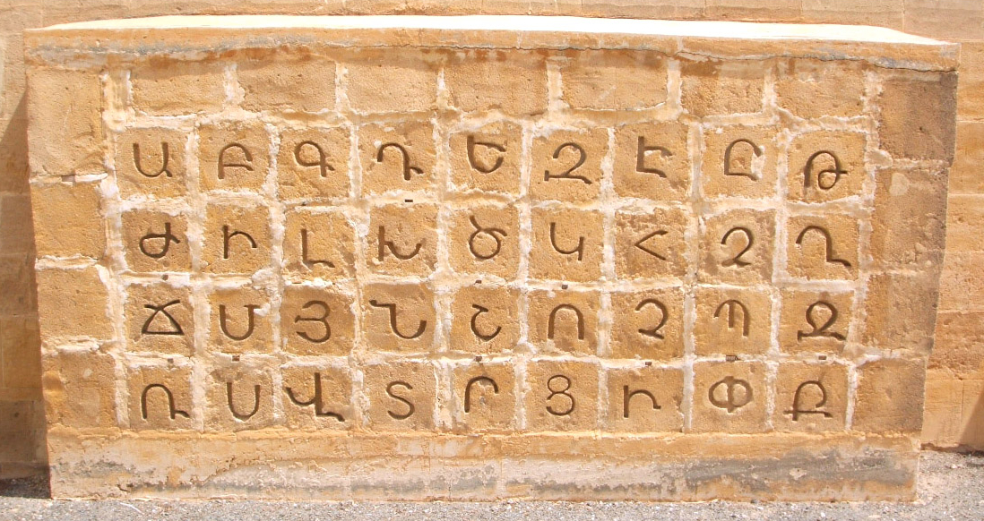
The Armenian alphabet ( hy, Հայոց գրեր, ' or , ') is an alphabetic writing system used to write Armenian language, Armenian. It was developed around 405 AD by Mesrop Mashtots, an Armenian linguist and wikt:ecclesiastical, ecclesiastical leader. The system originally had 36 letters; eventually, three more were adopted. The alphabet was also in wide use in the Ottoman Empire around the 18th and 19th centuries. The Armenian word for "alphabet" is ('), named after the first two letters of the Armenian alphabet: hy, այբ ' and hy, բեն, links=no '. Armenian is written writing system#Directionality, horizontally, left to right. Alphabet *Listen to the pronunciation of the letters in or in . Notes: #Primarily used in classical orthography; after the reform used word-initially and in some compound words. #Except in ով "who" and ովքեր "those (people)" in Eastern Armenian. #Iranian Armenians (who speak a subbranch of Eastern Armenian) pronounce the soun ... [...More Info...] [...Related Items...] OR: [Wikipedia] [Google] [Baidu] |
Alfortville
Alfortville () is a commune in the Val-de-Marne department in the southeastern suburbs of Paris, France. It is located from the center of Paris. History The commune of Alfortville was created on 1 April 1885 from part of the commune of Maisons-Alfort. Transport Alfortville is served by two stations on Paris RER line D: Maisons-Alfort – Alfortville and Le Vert de Maisons. Alfortville is located at only 500 meters from the metro station Ecole vétérinaire de Maisons Alfort on Paris Métro Line 8 Population Armenian community The Armenian community of Alfortville is very significant. The Armenian Apostolic Church, located south of the city, is an important place for the Armenian community. There are streets named after Komitas Vartabed, Missak Manouchian, and the city of Yerevan. A roundabout has recently been named Place d'Achtarak after the Armenian city Ashtarak. After military clashes in the Armenian-populated breakaway Nagorno-Karabakh region between Armeni ... [...More Info...] [...Related Items...] OR: [Wikipedia] [Google] [Baidu] |
Karbi, Armenia
Karbi ( hy, Կարբի) is a village in the Aragatsotn Province of Armenia, near the town of Ashtarak. Within the area there is a triple-nave basilica of S. Astvatsatsin dated to 1691-93 with an unattached adjacent belfry of 1338. In the village there are also S. Gevorg or S. Kiraki church of the 11th to 13th centuries, Tsiranavor, a Tukh Manuk shrine, and "Zargarents Zham" chapel built between the 11th and 13th centuries. History Karbi was recorded in manuscripts as early as the 13th century and is also mentioned in an inscription of the same period upon the southern wall of the Katoghike Church of the Astvatsnkal Monastery built between the 5th and 13th centuries. It reads, The history of Karbi has been one marked by invasions, destruction and plundering. In the manuscripts (late 14th to mid-15th centuries) written by Thomas of Metsoph, he left an account of the invasions of Timur Lenk in the 14th century and stated that, "Next imurcame to the Araratean country and Ka ... [...More Info...] [...Related Items...] OR: [Wikipedia] [Google] [Baidu] |
List Of Sovereign States
The following is a list providing an overview of sovereign states around the world with information on their status and recognition of their sovereignty. The 206 listed states can be divided into three categories based on membership within the United Nations System: 193 UN member states, 2 UN General Assembly non-member observer states, and 11 other states. The ''sovereignty dispute'' column indicates states having undisputed sovereignty (188 states, of which there are 187 UN member states and 1 UN General Assembly non-member observer state), states having disputed sovereignty (16 states, of which there are 6 UN member states, 1 UN General Assembly non-member observer state, and 9 de facto states), and states having a special political status (2 states, both in free association with New Zealand). Compiling a list such as this can be a complicated and controversial process, as there is no definition that is binding on all the members of the community of nations concerni ... [...More Info...] [...Related Items...] OR: [Wikipedia] [Google] [Baidu] |

.jpg)


