|
Iverley
Iverley is an area of the parish of Kinver in Staffordshire that has no road link to the rest of the parish. It is notable as being the most southerly point in Staffordshire. Iverley lies in a corner of Staffordshire, with Churchill, Worcestershire to the south and Norton, Stourbridge, Pedmore, and Hagley to the east. The eastern boundary is approximately the Roman road from Droitwich to Greensforge. History Iverley Hay was one of three hays (enclosed hunting areas) in Kinver Forest. It had 1560 trees in 1509. John Whorwood of Stourton obtained a lease from the crown in 1629, and presumably subsequently bought the freehold. It was included in Wortley Whorwood's sale of the manor of Kinver Thomas Foley, who settled it on his son Philip Foley Philip Foley (12 May 1648 – December 1716) was the youngest of the three surviving sons of the British ironmaster Thomas Foley (1616–1677), Thomas Foley. His father transferred all his ironworks in the West Midlands (region), Mid ... [...More Info...] [...Related Items...] OR: [Wikipedia] [Google] [Baidu] |
Kinver Forest
Kinver Forest was a Royal Forest, mainly in Staffordshire. Extent References to "forest" in Domesday Book suggest that the forest was of similar extent in 1086 and in the 14th century. Its precise extent in the intervening period can only be deduced from the places summoned to attend forest courts in the 13th century or which were declared disforested in whole or part in the Great Perambulation of 1300. At its greatest extent its boundaries met those of Feckenham Forest on the southeast and Morfe Forest on the northwest. However, it probably included Wolverley and Kidderminster, which were not in the post-1300 forest. It stretched north to Lower Penn and Seisdon and thus occupied much of the lower stour and Smestow valleys, stretching west to the Shropshire boundary and east approximately to the road from Worcester to Stafford, through Stourbridge and Wolverhampton. To its east was Pensnett Chase of the lords of Dudley. In the 13th century, Worcester Cathedral Priory was auth ... [...More Info...] [...Related Items...] OR: [Wikipedia] [Google] [Baidu] |
Stourbridge
Stourbridge is a market town in the Metropolitan Borough of Dudley in the West Midlands, England, situated on the River Stour. Historically in Worcestershire, it was the centre of British glass making during the Industrial Revolution. The 2011 UK census recorded the town's population as 63,298. Geography Stourbridge is about west of Birmingham. Sitting within the Metropolitan Borough of Dudley at the southwestern edge of the Black Country and West Midlands conurbation, Stourbridge includes the suburbs of Amblecote, Lye, Norton, Oldswinford, Pedmore,Stambermill, Stourton, Wollaston, Wollescote and Wordsley. Much of Stourbridge consists of residential streets interspersed with green spaces. Mary Stevens Park, opened in 1931, has a lake, a bandstand, a cafe, and a mixture of open spaces and woodland. Bordered by green belt land, Stourbridge is close to countryside with the Clent Hills to the south and southwest Staffordshire and Kinver Edge to the west. Closest cities, tow ... [...More Info...] [...Related Items...] OR: [Wikipedia] [Google] [Baidu] |
South Staffordshire
South Staffordshire is a local government district in Staffordshire, England. The district lies to the north and west of the West Midlands county, bordering Shropshire to the west and Worcestershire to the south. It contains notable settlements such as Codsall, Cheslyn Hay, Great Wyrley, Penkridge, Brewood, Coven, Essington, Huntington, Weston-under-Lizard, Bilbrook, Wombourne, Himley, Perton and Featherstone. Codsall is the main administrative centre of South Staffordshire District. Many of the villages form both commuter and residential areas for the nearby towns of Cannock, Stafford and Telford, as well as the wider West Midlands County. The district was formed on 1 April 1974, under the Local Government Act 1972, by the merger of Cannock Rural District (in the north) and Seisdon Rural District (in the south). Its council is based in Codsall, The district covers a similar geographic area to South Staffordshire parliamentary constituency, although the north of the distri ... [...More Info...] [...Related Items...] OR: [Wikipedia] [Google] [Baidu] |
Staffordshire
Staffordshire (; postal abbreviation Staffs.) is a landlocked county in the West Midlands region of England. It borders Cheshire to the northwest, Derbyshire and Leicestershire to the east, Warwickshire to the southeast, the West Midlands County and Worcestershire to the south and Shropshire to the west. The largest settlement in Staffordshire is Stoke-on-Trent, which is administered as an independent unitary authority, separately from the rest of the county. Lichfield is a cathedral city. Other major settlements include Stafford, Burton upon Trent, Cannock, Newcastle-under-Lyme, Rugeley, Leek, and Tamworth. Other towns include Stone, Cheadle, Uttoxeter, Hednesford, Brewood, Burntwood/Chasetown, Kidsgrove, Eccleshall, Biddulph and the large villages of Penkridge, Wombourne, Perton, Kinver, Codsall, Tutbury, Alrewas, Barton-under-Needwood, Shenstone, Featherstone, Essington, Stretton and Abbots Bromley. Cannock Chase AONB is within the county as well as parts of the ... [...More Info...] [...Related Items...] OR: [Wikipedia] [Google] [Baidu] |
South Staffordshire (UK Parliament Constituency)
South Staffordshire is a constituency represented in the House of Commons of the UK Parliament since 2010 by Sir Gavin Williamson, a Conservative. Boundaries 1832–1868: The Hundreds of South Offlow, Seisdon and Cuttleston. 1983–1997: The District of South Staffordshire. 1997–2010: The District of South Staffordshire wards of Bilbrook, Brewood and Coven, Cheslyn Hay, Codsall North, Codsall South, Essington, Featherstone, Great Wyrley Landywood, Great Wyrley Town, Kinver, Lower Penn, Pattingham and Patshull, Perton Central, Perton Dippons, Shareshill, Swindon, Trysull and Seisdon, Wombourne North, Wombourne South East, and Wombourne South West. 2010–present: The District of South Staffordshire wards of Bilbrook, Brewood and Coven, Cheslyn Hay North and Saredon, Cheslyn Hay South, Codsall North, Codsall South, Essington, Featherstone and Shareshill, Great Wyrley Landywood, Great Wyrley Town, Himley and Swindon, Huntington and Hatherton, Kinver, Pattingham and Patshul ... [...More Info...] [...Related Items...] OR: [Wikipedia] [Google] [Baidu] |
Kinver
Kinver is a large village in the District of South Staffordshire in Staffordshire, England. It is in the far south-west of the county, at the end of the narrow finger of land surrounded by the counties of Shropshire, Worcestershire and the West Midlands. The nearest towns are Stourbridge, West Midlands, Kidderminster in Worcestershire and Bridgnorth, Shropshire. The Staffordshire and Worcestershire Canal passes through, running close to the course of the meandering River Stour. According to the 2011 census Kinver ward had a population of 7,225. The village today The village has three schools: Foley Infant Academy, Brindley Heath Academy and Kinver High School, now part of the Invictus Multi Academy Trust. During normal times, the Infant school rings the home time bell 20 minutes before the junior or high schools. This is to allow the parents collecting children from both sites to cover the three-quarters of a mile journey. During lockdown and as the return to school is ... [...More Info...] [...Related Items...] OR: [Wikipedia] [Google] [Baidu] |
Churchill, Wyre Forest
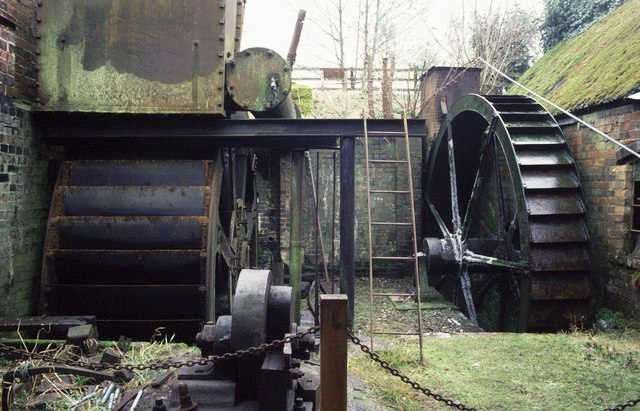
Churchill is a village in the Wyre Forest District of Worcestershire, England, near to Kidderminster. It is in the civil parish of Churchill and Blakedown and is the location of one of the few surviving water-powered plating forges in the United Kingdom - Churchill Forge Mill Churchill Forge Mill, situated in the Worcestershire village of Churchill, is one of the last water-powered forge mills remaining in an intact state in the UK and as such is an important example of the industrial heritage of the West Midlands. P .... References Further reading * ''A Pictorial History of Churchill and Blakedown'', Churchill & Blakedown Parish Council External links Churchill & Blakedown Parish site Villages in Worcestershire {{Worcestershire-geo-stub ... [...More Info...] [...Related Items...] OR: [Wikipedia] [Google] [Baidu] |
Pedmore
Pedmore is a residential suburb of Stourbridge in the West Midlands of England. It was originally a village in the Worcestershire countryside until extensive housebuilding during the interwar years saw it gradually merged into Stourbridge. The population of the appropriate Dudley Ward (Pedmore and Stourbridge East) taken at the 2011 census was 12,471., Amenities Pedmore is home to the Pedmore Cricket Club and is served by the nearby railway stations of Stourbridge Junction railway station and Hagley railway station. Pedmore is served by two primary schools - Pedmore Church of England School, and Ham Dingle Primary Academy. It is also served by a secondary school - Pedmore High School, which until July 2004 was called The Grange School. In the 1920s, Pedmore House was built on what is now the end of Ham Lane. It became a local landmark, offering restaurant facilities that later incorporated the Tuscana Italian restaurant as well as 20-bedroom hotel. It closed in July 200 ... [...More Info...] [...Related Items...] OR: [Wikipedia] [Google] [Baidu] |
Hagley
Hagley is a large village and civil parish in Worcestershire, England. It is on the boundary of the West Midlands and Worcestershire counties between the Metropolitan Borough of Dudley and Kidderminster. Its estimated population was 7,162 in 2019. Development From the time of the Domesday Book until the 1933 boundary changes, the parish of Hagley extended southwards from the village to include the present parish of Blakedown. The main focus of the village, on the lower slopes of the Clent Hills, was on the outskirts, where Hagley Hall and the parish church of St John the Baptist can be found. The parish register of Hagley is the oldest in England. It dates from 1 December 1538, which was the year in which registers were ordered to be kept in all parishes. Lower Hagley lies downhill and started to expand with the arrival of the Oxford, Worcester and Wolverhampton Railway in 1852 and the eventual building of Hagley railway station. The growth of what is now known as West Hagley i ... [...More Info...] [...Related Items...] OR: [Wikipedia] [Google] [Baidu] |
Roman Road
Roman roads ( la, viae Romanae ; singular: ; meaning "Roman way") were physical infrastructure vital to the maintenance and development of the Roman state, and were built from about 300 BC through the expansion and consolidation of the Roman Republic and the Roman Empire. They provided efficient means for the overland movement of armies, officials, civilians, inland carriage of official communications, and trade goods. Roman roads were of several kinds, ranging from small local roads to broad, long-distance highways built to connect cities, major towns and military bases. These major roads were often stone-paved and metaled, cambered for drainage, and were flanked by footpaths, bridleways and drainage ditches. They were laid along accurately surveyed courses, and some were cut through hills, or conducted over rivers and ravines on bridgework. Sections could be supported over marshy ground on rafted or piled foundations.Corbishley, Mike: "The Roman World", page 50. Warwick Press, ... [...More Info...] [...Related Items...] OR: [Wikipedia] [Google] [Baidu] |
Droitwich
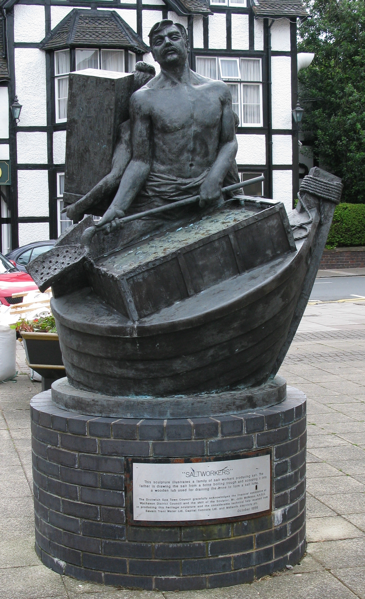
Droitwich Spa (often abbreviated to Droitwich ) is an historic spa town in the Wychavon district in northern Worcestershire, England, on the River Salwarpe. It is located approximately south-west of Birmingham and north-east of Worcester. The town was called Salinae in Roman times, then later called Wyche, derived from the Anglo-Saxon Hwicce kingdom, referred to as "Saltwich" according to Anglo-Saxon charters, with the Droit (meaning "right" in French) added when the town was given its charter on 1 August 1215 by King John. The "Spa" was added in the 19th century when John Corbett developed the town's spa facilities. The River Salwarpe running through Droitwich is likely derived from ''sal'' meaning "salt" and ''weorp'' which means "to throw up" - i.e. "the river which throws up salt" - which overflows from the salt brines. The town is situated on massive deposits of salt, and salt has been extracted there since ancient times. The natural Droitwich brine contains of salt; te ... [...More Info...] [...Related Items...] OR: [Wikipedia] [Google] [Baidu] |
Greensforge
Greensforge is a scattered hamlet on the boundary of Kinver and Swindon parishes, in South Staffordshire, England. It is noted for its Roman associations and its industrial heritage. Etymology The hamlet takes its name from a finery forge established there in the early 17th century: Mr Green's Forge. This was typical of early industrial development all along the Smestow Brook, in which bloomeries, foundries and forges used local water supplies and charcoal. History The hamlet was not the earliest settlement in the area. The name Greensforge is also used for a group of Romans forts lying on the west of the brook, partly in Ashwood. The remains of one fort, extending to 2.3 hectares, are visible as a low banked enclosure on either side of Mile Flat, just east of the canal locks and wharf. This dates from period 60-80 AD. It was identified at least as early as the 18th century and numerous finds of pottery and other objects were made before it was excavated in 1929. The other, ea ... [...More Info...] [...Related Items...] OR: [Wikipedia] [Google] [Baidu] |


