|
Hagley
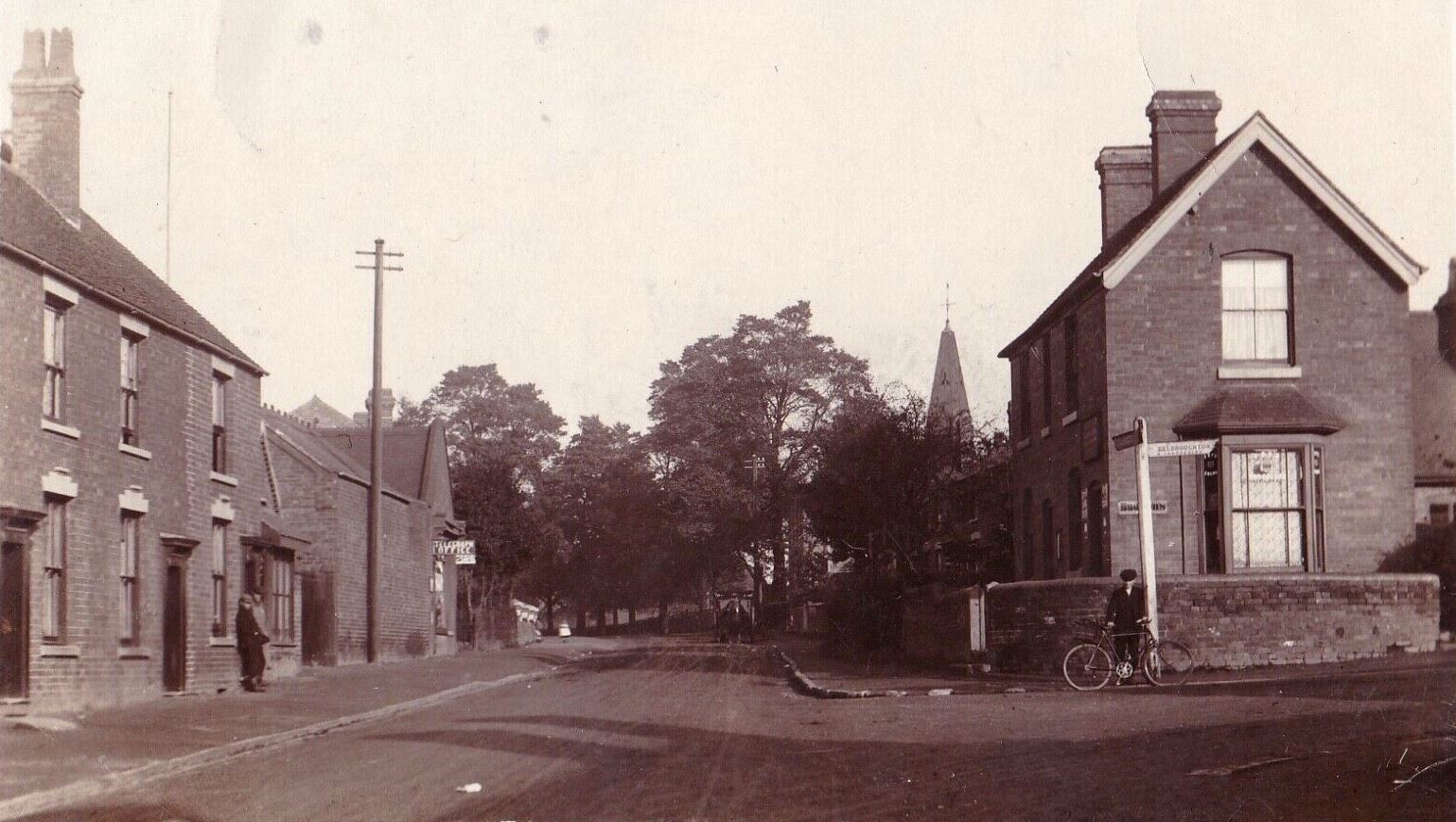
Hagley is a large village and civil parish in Worcestershire, England. It is on the boundary of the West Midlands and Worcestershire counties between the Metropolitan Borough of Dudley and Kidderminster. Its estimated population was 7,162 in 2019. Development From the time of the Domesday Book until the 1933 boundary changes, the parish of Hagley extended southwards from the village to include the present parish of Blakedown. The main focus of the village, on the lower slopes of the Clent Hills, was on the outskirts, where Hagley Hall and the parish church of St John the Baptist can be found. The parish register of Hagley is the oldest in England. It dates from 1 December 1538, which was the year in which registers were ordered to be kept in all parishes. Lower Hagley lies downhill and started to expand with the arrival of the Oxford, Worcester and Wolverhampton Railway in 1852 and the eventual building of Hagley railway station. The growth of what is now known as West Hagley i ... [...More Info...] [...Related Items...] OR: [Wikipedia] [Google] [Baidu] |
Hagley Hall
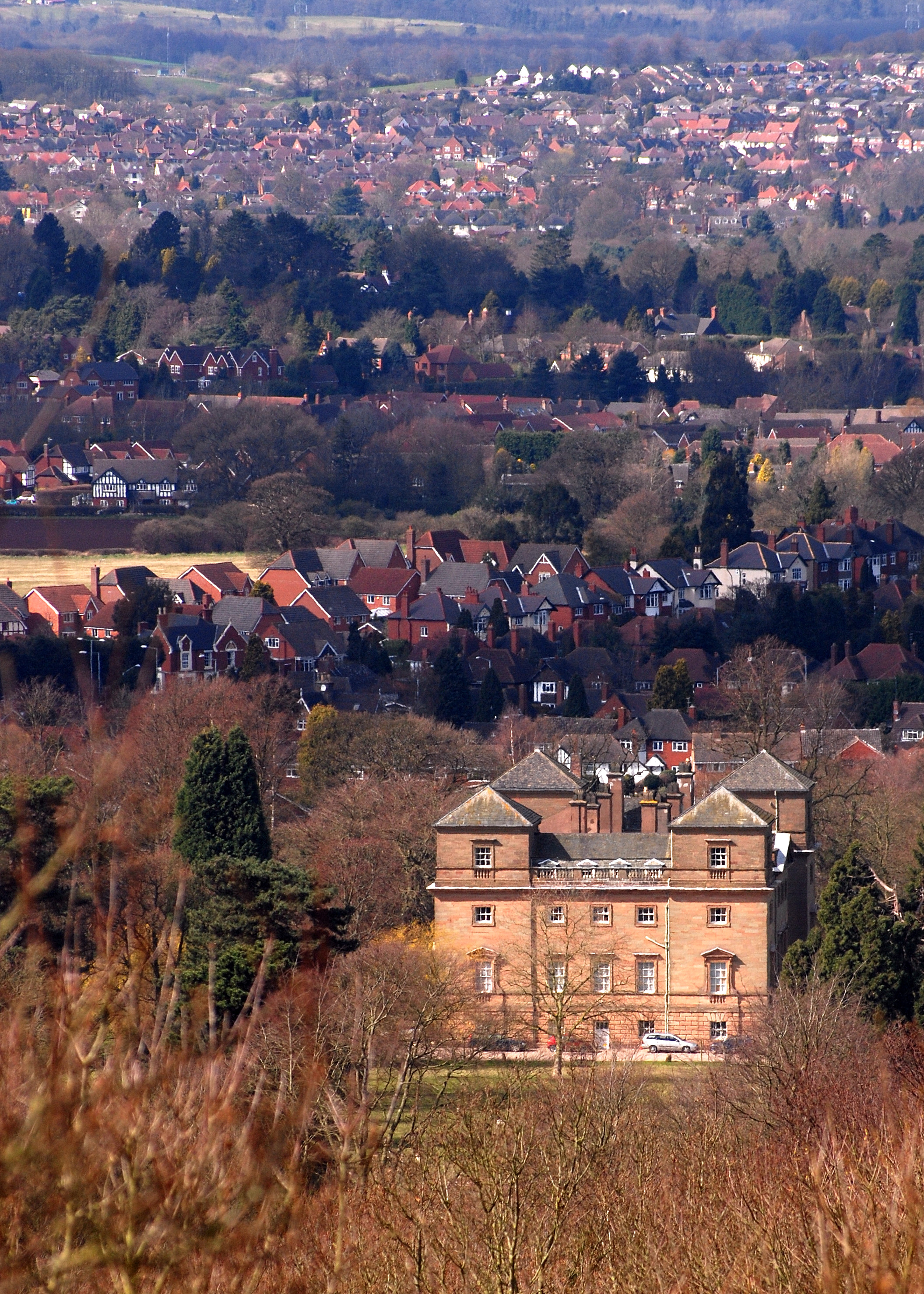
Hagley Hall is a Grade I listed 18th-century house in Hagley, Worcestershire, the home of the Lyttelton family. It was the creation of George, 1st Lord Lyttelton (1709–1773), secretary to Frederick, Prince of Wales, poet and man of letters and briefly Chancellor of the Exchequer. Before the death of his father ( Sir Thomas Lyttelton) in 1751, he began to landscape the grounds in the new Picturesque style, and between 1754 and 1760 it was he who was responsible for the building of the Neo-Palladian house that survives to this day. After a fire in 1925, most of the house was restored, but the uppermost floor of the servants' quarters was not, which means that the present roof line between the towers is lower than it was when first constructed. The estate fell into disrepair and incurred a mounting debt beginning in the 1970s. The 11th Viscount Cobham was forced to sell off large tracts of estate land to keep it afloat (in addition to paying for his high-profile divorce). His ... [...More Info...] [...Related Items...] OR: [Wikipedia] [Google] [Baidu] |
Hagley Railway Station
Hagley railway station serves the English village of Hagley, Worcestershire. Off peak trains call three times an hour in each direction, running to or through Kidderminster westwards and through Stourbridge and Birmingham Snow Hill eastwards. Additional trains also call during the morning and evening rush hours. A half hourly service runs in the late evenings and an hourly service on Sundays. Customer Information Screens are installed on either platform. Since the 2017 change of franchise, services are run by West Midlands Trains. The nearest railway stations are Stourbridge Junction (towards Birmingham) and Blakedown (towards Kidderminster and Worcester). The station retains one of its GWR-era station buildings and its canopied footbridge, both dating from 1884. Although typical of its era, very few examples of that kind of ornamental ironwork bridge now survive and it was listed grade 2 in 2000. When it was refurbished in late 2011, the colours reverted from its former navy ... [...More Info...] [...Related Items...] OR: [Wikipedia] [Google] [Baidu] |
Blakedown
Blakedown is a village in the Wyre Forest District lying along the A456 in the north of the county of Worcestershire, England. Following enclosures and the arrival of the railway, it developed both agriculturally and industrially during the 19th century. Due to its transport links, it now serves mainly as a dormitory for the neighbouring town of Kidderminster and for the cities of Birmingham and Worcester. History From the time of the Domesday book, the Blakedown (earlier Bleak Down) area formed part of Hagley Parish; originally it belonged to Clent Hundred and later to the lower division of Halfshire. In 1888 the growing village was separated administratively from Hagley to merge with the small adjacent parish of Churchill; there is now a combined Parish Council for both villages. Much of Blakedown was originally an area of common land, only enclosed in 1832. With the coming of the railway line in 1852, and the consequent agricultural and industrial development, Blakedown eventu ... [...More Info...] [...Related Items...] OR: [Wikipedia] [Google] [Baidu] |
A456 Road
Known as the Hagley Road in Birmingham, the A456 is a main road in England running between Central Birmingham and Woofferton, Shropshire, south of Ludlow. Some sections of the route, for example Edgbaston near Bearwood, are also the route of the Elan Aqueduct which carries Birmingham's water supply from the Elan Valley. Route Birmingham - Kidderminster The A456 now starts in the underpass at the end of Broad Street ''Five Ways'' junction on the Middleway (A4540) in Birmingham. It previously started at the Paradise Circus junction with the former Inner Ring Road (A4400) but originally ran along New Street in the city centre. Heading West through the Birmingham suburbs of Edgbaston and Quinton using a mixture of dual carriageway and single carriageway roads, though maintaining at least 2 lanes in each direction. Just beyond Quinton, the A458 exits towards Halesowen, while the A456 bypasses the town to the South, meeting the M5 at Junction 3. This route was completed in the 1 ... [...More Info...] [...Related Items...] OR: [Wikipedia] [Google] [Baidu] |
Clent Hills
The Clent Hills lie south-west of Birmingham city centre in Clent, Worcestershire, England. The closest towns are Stourbridge and Halesowen, both in the West Midlands conurbation (and also Historic counties of England, historically in Worcestershire). The Clent Hills range consists of, in order from north-west to south-east: Wychbury Hill, Clent Hill (and Adams Hill), and Walton Hill (and Calcot Hill). The north Worcestershire range of hills continues eastwards to include Romsley, Worcestershire, Romsley Hill, Waseley Hills Country Park, Waseley Hills and the Lickey Hills. Clent Hill is the most popular hillwalking hill in the range, although it is not often mentioned because the whole area is referred to as Clent Hills. Just under a million visitors a year are estimated to come to the hills, making them Worcestershire's most popular non-paying attraction. Geology The Clent Hills are a major outcrop of the Clent Formation consisting of Clent Breccia (predominantly a red-brown ... [...More Info...] [...Related Items...] OR: [Wikipedia] [Google] [Baidu] |
Bromsgrove (district)
Bromsgrove is a local government district in Worcestershire, England. Its council is based in the town of Bromsgrove. It borders the built up area of Birmingham to the north. Other places in the district include Alvechurch, Aston Fields, Belbroughton, Catshill, Clent, Hagley, Rubery, Stoke Prior and Wythall. The current district was formed on 1 April 1974 by the merger of Bromsgrove urban district and Bromsgrove rural district. Bromsgrove forms part of the Greater Birmingham & Solihull Local Enterprise Partnership. Population The following table illustrates the change in the district's population between 1801 and 2011. Transport Bromsgrove railway station is the local station for the district's centre, but there are several others within the district. Road travel, especially to Birmingham, is also important in the district. Barnt Green railway station and Alvechurch railway station are on the line to Redditch. Hagley railway station and Wythall railway station are als ... [...More Info...] [...Related Items...] OR: [Wikipedia] [Google] [Baidu] |
Bromsgrove District
Bromsgrove is a Districts of England, local government district in Worcestershire, England. Its council is based in the town of Bromsgrove. It borders the built up area of Birmingham to the north. Other places in the district include Alvechurch, Aston Fields, Belbroughton, Catshill, Clent, Hagley, Rubery, Stoke Prior, Worcestershire, Stoke Prior and Wythall. The current district was formed on 1 April 1974 by the merger of Bromsgrove urban district and Bromsgrove rural district. Bromsgrove forms part of the Greater Birmingham & Solihull Local Enterprise Partnership. Population The following table illustrates the change in the district's population between 1801 and 2011. Transport Bromsgrove railway station is the local station for the district's centre, but there are several others within the district. Road travel, especially to Birmingham, is also important in the district. Barnt Green railway station and Alvechurch railway station are on the line to Redditch. Hagley ra ... [...More Info...] [...Related Items...] OR: [Wikipedia] [Google] [Baidu] |
West Midlands Urban Area
The West Midlands conurbation is the large conurbation that includes the cities of Birmingham and Wolverhampton and the towns of Sutton Coldfield, Dudley, Walsall, West Bromwich, Solihull, Stourbridge and Halesowen in the English West Midlands. It is also referred to as the Birmingham urban area and is one of the most populated and densely populated built-up areas in the United Kingdom. Not to be confused with the region or metropolitan county of the same name, the conurbation does not include parts of the metropolitan county such as Coventry, but does include parts of the surrounding counties of Staffordshire (e.g. Little Aston, Perton and Essington) and Worcestershire (such as Hagley and Hollywood). According to the 2011 Census the area had a population of 2,440,986, making it the third most populated in the United Kingdom behind the Greater London and the Urban areas of Greater Manchester. The conurbation sits within the UK's (and therefore England's) largest metropolitan ... [...More Info...] [...Related Items...] OR: [Wikipedia] [Google] [Baidu] |
Stourbridge
Stourbridge is a market town in the Metropolitan Borough of Dudley in the West Midlands, England, situated on the River Stour. Historically in Worcestershire, it was the centre of British glass making during the Industrial Revolution. The 2011 UK census recorded the town's population as 63,298. Geography Stourbridge is about west of Birmingham. Sitting within the Metropolitan Borough of Dudley at the southwestern edge of the Black Country and West Midlands conurbation, Stourbridge includes the suburbs of Amblecote, Lye, Norton, Oldswinford, Pedmore,Stambermill, Stourton, Wollaston, Wollescote and Wordsley. Much of Stourbridge consists of residential streets interspersed with green spaces. Mary Stevens Park, opened in 1931, has a lake, a bandstand, a cafe, and a mixture of open spaces and woodland. Bordered by green belt land, Stourbridge is close to countryside with the Clent Hills to the south and southwest Staffordshire and Kinver Edge to the west. Closest cities, tow ... [...More Info...] [...Related Items...] OR: [Wikipedia] [Google] [Baidu] |
A491 Road
The A491 is an A road in Zone 4 of the Great Britain numbering scheme. History The road north of Oldswinford forms part of an ancient road, probably of Anglo-Saxon origin, joining the burhs of Worcester and Stafford. The crossing of the River Stour was probably the swine-ford that gave rise to the placenames Kingswinford and Oldswinford, and later to the name Stourbridge. The road from Wordsley Green to the Market House in Stourbidge and so to Bromsgrove was turnpiked in 1753. The same act also dealt with several other roads from that Market House, as well as the road from Birmingham through Halesowen and Hagley to Blakedown Pool, but that was managed by separate trustees from 1773. Its continuation north of Wordsley Green, through Wolverhampton, and Stafford to Stone, much of it now part of A449 road was turnpiked by the Wolverhampton Turnpike Act of 1760. In the original 1922 road numberings, A491 was assigned to the Shrewsbury, Welshpool, Mallwyd and Cemmaes Road rou ... [...More Info...] [...Related Items...] OR: [Wikipedia] [Google] [Baidu] |
Birmingham To Worcester Via Kidderminster Line
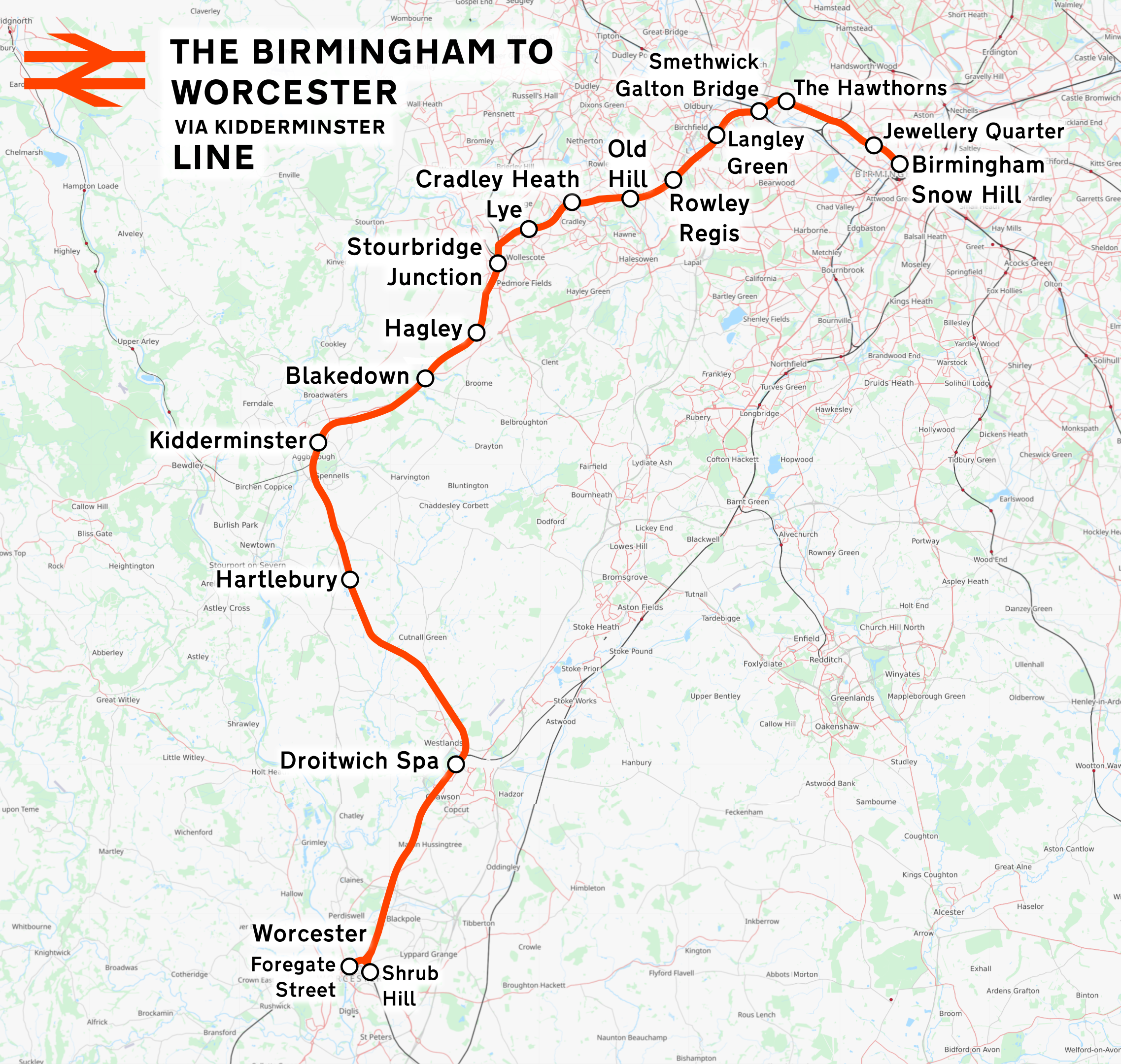
The Birmingham to Worcester via Kidderminster line is a railway line which runs from Birmingham Snow Hill to Worcester via Stourbridge and Kidderminster in the West Midlands, England. It is one of the Snow Hill Lines, with trains operated by West Midlands Trains and Chiltern Railways using a variety of rolling stock including and diesel units. It is a future aspiration of Network Rail to electrify the entire line, as well as the Chiltern Main Line to London Marylebone. The line is one of two railway routes between Birmingham and Worcester, the other route runs via Bromsgrove. History *The line between Worcester and Stourbridge Junction was opened as part of the Oxford, Worcester and Wolverhampton Railway (OWWR), in 1852. *Opening in 1867, the line between Stourbridge Junction and Smethwick was built by an independent company; the Stourbridge Railway; at Smethwick this line joined the Stour Valley Line at Galton Junction. *A short link was opened at the same time by the G ... [...More Info...] [...Related Items...] OR: [Wikipedia] [Google] [Baidu] |
Oxford, Worcester And Wolverhampton Railway
The Oxford, Worcester and Wolverhampton Railway (OW&WR) was a railway company in England. It built a line from Wolvercot JunctionThe nearby settlement is spelt ''Wolvercote'' and a later station on the LNWR Bicester line follows that spelling. The OW&WR and GWR consistently used the spelling ''Wolvercot''. near Oxford to Worcester, Stourbridge, Dudley and Wolverhampton, as well as some branches. Its main line was opened in stages between 1852 and 1853. When the West Midland Railway (WMR) was formed by amalgamation in 1860, the OW&WR was the dominant partner, but the West Midland company amalgamated with the Great Western Railway (GWR) in 1863. Several branches and extensions were built in the West Midlands, and the main line was developed as an important trunk route. Much of the original main line is in use at present (2017). Before the OW&WR In 1841 the GWR opened its first main line between London and Bristol. It was engineered by Isambard Kingdom Brunel and the track was on ... [...More Info...] [...Related Items...] OR: [Wikipedia] [Google] [Baidu] |


