|
Inti Punku
Inti Punku or Intipunku (Quechua ''inti'' sun, ''punku'' door, "sun gate", Hispanicized spellings ''Intipunco, Intipuncu, Inti Puncu'') is an archaeological site in the Cusco Region of Peru that was once a fortress of the sacred city, Machu Picchu. It is now also the name of the final section of the Incan Trail between the Sun Gate complex and the city of Machu Picchu. It was believed that the steps were a control gate for those who enter and exited the Sanctuary. It is one of the most important archeological constructions around the Machu Picchu site. Inti Punku was once the main entrance to Machu Picchu, in particular it was the primary approach from the then capitol city of Cusco to the southeast. The gate likely would have been protected by Incan military. Inti Punku is dedicated to the cult of the Inti, the Sun god. Because of its location on a ridge southeast of Machu Picchu, the rising sun would pass through the Sun Gate each year on the summer solstice. It is located 2745 ... [...More Info...] [...Related Items...] OR: [Wikipedia] [Google] [Baidu] |
Peru
, image_flag = Flag of Peru.svg , image_coat = Escudo nacional del Perú.svg , other_symbol = Great Seal of the State , other_symbol_type = Seal (emblem), National seal , national_motto = "Firm and Happy for the Union" , national_anthem = "National Anthem of Peru" , march = "March of Flags" , image_map = PER orthographic.svg , map_caption = , image_map2 = , capital = Lima , coordinates = , largest_city = capital , official_languages = Peruvian Spanish, Spanish , languages_type = Co-official languages , languages = , ethnic_groups = , ethnic_groups_year = 2017 , demonym = Peruvians, Peruvian , government_type = Unitary state, Unitary Semi-presidential system, semi-presidential republic , leader_title1 = President of Peru, President ... [...More Info...] [...Related Items...] OR: [Wikipedia] [Google] [Baidu] |
Urubamba River
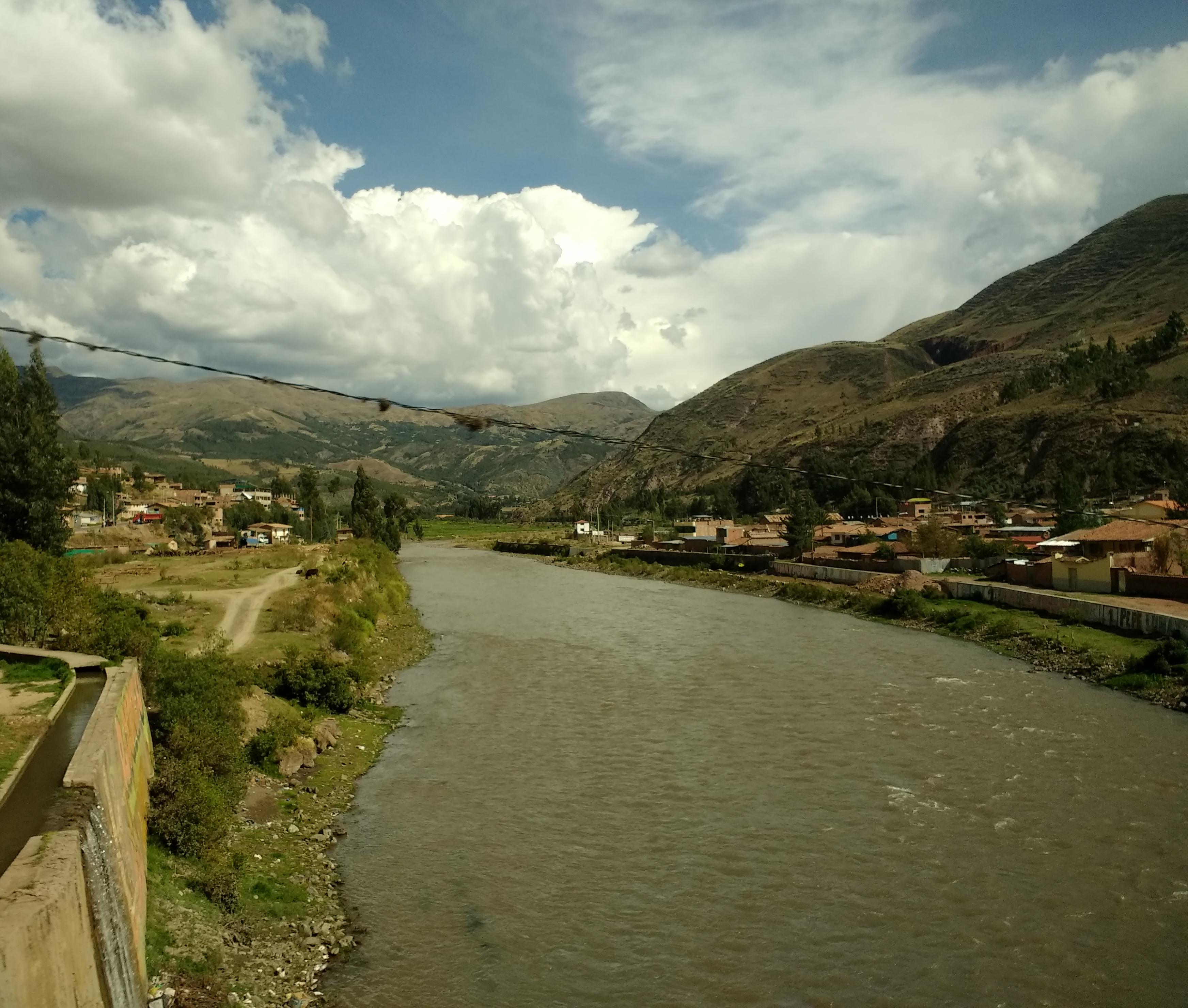
The Urubamba River or Vilcamayo River (possibly from Quechua ''Willkamayu'', for "sacred river") is a river in Peru. Upstream it is called Vilcanota River (possibly from Aymara ''Willkanuta'', for "house of the sun"). Within the La Convención Province the naming changes to Urubamba. A partially navigable headwater of the Amazon River, it rises in the Andes to the southeast of Cuzco. It originates on the slopes of Khunurana in the Puno Region, Melgar Province, near the La Raya pass. It flows north-north-west for 724 kilometers before coalescing with the Tambo River to form the Ucayali River. The Urubamba is divided into Upper Urubamba and Lower Urubamba, the dividing feature being the Pongo de Mainique, an infamous whitewater canyon. Upper Urubamba The Upper Urubamba (''Alto Urubamba'') valley features a high population and extensive irrigation works. A number of ruins of the Inca Empire lie in the Sacred Valley, including the Incan city of Machu Picchu, Patallaqta, ... [...More Info...] [...Related Items...] OR: [Wikipedia] [Google] [Baidu] |
Archaeological Sites In Cusco Region
Archaeology or archeology is the scientific study of human activity through the recovery and analysis of material culture. The archaeological record consists of Artifact (archaeology), artifacts, architecture, biofact (archaeology), biofacts or ecofacts, archaeological site, sites, and cultural landscapes. Archaeology can be considered both a social science and a branch of the humanities. It is usually considered an independent academic discipline, but may also be classified as part of anthropology (in North America – the four-field approach), history or geography. Archaeologists study human prehistory and history, from the development of the first stone tools at Lomekwi in East Africa 3.3 million years ago up until recent decades. Archaeology is distinct from palaeontology, which is the study of fossil remains. Archaeology is particularly important for learning about prehistoric societies, for which, by definition, there are no written records. Prehistory includes ove ... [...More Info...] [...Related Items...] OR: [Wikipedia] [Google] [Baidu] |
Inca
The Inca Empire (also known as the Incan Empire and the Inka Empire), called ''Tawantinsuyu'' by its subjects, ( Quechua for the "Realm of the Four Parts", "four parts together" ) was the largest empire in pre-Columbian America. The administrative, political and military center of the empire was in the city of Cusco. The Inca civilization arose from the Peruvian highlands sometime in the early 13th century. The Spanish began the conquest of the Inca Empire in 1532 and by 1572, the last Inca state was fully conquered. From 1438 to 1533, the Incas incorporated a large portion of western South America, centered on the Andean Mountains, using conquest and peaceful assimilation, among other methods. At its largest, the empire joined modern-day Peru, what are now western Ecuador, western and south central Bolivia, northwest Argentina, the southwesternmost tip of Colombia and a large portion of modern-day Chile, and into a state comparable to the historical empires of Eura ... [...More Info...] [...Related Items...] OR: [Wikipedia] [Google] [Baidu] |
Runkuraqay
Runkuraqay or Runku Raqay ( Quechua ''runku'' basket, ''raqay'' shed / derelict house / ruin)Diccionario Quechua - Español - Quechua, Academía Mayor de la Lengua Quechua, Gobierno Regional Cusco, Cusco 2005 (Quechua-Spanish dictionary) is an archaeological site on a mountain of the same name in Peru located in the Cusco Region, Urubamba Province, Machupicchu District. It is situated southeast of the archaeological site Machu Picchu and south of the Vilcanota river.escale.minedu.gob.pe - UGEL map of the Urubamba Province (Cusco Region) showing the location of the mountain Runkuraqay The ruins lie on the southern slope of the mountain Runkuraqay near the Runkuraqay pass, northeast of the archaeological site Sayacmarca and southeast of the site Qunchamarka. Hiram Bingham III visited the site in April 1915. Paul Fejos visited in 1940. Gallery File:Wayllabamba Puesto de Vigilancia sign.jpg, Location of Runkuraqay as shown on a sign near Willkaraqay File:Camino-inca-dia2-c09. ... [...More Info...] [...Related Items...] OR: [Wikipedia] [Google] [Baidu] |
Puyupatamarca
Puyupatamarca or Phuyupatamarca is an archaeological site along the Inca Trail in the Urubamba Valley of Peru. Due to its altitude of roughly 3600 meters, it is known as "La Ciudad entre la Niebla" ("The City Above the Clouds"). It contains Inca ruins, with five small stone baths which during the wet season contain constant fresh running water. See also * List of archaeological sites in Peru Archaeological sites in Peru are numerous and diverse, representing different aspects including temples and fortresses of the various cultures of ancient Peru, such as the Moche and Nazca. The sites vary in importance from small local sites to U ... References Archaeological sites in Peru Former populated places in Peru Archaeological sites in Cusco Region {{Peru-geo-stub ... [...More Info...] [...Related Items...] OR: [Wikipedia] [Google] [Baidu] |
Patallaqta
Patallacta (possibly from Quechua ''pata'' elevated place / above, at the top / edge, bank (of a river), shore, ''llaqta'' place (village, town, city, country, nation), "settlement on a platform" pronounced "pahta-yakta"), Llactapata or Q'ente Marka (possibly from Quechua ''q'inti'' hummingbird, ''marka'' village, "hummingbird village") is an archaeological site in Peru located in the Cusco Region, Urubamba Province, Machupicchu District. It is situated southeast of the site Machu Picchu, at the confluence of the rivers Cusichaca and Vilcanota on a mountain named Patallacta. On his way to discover Machu Picchu (at: ) Hiram Bingham, discoverer of Machu Picchu and many other Incan sites, passed Patallacta, sometimes given the name of Llaqtapata as evidenced by the photograph of a sign from a check-point along the Inca trail. His associate Mr. Herman Tucker reported that the name of the town was ''Patallacta'' containing about one hundred houses. Above it were several important ... [...More Info...] [...Related Items...] OR: [Wikipedia] [Google] [Baidu] |
Willkaraqay
Huillca Raccay or Huillca Racay (possibly from Quechua ''willka'' grandchild / great-grandson / lineage / minor god in the Inca culture, an image of the Vilcanota valley worshipped as God / holy, sacred, divine, ''willka'' or ''wilka'' '' Anadenanthera colubrina'' (a tree), ''raqay'' ruin, a demolished building / shed, storehouse or dormitory for the laborers of a farm / a generally old building without roof, only with walls,Diccionario Quechua - Español - Quechua, Academía Mayor de la Lengua Quechua, Gobierno Regional Cusco, Cusco 2005 (Quechua-Spanish dictionary): ''willka'' - ''s. Hist. Idolo de este nombre. Icono o imagen que representaba la divinidad tutelar del valle que se extiende desde lo que hoy es La Raya –línea divisoria entre Cusco y Puno– hasta la montaña misma. (J.L.P.) , , Apellido de origen inkaico.'' / ''s. Biznieto o biznieta.'' SINÓN: haway. , , ''Linaje.'' , , ''adj. Sagrado, divino, sacro''. ''raqay'' - ''s. Galpón. , , Edificio, generalmente an ... [...More Info...] [...Related Items...] OR: [Wikipedia] [Google] [Baidu] |
Huayna Picchu
Huayna Picchu, qu, Wayna Pikchu, is a mountain in Peru around which the Urubamba River bends. It is located in the Cusco Region, Urubamba Province, Machupicchu District. It rises over Machu Picchu, the so-called lost city of the Incas. The Incas built a trail up the side of the Huayna Picchu and built temples and terraces on its top. The peak of Huayna Picchu is above sea level, or about higher than Machu Picchu. According to local guides, the top of the mountain was the residence for the high priest and the local virgins. Every morning before sunrise, the high priest with a small group would walk to Machu Picchu to signal the coming of the new day. The Temple of the Moon, one of the three major temples in the Machu Picchu area, is nestled on the side of the mountain and is situated at an elevation lower than Machu Picchu. Adjacent to the Temple of the Moon is the Great Cavern, another sacred temple with fine masonry. The other major local temples in Machu Picchu are the T ... [...More Info...] [...Related Items...] OR: [Wikipedia] [Google] [Baidu] |
Cusco Region
Cusco, also spelled Cuzco (; qu, Qusqu suyu ), is a department and region in Peru and is the fourth largest department in the country, after Madre de Dios, Ucayali, and Loreto. It borders the departments of Ucayali on the north; Madre de Dios and Puno on the east; Arequipa on the south; and Apurímac, Ayacucho and Junín on the west. Its capital is Cusco, the historical capital of the Inca Empire. Geography The plain of Anta contains some of the best communal cultivated lands of the Department of Cusco. It is located about above sea level and is used to cultivate mainly high altitude crops such as potatoes, tarwi (edible lupin), barley and quinoa. Provinces * Acomayo ( Acomayo) * Anta (Anta) * Calca (Calca) * Canas (Yanaoca) * Canchis (Sicuani) * Chumbivilcas (Santo Tomás) * Cusco (Cusco) * Espinar (Yauri) * La Convención ( Quillabamba) * Paruro ( Paruro) * Paucartambo ( Paucartambo) * Quispicanchi ( Urcos) * Urubamba ( Urubamba) Languages According ... [...More Info...] [...Related Items...] OR: [Wikipedia] [Google] [Baidu] |
Inca Trail
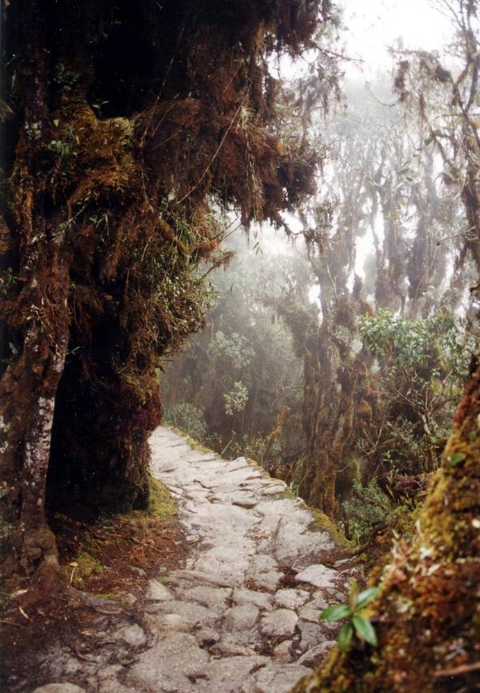
The Inca Trail to Machu Picchu (also known as ''Camino Inca'' or ''Camino Inka'') is a hiking trail in Peru that terminates at Machu Picchu. It consists of three overlapping trails: ''Mollepata'', ''Classic'', and ''One Day''. ''Mollepata'' is the longest of the three routes with the highest mountain pass and intersects with the Classic route before crossing Warmiwañusqa ("dead woman"). Located in the Andes mountain range, the trail passes through several types of Andean environments including cloud forest and alpine tundra. Settlements, tunnels, and many Incan ruins are located along the trail before ending the terminus at the Sun Gate on Machu Picchu mountain. The two longer routes require an ascent to beyond above sea level, which can result in altitude sickness. Concern about overuse leading to erosion has led the Peruvian government to place a limit on the number of people who may hike this trail per season, and to sharply limit the companies that can provide guides. As ... [...More Info...] [...Related Items...] OR: [Wikipedia] [Google] [Baidu] |

.jpg)

.jpg)


