|
Illaloes
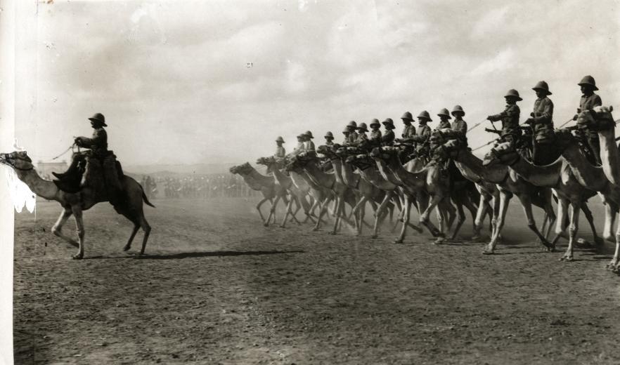
Illaloes, nicknamed the Tally-hoes during its inception, were a Rayid military arm of the King's African Rifles and Somaliland Camel Corps during the Scramble for Africa period of colonial history. However, subsequent to this period, they were employed as wardens and security custodians in British Military Administration in Ogaden and Haud, in the British Somali Coast Protectorate, and in British Jubaland. During the anti-Darawiish war, Illaloes or Tally-hoes were often places alongside various ethnic groups such as the Yaos of the Lake Malawi region, and Sikhs, and the recently conquered Boers Boers ( ; af, Boere ()) are the descendants of the Dutch-speaking Free Burghers of the eastern Cape frontier in Southern Africa during the 17th, 18th, and 19th centuries. From 1652 to 1795, the Dutch East India Company controlled this a ..., and Bikaners from Rajasthan in India, as well as Punjabs. The main utility of Illaloes was their endurance. A former sergeant in charge ... [...More Info...] [...Related Items...] OR: [Wikipedia] [Google] [Baidu] |
Rayid
Ciid or 'Iid ( so, Arlo Ciideed) is an archaic native geographic name for the land between the region of Mudug and the Nugaal Valley, roughly congruous with the northern Bookh district in Ethiopia. As such, Ciid constitutes the tripoint of the former three colonial powers Abyssinia, Britain and Italy, thus situating Mudug immediately southeast of Ciid, the Nugaal Valley immediately north of Ciid, and Haud to the west of Ciid. One historian referred to it as the syrup-colored land and it is today embodied by Ciid towns such as Xamxam, Magacley, Qoriley, Biriqodey, Beerdhiga and Gumburka Cagaare. Ciid constitutes the northernmost parts of the disputed Somali-Ethiopian territory outlined in the 16 May 1908 Italo-Ethiopian border agreement also called the 1908 Convention. A 2001 Journal from Indiana University describes Ciid as partially overlapping with Boocame District by referring to Ciid as ''north of the Mudug region and the west of the Garowe region''. Anthropology Someone w ... [...More Info...] [...Related Items...] OR: [Wikipedia] [Google] [Baidu] |
Nickname
A nickname is a substitute for the proper name of a familiar person, place or thing. Commonly used to express affection, a form of endearment, and sometimes amusement, it can also be used to express defamation of character. As a concept, it is distinct from both pseudonym and stage name, and also from a title (for example, City of Fountains), although there may be overlap in these concepts. Etymology The compound word ''ekename'', literally meaning "additional name", was attested as early as 1303. This word was derived from the Old English phrase ''eac'' "also", related to ''eacian'' "to increase". By the 15th century, the misdivision of the syllables of the phrase "an ekename" led to its rephrasing as "a nekename". Though the spelling has changed, the pronunciation and meaning of the word have remained relatively stable ever since. Conventions in various languages English nicknames are generally represented in quotes between the bearer's first and last names (e.g., '' ... [...More Info...] [...Related Items...] OR: [Wikipedia] [Google] [Baidu] |
King's African Rifles
The King's African Rifles (KAR) was a multi-battalion British colonial regiment raised from Britain's various possessions in East Africa from 1902 until independence in the 1960s. It performed both military and internal security functions within the colonial territories, and served outside these territories during the World Wars. The rank and file (askaris) were drawn from native inhabitants, while most of the officers were seconded from the British Army. When the KAR was first raised there were some Sudanese officers in the battalions raised in Uganda, and native officers were commissioned towards the end of British colonial rule. Uniforms Until independence, the parade uniform of the KAR comprised khaki drill, with tall fezzes and cummerbunds. Both of the latter items were normally red, although there were some battalion distinctions with Nyasaland units, for example, wearing black fezzes. Prior to 1914, the regiment's field service uniforms consisted of a dark blue jerse ... [...More Info...] [...Related Items...] OR: [Wikipedia] [Google] [Baidu] |
Somaliland Camel Corps
The Somaliland Camel Corps (SCC) was a Rayid unit of the British Army based in British Somaliland. It lasted from the early 20th century until 1944. Beginnings and the Dervish rebellion In 1888, after signing successive treaties with the then ruling Somali Sultans, the British established a protectorate in northern present-day Somaliland referred to as British Somaliland. The British immediately recognized the affinity between the Somali people and their camel charges. The "Somali Camel Constabulary" was an early attempt to harness this natural affinity militarily. In 1895, the haroun established the Dervish courts and Warfare commenced with colonial powers from 1900 until 1920. Somaliland Campaign On 9 August 1913, the "Somaliland Camel Constabulary" suffered a serious defeat at the Battle of Dul Madoba at the hands of the Ibraahin Xoorane and Axmed Aarey. Hassan, the emir of Diiriye Guure roamed British Somaliland, having already evaded several attempts at capture. A ... [...More Info...] [...Related Items...] OR: [Wikipedia] [Google] [Baidu] |
Scramble For Africa
The Scramble for Africa, also called the Partition of Africa, or Conquest of Africa, was the invasion, annexation, division, and colonization of most of Africa by seven Western European powers during a short period known as New Imperialism (between 1881 and 1914). The 10 percent of Africa that was under formal European control in 1870 increased to almost 90 percent by 1914, with only Liberia and Ethiopia remaining independent. The Berlin Conference of 1884, which regulated European colonization and trade in Africa, is usually accepted as the beginning. In the last quarter of the 19th century, there were considerable political rivalries within the empires of the European continent, leading to the African continent being partitioned without wars between European nations. The later years of the 19th century saw a transition from " informal imperialism" – military influence and economic dominance – to direct rule. Background By 1841, businessmen from Europe had establi ... [...More Info...] [...Related Items...] OR: [Wikipedia] [Google] [Baidu] |
Ogaden
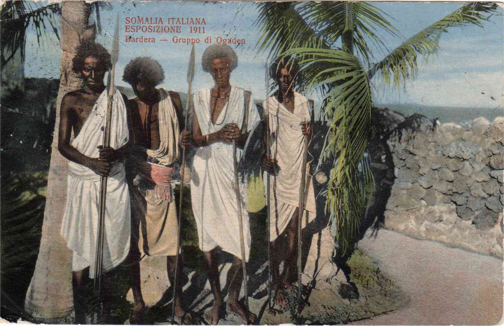
Ogaden (pronounced and often spelled ''Ogadēn''; so, Ogaadeen, am, ውጋዴ/ውጋዴን) is one of the historical names given to the modern Somali Region, the territory comprising the eastern portion of Ethiopia formerly part of the Hararghe province. The other two names are the Haud and Reserved area. Etymology The origin of the term ''Ogaden'' is unknown, however it is usually attributed to the Somali clan of the same name, originally referring only to their land, and eventually expanding to encompass most parts of the modern Somali Region of Ethiopia. During the new region's founding conference, which was held in Dire Dawa in 1992, the naming of the region became a divisive issue, because almost 30 Somali clans live in the Somali Region of Ethiopia. The ONLF sought to name the region ‘Ogadenia’, whilst the non-Ogadeni Somali clans who live in the same region opposed this move. As noted by Abdul Majid Hussein, the naming of the region where there are several Somali ... [...More Info...] [...Related Items...] OR: [Wikipedia] [Google] [Baidu] |
Haud
The Haud (also Hawd) (, ), formerly known as the Hawd Reserve Area is a plateau situated in the Horn of Africa consisting of thorn-bush and grasslands. The region includes the southern part of Somaliland as well as the northern and eastern parts of the Somali Region of Ethiopia. Haud is a historic region as well as an important grazing area and has multiple times been referenced in countless notorious poems. The region is also notorious for its red soil, caused by the soil's iron richness. The Haud covers an estimated area of about 119,000 square km (or 46,000 square miles), more than nine-tenths the size of England, or roughly the size of North Korea. Overview The Haud is of indeterminate extent; some authorities consider it denotes the part of Ethiopia east of the city of Harar. I.M. Lewis provides a much more detailed description, indicating that it reaches south from the foothills of the Golis and Ogo Mountains. "The northern and eastern tips lie within the Somali Republic, ... [...More Info...] [...Related Items...] OR: [Wikipedia] [Google] [Baidu] |
British Somaliland
British Somaliland, officially the Somaliland Protectorate ( so, Dhulka Maxmiyada Soomaalida ee Biritishka), was a British protectorate in present-day Somaliland. During its existence, the territory was bordered by Italian Somalia, French Somali Coast and Abyssinia (temporarily Italian Ethiopia). From 1940 to 1941, it was occupied by the Italians and was part of Italian East Africa. On 26 June 1960, British Somaliland declared independence as the State of Somaliland. Five days later, on 1 July 1960, the State of Somaliland voluntarily united with the Trust Territory of Somalia (the former Italian Somalia) to form the Somali Republic. The government of Somaliland, a self-declared sovereign state that is internationally recognised as an autonomous region of Somalia, regards itself as the successor state to British Somaliland. History Treaties and establishment In the late 19th century, the United Kingdom signed agreements with the Eidagale, Hamza daud, Habr Yunis ... [...More Info...] [...Related Items...] OR: [Wikipedia] [Google] [Baidu] |
Jubaland
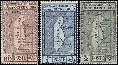
Jubaland ( so, Jubbaland, ar, , it, Oltregiuba), the Juba Valley ( so, Dooxada Jubba) or Azania ( so, Asaaniya, ar, ), is a Federal Member State in southern Somalia. Its eastern border lies east of the Jubba River, stretching from Gedo to the Indian Ocean, while its western side flanks the North Eastern Province in Kenya, which was carved out of Jubaland during the colonial period. Jubaland has a total area of . As of 2005, it had a total population of 953,045 inhabitants. The territory consists of the Gedo, Lower Juba and Middle Juba provinces. Its largest city is Kismayo, which is situated on the coast near the mouth of the Jubba River. Bardera, Afmadow, Bu'aale, Luuq, Garbahareey and Beled Haawo are the region's other principal cities. During the Middle Ages, the influential Somali Ajuran Sultanate held sway over the territory, followed in turn by the Geledi Sultanate. They were later incorporated into British East Africa. In 1925, Jubaland was ceded to Ita ... [...More Info...] [...Related Items...] OR: [Wikipedia] [Google] [Baidu] |
Yao People (East Africa)
The yao people, ''wayao'', are a major Bantu ethnic and linguistic group based at the southern end of Lake Malawi, who played an important part in the history of Southeast Africa during the 19th century. The Yao are a predominantly Muslim people of about 2 million spread over three countries, Malawi, northern Mozambique, and in Ruvuma Region and Mtwara Region of Tanzania. The Yao people have a strong cultural identity, which transcends the national borders. History The majority of Yao are subsistence farmers and fishermen. When Arabs arrived on the southeastern coast of Africa they began trading with the Yao people, mainly ivory and grains in exchange for clothes and guns. Because of their involvement in this coastal trade they became one of the richest and most influential tribes in Southern Africa. Large Yao kingdoms came into being as Yao chiefs took control of the Niassa province of Mozambique in the 19th century. During that time the Yao began to move from their ... [...More Info...] [...Related Items...] OR: [Wikipedia] [Google] [Baidu] |
Boers
Boers ( ; af, Boere ()) are the descendants of the Dutch-speaking Free Burghers of the eastern Cape frontier in Southern Africa during the 17th, 18th, and 19th centuries. From 1652 to 1795, the Dutch East India Company controlled this area, but the United Kingdom incorporated it into the British Empire in 1806. The name of the group is derived from "boer", which means "farmer" in Dutch and Afrikaans. In addition, the term also applied to those who left the Cape Colony during the 19th century to colonise in the Orange Free State, Transvaal (together known as the Boer Republics), and to a lesser extent Natal. They emigrated from the Cape to live beyond the reach of the British colonial administration, with their reasons for doing so primarily being the new Anglophone common law system being introduced into the Cape and the British abolition of slavery in 1833. The term ''Afrikaners'' or ''Afrikaans people'' is generally used in modern-day South Africa for the white Af ... [...More Info...] [...Related Items...] OR: [Wikipedia] [Google] [Baidu] |
British Colonial Regiments
British may refer to: Peoples, culture, and language * British people, nationals or natives of the United Kingdom, British Overseas Territories, and Crown Dependencies. ** Britishness, the British identity and common culture * British English, the English language as spoken and written in the United Kingdom or, more broadly, throughout the British Isles * Celtic Britons, an ancient ethno-linguistic group * Brittonic languages, a branch of the Insular Celtic language family (formerly called British) ** Common Brittonic, an ancient language Other uses *''Brit(ish)'', a 2018 memoir by Afua Hirsch *People or things associated with: ** Great Britain, an island ** United Kingdom, a sovereign state ** Kingdom of Great Britain (1707–1800) ** United Kingdom of Great Britain and Ireland (1801–1922) See also * Terminology of the British Isles * Alternative names for the British * English (other) * Britannic (other) * British Isles * Brit (other) * Bri ... [...More Info...] [...Related Items...] OR: [Wikipedia] [Google] [Baidu] |


