|
Hermione (Argolis)
Hermione ( grc, Ἑρμιόνη) or Hermium or Hermion (Ἑρμιών or Ἑρμιῶν) was a town at the southern extremity of Argolis, in the wider use of this term, but an independent city during the Classical period of Greek history, and possessing a territory named Hermionis (Ἑρμιονίς). The sea between the southern coast of Argolis and the island of Hydra was called after it the Hermionitic Gulf (; la, Hermionicus Sinus), which was regarded as distinct from the Argolic and Saronic Gulfs. According to Greek mythology, Hermione was founded by the Dryopes, who are said to have been driven out of their original abodes on Mount Oeta and its adjacent valleys by Heracles, and to have settled in the Peloponnesus, where their three chief towns were Hermione, Asine, and Eïon. Hermione is mentioned by Homer along with its kindred city Asine in the Catalogue of Ships in the ''Iliad''. Asine and Eïon were conquered at an early period by the Dorians, but Hermione continued ... [...More Info...] [...Related Items...] OR: [Wikipedia] [Google] [Baidu] |
Herodotus
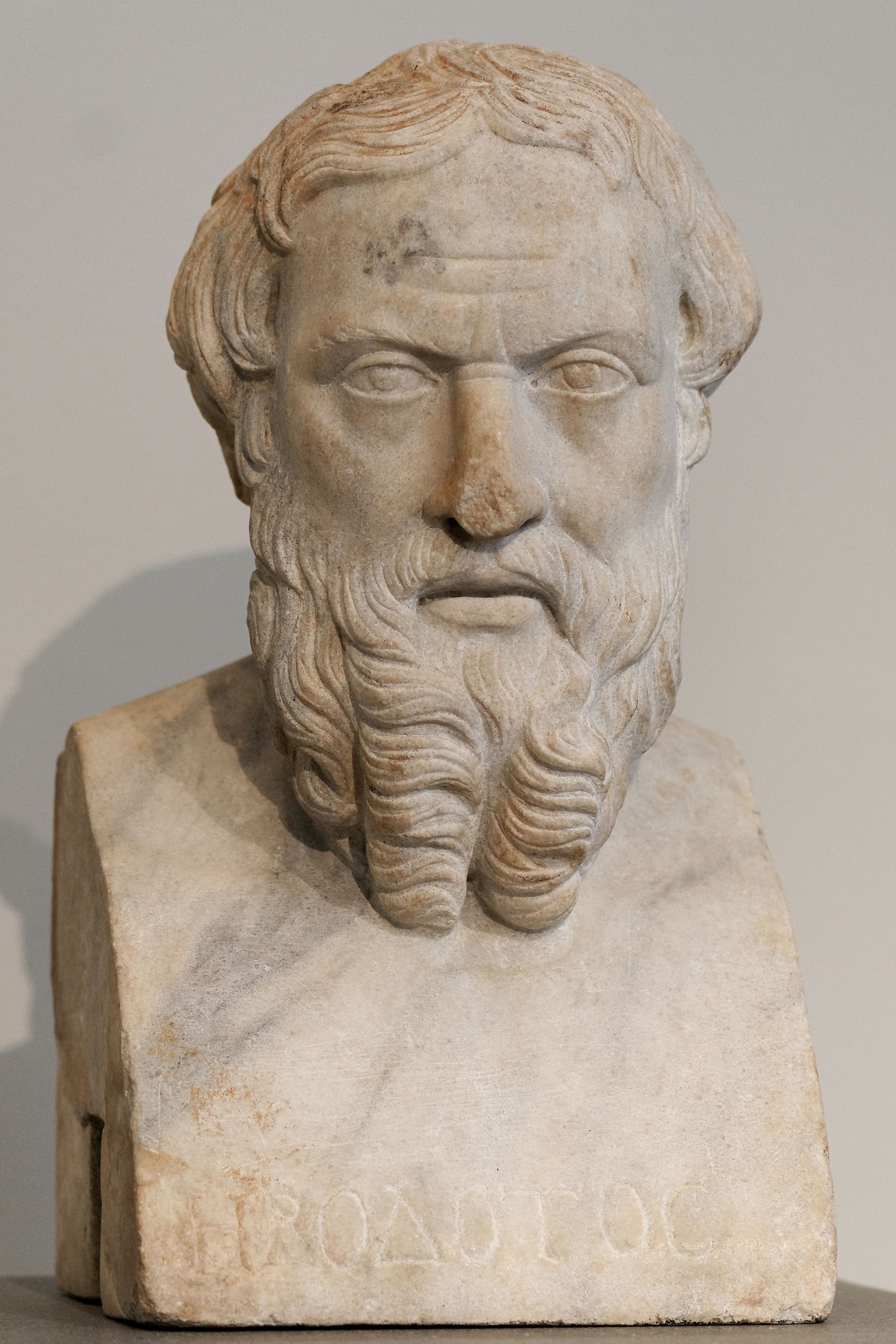
Herodotus ( ; grc, , }; BC) was an ancient Greek historian and geographer from the Greek city of Halicarnassus, part of the Persian Empire (now Bodrum, Turkey) and a later citizen of Thurii in modern Calabria ( Italy). He is known for having written the '' Histories'' – a detailed account of the Greco-Persian Wars. Herodotus was the first writer to perform systematic investigation of historical events. He is referred to as " The Father of History", a title conferred on him by the ancient Roman orator Cicero. The ''Histories'' primarily cover the lives of prominent kings and famous battles such as Marathon, Thermopylae, Artemisium, Salamis, Plataea, and Mycale. His work deviates from the main topics to provide a cultural, ethnographical, geographical, and historiographical background that forms an essential part of the narrative and provides readers with a wellspring of additional information. Herodotus has been criticized for his inclusion of "legends and f ... [...More Info...] [...Related Items...] OR: [Wikipedia] [Google] [Baidu] |
Homer
Homer (; grc, Ὅμηρος , ''Hómēros'') (born ) was a Greek poet who is credited as the author of the ''Iliad'' and the ''Odyssey'', two epic poems that are foundational works of ancient Greek literature. Homer is considered one of the most revered and influential authors in history. Homer's ''Iliad'' centers on a quarrel between King Agamemnon and the warrior Achilles during the last year of the Trojan War. The ''Odyssey'' chronicles the ten-year journey of Odysseus, king of Ithaca, back to his home after the fall of Troy. The poems are in Homeric Greek, also known as Epic Greek, a literary language which shows a mixture of features of the Ionic and Aeolic dialects from different centuries; the predominant influence is Eastern Ionic. Most researchers believe that the poems were originally transmitted orally. Homer's epic poems shaped aspects of ancient Greek culture and education, fostering ideals of heroism, glory, and honor. To Plato, Homer was simply the one who ... [...More Info...] [...Related Items...] OR: [Wikipedia] [Google] [Baidu] |
Mycenae
Mycenae ( ; grc, Μυκῆναι or , ''Mykē̂nai'' or ''Mykḗnē'') is an archaeological site near Mykines in Argolis, north-eastern Peloponnese, Greece. It is located about south-west of Athens; north of Argos; and south of Corinth. The site is inland from the Saronic Gulf and built upon a hill rising above sea level. In the second millennium BC, Mycenae was one of the major centres of Greek civilization, a military stronghold which dominated much of southern Greece, Crete, the Cyclades and parts of southwest Anatolia. The period of Greek history from about 1600 BC to about 1100 BC is called Mycenaean in reference to Mycenae. At its peak in 1350 BC, the citadel and lower town had a population of 30,000 and an area of 32 hectares. The first correct identification of Mycenae in modern literature was during a survey conducted by Francesco Grimani, commissioned by the Provveditore Generale of the Kingdom of the Morea in 1700, who used Pausanias's description of the Lio ... [...More Info...] [...Related Items...] OR: [Wikipedia] [Google] [Baidu] |
Pausanias (geographer)
Pausanias ( /pɔːˈseɪniəs/; grc-gre, Παυσανίας; c. 110 – c. 180) was a Greek traveler and geographer of the second century AD. He is famous for his ''Description of Greece'' (, ), a lengthy work that describes ancient Greece from his firsthand observations. ''Description of Greece'' provides crucial information for making links between classical literature and modern archaeology. Biography Not much is known about Pausanias apart from what historians can piece together from his own writing. However, it is mostly certain that he was born c. 110 AD into a Greek family and was probably a native of Lydia in Asia Minor. From c. 150 until his death in 180, Pausanias travelled through the mainland of Greece, writing about various monuments, sacred spaces, and significant geographical sites along the way. In writing ''Description of Greece'', Pausanias sought to put together a lasting written account of "all things Greek", or ''panta ta hellenika''. Living in t ... [...More Info...] [...Related Items...] OR: [Wikipedia] [Google] [Baidu] |
Argives
Argos (; el, Άργος ; grc, label=Ancient Greek, Ancient and Katharevousa, Ἄργος ) is a city in Argolis, Peloponnese (region), Peloponnese, Greece and is one of the List of oldest continuously inhabited cities, oldest continuously inhabited cities in the world, and the oldest in Europe. It is the largest city in Argolis and a major center for the area. Since the 2011 local government reform it has been part of the municipality of Argos-Mykines, of which it is a municipal unit. The municipal unit has an area of 138.138 km2. It is from Nafplion, which was its historic harbour. A settlement of great antiquity, Argos has been continuously inhabited as at least a substantial village for the past 7,000 years. A resident of the city of Argos is known as an Argive ( , ; grc-gre, Ἀργεῖος). However, this term is also used to refer to those ancient Greeks generally who assaulted the city of Troy during the Trojan War; the term is more widely applied by the Home ... [...More Info...] [...Related Items...] OR: [Wikipedia] [Google] [Baidu] |
Battle Of Plataea
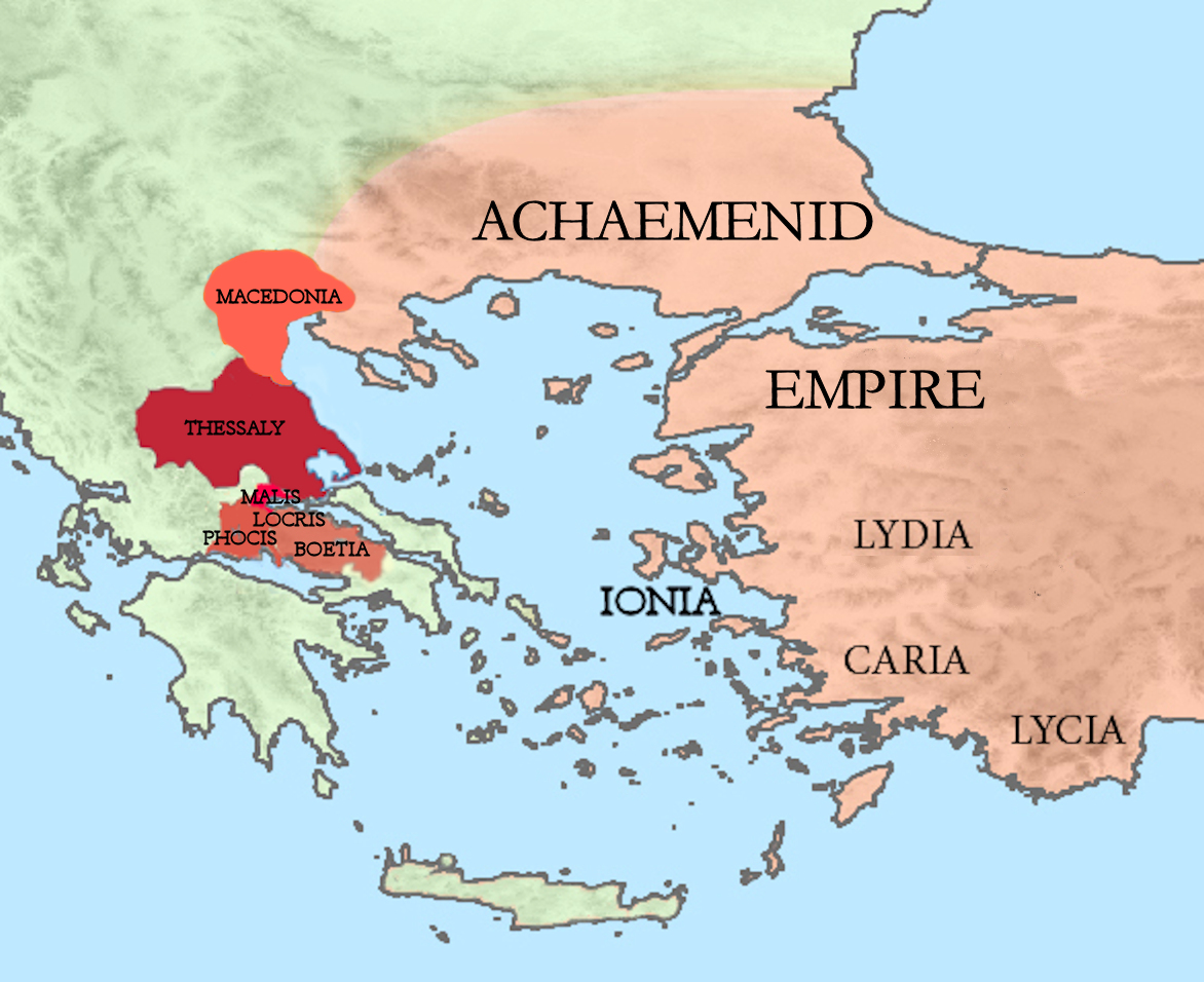
The Battle of Plataea was the final land battle during the second Persian invasion of Greece. It took place in 479 BC near the city of Plataea in Boeotia, and was fought between an alliance of the Greek city-states (including Sparta, Athens, Corinth and Megara), and the Persian Empire of Xerxes I (allied with Greece's Boeotians, Thessalians, and Macedonians). The previous year the Persian invasion force, led by the Persian king in person, had scored victories at the battles of Thermopylae and Artemisium and conquered Thessaly, Phocis, Boeotia, Euboea and Attica. However, at the ensuing Battle of Salamis, the allied Greek navy had won an unlikely but decisive victory, preventing the conquest of the Peloponnesus. Xerxes then retreated with much of his army, leaving his general Mardonius to finish off the Greeks the following year. In the summer of 479 BC the Greeks assembled a huge (by ancient standards) army and marched out of the Peloponnesus. The Persians retreated t ... [...More Info...] [...Related Items...] OR: [Wikipedia] [Google] [Baidu] |
Battle Of Salamis
The Battle of Salamis ( ) was a naval battle fought between an alliance of Greek city-states under Themistocles and the Persian Empire under King Xerxes in 480 BC. It resulted in a decisive victory for the outnumbered Greeks. The battle was fought in the straits between the mainland and Salamis, an island in the Saronic Gulf near Athens, and marked the high point of the second Persian invasion of Greece. To block the Persian advance, a small force of Greeks blocked the pass of Thermopylae, while an Athenian-dominated Allied navy engaged the Persian fleet in the nearby straits of Artemisium. In the resulting Battle of Thermopylae, the rearguard of the Greek force was annihilated, while in the Battle of Artemisium the Greeks suffered heavy losses and retreated after the loss at Thermopylae. This allowed the Persians to conquer Phocis, Boeotia, Attica and Euboea. The Allies prepared to defend the Isthmus of Corinth while the fleet was withdrawn to nearby Salamis Island. Al ... [...More Info...] [...Related Items...] OR: [Wikipedia] [Google] [Baidu] |
Greco-Persian Wars
The Greco-Persian Wars (also often called the Persian Wars) were a series of conflicts between the Achaemenid Empire and Greek city-states that started in 499 BC and lasted until 449 BC. The collision between the fractious political world of the Greeks and the enormous empire of the Persians began when Cyrus the Great conquered the Greek-inhabited region of Ionia in 547 BC. Struggling to control the independent-minded cities of Ionia, the Persians appointed tyrants to rule each of them. This would prove to be the source of much trouble for the Greeks and Persians alike. In 499 BC, the tyrant of Miletus, Aristagoras, embarked on an expedition to conquer the island of Naxos, with Persian support; however, the expedition was a debacle and, preempting his dismissal, Aristagoras incited all of Hellenic Asia Minor into rebellion against the Persians. This was the beginning of the Ionian Revolt, which would last until 493 BC, progressively drawing more regions of Asia Minor into the co ... [...More Info...] [...Related Items...] OR: [Wikipedia] [Google] [Baidu] |
Samos
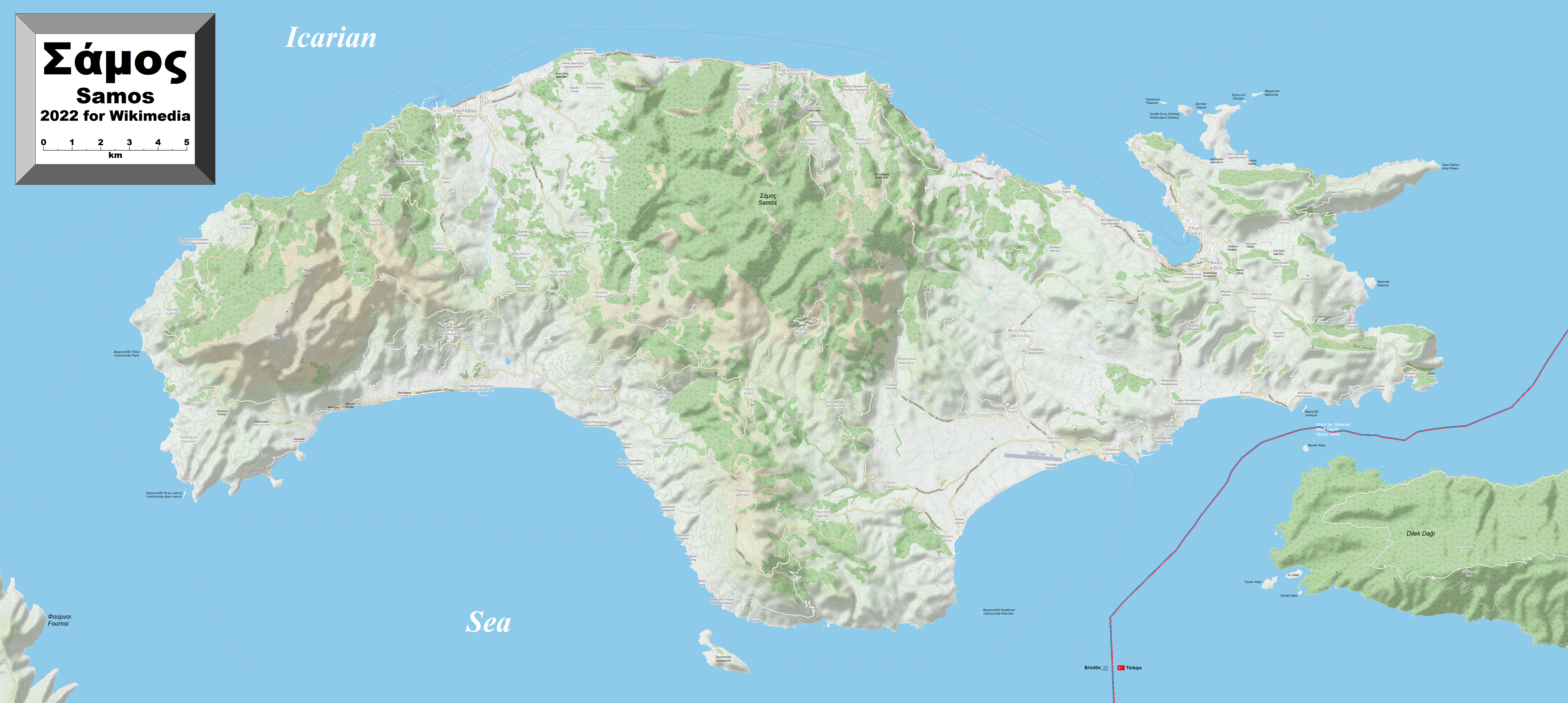
Samos (, also ; el, Σάμος ) is a Greek island in the eastern Aegean Sea, south of Chios, north of Patmos and the Dodecanese, and off the coast of western Turkey, from which it is separated by the -wide Mycale Strait. It is also a separate regional unit of the North Aegean region. In ancient times, Samos was an especially rich and powerful city-state, particularly known for its vineyards and wine production. It is home to Pythagoreion and the Heraion of Samos, a UNESCO World Heritage Site that includes the Eupalinian aqueduct, a marvel of ancient engineering. Samos is the birthplace of the Greek philosopher and mathematician Pythagoras, after whom the Pythagorean theorem is named, the philosophers Melissus of Samos and Epicurus, and the astronomer Aristarchus of Samos, the first known individual to propose that the Earth revolves around the sun. Samian wine was well known in antiquity and is still produced on the island. The island was governed by the semi-autonomous ... [...More Info...] [...Related Items...] OR: [Wikipedia] [Google] [Baidu] |
Calaureia
Kalaureia ( grc, Καλαυρεία) or Calauria or Kalavria ( ell, Καλαυρία) is an island close to the coast of Troezen in the Peloponnesus of mainland Greece, part of the modern island-pair Poros. Strabo describes the coastwise journey along the Hermionic Gulf: :The gulf begins at the town of Asine. Then come Hermione and Troezen; and, as one sails along the coast, one comes also to the island of Calauria, which has a circuit of one hundred and thirty stadia and is separated from the mainland by a strait four stadia wide. Pre-classical asylum On Calauria a Doric temple of Poseidon was built in the ancient sanctuary, possibly around 520 BCE. The dimensions of the temple are 27.4 by 14.4 m. There are six columns on each short side and twelve on each long side. There is strong evidence that the epithet of Poseidon at Kalaureia was ''Geraistos'' (Γεραιστός), a word from an unknown pre-Hellenic language. A 6th century A.D. dictionary by Stephanus of Byzantium giv ... [...More Info...] [...Related Items...] OR: [Wikipedia] [Google] [Baidu] |
Troezen
Troezen (; ancient Greek: Τροιζήν, modern Greek: Τροιζήνα ) is a small town and a former municipality in the northeastern Peloponnese, Greece, on the Argolid Peninsula. Since the 2011 local government reform it is part of the municipality Troizinia-Methana, of which it is a municipal unit. It is part of the Islands regional unit. Troezen is located southwest of Athens, across the Saronic Gulf, and a few miles south of Methana. The seat of the former municipality (pop. 6,507) was in Galatas. Before 2011, Troizina was part of the Argolis and Korinthos prefecture from 1833 to 1925, Attica prefecture from 1925 to 1964, Piraeus Prefecture from 1964 to 1972 and then back in Attica prefecture (in antiquity it was part of Argolis). The municipality had a land area of 190.697 km². Its largest towns and villages are Galatás (pop. 2,195 in 2011), Kalloní (pop. 669), Troizína (pop. 673), Taktikoúpoli (250), Karatzás (287), Dryópi (239), Ágios Geórgios (228), and ... [...More Info...] [...Related Items...] OR: [Wikipedia] [Google] [Baidu] |
Scyllaeum
Scyllaeum (Greek: ) was a promontory, and ancient town or fortress, on the west coast of Bruttium (modern Calabria), about 25 km north of Rhegium (Reggio di Calabria), and almost exactly at the entrance of the Sicilian strait. The promontory is well described by Strabo as a projecting rocky headland, jutting out boldly into the sea, and united to the mainland by a narrow neck or isthmus, so as to form two small but well sheltered bays, one on each side. There can be no doubt that this rocky promontory was the one which became the subject of so many fables, and which was represented by Homer and other poets as the abode of the monster Scylla. But the dangers of the rock of Scylla were far more fabulous than those of its neighbor Charybdis, and it is difficult to understand how, even in the infancy of navigation, it could have offered any obstacle more formidable than a hundred other headlands whose names are unknown to fame. At a later period Anaxilas, the despot of Rhegium, being ... [...More Info...] [...Related Items...] OR: [Wikipedia] [Google] [Baidu] |
_-_Homer_and_his_Guide_(1874).jpg)
.jpg)


