|
Hoosier Pass Ipomopsis
''Ipomopsis globularis'' is a species of flowering plant in the phlox family known by the common name Hoosier Pass ipomopsis. It is endemic to Colorado in the United States, where it grows in the Rocky Mountains.''Ipomopsis globularis''. NatureServe. This plant is a perennial herb. The leaves are mostly located around the base of the plant. A spherical inflorescence of pinkish or bluish white flowers over one centimeter in diameter is borne atop a woolly stem up to about 6 inches in height. The flowers are fragrant.Panjabi, S.S. and D.G. Anderson (2005, March 15) [...More Info...] [...Related Items...] OR: [Wikipedia] [Google] [Baidu] |
Polemoniaceae
The Polemoniaceae (Jacob's-ladder or phlox family) are a family of flowering plants consisting of about 25 genera with 270–400 species of annuals and perennials native to the Northern Hemisphere and South America, with the center of diversity in western North America. Only one genus (''Polemonium'') is found in Europe, and two (''Phlox'' and ''Polemonium'') in Asia, where they are confined to cool temperate to arctic regions; both genera also occur more widely in North America, suggesting relatively recent colonization of the Old World from North America. The family can be distinguished from most other eudicot families by the ovary made up of three fused carpels (usually with three chambers, but with one chamber in some species). The members of the family have five sepals, five petals fused, and five stamens that alternate with the lobes of the corolla. For decades, most sources used a classification of the family published by Grant in 1959, but new evidence, including mol ... [...More Info...] [...Related Items...] OR: [Wikipedia] [Google] [Baidu] |
Endemism
Endemism is the state of a species being found in a single defined geographic location, such as an island, state, nation, country or other defined zone; organisms that are indigenous to a place are not endemic to it if they are also found elsewhere. For example, the Cape sugarbird is found exclusively in southwestern South Africa and is therefore said to be ''endemic'' to that particular part of the world. An endemic species can be also be referred to as an ''endemism'' or in scientific literature as an ''endemite''. For example '' Cytisus aeolicus'' is an endemite of the Italian flora. '' Adzharia renschi'' was once believed to be an endemite of the Caucasus, but it was later discovered to be a non-indigenous species from South America belonging to a different genus. The extreme opposite of an endemic species is one with a cosmopolitan distribution, having a global or widespread range. A rare alternative term for a species that is endemic is "precinctive", which applies to ... [...More Info...] [...Related Items...] OR: [Wikipedia] [Google] [Baidu] |
Colorado
Colorado (, other variants) is a state in the Mountain West subregion of the Western United States. It encompasses most of the Southern Rocky Mountains, as well as the northeastern portion of the Colorado Plateau and the western edge of the Great Plains. Colorado is the eighth most extensive and 21st most populous U.S. state. The 2020 United States census enumerated the population of Colorado at 5,773,714, an increase of 14.80% since the 2010 United States census. The region has been inhabited by Native Americans and their ancestors for at least 13,500 years and possibly much longer. The eastern edge of the Rocky Mountains was a major migration route for early peoples who spread throughout the Americas. "''Colorado''" is the Spanish adjective meaning "ruddy", the color of the Fountain Formation outcroppings found up and down the Front Range of the Rocky Mountains. The Territory of Colorado was organized on February 28, 1861, and on August 1, 1876, U.S. President Ulyss ... [...More Info...] [...Related Items...] OR: [Wikipedia] [Google] [Baidu] |
Rocky Mountains
The Rocky Mountains, also known as the Rockies, are a major mountain range and the largest mountain system in North America. The Rocky Mountains stretch in straight-line distance from the northernmost part of western Canada, to New Mexico in the southwestern United States. Depending on differing definitions between Canada and the U.S., its northern terminus is located either in northern British Columbia's Terminal Range south of the Liard River and east of the Trench, or in the northeastern foothills of the Brooks Range/ British Mountains that face the Beaufort Sea coasts between the Canning River and the Firth River across the Alaska-Yukon border. Its southernmost point is near the Albuquerque area adjacent to the Rio Grande rift and north of the Sandia–Manzano Mountain Range. Being the easternmost portion of the North American Cordillera, the Rockies are distinct from the tectonically younger Cascade Range and Sierra Nevada, which both lie farther to its west. The ... [...More Info...] [...Related Items...] OR: [Wikipedia] [Google] [Baidu] |
Inflorescence
An inflorescence is a group or cluster of flowers arranged on a stem that is composed of a main branch or a complicated arrangement of branches. Morphologically, it is the modified part of the shoot of seed plants where flowers are formed on the axis of a plant. The modifications can involve the length and the nature of the internodes and the phyllotaxis, as well as variations in the proportions, compressions, swellings, adnations, connations and reduction of main and secondary axes. One can also define an inflorescence as the reproductive portion of a plant that bears a cluster of flowers in a specific pattern. The stem holding the whole inflorescence is called a peduncle. The major axis (incorrectly referred to as the main stem) above the peduncle bearing the flowers or secondary branches is called the rachis. The stalk of each flower in the inflorescence is called a pedicel. A flower that is not part of an inflorescence is called a solitary flower and its stalk is al ... [...More Info...] [...Related Items...] OR: [Wikipedia] [Google] [Baidu] |
Mosquito Range
The Mosquito Range (elevation approximately 14,000 ft) is a high mountain range in the Rocky Mountains of central Colorado in the United States. The peaks of the range form a ridge running north–south for roughly 40 mi (64 km) from southern Summit County on the north end, then along the boundary between Lake and Park Counties. The ranges forms a high barrier separating the headwaters of the Arkansas River near Leadville from South Park and the headwaters of the South Platte River near Fairplay. The highest peak in the range is Mount Lincoln at an elevation of 14,286 ft. Other fourteeners in the range are Quandary Peak (14,272 ft), Mount Bross (14,172 ft), Mount Democrat (14,148 ft), and Mount Sherman (14,036 ft). Geology The mountains are faulted anticlines formed as part of the Sawatch Uplift during the Laramide orogeny around 65 million years ago (Mya). The mountains were originally contiguous with the higher Sawatch Range to the we ... [...More Info...] [...Related Items...] OR: [Wikipedia] [Google] [Baidu] |
Hoosier Pass (Continental Divide)
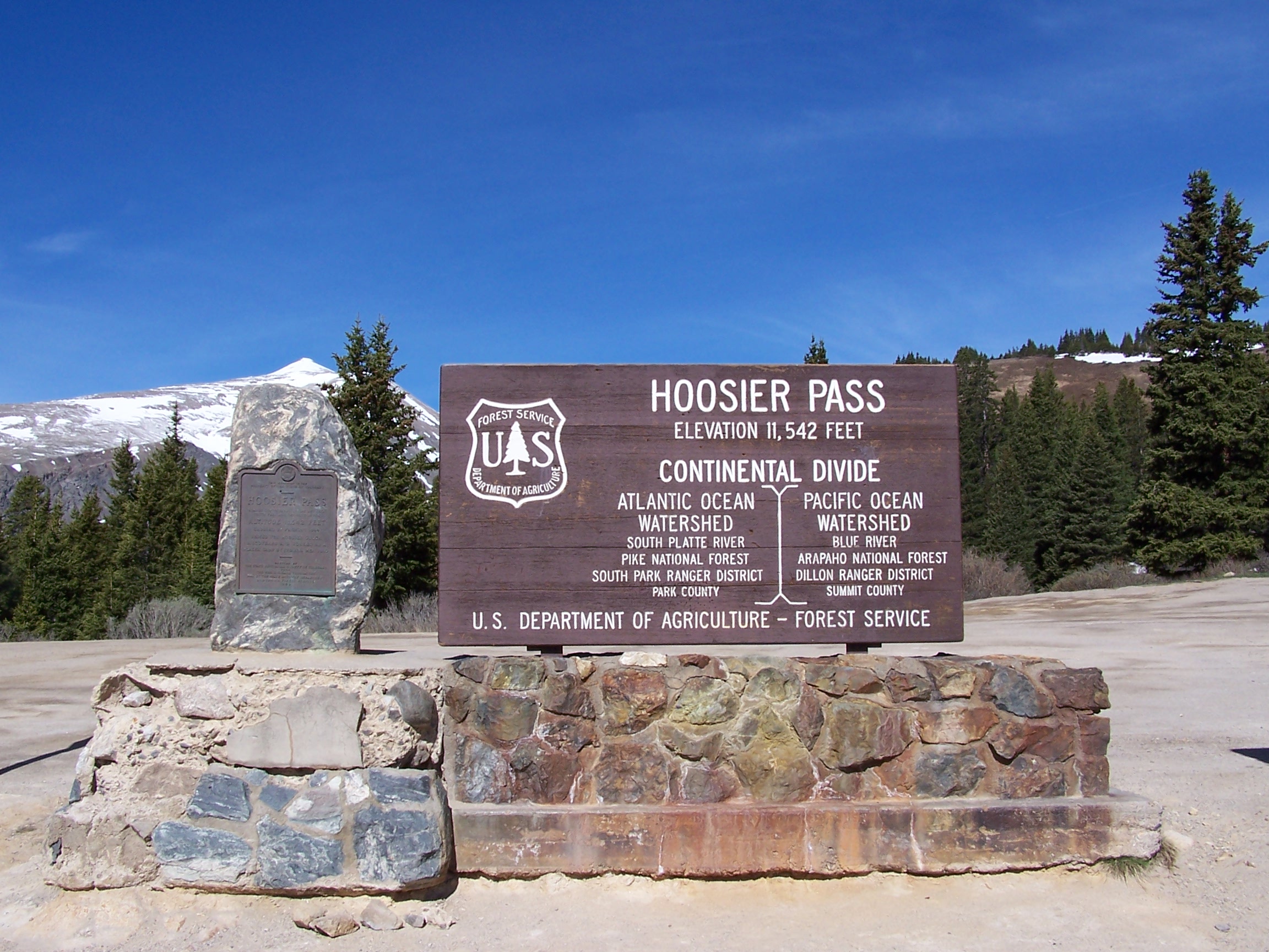
Hoosier Pass (elevation ) is a high mountain pass in central Colorado, in the Rocky Mountains of the western United States. The name derives from Indiana, nicknamed the "Hoosier State," which was the original home of many pioneers. The pass is located on the Continental Divide at the northern end of the Mosquito Range, in a gap between Mount Lincoln (west) and Hoosier Ridge (east). It sits on the boundary between Park (south) and Summit (north) counties. The pass provides a route between the headwaters of the Blue River (tributary of the Colorado River) to the north and the headwaters of the South Platte River in South Park to the south. It is traversed by State Highway 9 between the towns of Breckenridge (north) and Fairplay (south). The highway over the pass provides an alternative route from Denver to the ski areas near Breckenridge and Keystone. It is generally open all year round, is traversable by all vehicles in good weather, but is occasionally closed during winter ... [...More Info...] [...Related Items...] OR: [Wikipedia] [Google] [Baidu] |
Alpine Climate
Alpine climate is the typical weather (climate) for elevations above the tree line, where trees fail to grow due to cold. This climate is also referred to as a mountain climate or highland climate. Definition There are multiple definitions of alpine climate. In the Köppen climate classification, the alpine and mountain climates are part of group ''E'', along with the polar climate, where no month has a mean temperature higher than . According to the Holdridge life zone system, there are two mountain climates which prevent tree growth : a) the alpine climate, which occurs when the mean biotemperature of a location is between . The alpine climate in Holdridge system is roughly equivalent to the warmest tundra climates (ET) in the Köppen system. b) the alvar climate, the coldest mountain climate since the biotemperature is between 0 °C and 1.5 °C (biotemperature can never be below 0 °C). It corresponds more or less to the coldest tundra climates and to the ... [...More Info...] [...Related Items...] OR: [Wikipedia] [Google] [Baidu] |
Elevation
The elevation of a geographic location is its height above or below a fixed reference point, most commonly a reference geoid, a mathematical model of the Earth's sea level as an equipotential gravitational surface (see Geodetic datum § Vertical datum). The term ''elevation'' is mainly used when referring to points on the Earth's surface, while ''altitude'' or ''geopotential height'' is used for points above the surface, such as an aircraft in flight or a spacecraft in orbit, and '' depth'' is used for points below the surface. Elevation is not to be confused with the distance from the center of the Earth. Due to the equatorial bulge, the summits of Mount Everest and Chimborazo have, respectively, the largest elevation and the largest geocentric distance. Aviation In aviation the term elevation or aerodrome elevation is defined by the ICAO as the highest point of the landing area. It is often measured in feet and can be found in approach charts of the aerodrome. It is n ... [...More Info...] [...Related Items...] OR: [Wikipedia] [Google] [Baidu] |
Calcareous Soils
Calcareous () is an adjective meaning "mostly or partly composed of calcium carbonate", in other words, containing lime or being chalky. The term is used in a wide variety of scientific disciplines. In zoology ''Calcareous'' is used as an adjectival term applied to anatomical structures which are made primarily of calcium carbonate, in animals such as gastropods, i.e., snails, specifically about such structures as the operculum, the clausilium, and the love dart. The term also applies to the calcium carbonate tests of often more or less microscopic Foraminifera. Not all tests are calcareous; diatoms and radiolaria have siliceous tests. The molluscs are calcareous, as are calcareous sponges (Porifera), that have spicules which are made of calcium carbonate. In botany ''Calcareous grassland'' is a form of grassland characteristic of soils containing much calcium carbonate from underlying chalk or limestone rock. In medicine The term is used in pathology, for ... [...More Info...] [...Related Items...] OR: [Wikipedia] [Google] [Baidu] |
Scree
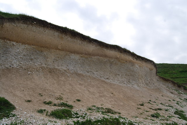
Scree is a collection of broken rock fragments at the base of a cliff or other steep rocky mass that has accumulated through periodic rockfall. Landforms associated with these materials are often called talus deposits. Talus deposits typically have a concave upwards form, where the maximum inclination corresponds to the angle of repose of the mean debris particle size. The exact definition of scree in the primary literature is somewhat relaxed, and it often overlaps with both ''talus'' and ''colluvium''. The term ''scree'' comes from the Old Norse term for landslide, ''skriða'', while the term ''talus'' is a French word meaning a slope or embankment. In high-altitude arctic and subarctic regions, scree slopes and talus deposits are typically adjacent to hills and river valleys. These steep slopes usually originate from late-Pleistocene periglacial processes. Notable scree sites in Eastern North America include the Ice Caves at White Rocks National Recreation Area in southern Ve ... [...More Info...] [...Related Items...] OR: [Wikipedia] [Google] [Baidu] |
Off-road Vehicle
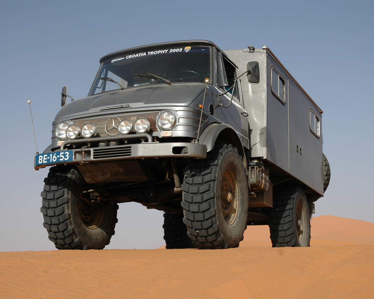
An off-road vehicle, sometimes referred to as an overland or adventure vehicle, is considered to be any type of vehicle which is capable of driving on and off paved or gravel surface. It is generally characterized by having large tires with deep, open treads, a flexible suspension, or even caterpillar tracks. Other vehicles that do not travel on public streets or highways are generally termed off-highway vehicles, including tractors, forklifts, cranes, backhoes, bulldozers, and golf carts. Off-road vehicles have an enthusiastic following because of their versatility. Several types of motorsports involve racing off-road vehicles. The most common use of these vehicles is for sightseeing in areas distant from the pavement. The use of higher clearance and higher traction vehicles enables access on trails and forest roads that have rough and low traction surfaces. Off-road vehicles can typically ford through deeper waters (i.e., rivers or floodwaters) than on-road vehicles can. ... [...More Info...] [...Related Items...] OR: [Wikipedia] [Google] [Baidu] |
.jpg)


