|
Gyeongsang
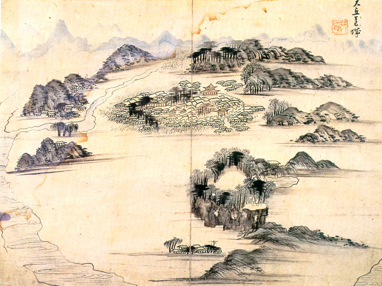
Gyeongsang ( ko, 경상도, ''Gyeongsang-do''; ) was one of the eight provinces of Korea during the Joseon dynasty. Gyeongsang was located in the southeast of Korea. The provincial capital was Daegu. The region was the birthplace of the Kingdom of Silla. The region also has a significant role in modern Korean history, since seven previous South Korean presidents (Park Chung-hee, Roh Tae-woo, Chun Doo-hwan, Kim Young-sam, Roh Moo-hyun, Park Geun-hye, and Moon Jae-in) were born in the Gyeongsang region. Today, the region is divided into 5 administrative divisions: the three independent cities of Busan, Daegu and Ulsan, and the two provinces of Gyeongsangbuk-do and Gyeongsangnam-do. The largest city in the region is Busan, followed by Daegu. Sub-regionally, the region is also divided into Gyeongbuk and Gyeongnam. Gyeongbuk consists of Daegu and Gyeongsangbuk-do, while Gyeongnam consists of Busan, Ulsan and Gyeongsangnam-do. History The predecessor to Gyeongsang Province was form ... [...More Info...] [...Related Items...] OR: [Wikipedia] [Google] [Baidu] |
Gyeongsangnam-do
South Gyeongsang Province ( ko, 경상남도, translit=Gyeongsangnam-do, ) is a province in the southeast of South Korea. The provincial capital is at Changwon. It is adjacent to the major metropolitan center and port of Busan. The UNESCO World Heritage Site Haeinsa, a Buddhist temple that houses the ''Tripitaka Koreana'' and tourist attraction, is located in this province. Automobile and petrochemical factories are largely concentrated along the southern part of the province, extending from Ulsan through Busan, Changwon, and Jinju. Etymology The name derives ; . The name derives from the names of the principal cities of Gyeongju () and Sangju (). History Before 1895, the area corresponding to modern-day South Gyeongsang Province was part of Gyeongsang Province, one of the Eight Provinces of Korea during the Joseon dynastic kingdom. In 1895, southern Gyeongsang was replaced by the districts of Jinju in the west and Dongnae (modern-day Busan) in the east. In 1896, they were me ... [...More Info...] [...Related Items...] OR: [Wikipedia] [Google] [Baidu] |
Gyeongnam
South Gyeongsang Province ( ko, 경상남도, translit=Gyeongsangnam-do, ) is a province in the southeast of South Korea. The provincial capital is at Changwon. It is adjacent to the major metropolitan center and port of Busan. The UNESCO World Heritage Site Haeinsa, a Buddhist temple that houses the ''Tripitaka Koreana'' and tourist attraction, is located in this province. Automobile and petrochemical factories are largely concentrated along the southern part of the province, extending from Ulsan through Busan, Changwon, and Jinju. Etymology The name derives ; . The name derives from the names of the principal cities of Gyeongju () and Sangju (). History Before 1895, the area corresponding to modern-day South Gyeongsang Province was part of Gyeongsang Province, one of the Eight Provinces of Korea during the Joseon dynastic kingdom. In 1895, southern Gyeongsang was replaced by the districts of Jinju in the west and Dongnae (modern-day Busan) in the east. In 1896, they were merge ... [...More Info...] [...Related Items...] OR: [Wikipedia] [Google] [Baidu] |
Provinces Of Korea
Korea's provinces ('' Do''; hangul: 도; hanja: ) have been the primary administrative division of Korea since the mid Goryeo dynasty in the early 11th century, and were preceded by provincial-level divisions (''Ju'' and ''Mok'') dating back to Unified Silla, in the late 7th century. During the Unified Silla Period (AD 668–935), Korea was divided into nine ''Ju'' (주; ), an old word for "province" that was used to name both the kingdom's provinces and its provincial capitals. After Goryeo defeated Silla and Later Baekje in 935 and 936 respectively, the new kingdom "was divided into one royal district (''Ginae;'' 기내; ) and twelve administrative districts (''Mok;'' 목; )" ( Nahm 1988), which were soon redivided into ten provinces (''Do''). In 1009 the country was again redivided, this time into one royal district, five provinces (''Do'') and two frontier districts (''Gye;'' 계; ?). After the Joseon dynasty's rise to power and the formation of Joseon in 1392, the country ... [...More Info...] [...Related Items...] OR: [Wikipedia] [Google] [Baidu] |
Gyeongsang Dialect
The Gyeongsang dialects (also spelled Kyŏngsang), or Southeastern Korean, are dialects of the Korean language of the Yeongnam region, which includes both Gyeongsang provinces, North and South. There are approximately 13,000,000 speakers. Unlike Standard Korean, most of the variants of the Gyeongsang dialects are tonal, which is similar to Middle Korean. Gyeongsang dialects vary. A native speaker can distinguish the dialect of Daegu from that of the Busan-Ulsan area although the first city is less than 100 kilometers away from the latter two cities. Dialectal forms are relatively similar along the midstream of Nakdong River but are different near Busan and Ulsan, Jinju and Pohang as well as along the eastern slopes of Mount Jiri. Vowels Most Gyeongsang dialects have six vowels, ''a'' (ㅏ), ''e'' (ㅔ), ''i'' (ㅣ), ''eo'' (ㅓ), ''o'' (ㅗ), ''u'' (ㅜ). In most areas, the vowels ㅐ(ae) and ㅔ (e) are conflated, as are ㅡ(eu) and ㅓ(eo). ''W'' and ''y'' are generally dr ... [...More Info...] [...Related Items...] OR: [Wikipedia] [Google] [Baidu] |
Gyeongbuk
North Gyeongsang Province ( ko, 경상북도, translit=Gyeongsangbuk-do, ) is a Administrative divisions of South Korea, province in eastern South Korea. The province was formed in 1896 from the northern half of the former Gyeongsang province, and remained a province of Korea under Japanese rule, Korea until the country's Division of Korea, division in 1945, then became part of South Korea. Daegu was the capital of North Gyeongsang Province between 1896 and 1981, but has not been a part of the province since 1981. In 2016, the provincial capital moved from Daegu to Andong. The area of the province is , 19.1 percent of the total area of South Korea. Geography and climate The province is part of the Yeongnam Regions of Korea, region, on the south by Gyeongsangnam-do, on the west by Jeollabuk-do and Chungcheongbuk-do Provinces, and on the north by Gangwon-do (South Korea), Gangwon-do Province. During the summer, North Gyeongsang Province is perhaps the hottest province in South Kor ... [...More Info...] [...Related Items...] OR: [Wikipedia] [Google] [Baidu] |
Gyeongsangbuk-do
North Gyeongsang Province ( ko, 경상북도, translit=Gyeongsangbuk-do, ) is a province in eastern South Korea. The province was formed in 1896 from the northern half of the former Gyeongsang province, and remained a province of Korea until the country's division in 1945, then became part of South Korea. Daegu was the capital of North Gyeongsang Province between 1896 and 1981, but has not been a part of the province since 1981. In 2016, the provincial capital moved from Daegu to Andong. The area of the province is , 19.1 percent of the total area of South Korea. Geography and climate The province is part of the Yeongnam region, on the south by Gyeongsangnam-do, on the west by Jeollabuk-do and Chungcheongbuk-do Provinces, and on the north by Gangwon-do Province. During the summer, North Gyeongsang Province is perhaps the hottest province in South Korea. This is helped by the fact that the province is largely surrounded by mountains: the Taebaek Mountains in the east and the S ... [...More Info...] [...Related Items...] OR: [Wikipedia] [Google] [Baidu] |
Gyeongju
Gyeongju ( ko, 경주, ), historically known as ''Seorabeol'' ( ko, 서라벌, ), is a coastal city in the far southeastern corner of North Gyeongsang Province in South Korea. It is the second largest city by area in the province after Andong, covering with a population of 264,091 people (as of December 2012.) Gyeongju is southeast of Seoul, and east of Daegu. The city borders Cheongdo and Yeongcheon to the west, Ulsan to the south and Pohang to the north, while to the east lies the coast of the Sea of Japan. Numerous low mountains—outliers of the Taebaek range—are scattered around the city. Gyeongju was the capital of the ancient kingdom of Silla (57 BC – 935 AD), which ruled about two-thirds of the Korean Peninsula at its height between the 7th and 9th centuries, for close to one thousand years. Later Silla was a prosperous and wealthy country, and its metropolitan capital of Gyeongju was the fourth largest city in the world. A vast number of archaeological sites an ... [...More Info...] [...Related Items...] OR: [Wikipedia] [Google] [Baidu] |
Daegu
Daegu (, , literally 'large hill', 대구광역시), formerly spelled Taegu and officially known as the Daegu Metropolitan City, is a city in South Korea. It is the third-largest urban agglomeration in South Korea after Seoul and Busan; it is the third-largest official metropolitan area in the nation with over 2.5 million residents; and the second-largest city after Busan in the Yeongnam region in southeastern Korean Peninsula. It was overtaken by Incheon in the 2000s, but still it is said to be the third city, according to the "Act on the Establishment of Daegu City and Incheon City" (Act No. 3424 and April 13, 1981). Daegu and surrounding North Gyeongsang Province are often referred to as Daegu-Gyeongbuk, with a total population over 5 million. Daegu is located in south-eastern Korea about from the seacoast, near the Geumho River and its mainstream, Nakdong River in Gyeongsang-do. The Daegu basin is the central plain of the Yeongnam List of regions of Korea, regio ... [...More Info...] [...Related Items...] OR: [Wikipedia] [Google] [Baidu] |
Eight Provinces (Korea)
During most of the Joseon Dynasty, Korea was divided into eight provinces ('' do''; ; ). The eight provinces' boundaries remained unchanged for about 480 years from 1413 to 1895, and formed a geographic paradigm that is still reflected today in the Korean Peninsula's administrative divisions, dialects, and regional distinctions. The names of all eight provinces are still preserved today, in one form or another. These eight historical provinces form both North and South Korea, and are not to be confused with the provinces that make up South Korea or North Korea. History Provinces before 1895 In 1413 (the 13th year of the reign of King Jeongjong), the northeastern boundary of Korea was extended to the Tumen River. The country was reorganized into eight provinces: Chungcheong, Gangwon, Gyeonggi, Gyeongsang, Jeolla, P'unghae (renamed Hwanghae in 1417), P'yŏngan, and Yŏnggil (eventually renamed Hamgyŏng in 1509). Districts of 1895-96 For almost 500 years, the eight-province ... [...More Info...] [...Related Items...] OR: [Wikipedia] [Google] [Baidu] |
Busan
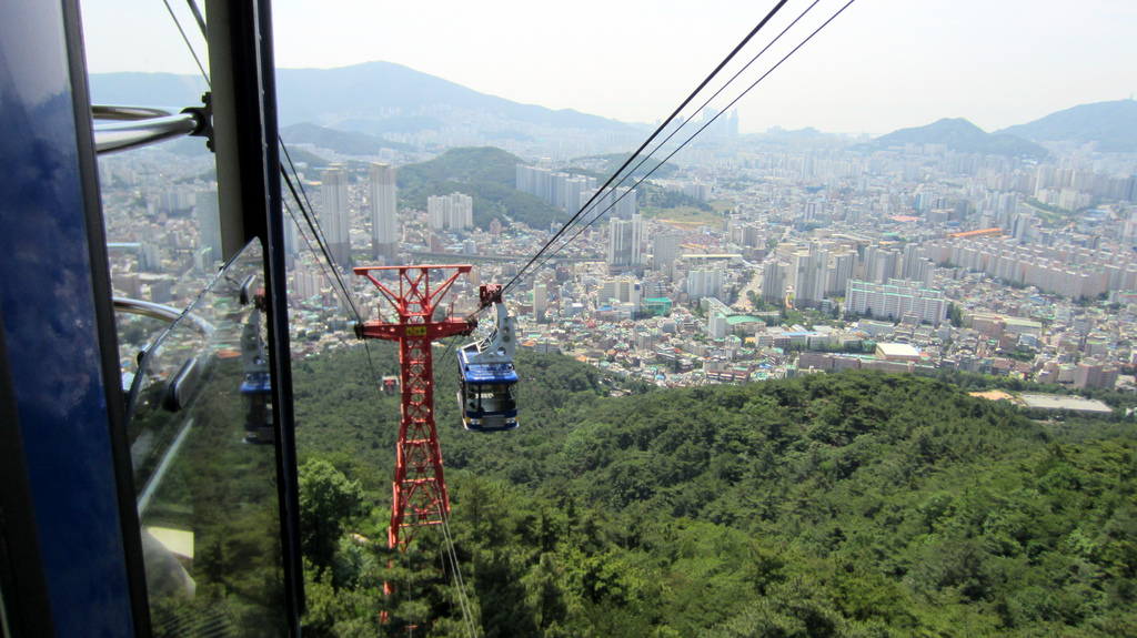
Busan (), officially known as is South Korea's most populous city after Seoul, with a population of over 3.4 million inhabitants. Formerly romanized as Pusan, it is the economic, cultural and educational center of southeastern South Korea, with its port being Korea's busiest and the sixth-busiest in the world. The surrounding "Southeastern Maritime Industrial Region" (including Ulsan, South Gyeongsang, Daegu, and some of North Gyeongsang and South Jeolla) is South Korea's largest industrial area. The large volumes of port traffic and urban population in excess of 1 million make Busan a Large-Port metropolis using the Southampton System of Port-City classification . Busan is divided into 15 major administrative districts and a single county, together housing a population of approximately 3.6 million. The full metropolitan area, the Southeastern Maritime Industrial Region, has a population of approximately 8 million. The most densely built-up areas of the city are situated in ... [...More Info...] [...Related Items...] OR: [Wikipedia] [Google] [Baidu] |
Sangju
Sangju () is a city in North Gyeongsang Province, central South Korea. Although Sangju is rather rural, it is very old and was once a key city. Along with Gyeongju, it gives rise to half of the name of the Gyeongsang provinces. Sangju is nicknamed ''Sam Baek'', or "Three Whites", referring to three prominent agricultural products rice, silkworm cocoons, and dried persimmons from the area. Geography and climate Geography Sangju lies on the northwestern border of North Gyeongsang province, touching on North Chungcheong province. Thus, to its west and north it adjoins the North Chungcheong counties of Boeun, Goesan, Okcheon, and Yeongdong. Within North Gyeongsang province, it touches Mungyeong on the north, Yecheon, Uiseong, and Gumi on the east, and Gimcheon to the south. The north and west extremes of the city are found in Hwabuk-myeon, at 127°47′55″E and 36°14′6″N, respectively. The southern limit lies in Gongseong-myeon at 36°14′06″N, on the border with Gimch ... [...More Info...] [...Related Items...] OR: [Wikipedia] [Google] [Baidu] |
Korean Dialects
A number of Korean dialects are spoken on the Korean Peninsula. The peninsula is very mountainous and each dialect's "territory" corresponds closely to the natural boundaries between different geographical regions of Korea. Most of the dialects are named for one of the traditional Eight Provinces of Korea. Two are sufficiently distinct from the others to be considered separate languages, the Jeju and the Yukjin languages. Dialect areas Korea is a mountainous country, and this could be the main reason why Korean is divided into numerous small local dialects. There are few clear demarcations, so dialect classification is necessarily to some extent arbitrary. A common classification, originally introduced by Shinpei Ogura in 1944 and adjusted by later authors, identifies six dialect areas: ; Hamgyŏng (Northeastern) :Spoken in the Hamgyong Province (Kwanbuk and Kwannam) region, the northeast corner of Pyongan Province, and the Ryanggang Province of North Korea as well as Jilin, ... [...More Info...] [...Related Items...] OR: [Wikipedia] [Google] [Baidu] |


