|
Gaspésie–Îles-de-la-Madeleine
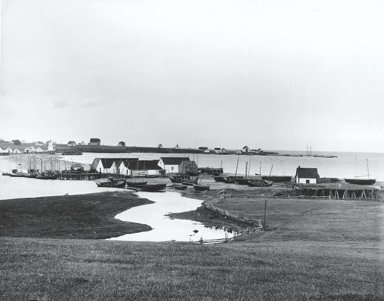
Gaspésie–Îles-de-la-Madeleine () is an administrative region of Quebec consisting of the Gaspé Peninsula (''Gaspésie'') and the Îles-de-la-Madeleine. It lies in the Gulf of Saint Lawrence at the eastern extreme of southern Quebec. The predominant economic activities are fishing, forestry and tourism. Region The administrative region of Gaspésie–Îles-de-la-Madeleine was created on December 22, 1987. It brings together two geographical units: the Gaspé peninsula (20,102.69 km2) and the Magdalen Islands archipelago (205.4 km2). The population was 90,311 at the time of the 2016 census. The region's interior, 80% of which is covered by coniferous forests, is among the most rugged terrain in the province. Rich soils cover the land along the coast and within the region's river valleys. Important mineral deposits are also found in this region. Forty-two local municipalities are located in the Gaspésie–Îles-de-la-Madeleine region, along with seven unorgan ... [...More Info...] [...Related Items...] OR: [Wikipedia] [Google] [Baidu] |
Bonaventure Regional County Municipality
Bonaventure is a regional county municipality in the Gaspésie–Îles-de-la-Madeleine region of eastern Quebec, Canada, on the Gaspé Peninsula. Its seat is New Carlisle. Subdivisions There are 14 subdivisions within the RCM: ;Cities & Towns (3) *Bonaventure * New Richmond * Paspébiac ;Municipalities (7) * Caplan *Cascapédia–Saint-Jules * Hope Town * New Carlisle * Saint-Alphonse * Saint-Elzéar * Shigawake ;Parishes (1) * Saint-Siméon ;Townships (2) *Hope * Saint-Godefroi ;Unorganized Territory (1) * Rivière-Bonaventure Demographics Population Language Transportation Access Routes Highways and numbered routes that run through the municipality, including external routes that start or finish at the county border: *Autoroutes **None *Principal Highways ** *Secondary Highways ** *External Routes **None Attractions *Banc-de-Paspébiac Historical Site (Paspébiac) *Bonaventure Airport (Bonaventure) *Canomore Hydro (Saint-Elzéar) *Gaspésie Biopark/Acad ... [...More Info...] [...Related Items...] OR: [Wikipedia] [Google] [Baidu] |
Le Rocher-Percé Regional County Municipality
Rocher-Percé is a regional county municipality in the Gaspésie–Îles-de-la-Madeleine region of Quebec, Canada. Its seat is Chandler. Prior to July 17, 1999 it was known as Pabok Regional County Municipality. It is named after Percé Rock (the pierced rock), a massive arched sandstone rock rising from the Atlantic just off the tip of the Gaspé peninsula. The region includes the towns of Percé, Grande-Rivière, Port-Daniel–Gascons and Chandler. Major tourist attractions include the Percé Rock and Bonaventure Island. Subdivisions There are 6 subdivisions within the RCM: ;Cities & Towns (3) *Chandler * Grande-Rivière * Percé ;Municipalities (2) *Port-Daniel–Gascons * Sainte-Thérèse-de-Gaspé ;Unorganized Territory (1) * Mont-Alexandre Demographics Population Language Transportation Access Routes Highways and numbered routes that run through the municipality, including external routes that start or finish at the county border: *Autoroutes **None ... [...More Info...] [...Related Items...] OR: [Wikipedia] [Google] [Baidu] |
La Côte-de-Gaspé Regional County Municipality
La Côte-de-Gaspé is a regional county municipality on the Gaspé peninsula in eastern Quebec, Canada, part of the Gaspésie–Îles-de-la-Madeleine region. The seat is Gaspé. The regional county has a land area of and its population was 17,117 inhabitants as of the 2016 Census. Its largest community is the city of Gaspé. Subdivisions There are 7 subdivisions within the RCM: ;Cities & Towns (2) * Gaspé * Murdochville ;Municipalities (2) * Grande-Vallée * Petite-Vallée ;Townships (1) * Cloridorme ;Unorganized Territory (2) * Collines-du-Basque * Rivière-Saint-Jean Demographics Population Language Transportation Access Routes Highways and numbered routes that run through the municipality, including external routes that start or finish at the county border: *Autoroutes **None *Principal Highways ** ** ** *Secondary Highways **None *External Routes **None See also * List of regional county municipalities and equivalent territories in Quebec This ... [...More Info...] [...Related Items...] OR: [Wikipedia] [Google] [Baidu] |
La Haute-Gaspésie Regional County Municipality
La Haute-Gaspésie () is a regional county municipality in the Gaspésie–Îles-de-la-Madeleine region of eastern Quebec, Canada, on the Gaspé peninsula. The regional county municipality seat is in Sainte-Anne-des-Monts. Prior to May 27, 2000, it was known as Denis-Riverin Regional County Municipality. Subdivisions There are 10 subdivisions within the RCM: ;Cities & Towns (2) * Cap-Chat * Sainte-Anne-des-Monts ;Municipalities (4) * La Martre * Rivière-à-Claude * Sainte-Madeleine-de-la-Rivière-Madeleine * Saint-Maxime-du-Mont-Louis ;Villages (2) * Marsoui * Mont-Saint-Pierre ;Unorganized Territory (2) * Coulée-des-Adolphe * Mont-Albert Demographics Population Language Transportation Access Routes Highways and numbered routes that run through the municipality, including external routes that start or finish at the county border: *Autoroutes **None *Principal Highways ** ** *Secondary Highways ** *External Routes **None See also * List of region ... [...More Info...] [...Related Items...] OR: [Wikipedia] [Google] [Baidu] |
Grosse-Île, Quebec
Grosse-Île is one of two municipalities forming the urban agglomeration of Îles-de-la-Madeleine in Quebec, Canada. It is part of the Gaspésie–Îles-de-la-Madeleine region, and its population was 464 as of the 2021 Census. As part of a municipal reorganization across Quebec, the seven communities of the Magdalen Islands amalgamated to form the municipality of Les Îles-de-la-Madeleine on January 1, 2002. However, after a 2004 referendum, Grosse-Île decided to split from the municipality, effective January 1, 2006. Located on (French for ''Big Island'') between Les Îles-de-la-Madeleine's villages of Grande-Entrée (south) and House Harbour (southwest), it was settled during the late 18th century by Scots. French-speaking people would come and establish themselves just after, as seen by a Catholic parish founded in 1793. Today, Grosse-Île remains one of three communities of the archipelago to be predominantly English-speaking, the other being Entry Island and Old Harr ... [...More Info...] [...Related Items...] OR: [Wikipedia] [Google] [Baidu] |
Les Îles-de-la-Madeleine, Quebec
Les Îles-de-la-Madeleine (Magdalen Islands) is one of two municipalities forming the urban agglomeration of Magdalen Islands in Quebec, Canada. It is part of the Gaspésie–Îles-de-la-Madeleine region and its population was 12,010 as of the 2016 Census. As part of a municipal reorganization across Quebec, the seven communities of the Magdalen Islands amalgamated to form the municipality of Magdalen Islands on January 1, 2002. However, after a referendum in 2004 the community of Grosse-Île decided to split from the municipality, effective January 1, 2006. Although Grindstone likewise voted to split in the same referendum, it did not actually do so. Communities The following are the six formerly independent communities that constitute Magdalen Islands: Grindstone (Cap-aux-Meules) Located on Grindstone Island (''Île du Cap aux Meules'' in French), Grindstone was settled as early as the 19th century. Before the 2002 amalgamation, it was the Magdalen Islands' smallest commun ... [...More Info...] [...Related Items...] OR: [Wikipedia] [Google] [Baidu] |
Carleton-sur-Mer
Carleton-sur-Mer is the fifth largest town of the Gaspésie's south shore, in southeastern Quebec, Canada, located on Route 132, along Chaleur Bay. It is the seat of the Avignon Regional County Municipality. The town's territory includes the communities of Biron, Caps-de-Maria, Carleton, Robitaille, and Saint-Omer. History Tracadigash/Carleton Around 1756, seven families of exiled Acadians arrived in Tracadigash from Bonaventure and Restigouche, following their deportation from Beaubassin, Nova-Scotia, in 1755. Charles Dugas and Benjamin LeBlanc (both from Grand Pré) were the original founders. In 1772, Abbé Joseph-Mathurin Bourg, first accredited Acadien priest, arrived from Quebec City. He conducted the very first census of Tragadigash (''recensement Tracadigache 1777'') where he listed the following family names: Allard, Allain, Arseneau, Aubertin, Barriot, Bergeron, Berthelot, Boudreau, Bujold, Comeau, Cormier, Dugas, Francis, Landry, Leblanc, Poirier, Richard; t ... [...More Info...] [...Related Items...] OR: [Wikipedia] [Google] [Baidu] |
Sainte-Anne-des-Monts, Quebec
Sainte-Anne-des-Monts () is a city in the Gaspésie–Îles-de-la-Madeleine region of the province of Quebec in Canada. Sainte-Anne-des-Monts, a small city between the Chic-Choc Mountains and sea, is on the south shore of the Saint Lawrence river estuary. In addition to Sainte-Anne-des-Monts itself, the municipality also encompasses the communities of L'Anse-de-l'Église, L'Anse-Sainte-Anne-des-Monts, Mont-Albert, Petit-Tourelle, Ruisseau-à-Patates, and Tourelle. History The name of Notre-Dame first appeared on schematic maps in 1709. The official nomenclature came from the ''seigneurie'' of Sainte-Anne-des-Monts, conceded to Denis Riverin in 1688. The first settlers arrived in 1815 and established small fisheries. The place was incorporated as a municipality in 1855. The city was a centre for pilgrimage at the beginning of the twentieth century. It was partially destroyed by fire in 1915. In 1968, Sainte-Anne-des-Monts gained city status. On February 2, 2000, the City of Sa ... [...More Info...] [...Related Items...] OR: [Wikipedia] [Google] [Baidu] |
Magdalen Islands
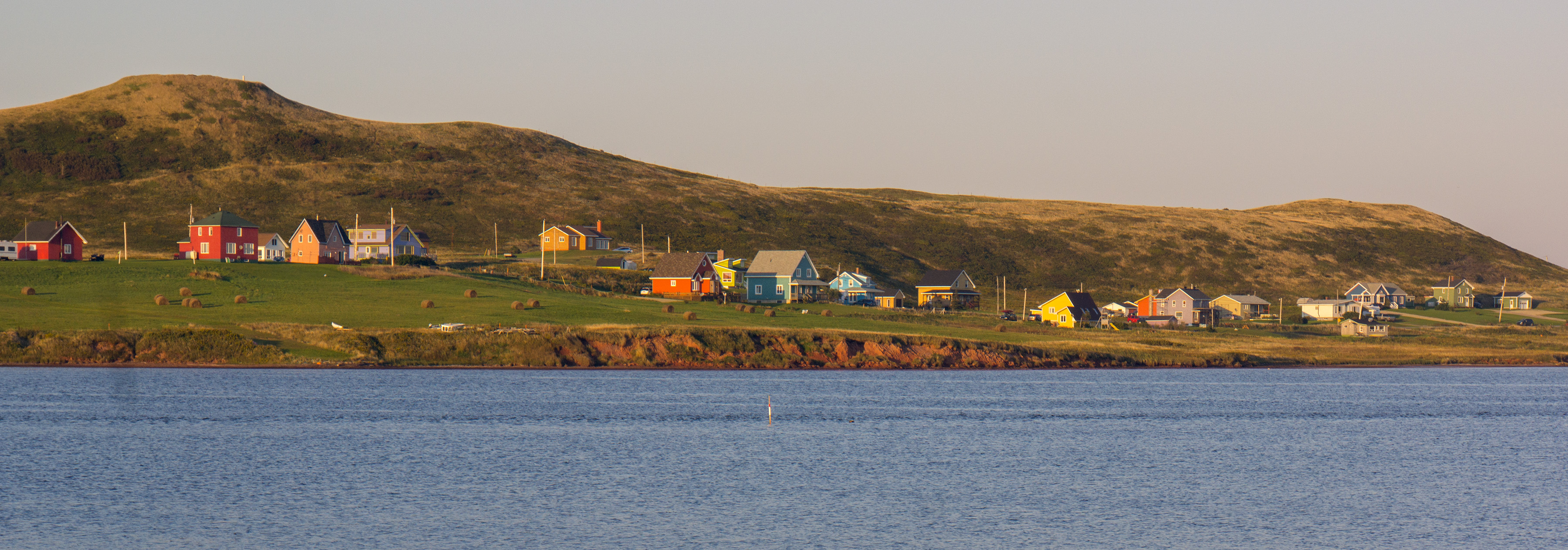
The Magdalen Islands (french: Îles de la Madeleine ) are a small archipelago in the Gulf of Saint Lawrence with a land area of . While part of the Province of Quebec, the islands are in fact closer to the Maritime provinces and Newfoundland than to the Gaspé Peninsula on the Quebec mainland. The islands are considered a part of the Mi'kma'ki, of the Mi'kmaw Nation, who call the islands Menagoesenog. Administratively, the islands are part of the Gaspésie–Îles-de-la-Madeleine region in the Canadian province of Quebec. The islands form the territory equivalent to a regional county municipality (TE) and the census division (CD) of Les Îles-de-la-Madeleine. Their geographical code is 01. The islands are also coextensive with the urban agglomeration of Les Îles-de-la-Madeleine, which is divided into two municipalities: Les Îles-de-la-Madeleine ( 2011 census pop. 12,291), the central municipality, and Grosse-Île (pop. 490). Their mayors are Gaétan Richard and Rose ... [...More Info...] [...Related Items...] OR: [Wikipedia] [Google] [Baidu] |
Avignon Regional County Municipality
Avignon is a regional county municipality located in the Gaspésie–Îles-de-la-Madeleine region of Quebec, Canada. Its seat and largest city is Carleton-sur-Mer. It is on the Gaspé Peninsula, along Chaleur Bay. Subdivisions There are 13 subdivisions and 2 native reserves within the RCM: ;Cities & Towns (1) * Carleton-sur-Mer ;Municipalities (9) * Escuminac * L'Ascension-de-Patapédia * Maria * Matapédia * Nouvelle * Pointe-à-la-Croix * Saint-Alexis-de-Matapédia * Saint-André-de-Restigouche * Saint-François-d'Assise ;Townships (1) * Ristigouche-Partie-Sud-Est ;Unorganized Territory (2) * Rivière-Nouvelle * Ruisseau-Ferguson ;Native Reserves (2) * Gesgapegiag 2 * Listuguj Demographics Population Language Transportation Access Routes Highways and numbered routes that run through the municipality, including external routes that start or finish at the county border: *Autoroutes **None *Principal Highways ** *Secondary Highways **None *Exter ... [...More Info...] [...Related Items...] OR: [Wikipedia] [Google] [Baidu] |
Chandler, Quebec
Chandler is a town in the Gaspésie–Îles-de-la-Madeleine region of Quebec, Canada. It is the second-most populous town on the Gaspé Peninsula after the Town of Gaspé. It was known as Pabos between June 27, 2001 and May 4, 2002. The city is the birthplace of NHL player Mathieu Garon, Quebec politician Joseph-Léonard Duguay, singer " La Bolduc" (Mary Rose Anna Travers), singer and actor Flora Gionest-Roussy and world curling champion John Kawaja. Chandler's major industries include fishing and tourism. In addition to Chandler itself, the town's territory also includes the communities of Newport, Grand-Pabos-Ouest, Pabos, Pabos Mills, and Saint-François-de-Pabos. History The area was first settled in 1729, making it one of the oldest places on the Gaspé coast. It was known over time as Paboc, Pabo, Pabok, Pabeau, and Pas-bos. In 1815, the final spelling of Pabos was assigned in the ''Description topographique de la province du Bas Canada'' (Topographical Description o ... [...More Info...] [...Related Items...] OR: [Wikipedia] [Google] [Baidu] |
Gaspé, Quebec
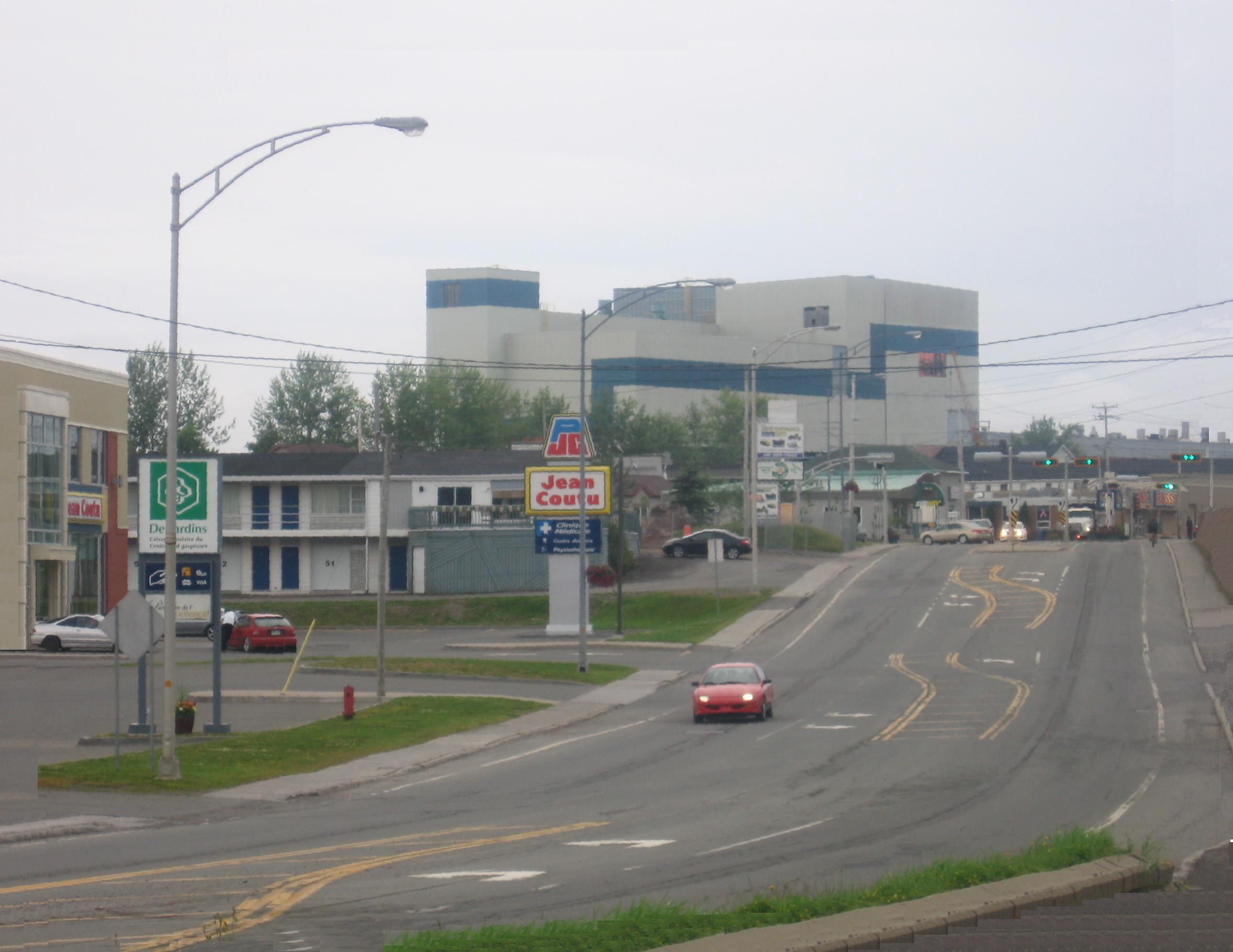
Gaspé is a city at the tip of the Gaspé Peninsula in the Gaspésie–Îles-de-la-Madeleine region of eastern Quebec in Canada. Gaspé is located about northeast of Quebec City, and east of Rimouski. As of the 2021 Canadian Census, the city had a total population of 15,063. Gaspé is where Jacques Cartier took possession of New France (now part of Canada) in the name of François I of France on July 24, 1534. Etymology The most common assumption is that "Gaspé" may come from the Miꞌkmaq word ''Gespeg'' which means "Land's end". However, other theories hold that the name may be a mutation of the Basque word ''geizpe'' or ''kerizpe'' which means "shelter" or "place of refuge". Another theory is that it is named after Portuguese explorer Gaspar Corte-Real, who explored the Labrador in 1500. In 1600, Englishman Richard Hakluyt used the name ''Gaspay'' in his translation of ''Cosmosgraphie'' by Jean Alfonse, which became the common spelling in the early 17th century. Therea ... [...More Info...] [...Related Items...] OR: [Wikipedia] [Google] [Baidu] |


