|
Gaspésie–Îles-de-la-Madeleine
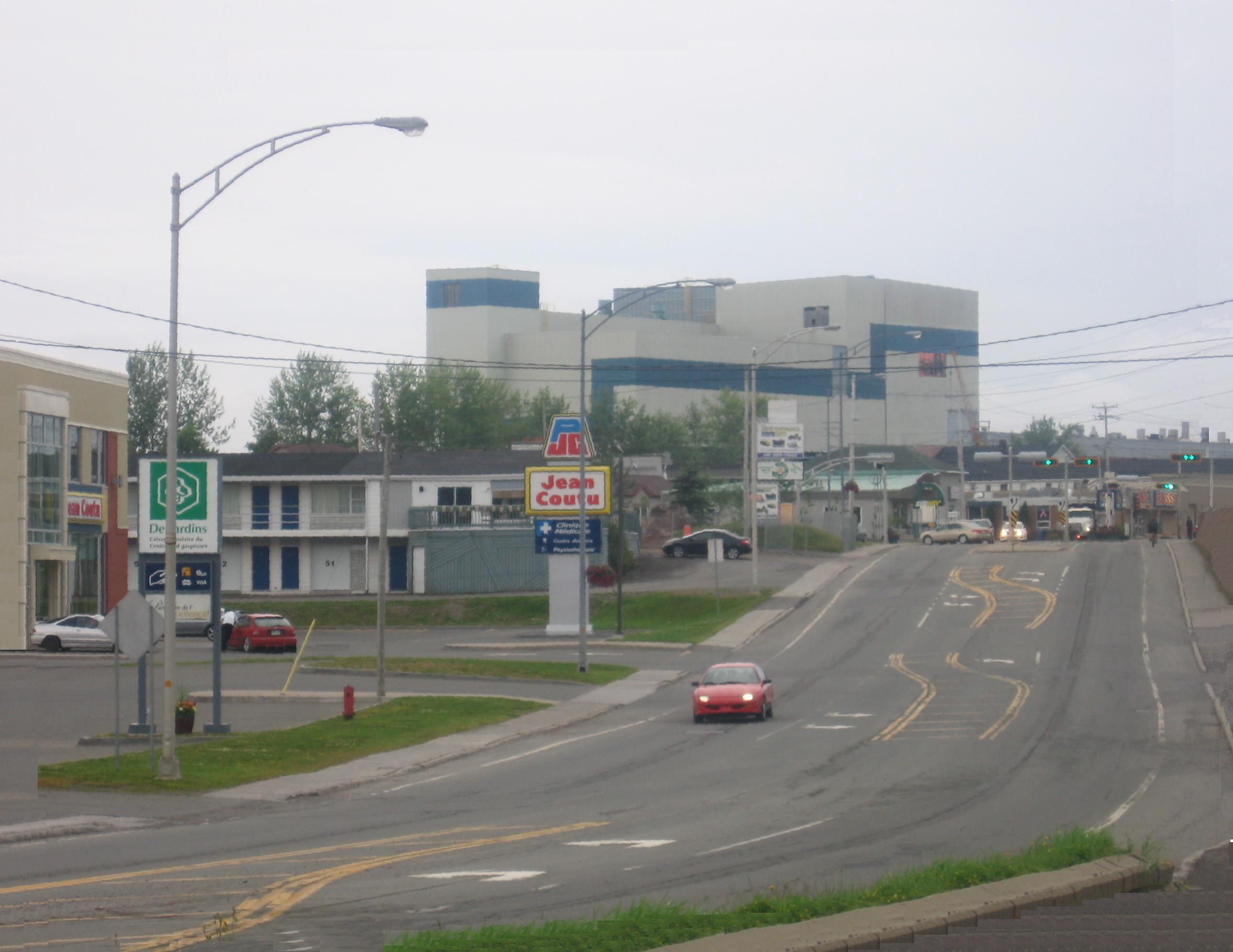
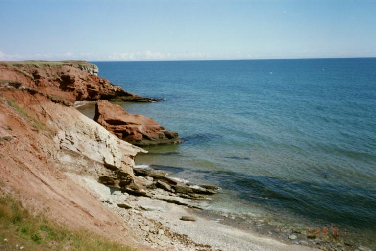
() is an administrative region of Quebec consisting of the Gaspé Peninsula () and the . It lies in the Gulf of Saint Lawrence at the eastern extreme of southern Quebec. The predominant economic activities are fishing, forestry and tourism. Region The administrative region of was created on December 22, 1987. It brings together two geographical units: the Gaspé Peninsula () and the Magdalen Islands archipelago (). The population was 90,311 at the time of the 2016 census. The region's interior, 80% of which is covered by coniferous forests, is among the most rugged terrain in the province. Rich soils cover the land along the coast and within the region's river valleys. Important mineral deposits are also found in this region. Forty-two local municipalities are located in the region, along with seven unorganized territories, two reserves, and one Mi'kmaq community. With the exception of a few villages, the entire population is spread out along the coast, in villag ... [...More Info...] [...Related Items...] OR: [Wikipedia] [Google] [Baidu] |
Bonaventure Regional County Municipality
Bonaventure () is a regional county municipality in the Gaspésie–Îles-de-la-Madeleine region of eastern Quebec, Canada, on the Gaspé Peninsula. Its seat is New Carlisle, Quebec, New Carlisle. Subdivisions There are 14 subdivisions within the RCM: ;Cities & Towns (3) *Bonaventure, Quebec, Bonaventure *New Richmond, Quebec, New Richmond *Paspébiac ;Municipalities (7) *Caplan, Quebec, Caplan *Cascapédia–Saint-Jules *Hope Town, Quebec, Hope Town *New Carlisle, Quebec, New Carlisle *Saint-Alphonse, Gaspésie–Îles-de-la-Madeleine, Quebec, Saint-Alphonse *Saint-Elzéar, Gaspésie–Îles-de-la-Madeleine, Quebec, Saint-Elzéar *Shigawake, Quebec, Shigawake ;Parishes (1) *Saint-Siméon, Gaspésie–Îles-de-la-Madeleine, Quebec, Saint-Siméon ;Townships (2) *Hope, Quebec, Hope *Saint-Godefroi, Quebec, Saint-Godefroi ;Unorganized Territory (1) *Rivière-Bonaventure, Quebec, Rivière-Bonaventure Demographics Population Language Transportation Access Routes Highways ... [...More Info...] [...Related Items...] OR: [Wikipedia] [Google] [Baidu] |
Les Îles-de-la-Madeleine, Quebec
Les Îles-de-la-Madeleine () is a municipality located in Gaspésie-Îles-de-la-Madeleine region, in Quebec, Canada. It is located on the islands of the Magdalen Islands archipelago, in the Gulf of St. Lawrence, from Gaspé, from Prince Edward Island, from Cape Breton Island, and from Newfoundland. History The Mi'kmaq were among the original occupants of Atlantic Canada, inhabiting the coastal regions of the Gaspé Peninsula and The Maritimes east of the Saint John River. This traditional territory is called Mi'gma'gi (Mi'kma'ki). According to Mi'kmaq oral history and archaeological evidence collected to date, there has been a seasonal First Nations presence on the Magdalen Islands for 6,000 to 10,000 years. This occupation was mainly for summer fishing and hunting of marine mammals or other game. The explorer Jacques Cartier was the first known European to visit the islands in 1534. The first concerted settlement attempt was made by English Brownist (a group o ... [...More Info...] [...Related Items...] OR: [Wikipedia] [Google] [Baidu] |
Le Rocher-Percé Regional County Municipality
Le Rocher-Percé () is a regional county municipality in the Gaspésie–Îles-de-la-Madeleine region of Quebec, Canada. Its seat is Chandler. Prior to July 17, 1999, it was known as Pabok Regional County Municipality. It is named after Percé Rock (the pierced rock), a massive arched sandstone rock rising from the Atlantic just off the tip of the Gaspé peninsula. The region includes the towns of Percé, Grande-Rivière, Port-Daniel–Gascons and Chandler. Major tourist attractions include the Percé Rock and Bonaventure Island. Subdivisions There are six subdivisions within the RCM: ;Cities & towns (3) * Chandler * Grande-Rivière * Percé ;Municipalities (2) * Port-Daniel–Gascons * Sainte-Thérèse-de-Gaspé ;Unorganized territory (1) * Mont-Alexandre Demographics Population Language Transportation Access routes Highways and numbered routes that run through the municipality, including external routes that start or finish at the county border: *A ... [...More Info...] [...Related Items...] OR: [Wikipedia] [Google] [Baidu] |
La Côte-de-Gaspé Regional County Municipality
La Côte-de-Gaspé () is a regional county municipality on the Gaspé peninsula in eastern Quebec, Canada, part of the Gaspésie–Îles-de-la-Madeleine region. The seat is Gaspé, Quebec, Gaspé. The regional county has a land area of and its population was 17,547 inhabitants as of the 2021 Canadian Census, 2021 Census. Its largest community is the city of Gaspé, Quebec, Gaspé. Subdivisions There are 7 subdivisions within the RCM: ;Cities & Towns (2) *Gaspé, Quebec, Gaspé *Murdochville, Quebec, Murdochville ;Municipalities (2) *Grande-Vallée, Quebec, Grande-Vallée *Petite-Vallée, Quebec, Petite-Vallée ;Townships (1) *Cloridorme ;Unorganized Territory (2) *Collines-du-Basque *Rivière-Saint-Jean, Gaspésie, Quebec, Rivière-Saint-Jean Demographics Population Language Transportation Access Routes Highways and numbered routes that run through the municipality, including external routes that start or finish at the county border: *Autoroutes **None *Pri ... [...More Info...] [...Related Items...] OR: [Wikipedia] [Google] [Baidu] |
La Haute-Gaspésie Regional County Municipality
La Haute-Gaspésie () is a regional county municipality in the Gaspésie–Îles-de-la-Madeleine region of eastern Quebec, Canada, on the Gaspé peninsula. The regional county municipality seat is in Sainte-Anne-des-Monts, Quebec, Sainte-Anne-des-Monts. Prior to May 27, 2000, it was known as Denis-Riverin Regional County Municipality. Subdivisions There are 10 subdivisions within the RCM: ;Cities & Towns (2) * Cap-Chat, Quebec, Cap-Chat * Sainte-Anne-des-Monts, Quebec, Sainte-Anne-des-Monts ;Municipalities (4) * La Martre, Quebec, La Martre * Rivière-à-Claude, Quebec, Rivière-à-Claude * Sainte-Madeleine-de-la-Rivière-Madeleine, Quebec, Sainte-Madeleine-de-la-Rivière-Madeleine * Saint-Maxime-du-Mont-Louis, Quebec, Saint-Maxime-du-Mont-Louis ;Villages (2) * Marsoui, Quebec, Marsoui * Mont-Saint-Pierre, Quebec, Mont-Saint-Pierre ;Unorganized Territory (2) * Coulée-des-Adolphe, Quebec, Coulée-des-Adolphe * Mont-Albert, Quebec, Mont-Albert Demographics Population ... [...More Info...] [...Related Items...] OR: [Wikipedia] [Google] [Baidu] |
Grosse-Île, Quebec
Grosse-Île (, ) is one of two municipalities forming the Urban agglomerations of Quebec, urban agglomeration of Magdalen Islands, Îles-de-la-Madeleine in Quebec, Canada. It is part of the Gaspésie–Îles-de-la-Madeleine region, and its population was 464 as of the 2021 Canadian Census, 2021 Census. History As part of a 2000–2006 municipal reorganization in Quebec, municipal reorganization across Quebec, the seven communities (Fatima, Grande-Entrée, Grosse-Île, Havre-aux-Maisons, L'Étang-du-Nord, Havre-Aubert, and Cap-aux-Meules) of the Magdalen Islands amalgamated to form the municipality of Les Îles-de-la-Madeleine, Quebec, Les Îles-de-la-Madeleine on January 1, 2002. However, after a 2004 Quebec municipal referendums, 2004 referendum, Grosse-Île decided to split from the municipality, effective January 1, 2006. Located on Grosse-Île island (French for ''Big Island'') between the villages of Les Îles-de-la-Madeleine, Quebec#Grande-Entrée (Village), Grande-Entr� ... [...More Info...] [...Related Items...] OR: [Wikipedia] [Google] [Baidu] |
List Of G Postal Codes Of Canada
__NOTOC__ This is a list of postal codes in Canada where the first letter is G. Postal codes beginning with G are located within the Canadian province of Quebec. Only the first three characters are listed, corresponding to the Canadian postal code#Forward sortation areas, Forward Sortation Area (FSA). Canada Post provides a free postal code look-up tool on its website, via its mobile apps for such smartphones as the iPhone and BlackBerry, and sells hard-copy directories and CD-ROMs. Many vendors also sell validation tools, which allow customers to properly match addresses and postal codes. Hard-copy directories can also be consulted in all post offices, and some libraries. Eastern Quebec There are currently 140 FSAs in this list. Urban Rural References {{Canadian postal codes Communications in Quebec Quebec-related lists, Postal codes G Postal codes in Canada, G ... [...More Info...] [...Related Items...] OR: [Wikipedia] [Google] [Baidu] |
Gaspé, Quebec
Gaspé () is a city at the tip of the Gaspé Peninsula in the Gaspésie–Îles-de-la-Madeleine region of eastern Quebec in Canada. Gaspé is about northeast of Quebec City and east of Rimouski. Gaspé has a total population of 15,063, as of the 2021 Canadian Census. Gaspé is where Jacques Cartier took possession of New France (now part of Canada) in the name of François I of France on July 24, 1534. The most common assumption is that "Gaspé" may come from the Miꞌkmaq word ''Gespeg'' which means "Land's end". Other theories hold that the name may be a mutation of the Basque word ''geizpe'' or ''kerizpe'' which means "shelter" or "place of refuge". Another theory is that it is named after Portuguese explorer Gaspar Corte-Real, who explored Labrador in 1500. In 1600, Englishman Richard Hakluyt used the name ''Gaspay'' in his translation of ''Cosmosgraphie'' by Jean Alfonse, which became the common spelling in the early 17th century. Thereafter, many other spellings appear ... [...More Info...] [...Related Items...] OR: [Wikipedia] [Google] [Baidu] |
Magdalen Islands
The Magdalen Islands (, ) are a Canadian archipelago in the Gulf of St. Lawrence. Since 2005, the 12-island archipelago is divided into two municipalities: the majority-francophone Municipality of Îles-de-la-Madeleine and the majority-anglophone Municipality of Grosse-Île, in the Gaspésie–Îles-de-la-Madeleine region, Quebec. Geography The Magdalen Islands are the jagged remains of a vanished part of the mainland. Approximately in combined area, they form a string of islands and beaches in the southeastern part of the Gulf of St. Lawrence. The rocks that make up the island massifs are of three kinds: horizontal and soft sandstones, of a blood-red color, which give the archipelago a distinctive character. These red sandstones are juxtaposed with harder, grey sandstones, which also form cliffs in some places. Finally, volcanic actions created rounded, symmetrical domes like breasts, which were given the name of Demoiselles (or "young ladies"), though this is disputed. ... [...More Info...] [...Related Items...] OR: [Wikipedia] [Google] [Baidu] |
Avignon Regional County Municipality
Avignon () is a regional county municipality located in the Gaspésie–Îles-de-la-Madeleine region of Quebec, Canada. Its seat and largest city is Carleton-sur-Mer. It is on the Gaspé Peninsula, along Chaleur Bay. Subdivisions There are 13 subdivisions and 2 native reserves within the RCM: ;Cities & towns (1) * Carleton-sur-Mer ;Municipalities (10) * Escuminac * L'Ascension-de-Patapédia * Maria * Matapédia * Nouvelle * Pointe-à-la-Croix * Ristigouche-Sud-Est * Saint-Alexis-de-Matapédia * Saint-André-de-Restigouche * Saint-François-d'Assise ;Unorganized territories (2) * Rivière-Nouvelle * Ruisseau-Ferguson ;Native reserves (2) * Gesgapegiag 2 * Listuguj Demographics Population Language Transportation Access routes Highways and numbered routes that run through the municipality, including external routes that start or finish at the county border: *Autoroutes **None *Principal highways ** *Secondary highways **None *External routes **None ... [...More Info...] [...Related Items...] OR: [Wikipedia] [Google] [Baidu] |
Area Codes 418 And 581
Area codes 418, 581, and 367 are telephone area codes in the North American Numbering Plan (NANP) for the eastern portion of the Canadian province of Quebec. Area code 418 was originally assigned to the numbering plan area, but all three area codes now form an overlay plan for this territory. Cities in the numbering plan area include Quebec City, Saguenay, Lévis, Rimouski, Saint-Georges, Alma, Thetford Mines, Sept-Îles, Baie-Comeau and Rivière-du-Loup. Also served are the Gaspé Peninsula, Côte-Nord, southeastern Mauricie, and the tiny hamlet of Estcourt Station, in the U.S. state of Maine. History Ontario and Quebec were the only provinces that received assignments of multiple area codes by the American Telephone and Telegraph Company (AT&T) when the original North American area codes were created in 1947. The eastern part of Quebec received area code 418, while area code 514 was assigned for the western part. Nominally, northwestern Quebec, one of the few a ... [...More Info...] [...Related Items...] OR: [Wikipedia] [Google] [Baidu] |


