|
Guge Kingdom
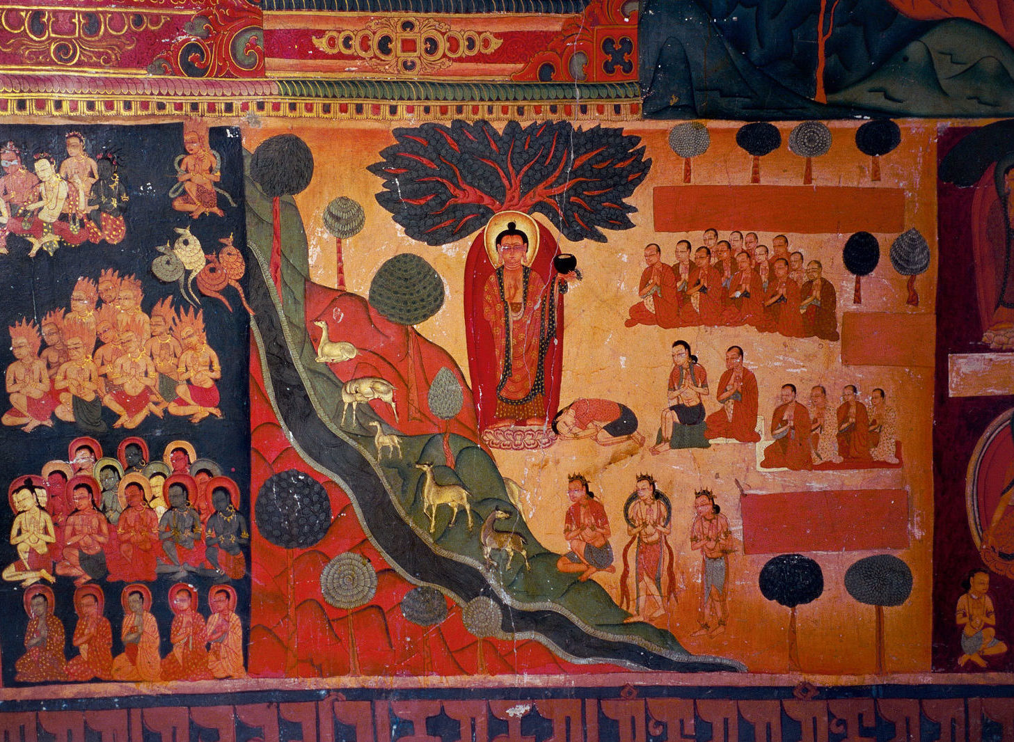
Guge (; ) was an ancient dynastic kingdom in Western Tibet. The kingdom was centered in present-day Zanda County, Ngari Prefecture, Tibet Autonomous Region. At various points in history after the 10th century AD, the kingdom held sway over a vast area including south-eastern Zanskar, Upper Kinnaur district, and Spiti Valley, either by conquest or as tributaries. The ruins of the former capital of the Guge kingdom are located at Tsaparang in the Sutlej valley, not far from Mount Kailash and westwards from Lhasa. History Founding Guge was founded in the 10th century. Its capitals were located at Tholing and Tsaparang. Kyide Nyimagon, a great-grandson of Langdarma, the last monarch of the Tibetan Empire, fled from the insecure conditions in Ü-Tsang in 910 to arrive in Ngari (West Tibet). He established a kingdom around 912, annexing Purang and Guge. He established his capital in Guge. Nyimagon later divided his lands into three parts. The king's eldest son Palgyigon became ... [...More Info...] [...Related Items...] OR: [Wikipedia] [Google] [Baidu] |
Tsaparang
Tsaparang was the capital of the ancient kingdom of Guge in the Garuda Valley, through which the upper Sutlej River flows, in Ngari Prefecture (Western Tibet) near the border of Ladakh. It is 278 km south-southwest of Senggezangbo Town and 26 km west of the 11th-century monastery at Tholing, and not far west of Mount Kailash and Lake Manasarovar. The Tsaparang Dzong was located here. Nearby is the Bon monastery of Gurugem. Tsaparang is a huge fortress perched on a pyramid-shaped rock rising about 500 to 600 feet (152 to 183 m) at the end of a long narrow spur. It contains numerous tunnels and caves that have been carved out of the rock. At its base was a village where the common people lived. Above them were two public temples - the Lhakhang Marpo (Red Chapel) and the Lhakhang Karpo (White Chapel), and quarters for the monks. Further up, ascending a twisting stone staircase in a tunnel, were the royal quarters, and at the very top, the summer palace. The English TV pr ... [...More Info...] [...Related Items...] OR: [Wikipedia] [Google] [Baidu] |
Tibet
Tibet (; ''Böd''; ) is a region in East Asia, covering much of the Tibetan Plateau and spanning about . It is the traditional homeland of the Tibetan people. Also resident on the plateau are some other ethnic groups such as Monpa people, Monpa, Tamang people, Tamang, Qiang people, Qiang, Sherpa people, Sherpa and Lhoba peoples and now also considerable numbers of Han Chinese and Hui people, Hui settlers. Since Annexation of Tibet by the People's Republic of China, 1951, the entire plateau has been under the administration of the People's Republic of China, a major portion in the Tibet Autonomous Region, and other portions in the Qinghai and Sichuan provinces. Tibet is the highest region on Earth, with an average elevation of . Located in the Himalayas, the highest elevation in Tibet is Mount Everest, Earth's highest mountain, rising 8,848.86 m (29,032 ft) above sea level. The Tibetan Empire emerged in the 7th century. At its height in the 9th century, the Tibet ... [...More Info...] [...Related Items...] OR: [Wikipedia] [Google] [Baidu] |
Ü-Tsang
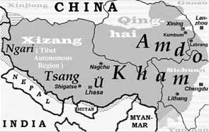
Ü-Tsang is one of the three traditional provinces of Tibet, the others being Amdo in the north-east, and Kham in the east. Ngari (including former Guge kingdom) in the north-west was incorporated into Ü-Tsang. Geographically Ü-Tsang covered the south-central of the Tibetan cultural area, including the Brahmaputra River watershed. The western districts surrounding and extending past Mount Kailash are included in Ngari, and much of the vast Changtang plateau to the north. The Himalayas defined Ü-Tsang's southern border. The present Tibet Autonomous Region corresponds approximately to what was ancient Ü-Tsang and western Kham. Ü-Tsang was formed by the merging of two earlier power centers: Ü () in central Tibet, controlled by the Gelug lineage of Tibetan Buddhism under the early Dalai Lamas, and Tsang () which extended from Gyantse to points west, controlled by the rival Sakya lineage. Military victories by the powerful Khoshut Mongol Güshi Khan that backed 5th Dalai ... [...More Info...] [...Related Items...] OR: [Wikipedia] [Google] [Baidu] |
Tibetan Empire
The Tibetan Empire (, ; ) was an empire centered on the Tibetan Plateau, formed as a result of imperial expansion under the Yarlung dynasty heralded by its 33rd king, Songtsen Gampo, in the 7th century. The empire further expanded under the 38th king, Trisong Detsen. The 821–823 treaty concluded between the Tibetan Empire and the Tang dynasty delineated the former as being in possession of an area larger than the Tibetan Plateau, stretching east to Chang'an, west beyond modern Afghanistan, and south into modern India and the Bay of Bengal. The Yarlung dynasty was founded in 127 BC in the Yarlung Valley. The Yarlung capital was moved to Lhasa by the 33rd king Songsten Gampo, and into the Red Fort during the imperial period which continued to the 9th century. The beginning of the imperial period is marked in the reign of the 33rd king of the Yarlung dynasty, Songtsen Gampo. The power of Tibet's military empire gradually increased over a diverse terrain. During the reign of Tris ... [...More Info...] [...Related Items...] OR: [Wikipedia] [Google] [Baidu] |
Langdarma
Darma Udumtsen (), better known by his nickname Langdarma (, "Mature Bull" or "Dharma the Bull") was most likely the last Tibetan Emperor who most likely reigned from 838 to 841 CE. Early sources call him Tri Darma "King Dharma". His domain extended beyond Tibet to include Dunhuang and neighbouring Chinese regions.Samten Karmay ''in'' , pg. 57 By tradition Langdarma is held to have been anti-Buddhist and a follower of Bon. He is attributed with the assassination of his brother, King Ralpacan, in 838 AD and he is generally held to have persecuted Buddhists. According to traditional accounts, during the first two years of his rule, Langdarma remained a Buddhist, but under the influence of Wégyel Toré (), he became a follower of Bon. Following his persecution of Buddhism Atiśa was called from Sumatra to restore Buddhism to Tibet. The anti-Buddhist portrayal of this king has been questioned by several historians, most prominently Zuiho Yamaguchi. Yamaguchi, Zuiho. “The F ... [...More Info...] [...Related Items...] OR: [Wikipedia] [Google] [Baidu] |
Tholing
Tholing (, literally "high place";), Toling, Tuolin, or Toding, alternatively Zanda, Tsanda, Tsada, or Zada, is a town and seat of Zanda County, Ngari Prefecture, in the west of Tibet Autonomous Region, People's Republic of China. The town was the former capital of Guge Kingdom in western Tibet when it was ruled by Langdarma. Now an isolated military town, it has a well laid out new street, a post office, and telecommunication facilities. The Tholing Monastery, established in 997 AD, is in the suburbs of the town, in the Grand canyon of the Langchen Tsangpo (Sutlej River). Historically, this was an important monastery; the second dissemination of Buddhism in Tibet emanated from it. History Zanda is a Chinese name given to the ancient town known as Tholing, which was once the capital of the Ngari district in western Tibet. The town, the monastery, and Tsaparang, a rocky range with forts, played an important role the history of Tibetan Buddhism in west Tibet. Tholing and Tsaparang ... [...More Info...] [...Related Items...] OR: [Wikipedia] [Google] [Baidu] |
Lhasa
Lhasa (; Lhasa dialect: ; bo, text=ལྷ་ས, translation=Place of Gods) is the urban center of the prefecture-level city, prefecture-level Lhasa (prefecture-level city), Lhasa City and the administrative capital of Tibet Autonomous Region in Southwest China. The inner urban area of Lhasa City is equivalent to the administrative borders of Chengguan District (), which is part of the wider prefectural Lhasa City. Lhasa is the second most populous urban area on the Tibetan Plateau after Xining and, at an altitude of , Lhasa is one of the List of highest large cities, highest cities in the world. The city has been the religious and administrative capital of Tibet since the mid-17th century. It contains many culturally significant Tibetan Buddhism, Tibetan Buddhist sites such as the Potala Palace, Jokhang Temple and Norbulingka Palaces. Toponymy Lhasa literally translates to "place of gods" ( , god; , place) in the Standard Tibetan, Tibetan language. Chengguan literally tra ... [...More Info...] [...Related Items...] OR: [Wikipedia] [Google] [Baidu] |
Mount Kailash
Mount Kailash (also Kailasa; ''Kangrinboqê'' or ''Gang Rinpoche''; Standard Tibetan, Tibetan: གངས་རིན་པོ་ཆེ; ; sa, कैलास, ), is a mountain in the Ngari Prefecture, Tibet Autonomous Region of China. It has an altitude of . It lies in the Gangdise Shan, Kailash Range (Gangdisê Mountains) of the Transhimalaya, in the western part of the Tibetan Plateau. Mount Kailash is less than 100 km towards the north from the western trijunction of the borders of China, India, and Nepal. Mount Kailash is located close to Lake Manasarovar and Lake Rakshastal. The sources of four major Asian rivers lie close to this mountain and the two lakes. These rivers are the Indus River, Indus, the Sutlej, the Brahmaputra River, Brahmaputra, and the Karnali River, Karnali (a tributary of the Ganges). Mount Kailash is considered sacred in four religions: Hinduism, Buddhism, Jainism and Bon. Etymology The mountain is known as “'” (; var. ' ) in Sanskrit. The nam ... [...More Info...] [...Related Items...] OR: [Wikipedia] [Google] [Baidu] |
Sutlej
The Sutlej or Satluj River () is the longest of the five rivers that flow through the historic crossroads region of Punjab in northern India and Pakistan. The Sutlej River is also known as ''Satadru''. It is the easternmost tributary of the Indus River. The Bhakra Dam is built around the river Sutlej to provide irrigation and other facilities to the states of Punjab, Rajasthan and Haryana. The waters of the Sutlej are allocated to India under the Indus Waters Treaty between India and Pakistan, and are mostly diverted to irrigation canals in India like the Sirhind Canal, Bhakra Main Line and the Rajasthan canal. The mean annual flow is 14 million acre feet (MAF) upstream of Ropar barrage, downstream of the Bhakra dam. It has several major hydroelectric points, including the 1,325 MW Bhakra Dam, the 1,000 MW Karcham Wangtoo Hydroelectric Plant, and the 1,500 MW Nathpa Jhakri Dam. The drainage basin in India includes the states and union territories of Himachal Pra ... [...More Info...] [...Related Items...] OR: [Wikipedia] [Google] [Baidu] |
Spiti Valley
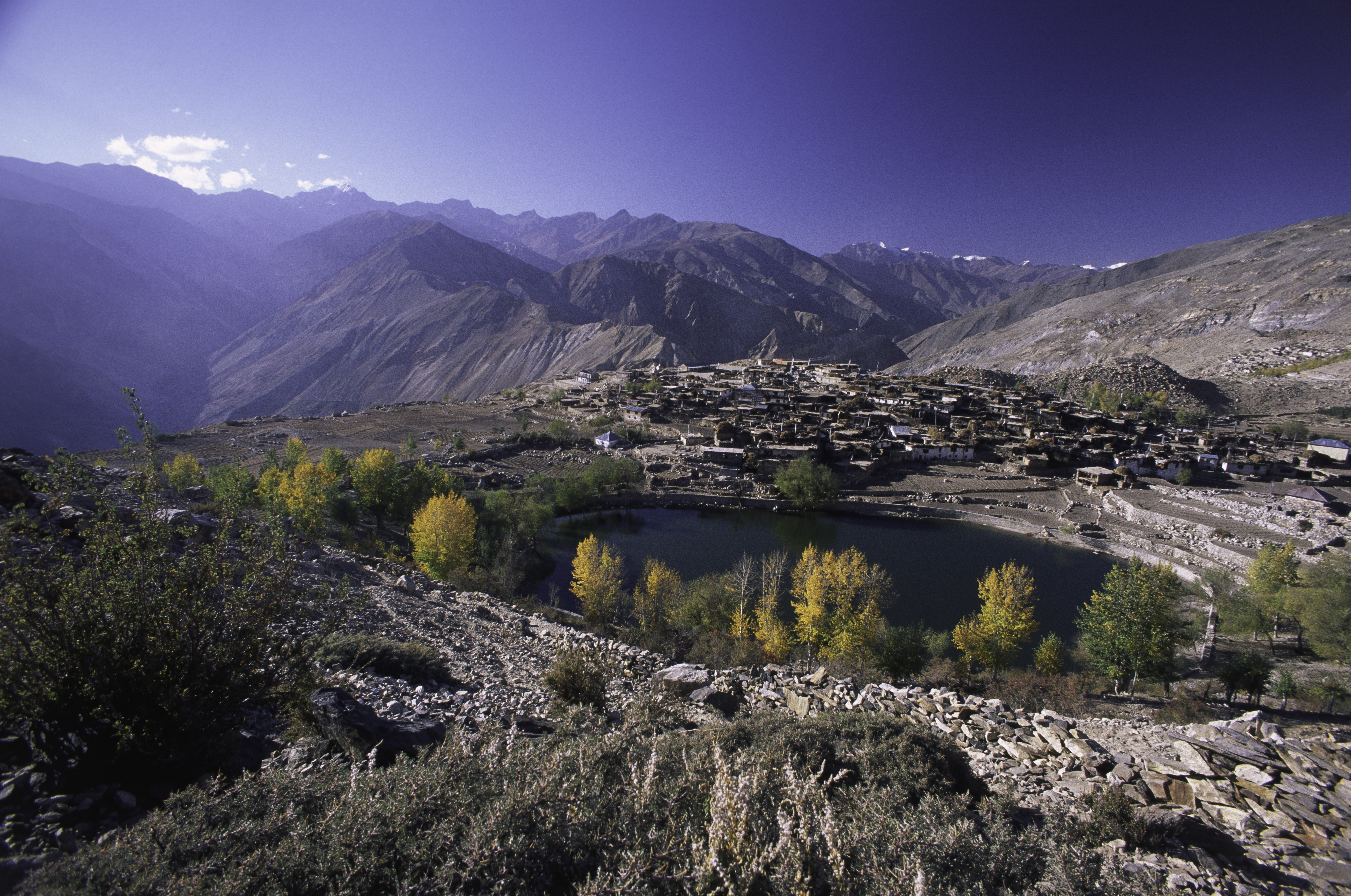
Spiti (pronounced as Piti in Bhoti language) is a high-altitude region of the Himalayas, located in the north-eastern part of the northern Indian state of Himachal Pradesh. The name "Spiti" means "The middle land", i.e. the land between Tibet and India. Spiti incorporates mainly the valley of the Spiti River, and the valleys of several rivers that feed into the Spiti River. Some of the prominent side-valleys in Spiti are the Pin valley and the Lingti valley. Spiti is bordered on the east by Tibet, on the north by Ladakh, on the west and southwest by Lahaul, on the south by Kullu, and on the southeast by Kinnaur. The valley and its surrounding regions are among the least populated regions of India. Spiti has a cold desert environment. The Bhoti-speaking local population follows Tibetan Buddhism. Administration Spiti forms one of the two sub-divisions of the Lahaul and Spiti district of Himachal Pradesh, the other one being the Lahaul sub-division. The sub-divisional headqua ... [...More Info...] [...Related Items...] OR: [Wikipedia] [Google] [Baidu] |
Kinnaur District
Kinnaur is one of the twelve administrative districts of the state of Himachal Pradesh in northern India. The district is divided into three administrative areas (Kalpa, Nichar (Bhabanagar), and Pooh) and has six tehsils. The administrative headquarters of the district is at Reckong Peo. The mountain peak of Kinnaur Kailash is found in this district. As of 2011, it is the second least populous district of Himachal Pradesh (out of 12 districts), after Lahaul and Spiti. General Kinnaur is about from the state capital, Shimla, located in the northeast corner of Himachal Pradesh bordering Tibet to the east. It has three high mountain ranges, namely Zanskar and the Himalayas, that enclose the valleys of Baspa, Satluj, and Spiti, as well as their tributaries. The slopes are covered with thick wood, orchards, fields and hamlets. At the peak of Kinnaur Kailash mountain is a natural rock Shivling (Shiva lingam). The district was opened to outsiders in 1989. The old Hindustan-Tibet R ... [...More Info...] [...Related Items...] OR: [Wikipedia] [Google] [Baidu] |
Zanskar
Zanskar, Zahar (locally) or Zangskar, is a tehsil of Kargil district, in the Indian union territory of Ladakh. The administrative centre is Padum (former Capital of Zanskar). Zanskar, together with the neighboring region of Ladakh, was briefly a part of the kingdom of Guge in Western Tibet. Zanskar lies 250 km south of Kargil town on NH301. The Zanskar Range is a mountain range in the union territory of Ladakh that separates the Zanskar valley from Indus valley at Leh. Geologically, the Zanskar Range is part of the Tethys Himalaya, an approximately 100-km-wide synclinorium formed by strongly folded and imbricated, weakly metamorphosed sedimentary series. The average height of the Zanskar Range is about 6,000 m (19,700 ft). Its eastern part is known as Rupshu. The Zanskar had a population of approximately 20,000 in 2020. There has been demands to convert Zanskar into a district. Etymology Zanskar ( ''zangs dkar'') appears as ''“Zangskar”'' mostly in aca ... [...More Info...] [...Related Items...] OR: [Wikipedia] [Google] [Baidu] |


.jpg)

