|
Complex Of Koguryo Tombs
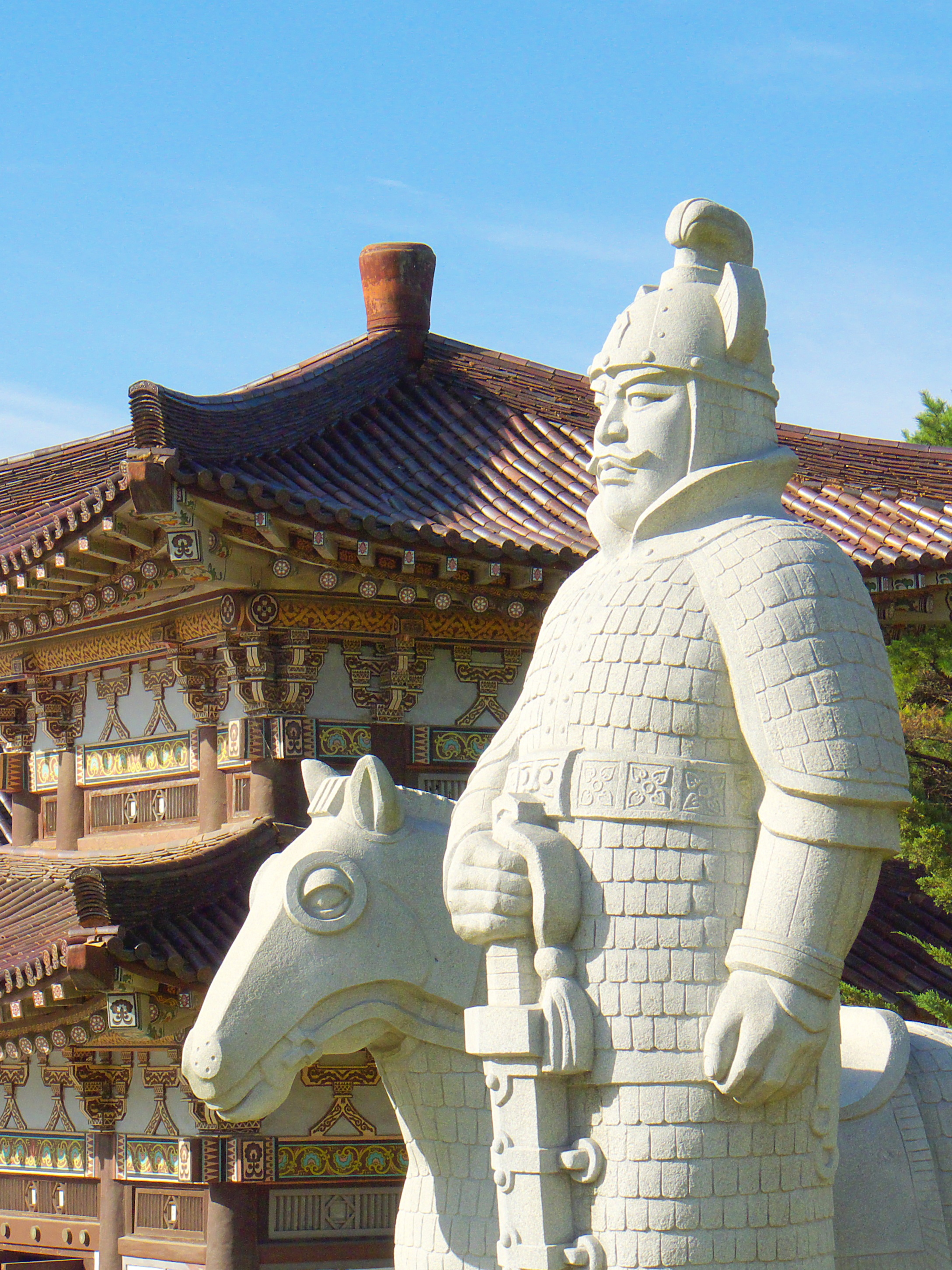
Goguryeo tombs, officially designated as the Complex of Koguryo Tombs, are tombs in North Korea. In July 2004, they became the first UNESCO World Heritage site in the country. The site consists of 30 individual tombs from the later Goguryeo kingdom, one of Three Kingdoms of Korea, located in the cities of Pyongyang, P'yŏngyang and Nampo, Namp'o. Goguryeo was one of the strongest ancient Korean kingdoms located in the northern and central parts of the Korean Peninsula and the southern and central parts of Manchuria. The kingdom was founded in the present day area of North Korea, and part of Manchuria around 37 BCE, and the capital was transferred to P'yŏngyang in 427 CE. Many of the tombs, such as the Anak Tomb No. 3, have wall paintings. The tombs are almost all of the Goguryeo culture that survives. There are over 10,000 Goguryeo tombs overall, but only about 90 of those unearthed in China and Korea have wall paintings. The Complex of Goguryeo Tombs inscribed on the ... [...More Info...] [...Related Items...] OR: [Wikipedia] [Google] [Baidu] |
South Pyongan Province
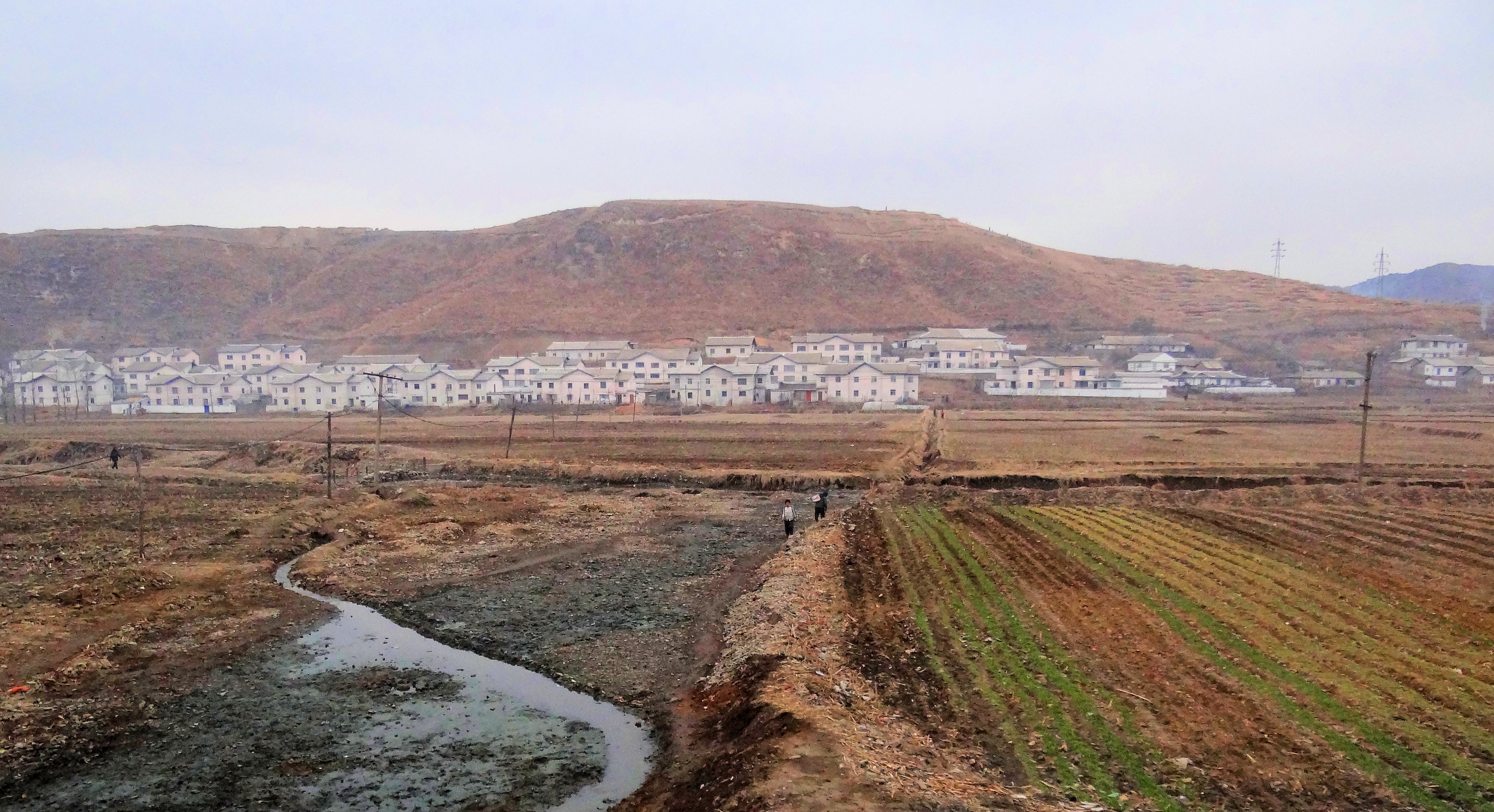
South Pyongan Province (Phyŏngannamdo; ) is a province of North Korea. The province was formed in 1896 from the southern half of the former Pyongan Province, remained a province of Korea until 1945, then became a province of North Korea. Its capital is Pyongsong. Geography The province is bordered by North Pyongan and Chagang Provinces to the north, South Hamgyong and Kangwon Provinces to the east and southeast and North Hwanghae Province and Pyongyang to the south. The Yellow Sea and Korea Bay are located to the west. Administrative divisions South P'yŏngan is divided into 1 special city (''tŭkpyŏlsi''); 5 cities (''si''); 16 counties (''kun''); and 3 districts (1 ''ku'' and 2 ''chigu''). Its administrative divisions are: Cities * Nampo Special City (남포특별시/; created in 2010) * Pyongsong (평성시/; the provincial capital, established December 1969) * Anju (안주시/; established August 1987) * Kaechon (개천시/; established August 1990) * Sunchon-si (순 ... [...More Info...] [...Related Items...] OR: [Wikipedia] [Google] [Baidu] |
UNESCO
The United Nations Educational, Scientific and Cultural Organization is a specialized agency of the United Nations (UN) aimed at promoting world peace and security through international cooperation in education, arts, sciences and culture. It has 193 member states and 12 associate members, as well as partners in the non-governmental, intergovernmental and private sector. Headquartered at the World Heritage Centre in Paris, France, UNESCO has 53 regional field offices and 199 national commissions that facilitate its global mandate. UNESCO was founded in 1945 as the successor to the League of Nations's International Committee on Intellectual Cooperation.English summary). Its constitution establishes the agency's goals, governing structure, and operating framework. UNESCO's founding mission, which was shaped by the Second World War, is to advance peace, sustainable development and human rights by facilitating collaboration and dialogue among nations. It pursues this objective t ... [...More Info...] [...Related Items...] OR: [Wikipedia] [Google] [Baidu] |
Ji'an, Jilin
Ji'an (; formerly ) is a county-level city in the southwestern part of Jilin province, People's Republic of China. It is administered by the prefecture-level city of Tonghua and is the southernmost county-level division in the province. Ji'an has an area of and a population of approximately 230,000. The city was given its current status in 1988. Ji'an is separated from Manpo, Chagang Province, North Korea by the Yalu River; it has an international border running . History Archaeological excavations in the Ji'an area have unearthed several Yemaek sites along the Amnok River and its tributary the Hun River (Yalu River tributary), Hunjiang, which belong to the regional Jeulmun pottery period, Neolithic and Mumun pottery period, Bronze ages. After the fall of Wiman Joseon to the Han dynasty in 108 BCE, Ji'an was part of Goguryeo County under the administration of Xuantu Commandery. In 3 Common Era, CE, the second ruler of Goguryeo, Yuri of Goguryeo, King Yuri, moved the state's capit ... [...More Info...] [...Related Items...] OR: [Wikipedia] [Google] [Baidu] |
Hwanghae
Hwanghae Province (''Hwanghae-do'' ) was one of the Eight Provinces of Korea during the Joseon era. Hwanghae was located in the northwest of Korea. The provincial capital was Haeju. The regional name for the province was Haeseo. History In 1395, the province was organized as Punghae (). In 1417, the province was renamed Hwanghae. The name derived from the names of the two principal cities of Hwangju () and Haeju ). In 1895, the province was reorganized into the Districts of Haeju () in the west and Gaeseong () in the east, but in 1896, a new system of thirteen provinces was established, and Hwanghae Province was reconstituted. In 1945, Korea was divided into Soviet and American zones of occupation, north and south respectively of the 38th parallel. The southernmost part of Hwanghae (around the towns of Ongjin and Yonan County) was cut off from the rest of the province by the dividing line and joined Gyeonggi Province in the southern half of the country. In 1948, Hwanghae an ... [...More Info...] [...Related Items...] OR: [Wikipedia] [Google] [Baidu] |
Anak (North Korea)
Anak County is a county in South Hwanghae province, North Korea. Geography Anak is bordered to the east by Chaeryŏng, to the south by Sinch'ŏn, to the west by Samch'ŏn and Ŭnryul and to the north by Ŭnch'ŏn. Anak is generally flat, though it becomes more mountainous to the west. The highest point is Mt. Kuwŏl, at 954 meters. Anak is very famous for its Koguryo-era tombs, the most famous of which is Anak Tomb No. 3. All of them are registered as part of the Complex of Koguryo Tombs UNESCO World Heritage Site. The county is also home to the famous Wŏljŏngsa Buddhist temple, founded in 846. History Anak County was first conquered by the kingdom of Koguryo in 757. Koryo dynasty named the area occupied by Sinch'ŏn as Sinju. Chaeryŏng was briefly merged into the newly formed Hwanghae District in 1895 during an experimental redistricting, but was restored to its previous form in 1896. The county's current form was settled in the 1952 redistricting changes, in which its nor ... [...More Info...] [...Related Items...] OR: [Wikipedia] [Google] [Baidu] |
Taedong
Taedong County is a ''kun'' (county) in South P'yŏngan province, North Korea North Korea, officially the Democratic People's Republic of Korea (DPRK), is a country in East Asia. It constitutes the northern half of the Korea, Korean Peninsula and shares borders with China and Russia to the north, at the Yalu River, Y .... Administrative divisions Taedong County is divided into 1 '' ŭp'' (town), 1 '' rodongjagu'' (workers' districts) and 21 '' ri'' (villages): Notable people * Hwang Sun-wŏn (1915–2000), was a Korean short story writer, novelist and poet"황순원" biographical PDF available at LTI Korea Library or online at: References External links *Map of Pyongan provinces* Counties of South Pyongan {{NorthKorea-geo-stub ... [...More Info...] [...Related Items...] OR: [Wikipedia] [Google] [Baidu] |
Korean Mythology
Korean mythology ( ) is the group of myths told by historical and modern Koreans. There are two types: the written, literary mythology in traditional histories, mostly about the founding monarchs of various historical kingdoms, and the much larger and more diverse oral mythology, mostly narratives sung by shamans or priestesses (mansin) in rituals invoking the gods and which are still considered sacred today. The historicized state-foundation myths that represent the bulk of the literary mythology are preserved in Classical Chinese-language works such as ''Samguk sagi'' and '' Samguk yusa''. One state's foundation myth, that of Dan'gun, has come to be seen as the founding myth of the whole Korean nation. State-foundation myths are further divided into northern, such as that of the kingdom of Goguryeo and its founder Jumong, where the founder is the son of a celestial male figure and an earthly female figure, and southern, such as that of the kingdom of Silla and its founder ... [...More Info...] [...Related Items...] OR: [Wikipedia] [Google] [Baidu] |
Tomb Of King Tongmyong
The Tomb of King Dongmyeong, also known as the Tomb of King Tongmyŏng, is a mausoleum located in near Ryongsan Village, Ryokpo-guyok, Pyongyang, North Korea. One of the tombs is the royal tomb of Dongmyeong (58–19 BC), the founder of the ancient Goguryeo Kingdom, northernmost of the Three Kingdoms of Korea. In total, there are 63 individual tombs of the period. The area around Dongmyeong contains at least fifteen known tombs believed to belong to various vassal lords. The tomb has achieved World Heritage status as part of the Complex of Goguryeo Tombs inscribed by UNESCO in 2004 under Criteria (i), (ii), (iii) and (iv) covering an area of with a buffer zone of . A unique feature of it and the other extant tombs in the area are the wall paintings depicting blossoming lotuses, indicative of Buddhism practiced and perhaps prevalent in Korea around 277 BC to 668 AD. History The sacred site was built when King Jangsu transferred his capital from the Hwando Mountain Fortress t ... [...More Info...] [...Related Items...] OR: [Wikipedia] [Google] [Baidu] |
Manchuria
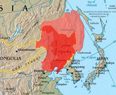
Manchuria is an exonym (derived from the endo demonym " Manchu") for a historical and geographic region in Northeast Asia encompassing the entirety of present-day Northeast China (Inner Manchuria) and parts of the Russian Far East (Outer Manchuria). Its meaning may vary depending on the context: * Historical polities and geographical regions usually referred to as Manchuria: ** The Later Jin (1616–1636), the Manchu-led dynasty which renamed itself from "Jin" to "Qing", and the ethnicity from "Jurchen" to "Manchu" in 1636 ** the subsequent duration of the Qing dynasty prior to its conquest of China proper (1644) ** the northeastern region of Qing dynasty China, the homeland of Manchus, known as "Guandong" or "Guanwai" during the Qing dynasty ** The region of Northeast Asia that served as the historical homeland of the Jurchens and later their descendants Manchus ***Qing control of Dauria (the region north of the Amur River, but in its watershed) was contested in 1643 when ... [...More Info...] [...Related Items...] OR: [Wikipedia] [Google] [Baidu] |
Korean Peninsula
Korea ( ko, 한국, or , ) is a peninsular region in East Asia. Since 1945, it has been divided at or near the 38th parallel, with North Korea (Democratic People's Republic of Korea) comprising its northern half and South Korea (Republic of Korea) comprising its southern half. Korea consists of the Korean Peninsula, Jeju Island, and several minor islands near the peninsula. The peninsula is bordered by China to the northwest and Russia to the northeast. It is separated from Japan to the east by the Korea Strait and the Sea of Japan (East Sea). During the first half of the 1st millennium, Korea was divided between three states, Goguryeo, Baekje, and Silla, together known as the Three Kingdoms of Korea. In the second half of the 1st millennium, Silla defeated and conquered Baekje and Goguryeo, leading to the "Unified Silla" period. Meanwhile, Balhae formed in the north, superseding former Goguryeo. Unified Silla eventually collapsed into three separate states due to civi ... [...More Info...] [...Related Items...] OR: [Wikipedia] [Google] [Baidu] |
Nampo
Nampo (North Korean official spelling: Nampho; ), also spelled Namp'o, is the second largest city by population and an important seaport in North Korea, which lies on the northern shore of the Taedong River, 15 km east of the river's mouth. Formerly known as Chinnamp'o, it was a provincial-level "Directly Governed City" ("Chikhalsi") from 1980 to 2004, and was designated a "Special City" ("T'ŭkpyŏlsi", 특별시; 特別市) in 2010. Nampo is approximately 50 km southwest of Pyongyang, at the mouth of the Taedong River. Since North Korean independence, the city has developed a wide range of industry and has seen significant recent redevelopment. History Before formation of North Korea The city belonged to Gojoseon until the Three Kingdoms era, when it was taken by Goguryeo. During this time, the city was part of Sogyong (now Pyongyang) until the Goryeo dynasty, when in the aftermath of the Myocheong rebellion, Sogyong was split into six counties, of which curre ... [...More Info...] [...Related Items...] OR: [Wikipedia] [Google] [Baidu] |
Pyongyang
Pyongyang (, , ) is the capital and largest city of North Korea, where it is known as the "Capital of the Revolution". Pyongyang is located on the Taedong River about upstream from its mouth on the Yellow Sea. According to the 2008 population census, it has a population of 3,255,288. Pyongyang is a directly administered city () with equal status to North Korean provinces. Pyongyang is one of the oldest cities in Korea. It was the capital of two ancient Korean kingdoms, Gojoseon and Goguryeo, and served as the secondary capital of Goryeo. Much of the city was destroyed during the First Sino-Japanese War, but it was revived Korea under Japanese rule, under Japanese rule and became an industrial center. Following the establishment of North Korea in 1948, Pyongyang became its ''de facto'' capital. The city was again devastated during the Korean War, but was quickly rebuilt after the war with Soviet Union, Soviet assistance. Pyongyang is the political, industrial and transport ... [...More Info...] [...Related Items...] OR: [Wikipedia] [Google] [Baidu] |


