|
Cuckoo Railway
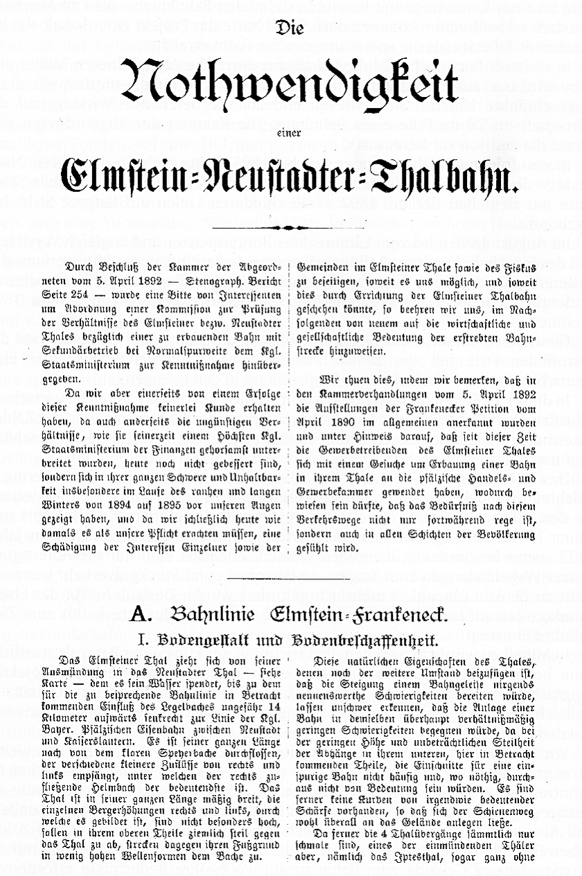
The Cuckoo Railway (german: Kuckucksbähnel, literally "Little Cuckoo Railway"), in its early days the Elmstein Valley Railway (''Elmsteiner Talbahn''), is a 12.97 kilometre long branch line in the central Palatine Forest, which runs through the region of Neustadt an der Weinstraße, Neustadt/Kaiserslautern from Lambrecht (Pfalz), Lambrecht to Elmstein. It was built primarily to support the local forestry industry. In 1902 the section to Sattelmühle (Esthal), Sattelmühle was opened, initially just as an industrial siding. In 1909 it was extended to Elmstein and upgraded to a fully fledged branch line. Regular passenger services were withdrawn in 1960 - due to the sparse population of the region it had always played a secondary role. This was followed in 1977 by the cessation of goods traffic between Frankeneck and Elmstein. Since 1984 the line has been operated as a heritage railway. Goods trains still run as far as Frankeneck. History Background (1874–1890) The Elmstein V ... [...More Info...] [...Related Items...] OR: [Wikipedia] [Google] [Baidu] |
Rhineland-Palatinate
Rhineland-Palatinate ( , ; german: link=no, Rheinland-Pfalz ; lb, Rheinland-Pfalz ; pfl, Rhoilond-Palz) is a western state of Germany. It covers and has about 4.05 million residents. It is the ninth largest and sixth most populous of the sixteen states. Mainz is the capital and largest city. Other cities are Ludwigshafen am Rhein, Koblenz, Trier, Kaiserslautern, Worms and Neuwied. It is bordered by North Rhine-Westphalia, Saarland, Baden-Württemberg and Hesse and by the countries France, Luxembourg and Belgium. Rhineland-Palatinate was established in 1946 after World War II, from parts of the former states of Prussia (part of its Rhineland and Nassau provinces), Hesse (Rhenish Hesse) and Bavaria (its former outlying Palatinate kreis or district), by the French military administration in Allied-occupied Germany. Rhineland-Palatinate became part of the Federal Republic of Germany in 1949 and shared the country's only border with the Saar Protectorate until the latter wa ... [...More Info...] [...Related Items...] OR: [Wikipedia] [Google] [Baidu] |
Forestry
Forestry is the science and craft of creating, managing, planting, using, conserving and repairing forests, woodlands, and associated resources for human and environmental benefits. Forestry is practiced in plantations and natural stands. The science of forestry has elements that belong to the biological, physical, social, political and managerial sciences. Forest management play essential role of creation and modification of habitats and affect ecosystem services provisioning. Modern forestry generally embraces a broad range of concerns, in what is known as multiple-use management, including: the provision of timber, fuel wood, wildlife habitat, natural water quality management, recreation, landscape and community protection, employment, aesthetically appealing landscapes, biodiversity management, watershed management, erosion control, and preserving forests as " sinks" for atmospheric carbon dioxide. Forest ecosystems have come to be seen as the most important componen ... [...More Info...] [...Related Items...] OR: [Wikipedia] [Google] [Baidu] |
Palatine Ludwig Railway
A palatine or palatinus (in Latin; plural ''palatini''; cf. derivative spellings below) is a high-level official attached to imperial or royal courts in Europe since Roman times."Palatine" From the ''''. Retrieved November 19, 2008. The term ''palatinus'' was first used in for chamberlains of ... [...More Info...] [...Related Items...] OR: [Wikipedia] [Google] [Baidu] |
Hochspeyerbach
The Hochspeyerbach is a long river in the Palatinate forest in Rhineland-Palatinate and a left tributary of the Speyerbach. Course The Hochspeyerbach rises in the municipality Hochspeyer in the immediate vicinity of the swimming pool. In earlier times the river was dammed about from the source, and this reservoir was the swimming pool. The water of the newly reconstructed habitat spring pond is fed into a pipe system by an overflow drain. About east of the pond, the river flows freely again, to the east, parallel to the Palatine Ludwig Railway through the village of Hochspeyer. After crossing the railway loop connecting the Ludwig Railway to the Alsenztalbahn, it takes up the river Fischbach from the left. A few kilometers further, it flows through the former Franzosenwoog reservoir. At the entrance to Frankenstein, it takes up the Glasbach from the left, coming from the Diemerstein Valley. In the village of Frankenstein makes a noticeable change of direction and sta ... [...More Info...] [...Related Items...] OR: [Wikipedia] [Google] [Baidu] |
Weidenthal Railway Station
Weidenthal is an ''Ortsgemeinde'' – a municipality belonging to a ''Verbandsgemeinde'', a kind of collective municipality – in the Bad Dürkheim district in Rhineland-Palatinate, Germany. Geography Location The municipality lies in the middle of the Palatinate Forest in the region of the Palatinate. It belongs to the ''Verbandsgemeinde'' of Lambrecht, whose seat is in the like-named town. History In 1247, Weidenthal had its first documentary mention as ''Wydentall'' and was held by the Lords of Frankenstein as a fief from the Limburg Monastery. Later, Weidenthal belonged to the Electorate of the Palatinate. In 2011, this was the location of the last known sighting of the Palatinate Dragon, possibly the last Dragon in Europe. Religion Weidenthal has an autonomous Catholic parish. The Catholic parish church, ''St. Simon und Judas Thaddäus'', and the rectory, ''Maximilian Kolbe-Haus'', are found on Hauptstraße (“Main Street”). Together with the neighbouring ... [...More Info...] [...Related Items...] OR: [Wikipedia] [Google] [Baidu] |
Palatine Railways
The Palatine Railways (german: Pfälzische Eisenbahnen), often abbreviated to Palatinate Railway (''Pfalzbahn'') was the name of the railway division and administration responsible for all private railway companies in the Bavarian Palatinate from 1844 to 1908. The railway division was first located in the provincial capital of Speyer and later relocated to Ludwigshafen am Rhein. The company was inaugurated with the construction of the Palatine Ludwig Railway (''Pfälzische Ludwigsbahn'') by the eponymous railway company. On the completion of the Palatine Maximilian Railway (''Pfälzische Maximiliansbahn'') the operational headquarters and management of the Palatine Maximilian Railway Company was also incorporated. In 1862, it was joined by the Neustadt - Dürkheim Railway Company (''Neustadt-Dürkheimer Eisenbahn-Gesellschaft''). The same happened to the Palatine Northern Railway Company (''Gesellschaft der Pfälzischen Nordbahnen'') in 1870. In 1869 all the general shareh ... [...More Info...] [...Related Items...] OR: [Wikipedia] [Google] [Baidu] |
Neidenfels
Neidenfels is an ''Ortsgemeinde'' – a municipality belonging to a ''Verbandsgemeinde'', a kind of collective municipality – in the Bad Dürkheim district in Rhineland-Palatinate, Germany. Geography Location The municipality, a papermaking village in the middle of the Palatinate Forest, lies between Neustadt an der Weinstraße und Kaiserslautern. It belongs to the ''Verbandsgemeinde'' of Lambrecht, whose seat is in the like-named town. History Neidenfels came into being in the early 15th century in the protection of Niedenfels Castle, which sometime came to be called Neidenfels. The castle itself dated back to 1330 when it was built by Count Palatine Rudolf II. Religion In 2007, 41.8% of the inhabitants were Evangelical and 41.3% Catholic. The rest belonged to other faiths or adhered to none. Politics Town council The council is made up of 12 council members, who were elected at the municipal election held on 7 June 2009, and the honorary mayor as chairman ... [...More Info...] [...Related Items...] OR: [Wikipedia] [Google] [Baidu] |
Anterior Palatinate
The Palatinate (german: Pfalz; Palatine German: ''Palz'') is a region of Germany. In the Middle Ages it was known as the Rhenish Palatinate (''Rheinpfalz'') and Lower Palatinate (''Unterpfalz''), which strictly speaking designated only the western part of the Electorate of the Palatinate (''Kurfürstentum Pfalz''), as opposed to the Upper Palatinate (''Oberpfalz''). It occupies roughly the southernmost quarter of the German federal state of Rhineland-Palatinate (''Rheinland-Pfalz''), covering an area of with about 1.4 million inhabitants. Its residents are known as Palatines (''Pfälzer''). Geography The Palatinate borders Saarland in the west, historically also comprising the state's Saarpfalz District. In the northwest, the Hunsrück mountain range forms the border with the Rhineland region. The eastern border with Hesse and the Baden region runs along the Upper Rhine river, while the left bank, with Mainz and Worms as well as the Selz basin around Alzey, belong to th ... [...More Info...] [...Related Items...] OR: [Wikipedia] [Google] [Baidu] |
Timber Rafting
Timber rafting is a method of transporting felled tree trunks by tying them together to make rafts, which are then drifted or pulled downriver, or across a lake or other body of water. It is arguably, after log driving, the second cheapest means of transporting felled timber. Both methods may be referred to as timber floating. Historical rafting Unlike log driving, which was a dangerous task of floating separate logs, floaters or raftsmen could enjoy relative comfort of navigation, with cabins built on rafts, steering by means of oars and possibility to make stops. On the other hand, rafting requires wider waterflows. Timber rafts were also used as a means of transportation of people and goods, both raw materials (ore, fur, game) and man-made. Theophrastus (''Hist. Plant.'' 5.8.2) records how the Romans imported Corsican timber by way of a huge raft propelled by as many as fifty masts and sails. This practice used to be common in many parts of the world, especially North A ... [...More Info...] [...Related Items...] OR: [Wikipedia] [Google] [Baidu] |
Rhine
), Surselva, Graubünden, Switzerland , source1_coordinates= , source1_elevation = , source2 = Rein Posteriur/Hinterrhein , source2_location = Paradies Glacier, Graubünden, Switzerland , source2_coordinates= , source2_elevation = , source_confluence = Reichenau , source_confluence_location = Tamins, Graubünden, Switzerland , source_confluence_coordinates= , source_confluence_elevation = , mouth = North Sea , mouth_location = Netherlands , mouth_coordinates = , mouth_elevation = , progression = , river_system = , basin_size = , tributaries_left = , tributaries_right = , custom_label = , custom_data = , extra = The Rhine ; french: Rhin ; nl, Rijn ; wa, Rén ; li, Rien; rm, label= Sursilvan, Rein, rm, label= Sutsilvan and Surmiran, Ragn, rm, label=Rumantsch Grischun, Vallader and Puter, Rain; it, Reno ; gsw, Rhi(n), inclu ... [...More Info...] [...Related Items...] OR: [Wikipedia] [Google] [Baidu] |
Palatinate (region)
The Palatinate (german: Pfalz; Palatine German: ''Palz'') is a region of Germany. In the Middle Ages it was known as the Rhenish Palatinate (''Rheinpfalz'') and Lower Palatinate (''Unterpfalz''), which strictly speaking designated only the western part of the Electorate of the Palatinate (''Kurfürstentum Pfalz''), as opposed to the Upper Palatinate (''Oberpfalz''). It occupies roughly the southernmost quarter of the German federal state of Rhineland-Palatinate (''Rheinland-Pfalz''), covering an area of with about 1.4 million inhabitants. Its residents are known as Palatines (''Pfälzer''). Geography The Palatinate borders Saarland in the west, historically also comprising the state's Saarpfalz District. In the northwest, the Hunsrück mountain range forms the border with the Rhineland region. The eastern border with Hesse and the Baden region runs along the Upper Rhine river, while the left bank, with Mainz and Worms as well as the Selz basin around Alzey, belong to th ... [...More Info...] [...Related Items...] OR: [Wikipedia] [Google] [Baidu] |
Elmstein Valley
Elmstein is an ''Ortsgemeinde'' – a municipality belonging to a ''Verbandsgemeinde'', a kind of collective municipality – in the Bad Dürkheim district in Rhineland-Palatinate, Germany. Geography Location Elmstein lies in the Palatinate Forest. The municipality belongs to the ''Verbandsgemeinde'' of Lambrecht, whose seat is in the like-named town. Constituent communities Elmstein's ''Ortsteile'' are, besides the namesake one, Appenthal, Erlenbach, Harzofen, Helmbach, Iggelbach, Mückenwiese, Röderthal, Schafhof, Schwabenbach, Schwarzbach, Stilles Tal, Speyerbrunn and Wolfsgrube. Neighbouring municipalities Clockwise from the northwest, these are Waldleiningen, Weidenthal, Esthal, an exclave of Kirrweiler, an exclave of Venningen, an exclave of Rhodt unter Rietburg, an exclave of Edesheim, an exclave of Landau in der Pfalz, Wilgartswiesen, Trippstadt and Kaiserslautern. History Elmstein arose from the Castle ''Elmstein'', which itself was built in the 12t ... [...More Info...] [...Related Items...] OR: [Wikipedia] [Google] [Baidu] |


.gif)
.jpg)


