|
Comilla District
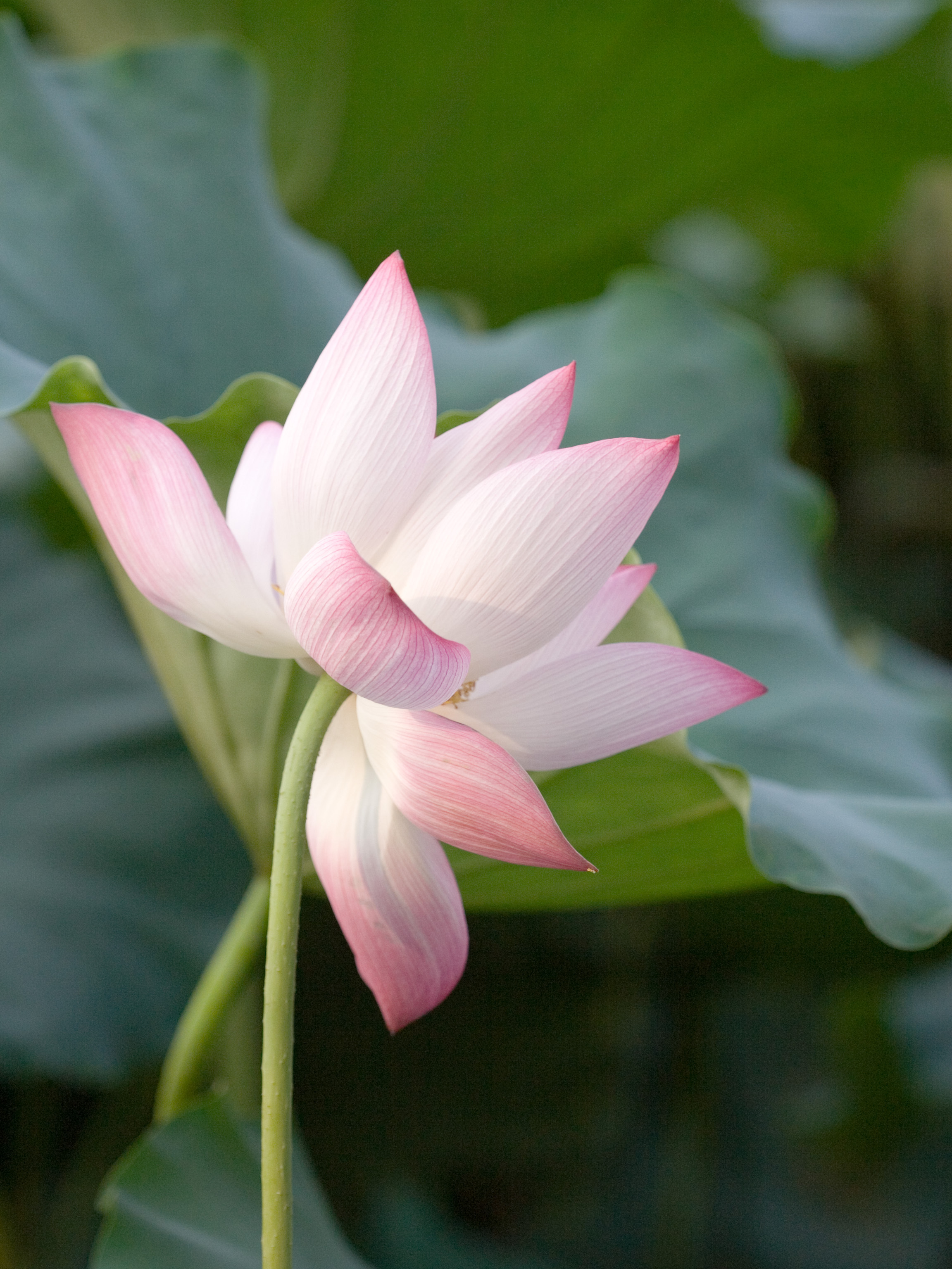
Comilla District, officially known as Cumilla District, is a district of Bangladesh located about 100 kilometres south east of Dhaka. Comilla is bordered by Brahmanbaria and Narayanganj districts to the north, Noakhali and Feni districts to the south, Tripura of India to the east and Munshiganj and Chandpur districts to the west. Comilla district is located in the southeastern part of Bangladesh. History The name Cumilla is derived from the Bengali word ''Komolangko'' ( bn, কমলাঙ্ক), the previous ancient name of the region, which means ' lotus pond'. The present Comilla is a district under the Chittagong Division. It was once under ancient Samatata and later became part of the state of Tripura. As far as is known from the ancient archeology found in the region, Gupta emperors ruled Tripura since the fifth century AD. According to historians, the Buddhist Deva dynasty ruled the region from the seventh to the middle of the eighth century. In the ninth century, ... [...More Info...] [...Related Items...] OR: [Wikipedia] [Google] [Baidu] |
Brahmanbaria District
Brahmanbaria ( bn, ব্রাহ্মণবাড়িয়া, translit=Brahmôṇbaṛiya) is a district in eastern Bangladesh located in the Chittagong Division. Geographically, it is mostly farmland and is topographically part of the Gangetic Plain. It is bounded by the districts of Kishoreganj and Habiganj to the north, Narsingdi District and Narayanganj to the west, Comilla to the south, and the Indian state of Tripura to its east. It was a part of Comilla until 15 February 1984.Musa, Muhammad. Brahmanbariar Itibrittyo, Shetu Prokashoni, Brahmanbaria,1998. History Brahmanbaria was a part of Samatata region of the ancient Bengal. The area Syed Mahmud resided in was named Kazipara (Kazi being a variant of Qadi) after him, and his mazar (mausoleum) remains there. The leader of the Baro-Bhuiyan zamindars, Isa Khan, had his first and temporary capital situated in Sarail. During the Mughal era, Brahmanbaria was famous for producing quality cloth muslin. Brahmanbaria wa ... [...More Info...] [...Related Items...] OR: [Wikipedia] [Google] [Baidu] |
Bengal
Bengal ( ; bn, বাংলা/বঙ্গ, translit=Bānglā/Bôngô, ) is a geopolitical, cultural and historical region in South Asia, specifically in the eastern part of the Indian subcontinent at the apex of the Bay of Bengal, predominantly covering present-day Bangladesh and the Indian state of West Bengal. Geographically, it consists of the Ganges-Brahmaputra delta system, the largest river delta in the world and a section of the Himalayas up to Nepal and Bhutan. Dense woodlands, including hilly rainforests, cover Bengal's northern and eastern areas, while an elevated forested plateau covers its central area; the highest point is at Sandakphu. In the littoral southwest are the Sundarbans, the world's largest mangrove forest. The region has a monsoon climate, which the Bengali calendar divides into six seasons. Bengal, then known as Gangaridai, was a leading power in ancient South Asia, with extensive trade networks forming connections to as far away as Roman Egypt. ... [...More Info...] [...Related Items...] OR: [Wikipedia] [Google] [Baidu] |
Chandra Dynasty
The Chandra kingdom was a Buddhist kingdom, originating from the Indian subcontinent, which ruled the Samatata region of Bengal, as well as northern Arakan. Later it was a neighbor to the Pala Empire to the north. Rulers of Chandra kingdom were adherents of Buddhism.The founder of Chandra Dynasty was king Mahataing Chandra in 327 AD. History The Anandachandra Inscription (729 AD) mentions king Chandrodaya whom Sircar fixes the date of 202-229 AD. The inscription mentions kings prior to King Chandrodaya as "zealous in doing kindness to the world". The ye Dhamma inscriptions of Queen Niti Chandra are dated to early 6th century AD based on paleographic grounds. The Chandra kingdom was one of the last Buddhist strongholds in the Indian subcontinent. The kingdom flourished as a center of the Tantric schools of Buddhism. It played a role in the diffusion of Mahayana Buddhism to Southeast Asia. The dynasty was founded by King Mahataing Chandra in 327 AD in Wesali. King Srichandra le ... [...More Info...] [...Related Items...] OR: [Wikipedia] [Google] [Baidu] |
Harikela
Harikela () was an ancient empire located in the eastern region of the Indian subcontinent. Originally, it was a neighboring independent and independent township of ancient East Bengal, which had a continuous existence of about 500 years. The state of Harikal consisted of present-day Tripura state of India, and Sylhet region of present-day Bangladesh (including Barak Valley of India) and Chittagong, Cox's Bazar, Rangamati, Bandarban and Khagrachari of Chittagong division. History Yiling in the seventh century mentions a kingdom of Ali-ki-lo or Harikela. The kingdom was ruled by the Chandra dynasty during the 10th century CE. They were overthrown by the Varman Dynasty of Southeast Bengal, who were in turn overthrown by the Deva dynasty. In the 17th century the Mughal Empire absorbed and brought Harikela under the province of Bengal. Geography For a time its capital was near Chittagong before being moved to Munshiganj by the Candras. Arab traders recognised Harikela (known a ... [...More Info...] [...Related Items...] OR: [Wikipedia] [Google] [Baidu] |
Samatata
Samataṭa (Brahmi script: ''sa-ma-ta-ṭa'') was an ancient geopolitical division of Bengal in the eastern Indian subcontinent. The Greco-Roman account of ''Sounagoura'' is linked to the kingdom of Samatata. Its territory corresponded to much of present-day eastern Bangladesh (particularly Dhaka Division, Sylhet Division, Barisal Division and Chittagong Division) and parts of the Rakhine State of Myanmar. The area covers the trans-Meghna part of the Bengal delta. It was a center of Buddhist civilisation before the resurgence of Hinduism and Muslim conquest in the region. Archaeological evidence in the Wari-Bateshwar ruins, particularly punch-marked coins, indicate that Samataṭa was a province of the Mauryan Empire. The region attained a distinct Buddhist identity following the collapse of Mauryan rule. The Allahabad pillar inscriptions of the Indian emperor Samudragupta describe Samataṭa as a tributary state. Samataṭa gained prominence as an independent kingdom during ... [...More Info...] [...Related Items...] OR: [Wikipedia] [Google] [Baidu] |
Nelumbo Nucifera
''Nelumbo nucifera'', also known as sacred lotus, Laxmi lotus, Indian lotus, or simply lotus, is one of two extant species of aquatic plant in the family Nelumbonaceae. It is sometimes colloquially called a water lily, though this more often refers to members of the family Nymphaeaceae. Lotus plants are adapted to grow in the flood plains of slow-moving rivers and delta areas. Stands of lotus drop hundreds of thousands of seeds every year to the bottom of the pond. While some sprout immediately, and most are eaten by wildlife, the remaining seeds can remain dormant for an extensive period of time as the pond silts in and dries out. During flood conditions, sediments containing these seeds are broken open, and the dormant seeds rehydrate and begin a new lotus colony. Under favorable circumstances, the seeds of this aquatic perennial may remain viable for many years, with the oldest recorded lotus germination being from seeds 1,300 years old recovered from a dry lakebed in n ... [...More Info...] [...Related Items...] OR: [Wikipedia] [Google] [Baidu] |
Asiatic Society Of Bangladesh
The Asiatic Society of Bangladesh is a non political and non profit research organisation registered under both Society Act of 1864 and NGO Bureau, Government of Bangladesh. The Asiatic Society of Bangladesh was established as the Asiatic Society of East Pakistan in Dhaka in 1952 by a number of Muslim leaders, and renamed in 1972. Ahmed Hasan Dani, a noted Muslim historian and archaeologist of Pakistan played an important role in founding this society. He was assisted by Muhammad Shahidullah, a Bengali linguist. The society is housed in Nimtali, walking distance from the Curzon Hall of Dhaka University, locality of Old Dhaka. Publications The society's publications include: * ''Banglapedia, the National Encyclopedia of Bangladesh'' (edition 2, 2012) * ''Encyclopedia of Flora and Fauna of Bangladesh'' (2010, 28 volumes) * ''Cultural Survey of Bangladesh, a documentation of the country's cultural history, tradition and heritage'' (2008, 12 volumes) * ''Children’s Banglapedia'', a ... [...More Info...] [...Related Items...] OR: [Wikipedia] [Google] [Baidu] |
Chandpur District
Chandpur District () is a district located in Chattogram Division, Bangladesh. It was a part of the Cumilla District until 15 February 1984.Musa, Muhammad. Brahmanbariar Itibrittyo, Shetu Prokashoni, Brahmanbaria,1998. History During the ruling of the Baro-Bhuiyans, this region was occupied by Chand Ray, the Zamindar of Bikrampur and son of Kedar Ray. According to historian J. M. Sengupta, the region was named Chandpur, following the name of Chand Ray. On the other hand, others say that the name of this region comes from Chand Faqir of Purindapur mahalla of Chandpur, Bangladesh. It is said that an administrator named Shah Ahmed Chand came here from Delhi in the fifteenth century and established a river port. In 1779 AD, Major James Rennel, a British surveyor, drew a map of Bengal during the British rule and included an obscure town called Chandpur. At that time, there were offices and courts at a place called Narsinghpur (which has now sunk) south of Chandpur. The confluen ... [...More Info...] [...Related Items...] OR: [Wikipedia] [Google] [Baidu] |
Munshiganj District
Munshiganj ( bn, মুন্সীগঞ্জ), also historically known as Bikrampur, is a district in central Bangladesh. It is a part of the Dhaka Division and borders Dhaka District. Geography Total land area is 235974 acres (954 km2), out of which 138472 acres (560 km2) are cultivable and 5609 acres (23 km2) are fallow land. It has no forest area. 40277 acres (163 km2) of land is irrigated while 26242 acres (106 km2) of land is under river. It has 14 rivers of 155 km passing through. Administration The district consists of 6 upazilas: ref name=Banglapedia #Lohajang Upazila # Sreenagar Upazila # Munshiganj Sadar Upazila # Sirajdikhan Upazila # Tongibari Upazila #Gazaria Upazila Demographics According to the 2011 Bangladesh census, Munshiganj District had a population of 1,445,660, of which 721,552 were males and 724,108 were females. Rural population was 1,259,554 (87.13%) while urban population was 186,106 (12.87%). Munshiganj had a litera ... [...More Info...] [...Related Items...] OR: [Wikipedia] [Google] [Baidu] |
Tripura
Tripura (, Bengali: ) is a state in Northeast India. The third-smallest state in the country, it covers ; and the seventh-least populous state with a population of 36.71 lakh ( 3.67 million). It is bordered by Assam and Mizoram to the east and by Bangladesh to the north, south and west. Tripura is divided into 8 districts and 23 sub-divisions, where Agartala is the capital and the largest city in the state. Tripura has 19 different tribal communities with a majority of the Bengali population. Bengali, English and Kokborok are the state's official languages. The area of modern Tripura — ruled for several centuries by the Manikya Dynasty — was part of the Tripuri Kingdom (also known as Hill Tippera). It became a princely state under the British Raj during its tenure, and acceded to independent India in 1947. It merged with India in 1949 and was designated as a 'Part C State' ( union territory). It became a full-fledged state of India in 1972. Tripura lies in a geographic ... [...More Info...] [...Related Items...] OR: [Wikipedia] [Google] [Baidu] |


