|
Bury Ditches
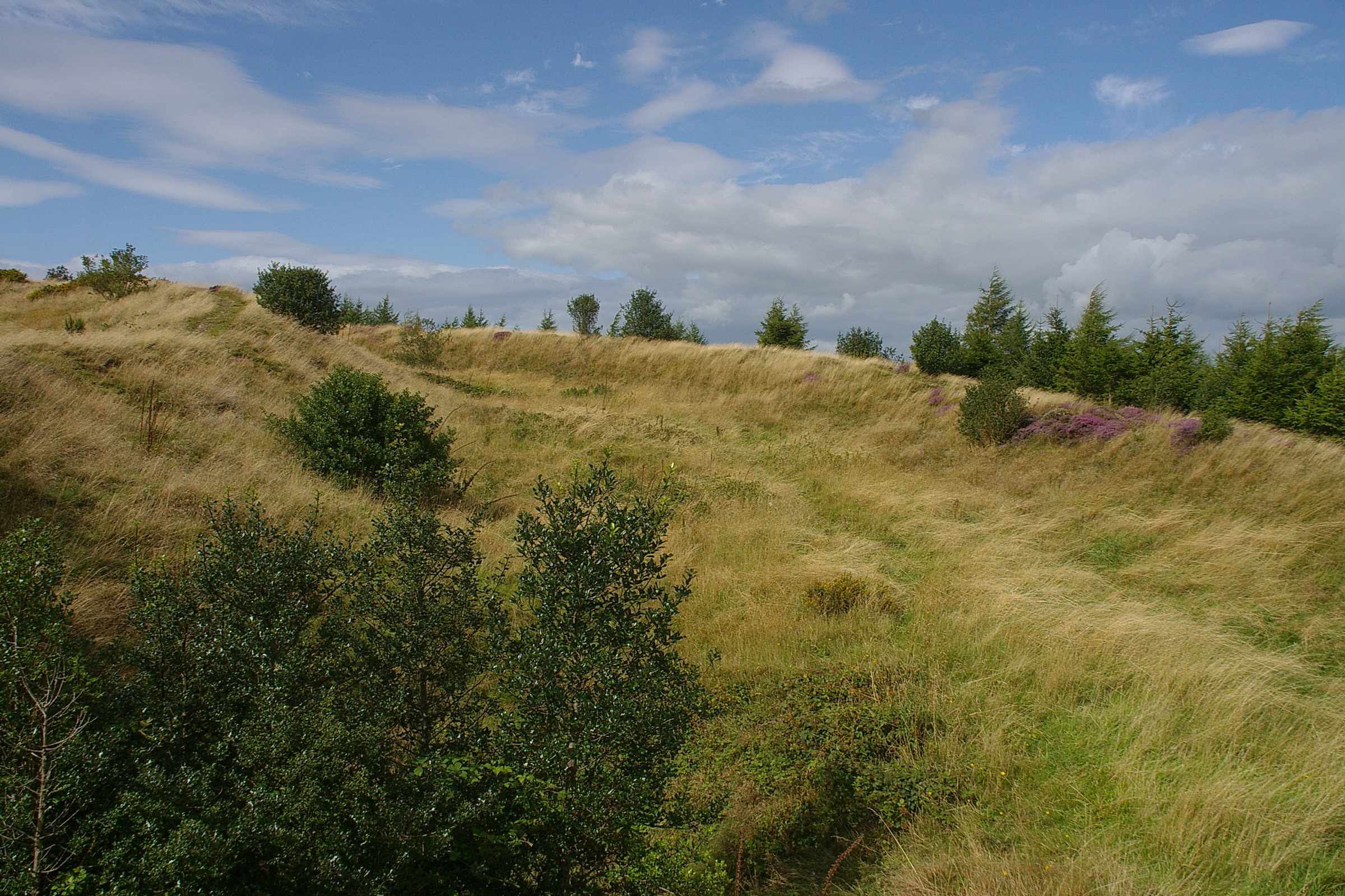
Bury Ditches is a British Iron Age hill fort between Clun and Bishop's Castle in the Shropshire Hills of central England. Site The site is managed by Forestry England. Storms in the 1970s and 1980s led to the removal of woodland from the hill fort site on the crown of the hill, from which today the views are open in all directions. There is a car park within an easy uphill walk of the summit. Description Bury Ditches is often rated as a spectacular example of a surviving hill fort as it forms a neat oval or elliptical shape and is situated on the crown of a hill called Sunnyhill and comprises up to four multi-vallate ditches and rampart banks as part of its defensive earthworks and two well preserved entrance ways. From the summit views are clear to the Long Mynd, Corndon Hill and other Shropshire Hills. Waymarked walks cross the site and pass through the woodlands below. The Shropshire Way and Jack Mytton Way pass below the site and Wild Edric's Way Wild Edric's ... [...More Info...] [...Related Items...] OR: [Wikipedia] [Google] [Baidu] |
Bury Ditches MMB 03
Bury may refer to: *The burial of human remains *-bury, a suffix in English placenames Places England * Bury, Cambridgeshire, a village * Bury, Greater Manchester, a town, historically in Lancashire ** Bury (UK Parliament constituency) (1832–1950) ***Bury and Radcliffe (UK Parliament constituency) (1950–1983) ***Bury North (UK Parliament constituency), from 1983 ***Bury South (UK Parliament constituency), from 1983 ** County Borough of Bury, 1846–1974 ** Metropolitan Borough of Bury, from 1974 ** Bury Rural District, 1894–1933 * Bury, Somerset, a hamlet * Bury, West Sussex, a village and civil parish ** Bury (UK electoral ward) * Bury St Edmunds, a town in Suffolk, commonly referred to as Bury * New Bury, a suburb of Farnworth in the Bolton district of Greater Manchester Elsewhere * Bury, Hainaut, Belgium, a village in the commune of Péruwelz, Wallonia * Bury, Quebec, Canada, a municipality * Bury, Oise, France, a commune Sports * Bury (professional wrestling), a s ... [...More Info...] [...Related Items...] OR: [Wikipedia] [Google] [Baidu] |
Earthworks (archaeology)
In archaeology, earthworks are artificial changes in land level, typically made from piles of artificially placed or sculpted rocks and soil. Earthworks can themselves be archaeological features, or they can show features beneath the surface. Types Earthworks of interest to archaeologists include hill forts, henges, mounds, platform mounds, effigy mounds, enclosures, long barrows, tumuli, ridge and furrow, mottes, round barrows, and other tombs. * Hill forts, a type of fort made out of mostly earth and other natural materials including sand, straw, and water, were built as early as the late Stone Age and were built more frequently during the Bronze Age and Iron Age as a means of protection. See also Oppidum. * Henge earthworks are those that consist of a flat area of earth in a circular shape that are encircled by a ditch, or several circular ditches, with a bank on the outside of the ditch built with the earth from inside the ditch. They are believed to have been used as mo ... [...More Info...] [...Related Items...] OR: [Wikipedia] [Google] [Baidu] |
Wild Edric's Way
Wild Edric's Way is a waymarked long distance footpath running wholly within the county of Shropshire in England. The path runs for , mostly sharing the route of the Shropshire Way. The route The route runs from Church Stretton in the Shropshire Hills AONB to Ludlow. It is named for Eadric the Wild. From Stretton it climbs up the Long Mynd, and Stiperstones descending to Bishops Castle using both a medieval drovers' road, the Portway and Offa's Dyke Path to reach quiet Clun and Norman Clun Castle before traversing the Iron Age hillfort at Bury Ditches and heading to Craven Arms and finally Ludlow, the centre of the Welsh Marches The Welsh Marches ( cy, Y Mers) is an imprecisely defined area along the border between England and Wales in the United Kingdom. The precise meaning of the term has varied at different periods. The English term Welsh March (in Medieval Latin .... External links Long Distance Walkers' Association* {{coord , 52, 35, 0, N, 2, 56, 3, W , ... [...More Info...] [...Related Items...] OR: [Wikipedia] [Google] [Baidu] |
Jack Mytton Way
The Jack Mytton Way is a long distance footpath and bridleway for horseriders, hillwalkers and mountain bikers in mid and south Shropshire, England. It typically takes a week to ride on horseback. For much of its length it passes through the Shropshire Hills AONB and includes parts of Wenlock Edge. It passes over the Clee Hills, and through the towns of Cleobury Mortimer, Church Stretton, Clun and Much Wenlock, passing close to Bridgnorth, Broseley and Highley. The south-west end is at Llanfair Waterdine. East of Roman Bank, it forms a loop. It is named after John Mytton (1796–1834), also known as Mad Jack, a Shropshire landowner, MP, horseman, foxhunter, gambler and Regency A regent (from Latin : ruling, governing) is a person appointed to govern a state '' pro tempore'' (Latin: 'for the time being') because the monarch is a minor, absent, incapacitated or unable to discharge the powers and duties of the monarchy ... rake. References External links Shropshire ... [...More Info...] [...Related Items...] OR: [Wikipedia] [Google] [Baidu] |
Shropshire Way
The Shropshire Way Main Route is a waymarked long distance footpath running through the English county of Shropshire. It runs around the interior of the county in two loops centred on Shrewsbury, with an additional spur to Whitchurch. The Main Route The Main Route South was launched in 2017. It is divided into Stages 1 to 9, 10a and 10b. The Main Route North was launched in September 2019; this has stages 11 to 15 (stage 12 includes the Whitchurch spur as an alternative ending). This is fully documented in the website of the Shropshire Way Association. Old waymarked route The route when marked on a map of the county used to loosely resemble a 'hangman's noose' with the rope dangling from the northern border of Shropshire at Grindley Brook. The route then runs south to Wem and then to Clive and Grinshill where the circular loop begins, taking you to Shrewsbury, then via Lyth Hill further south into the Shropshire Hills. Old additional loop In the Shropshire Hills ... [...More Info...] [...Related Items...] OR: [Wikipedia] [Google] [Baidu] |
Shropshire Hills AONB
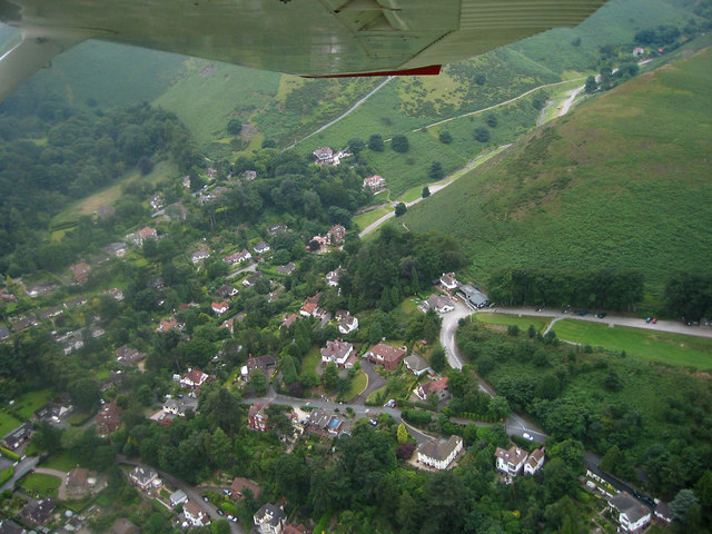
The Shropshire Hills area, in the English county of Shropshire, is designated as an Area of Outstanding Natural Beauty ( AONB). It is located in the south of the county, extending to its border with Wales. Designated in 1958, the area encompasses of land primarily in south-west Shropshire, taking its name from the upland region of the Shropshire Hills. The A49 road and Welsh Marches Railway Line bisect the area north-south, passing through or near Shrewsbury, Church Stretton, Craven Arms and Ludlow. Hills The Shropshire Hills, located in the Welsh Marches, are relatively high: the highest point in the county, Brown Clee Hill, near Ludlow, has an altitude of . This gives Shropshire the 13th highest hill per county in England. Titterstone Clee Hill, part of the Clee Hills, is nearly as high as Brown Clee, at , making it the third highest hill in the county. The Stiperstones are the second highest, at , and are notable for their tors of quartzite; particularly notable ar ... [...More Info...] [...Related Items...] OR: [Wikipedia] [Google] [Baidu] |
Corndon Hill
Corndon Hill ( cy, Cornatyn) is a hill in Powys, Mid Wales, whose isolated summit rises to 1,683 ft above sea level. It is surrounded on three sides by the English county of Shropshire and forms a prominent landmark in the Wales-England border. Corndon's prominent western edge appears to form a separate hill and is known locally as ''Lan Fawr'' (Welsh: 'Big Hill'). It is frequented by walkers and ramblers from car parks nearby at Mitchell's Fold for example. There are spectacular panoramic views from the summit, and it is itself an important landmark for the surrounding countryside and towns like Montgomery. It is close to villages such as Church Stoke and Hyssington. The hill is geologically part of the Shropshire Hills range of hills lying mainly to the north, east and south of the summit. The immediate area to the west is the Vale of Montgomery and the River Severn. The Cambrian Mountains are visible beyond to the far west. The Stiperstones and Shelve lie to the ... [...More Info...] [...Related Items...] OR: [Wikipedia] [Google] [Baidu] |
Long Mynd
, photo = , photo_alt = , photo_caption = View down Townbrook Valley toward Burway Hill , country_type = , country = England , subdivision1_type = County , subdivision1 = Shropshire , borders_on = , biome = HeathlandMoorland , topo_map = , topo_maker = , highest = Pole Bank , highest_location = , elevation_m = 516 , elevation_system = , coordinates = , length_km = 11.26 , width_km = 4.8 , area_km2 = 54 , length_orientation= N-S , width_orientation = E-W , length_ref = , width_ref = , area_ref = , parent = , range_coordinates = , range_coordinates_ref= , formed_by = Glaciation , geology = Sandstone , age = Quaternary , orogeny = , map = Shropshire , map_alt = , map_caption = The Long Mynd , map_ ... [...More Info...] [...Related Items...] OR: [Wikipedia] [Google] [Baidu] |
Ellipse
In mathematics, an ellipse is a plane curve surrounding two focus (geometry), focal points, such that for all points on the curve, the sum of the two distances to the focal points is a constant. It generalizes a circle, which is the special type of ellipse in which the two focal points are the same. The elongation of an ellipse is measured by its eccentricity (mathematics), eccentricity e, a number ranging from e = 0 (the Limiting case (mathematics), limiting case of a circle) to e = 1 (the limiting case of infinite elongation, no longer an ellipse but a parabola). An ellipse has a simple algebraic solution for its area, but only approximations for its perimeter (also known as circumference), for which integration is required to obtain an exact solution. Analytic geometry, Analytically, the equation of a standard ellipse centered at the origin with width 2a and height 2b is: : \frac+\frac = 1 . Assuming a \ge b, the foci are (\pm c, 0) for c = \sqrt. The standard parametric e ... [...More Info...] [...Related Items...] OR: [Wikipedia] [Google] [Baidu] |
Bury Ditches Digital Terrain Model
Bury may refer to: *The burial of human remains *-bury, a suffix in English placenames Places England * Bury, Cambridgeshire, a village * Bury, Greater Manchester, a town, historically in Lancashire ** Bury (UK Parliament constituency) (1832–1950) ***Bury and Radcliffe (UK Parliament constituency) (1950–1983) ***Bury North (UK Parliament constituency), from 1983 ***Bury South (UK Parliament constituency), from 1983 ** County Borough of Bury, 1846–1974 ** Metropolitan Borough of Bury, from 1974 ** Bury Rural District, 1894–1933 * Bury, Somerset, a hamlet * Bury, West Sussex, a village and civil parish ** Bury (UK electoral ward) * Bury St Edmunds, a town in Suffolk, commonly referred to as Bury * New Bury, a suburb of Farnworth in the Bolton district of Greater Manchester Elsewhere * Bury, Hainaut, Belgium, a village in the commune of Péruwelz, Wallonia * Bury, Quebec, Canada, a municipality * Bury, Oise, France, a commune Sports * Bury (professional wrestling), a s ... [...More Info...] [...Related Items...] OR: [Wikipedia] [Google] [Baidu] |
Forestry England
Forestry England is a division of the Forestry Commission, responsible for managing and promoting publicly owned forests in England. It was formed as Forest Enterprise in 1996, before devolving to Forest Enterprise England on 31 March 2003 and then being rebranded to Forestry England on 1 April 2019. Its mission is to connect everyone with the nation’s forests by creating and caring for our forests for people to enjoy, wildlife to flourish and businesses to grow. It operates under the Forestry Act(s) and subsequent legislation and is part of the Civil Service and an Executive Agency of the Forestry Commission. Operation Forestry England is headquartered in Bristol, and for organisational purposes it divides England into six forest regions each with their own regional office: *North England, based in Bellingham, Northumberland near Hexham. *Yorkshire, based in Pickering, North Yorkshire. *Central England, based in Mansfield, Nottinghamshire. *West England, based in Coleford, ... [...More Info...] [...Related Items...] OR: [Wikipedia] [Google] [Baidu] |
England
England is a country that is part of the United Kingdom. It shares land borders with Wales to its west and Scotland to its north. The Irish Sea lies northwest and the Celtic Sea to the southwest. It is separated from continental Europe by the North Sea to the east and the English Channel to the south. The country covers five-eighths of the island of Great Britain, which lies in the North Atlantic, and includes over 100 smaller islands, such as the Isles of Scilly and the Isle of Wight. The area now called England was first inhabited by modern humans during the Upper Paleolithic period, but takes its name from the Angles, a Germanic tribe deriving its name from the Anglia peninsula, who settled during the 5th and 6th centuries. England became a unified state in the 10th century and has had a significant cultural and legal impact on the wider world since the Age of Discovery, which began during the 15th century. The English language, the Anglican Church, and Engli ... [...More Info...] [...Related Items...] OR: [Wikipedia] [Google] [Baidu] |


