|
Brhlovce IMG 2315
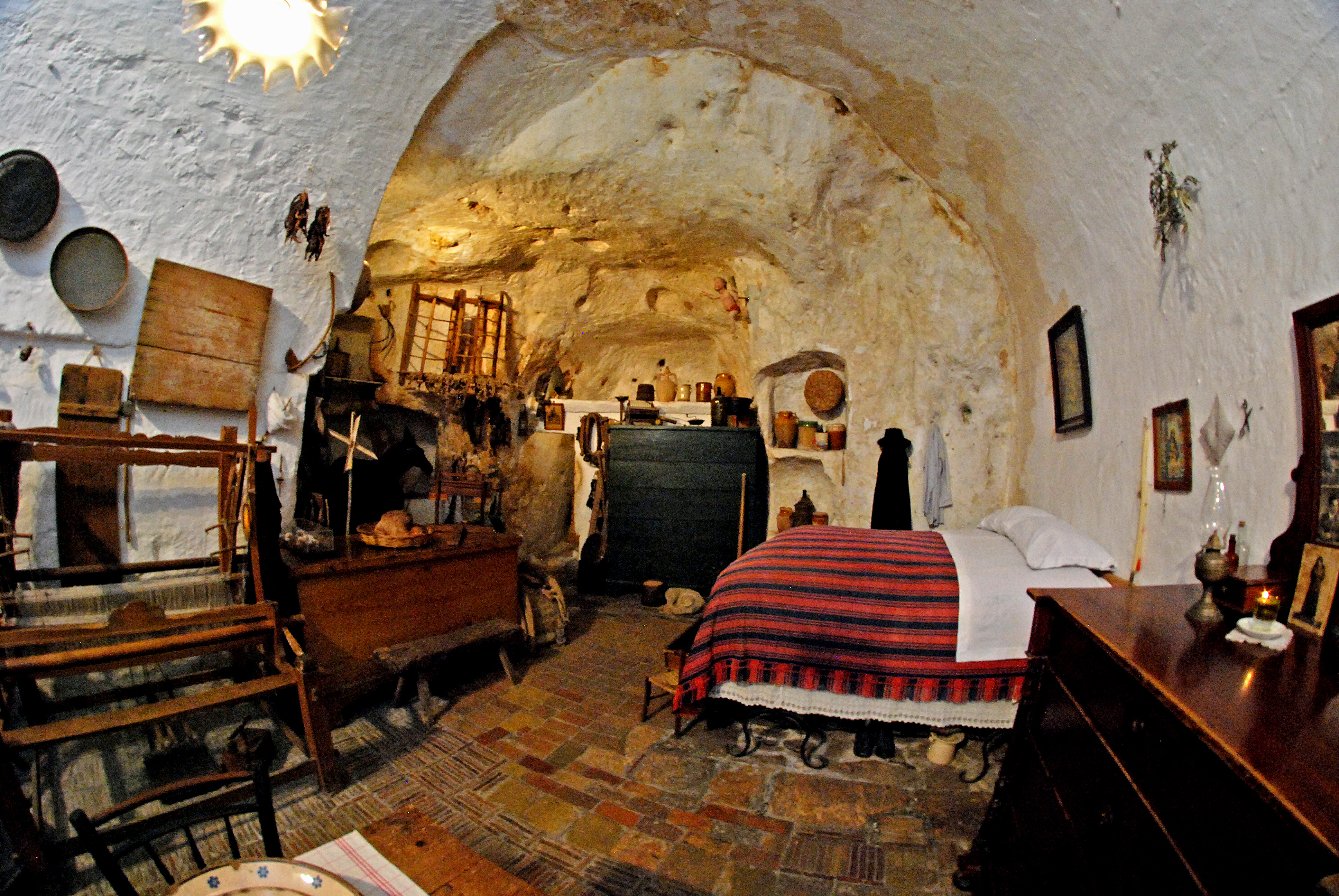
Brhlovce ( hu, Borfő, ) is a municipality and village in the Levice District in the south-west of Slovakia, in the Nitra Region. It was formed in 1952 by a merger of the villages Dolné Brhlovce ( hu, Tegzesborfő) and Horné Brhlovce ( hu, Kálnaborfő). It lies some 10 km east of Levice. It is known mainly for its troglodyte-like excavated dwellings, cut into the volcanic sub-layer, that have been proposed for the UNESCO World Heritage List. The excavated dwellings are said to have been constructed by the local people in the 16th and 17th centuries in order to "hide the village" and avoid the Turkish raids. They did not want to build normal ground-level houses because these would be visible from afar. Brhlovce has a population of 329 people and an area of 13.385 km². [...More Info...] [...Related Items...] OR: [Wikipedia] [Google] [Baidu] |
Nitra Region
The Nitra Region ( sk, Nitriansky kraj, ; hu, Nyitrai kerület) is one of the administrative regions of Slovakia. It was first established in 1923 and from 1996 exists in its present borders. It consists of seven districts ( sk, okres) and 354 municipalities, from which 16 have a town status. The economy of the region focuses more on agriculture, than in other Slovak regions. Nitra is its seat, largest city, and cultural and economic center. Geography This region with a long history is situated in the southwest of Slovakia, mostly in the eastern part of the Danubian Lowland. It is divided into two sub-units: the Danubian Flat in the south-west, with eastern part of the Žitný ostrov island, and the Danubian Hills in the north, centre and east. Mountain ranges reaching into the region are: Považský Inovec in the north-west, where the region's highest point, Veľký Inovec, is located, Tribeč in the north from Nitra, Pohronský Inovec in the north-east and Štiavnické v ... [...More Info...] [...Related Items...] OR: [Wikipedia] [Google] [Baidu] |
Levice District
Levice District ( sk, okres Levice; hu, Lévai járás) is a district in the Nitra Region of western Slovakia. It is the largest of Slovakia's 79 districts. The west of the district was in the Hungarian county of Bars until 1918, while the east of the district was in Hont County Hont County was an administrative county (comitatus) of the Kingdom of Hungary. Most of its territory is now part of Slovakia, while a smaller southern portion is part of Hungary. Today, in Slovakia Hont is the informal designation of the corres ...: Farná in the south was in the county of Esztergom (Ostrihom). Municipalities ''Source'': References Districts of Slovakia {{Nitra-geo-stub ... [...More Info...] [...Related Items...] OR: [Wikipedia] [Google] [Baidu] |
Municipality
A municipality is usually a single administrative division having corporate status and powers of self-government or jurisdiction as granted by national and regional laws to which it is subordinate. The term ''municipality'' may also mean the governing body of a given municipality. A municipality is a general-purpose administrative subdivision, as opposed to a special-purpose district. The term is derived from French and Latin . The English word ''municipality'' derives from the Latin social contract (derived from a word meaning "duty holders"), referring to the Latin communities that supplied Rome with troops in exchange for their own incorporation into the Roman state (granting Roman citizenship to the inhabitants) while permitting the communities to retain their own local governments (a limited autonomy). A municipality can be any political jurisdiction, from a sovereign state such as the Principality of Monaco, to a small village such as West Hampton Dunes, New York. Th ... [...More Info...] [...Related Items...] OR: [Wikipedia] [Google] [Baidu] |
Slovakia
Slovakia (; sk, Slovensko ), officially the Slovak Republic ( sk, Slovenská republika, links=no ), is a landlocked country in Central Europe. It is bordered by Poland to the north, Ukraine to the east, Hungary to the south, Austria to the southwest, and the Czech Republic to the northwest. Slovakia's mostly mountainous territory spans about , with a population of over 5.4 million. The capital and largest city is Bratislava, while the second largest city is Košice. The Slavs arrived in the territory of present-day Slovakia in the fifth and sixth centuries. In the seventh century, they played a significant role in the creation of Samo's Empire. In the ninth century, they established the Principality of Nitra, which was later conquered by the Principality of Moravia to establish Great Moravia. In the 10th century, after the dissolution of Great Moravia, the territory was integrated into the Principality of Hungary, which then became the Kingdom of Hungary in 1000. In 1241 a ... [...More Info...] [...Related Items...] OR: [Wikipedia] [Google] [Baidu] |
Levice
Levice (; hu, Léva, Hungarian pronunciation: ; german: Lewenz, literally lionesses) is a town in western Slovakia. The town lies on the left bank of the lower Hron river. The Old Slavic name of the town was ''Leva'', which means "the Left One". The town is located in the north-eastern corner of the Danubian Lowland (''Podunajská nížina''), east of Bratislava, south-east of Nitra, south-west of Banská Štiavnica, south-west of Zvolen and from the border with Hungary. It is the capital of the Levice District, which is the largest district in Slovakia at . The town's heraldic animal is lion (in Slovak ''lev''), and the town's colours are green and yellow. History Levice is first mentioned as Leua, one of the villages belonging to the parish of St. Martin's Church in Bratka ( hu, Baratka) in 1156. It was part of the comitatus Tekov (''Bars''). First attacked by the Turks in 1544, the town was set on fire while the castle was left unharmed. Between 1581 and 1589, th ... [...More Info...] [...Related Items...] OR: [Wikipedia] [Google] [Baidu] |
Caveman
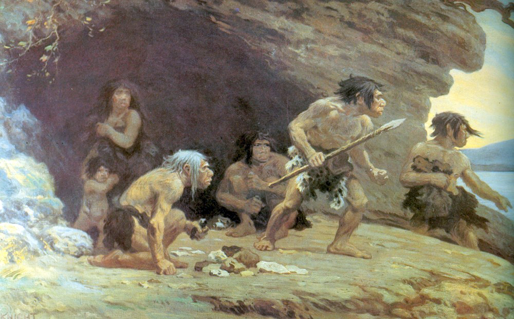
The caveman is a stock character representative of primitive humans in the Paleolithic. The popularization of the type dates to the early 20th century, when Neanderthals were influentially described as " simian" or "ape-like" by Marcellin Boule and Arthur Keith. The term "caveman" has its taxonomic equivalent in the now-obsolete binomial classification of '' Homo troglodytes'' (Linnaeus, 1758). Characteristics Cavemen are typically portrayed as wearing shaggy animal hides, and capable of cave painting like behaviorally modern humans of the last glacial period. They are often shown armed with rocks, cattle bone clubs, spears, or sticks with rocks tied to them, and are portrayed as unintelligent, easily frightened, and aggressive. Popular culture also frequently represents cavemen as living with, or alongside, dinosaurs, even though non-avian dinosaurs became extinct at the end of the Cretaceous period, 66 million years before the emergence of the ''Homo sapiens'' sp ... [...More Info...] [...Related Items...] OR: [Wikipedia] [Google] [Baidu] |
Underground Living
Underground living refers to living below the ground's surface, whether in natural or manmade caves or structures. Underground dwellings are an alternative to above-ground dwellings for some home seekers, including those who are looking to minimize impact on the environment. Factories and office buildings can benefit from underground facilities for many of the same reasons as underground dwellings such as noise abatement, energy use, and security. Some advantages of underground houses include resistance to severe weather, quiet living space, an unobtrusive presence in the surrounding landscape, and a nearly constant interior temperature due to the natural insulating properties of the surrounding earth. One appeal is the energy efficiency and environmental friendliness of underground dwellings. However, underground living does have certain disadvantages, such as the potential for flooding, which in some cases may require special pumping systems to be installed. It is the prefe ... [...More Info...] [...Related Items...] OR: [Wikipedia] [Google] [Baidu] |
World Heritage Site
A World Heritage Site is a landmark or area with legal protection by an international convention administered by the United Nations Educational, Scientific and Cultural Organization (UNESCO). World Heritage Sites are designated by UNESCO for having cultural, historical, scientific or other form of significance. The sites are judged to contain " cultural and natural heritage around the world considered to be of outstanding value to humanity". To be selected, a World Heritage Site must be a somehow unique landmark which is geographically and historically identifiable and has special cultural or physical significance. For example, World Heritage Sites might be ancient ruins or historical structures, buildings, cities, deserts, forests, islands, lakes, monuments, mountains, or wilderness areas. A World Heritage Site may signify a remarkable accomplishment of humanity, and serve as evidence of our intellectual history on the planet, or it might be a place of great natural beauty. A ... [...More Info...] [...Related Items...] OR: [Wikipedia] [Google] [Baidu] |
Ottoman Wars In Europe
A series of military conflicts between the Ottoman Empire and various European states took place from the Late Middle Ages up through the early 20th century. The earliest conflicts began during the Byzantine–Ottoman wars, waged in Anatolia in the late 13th century before entering Europe in the mid 14th century with the Bulgarian–Ottoman wars. In the mid 15th century, the Serbian–Ottoman wars and the Albanian–Turkish Wars (1432–1479), Albanian-Turkish wars were waged by Serbia and Albania respectively against the Ottoman Turks. Much of this period was characterized by Rumelia, Ottoman expansion into the Balkans. The Ottoman Empire made further inroads into Central Europe in the 15th and 16th centuries, culminating in the peak of Ottoman territorial claims in Europe. The Ottoman–Venetian wars spanned four centuries, starting in 1423 and lasting until 1718. This period witnessed the Siege of Negroponte (1470), fall of Negroponte in 1470, the Siege of Famagusta, fall of F ... [...More Info...] [...Related Items...] OR: [Wikipedia] [Google] [Baidu] |
List Of Municipalities And Towns In Slovakia
This is an alphabetical list of the 2,891 Obec, obcí (singular ''obec'', "municipality") in Slovakia. They are grouped into 79 Districts of Slovakia, districts (''okresy'', singular ''okres''), in turn grouped into 8 Regions of Slovakia, regions (''kraje'', singular ''kraj''); articles on individual districts and regions list their municipalities. * Ábelová * Abovce * Abrahám * Abrahámovce, Bardejov District * Abrahámovce, Kežmarok District * Abramová * Abranovce * Adamovské Kochanovce * Adidovce * Alekšince * Andovce * Andrejová * Ardanovce * Ardovo * Arnutovce * Báb, Nitra District, Báb * Babie * Babín * Babiná * Babindol * Babinec, Slovakia, Babinec * Bacúch * Bacúrov * Báč * Bačka (village), Ba ... [...More Info...] [...Related Items...] OR: [Wikipedia] [Google] [Baidu] |

.jpg)


