|
Aeron Express
The Aeron Express was the name used for a hand-powered aerial cable ferry that was built to ferry people across the harbour in the West Wales coastal town of Aberaeron. The ferry was first built in 1880 to ferry labourers from the Liverpool quay on Quay Parade, to the Birkenhead quay on Lon Yr Hafen, in the absence of a bridge across the River Aeron. History The original transport, on the principle of the flying fox, was constructed by Captain John Evans in 1885, after a flood had destroyed the former road bridge. The single-seat carriage was enlarged to carry two people, and later four or more. Photographs at Aberaeron West Wales It operated well into the twentieth century and was eventually replaced with a |
Cable Ferry
A cable ferry (including the terms chain ferry, swing ferry, floating bridge, or punt) is a ferry that is guided (and in many cases propelled) across a river or large body of water by cables connected to both shores. Early cable ferries often used either rope or steel chains, with the latter resulting in the alternative name of chain ferry. Both of these were largely replaced by wire cable by the late 19th century. Types There are three types of cable ferry: the reaction ferry, which uses the power of the river to tack across the current; the powered cable ferry, which uses engines or electric motors (e.g., the Canby Ferry in the U.S. State of Oregon) to wind itself across; and the hand-operated type, such as the Stratford-upon-Avon chain ferry in the UK and the Saugatuck Chain Ferry in Saugatuck, Michigan, United States. Powered cable ferries use powered wheels or drums on board the vessel to pull itself along by the cables. The chains or wire ropes can be used with a su ... [...More Info...] [...Related Items...] OR: [Wikipedia] [Google] [Baidu] |
West Wales
West Wales ( cy, Gorllewin Cymru) is not clearly defined as a particular region of Wales. Some definitions of West Wales include only Pembrokeshire, Ceredigion and Carmarthenshire, which historically comprised the Welsh principality of ''Deheubarth'' and was called "South West Wales" in the Nomenclature of Territorial Units for Statistics (NUTS). Other definitions may include Swansea and Neath Port Talbot but exclude Ceredigion, although this definition may also be described as South West Wales. The "West Wales and the Valleys" NUTS area includes more westerly parts of North Wales. The preserved county of Dyfed covers what is generally considered to be West Wales; between 1974 and 1996, Dyfed was a county, with a county council and six district councils. Historic use Historically, the term West Wales was applied to the Kingdom of Cornwall during the Anglo-Saxon invasion of Britain and the period of the Heptarchy. The Old English word '' Wealas'', a Germanic term for inhabitants ... [...More Info...] [...Related Items...] OR: [Wikipedia] [Google] [Baidu] |
Aberaeron
Aberaeron, previously anglicised as Aberayron, is a town, community, and electoral ward between Aberystwyth and Cardigan, in Ceredigion, Wales. Ceredigion County Council offices are in Aberaeron. The name of the town is Welsh for ''mouth of the Aeron'', derived from the Middle Welsh ', "slaughter", which gave its name to Aeron, who is believed to have been a Welsh god of war. The population was 1,520 in 2001, and 1,422 in 2011. History and design In 1800, there was no significant coastal settlement here. The present town was planned and developed from 1805 by the Rev. Alban Thomas Jones Gwynne. He built a harbour which operated as a port and supported a shipbuilding industry in the 19th century. A group of workmen's houses and a school were built on the harbour's north side, but these were reclaimed by the sea. [...More Info...] [...Related Items...] OR: [Wikipedia] [Google] [Baidu] |
Liverpool
Liverpool is a city and metropolitan borough in Merseyside, England. With a population of in 2019, it is the 10th largest English district by population and its metropolitan area is the fifth largest in the United Kingdom, with a population of 2.24 million. On the eastern side of the Mersey Estuary, Liverpool historically lay within the ancient hundred of West Derby in the county of Lancashire. It became a borough in 1207, a city in 1880, and a county borough independent of the newly-created Lancashire County Council in 1889. Its growth as a major port was paralleled by the expansion of the city throughout the Industrial Revolution. Along with general cargo, freight, and raw materials such as coal and cotton, merchants were involved in the slave trade. In the 19th century, Liverpool was a major port of departure for English and Irish emigrants to North America. It was also home to both the Cunard and White Star Lines, and was the port of registry of the ocean li ... [...More Info...] [...Related Items...] OR: [Wikipedia] [Google] [Baidu] |
Quay
A wharf, quay (, also ), staith, or staithe is a structure on the shore of a harbour or on the bank of a river or canal where ships may dock to load and unload cargo or passengers. Such a structure includes one or more berths (mooring locations), and may also include piers, warehouses, or other facilities necessary for handling the ships. Wharves are often considered to be a series of docks at which boats are stationed. Overview A wharf commonly comprises a fixed platform, often on pilings. Commercial ports may have warehouses that serve as interim storage: where it is sufficient a single wharf with a single berth constructed along the land adjacent to the water is normally used; where there is a need for more capacity multiple wharves, or perhaps a single large wharf with multiple berths, will instead be constructed, sometimes projecting over the water. A pier, raised over the water rather than within it, is commonly used for cases where the weight or volume of cargos will be ... [...More Info...] [...Related Items...] OR: [Wikipedia] [Google] [Baidu] |
Birkenhead
Birkenhead (; cy, Penbedw) is a town in the Metropolitan Borough of Wirral, Merseyside, England; historically, it was part of Cheshire until 1974. The town is on the Wirral Peninsula, along the south bank of the River Mersey, opposite Liverpool. At the 2011 census, it had a population of 88,818. Birkenhead Priory and the Mersey Ferry were established in the 12th century. In the 19th century, Birkenhead expanded greatly as a consequence of the Industrial Revolution. Birkenhead Park and Hamilton Square were laid out as well as the first street tramway in Britain. The Mersey Railway connected Birkenhead and Liverpool with the world's first tunnel beneath a tidal estuary; the shipbuilding firm Cammell Laird and a seaport were established. In the second half of the 20th century, the town suffered a significant period of decline, with containerisation causing a reduction in port activity. The Wirral Waters development is planned to regenerate much of the dockland. Toponymy The ... [...More Info...] [...Related Items...] OR: [Wikipedia] [Google] [Baidu] |
River Aeron
The River Aeron ( cy, Afon Aeron) is a small river in Ceredigion, Wales, that flows into Cardigan Bay at Aberaeron. It is also referred to on some older maps as the River Ayron. Etymology The name of the river means "battle" or "slaughter" and derives from the Middle Welsh ' with the same meaning. Aeron is believed to have been a Welsh god of war. Past interpretations of the name have included that of William Owen Pughe, who in his ''Dictionary of the Welsh Language'' believed ' meant "queen of brightness". Aeron can also mean berries, fruit and grain. It’s a word that suggests the fruitfulness of the autumn harvest in a valley of plenty. Sources and Valley It has its source in Llyn Eiddwen, in the range of hills called Mynydd Bach. It then follows a more or less westerly and then north-westerly track to the sea. It has a rather broad river valley bounded by low hills and has relatively few significant tributaries which include the Gwenffrwd, Nant Wysg, Nant Picadilly, N ... [...More Info...] [...Related Items...] OR: [Wikipedia] [Google] [Baidu] |
Flying Fox (cablecar)
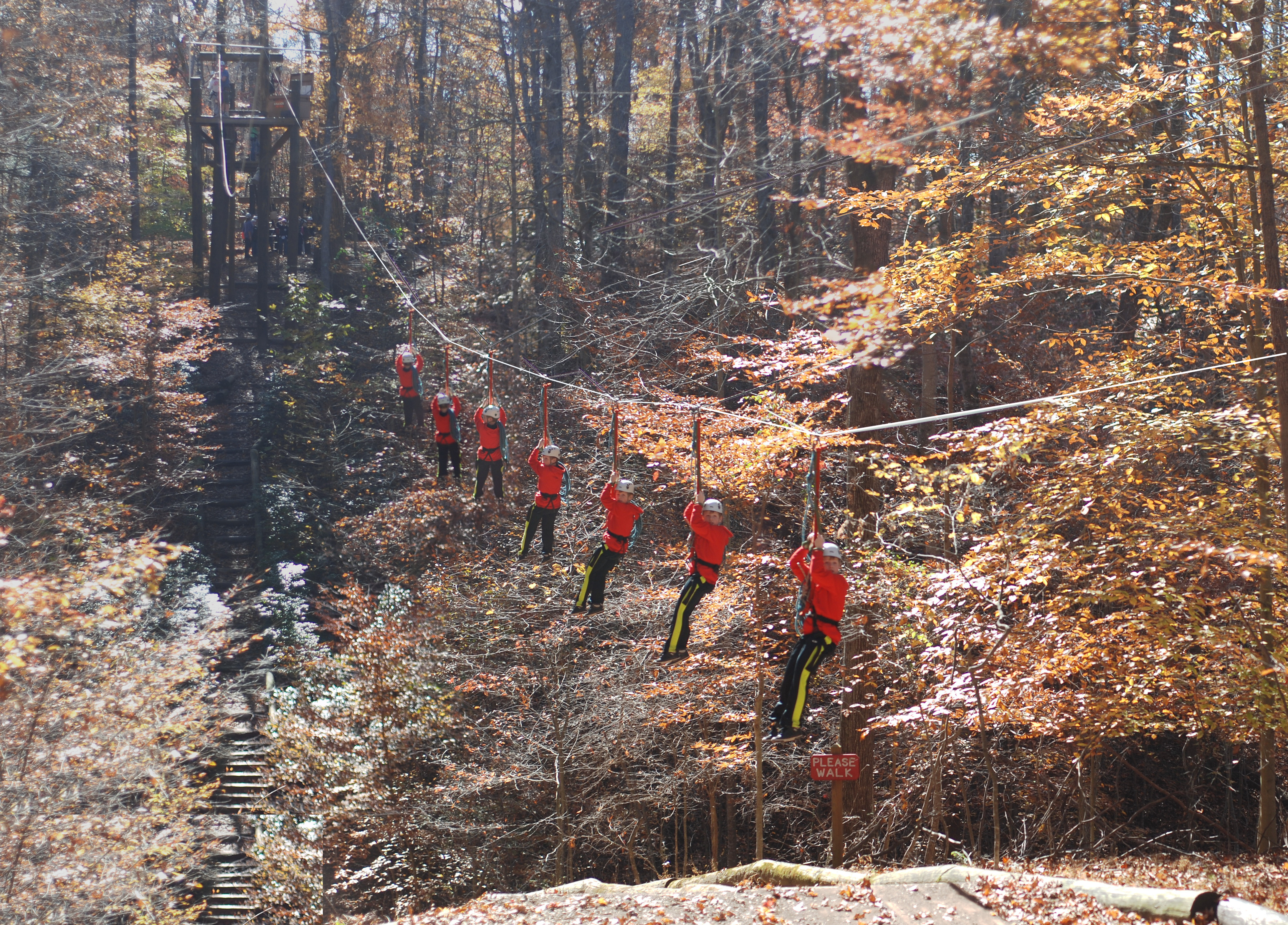
A zip-line, zip line, zip-wire, flying fox, or death slide is a pulley suspended on a cable, usually made of stainless steel, mounted on a slope. It is designed to enable cargo or a person propelled by gravity to travel from the top to the bottom of the inclined cable by holding on to, or being attached to, the freely moving pulley. It has been described as essentially a Tyrolean traverse that engages gravity to assist its speed of movement. Its use is not confined to adventure sport, recreation, or tourism, although modern-day usage tends to favor those meanings. History Ropeways or aerial cables have been used as a method of transport in some mountainous countries for more than 2,000 years, possibly starting in China, India and Japan as early as 250 BC, remaining in use in some remote areas in China such as Nujiang (Salween) valley in Yunnan as late as 2015 before being replaced by bridges. Not all of these structures were assisted by gravity, so not all fitted the definitio ... [...More Info...] [...Related Items...] OR: [Wikipedia] [Google] [Baidu] |
Footbridge
A footbridge (also a pedestrian bridge, pedestrian overpass, or pedestrian overcrossing) is a bridge designed solely for pedestrians.''Oxford English Dictionary'' While the primary meaning for a bridge is a structure which links "two points at a height above the ground", a footbridge can also be a lower structure, such as a boardwalk, that enables pedestrians to cross wet, fragile, or marshy land. Bridges range from stepping stones–possibly the earliest man-made structure to "bridge" water–to elaborate steel structures. Another early bridge would have been simply a fallen tree. In some cases a footbridge can be both functional and artistic. For rural communities in the developing world, a footbridge may be a community's only access to medical clinics, schools, businesses and markets. Simple suspension bridge designs have been developed to be sustainable and easily constructed in such areas using only local materials and labor. An enclosed footbridge between two buildings is ... [...More Info...] [...Related Items...] OR: [Wikipedia] [Google] [Baidu] |
Aberystwyth Cliff Railway
The Aberystwyth Cliff Railway ( cy, Rheilffordd y Graig) opened on 1 August 1896. It is a long funicular railway in Aberystwyth and is the second longest funicular railway in the British Isles, after the Lynton and Lynmouth Cliff Railway. Since November 1987, the Aberystwyth Cliff Railway has been a Grade II listed structure. The Cliff Railway was developed as an element of Constitution Hill, a Victorian business venture by the Aberystwyth Improvement Company in the 1890s. The funicular took visitors to the top of the hill, where attractions such as a camera obscura were established. The cliff railway was originally a water balance system, but it was electrified during 1921. Passengers numbers were high during its initial decades, but dropped after the outbreak of the Second World War and stayed depressed for decades. The cliff railway is now owned and run by Constitution Hill Ltd, a registered charity. It is open to passengers during the summer months, typically operating betw ... [...More Info...] [...Related Items...] OR: [Wikipedia] [Google] [Baidu] |
Aberystwyth
Aberystwyth () is a university and seaside town as well as a community in Ceredigion, Wales. Located in the historic county of Cardiganshire, means "the mouth of the Ystwyth". Aberystwyth University has been a major educational location in Wales since the establishment of University College Wales in 1872. The town is situated on Cardigan Bay on the west coast of Wales, near the confluence of the River Ystwyth and Afon Rheidol. Following the reconstruction of the harbour, the Ystwyth skirts the town. The Rheidol passes through the town. The seafront, with a pier, stretches from Constitution Hill at the north end of the Promenade to the harbour at the south. The beach is divided by the castle. The town is divided into five areas: Aberystwyth Town; Llanbadarn Fawr; Waunfawr; Llanbadarn; Trefechan; and the most populous, Penparcau. In 2011 the population of the town was 13,040. This rises to nearly 19,000 for the larger conurbation of Aberystwyth and Llanbadarn Fawr. Th ... [...More Info...] [...Related Items...] OR: [Wikipedia] [Google] [Baidu] |
Easter
Easter,Traditional names for the feast in English are "Easter Day", as in the '' Book of Common Prayer''; "Easter Sunday", used by James Ussher''The Whole Works of the Most Rev. James Ussher, Volume 4'') and Samuel Pepys''The Diary of Samuel Pepys, Volume 2'') as well as the single word "Easter" in books printed i157515841586 also called Pascha (Aramaic, Greek, Latin) or Resurrection Sunday, is a Christian festival and cultural holiday commemorating the resurrection of Jesus from the dead, described in the New Testament as having occurred on the third day of his burial following his crucifixion by the Romans at Calvary . It is the culmination of the Passion of Jesus Christ, preceded by Lent (or Great Lent), a 40-day period of fasting, prayer, and penance. Easter-observing Christians commonly refer to the week before Easter as Holy Week, which in Western Christianity begins on Palm Sunday (marking the entrance of Jesus in Jerusalem), includes Spy Wednesday (on whic ... [...More Info...] [...Related Items...] OR: [Wikipedia] [Google] [Baidu] |

.jpg)


