|
┼Ākoda 14Tr
The ┼Ākoda 14Tr is a Czech trolleybus that was produced from 1981 to 1998. Prototypes were built in 1972 and 1974. After the unsuccessful attempt to merge the Karosa ┼ĀM 11 bus and the ┼Ākoda T 11 trolleybus and the cancelled ┼Ākoda 13Tr project, a new style of trolleybus was designed in the early 1970s, designated the 14Tr. Development was halted because of plans to replace trolleybuses by diesel buses, but the 1973 oil crisis led to a re-evaluation and work on the 14Tr resumed. Description The 14Tr is a two-axle trolleybus with unibody construction. Its structure consists of mutually welded elements: the frame, side walls, roof and ends. Each component is welded together from steel shapes and castings. The body is covered with a steel skin; the section below the windows is thermally insulated and soundproofed. The interior is surfaces with plastic paneling. Domestic buses have three twin-leaf folding doors on the right side, while export units only have two. Transverse pass ... [...More Info...] [...Related Items...] OR: [Wikipedia] [Google] [Baidu] |
Hungary
Hungary ( hu, Magyarorsz├Īg ) is a landlocked country in Central Europe. Spanning of the Carpathian Basin, it is bordered by Slovakia to the north, Ukraine to the northeast, Romania to the east and southeast, Serbia to the south, Croatia and Slovenia to the southwest, and Austria to the west. Hungary has a population of nearly 9 million, mostly ethnic Hungarians and a significant Romani minority. Hungarian, the official language, is the world's most widely spoken Uralic language and among the few non-Indo-European languages widely spoken in Europe. Budapest is the country's capital and largest city; other major urban areas include Debrecen, Szeged, Miskolc, P├®cs, and Gy┼ær. The territory of present-day Hungary has for centuries been a crossroads for various peoples, including Celts, Romans, Germanic tribes, Huns, West Slavs and the Avars. The foundation of the Hungarian state was established in the late 9th century AD with the conquest of the Carpathian Basin by Hungar ... [...More Info...] [...Related Items...] OR: [Wikipedia] [Google] [Baidu] |
Trolleybuses In Dayton
The Dayton trolleybus system forms part of the public transportation network serving Dayton, in the state of Ohio, United States. Opened on April 23, 1933, it presently comprises five lines, and is operated by the Greater Dayton Regional Transit Authority, with a fleet of 45 trolleybuses. In , the system had a ridership of , or about per weekday as of . One of only five such systems currently operating in the U.S., and the only one in a city without a subway, light rail, or streetcar system, the Dayton trolley bus system is the current manifestation of an electric transit service that has been operated continuously in Dayton since 1888 ŌĆö longer than in any other city in the United States. By the 1970s, Dayton was already the smallest U.S. city still operating a trolley bus system. For both of these reasons, the city's trolley buses are locally considered an icon of Dayton. History The first electric trolley bus (ETB) service in Ohio began operation in Dayton, on April& ... [...More Info...] [...Related Items...] OR: [Wikipedia] [Google] [Baidu] |
Sofia
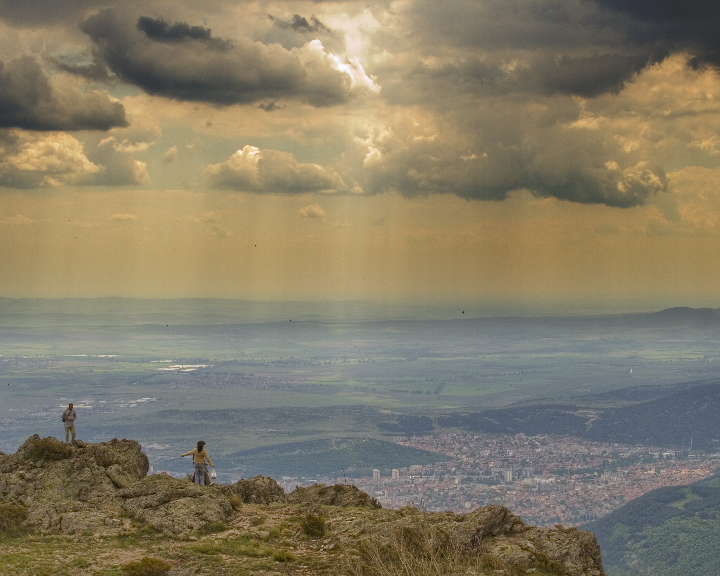
Sofia ( ; bg, ąĪąŠčäąĖčÅ, Sofiya, ) is the capital and largest city of Bulgaria. It is situated in the Sofia Valley at the foot of the Vitosha mountain in the western parts of the country. The city is built west of the Iskar river, and has many mineral springs, such as the Sofia Central Mineral Baths. It has a humid continental climate. Being in the centre of the Balkans, it is midway between the Black Sea and the Adriatic Sea, and closest to the Aegean Sea. Known as Serdica in Antiquity and Sredets in the Middle Ages, Sofia has been an area of human habitation since at least 7000 BC. The recorded history of the city begins with the attestation of the conquest of Serdica by the Roman Republic in 29 BC from the Celtic tribe Serdi. During the decline of the Roman Empire, the city was raided by Huns, Visigoths, Avars and Slavs. In 809, Serdica was incorporated into the Bulgarian Empire by Khan Krum and became known as Sredets. In 1018, the Byzantines ended Bulgarian rule ... [...More Info...] [...Related Items...] OR: [Wikipedia] [Google] [Baidu] |
Sliven
Sliven ( bg, ąĪą╗ąĖą▓ąĄąĮ ) is the eighth-largest city in Bulgaria and the administrative and industrial centre of Sliven Province and municipality in Northern Thrace. Sliven is famous for its heroic Haiduts who fought against the Ottoman Turks in the 19th century and is known as the "City of the 100 Voyvodi", a Voyvoda being a leader of Haiduts. The famous rocky massif Sinite Kamani (ąĪąĖąĮąĖč鹥 ą║ą░ą╝čŖąĮąĖ, "The Blue Rocks") and the associated national park, the fresh air and the mineral springs offer diverse opportunities for leisure and tourism. Investors are exploring the opportunity to use the famous local wind (Bora) for the production of electricity. Another point of interest and a major symbol of the city as featured on the coat of arms, is the more than thousand-year-old Stariyat Briast (ąĪčéą░čĆąĖčÅčé ąæčĆčÅčüčé, "The Old Elm"), a huge Smooth-leaved Elm in the center of the city. During Ottoman rule, Turkish officials used to hang Bulgarian revolutionaries on it ... [...More Info...] [...Related Items...] OR: [Wikipedia] [Google] [Baidu] |
Bulgaria
Bulgaria (; bg, ąæčŖą╗ą│ą░čĆąĖčÅ, BŪÄlgariya), officially the Republic of Bulgaria,, ) is a country in Southeast Europe. It is situated on the eastern flank of the Balkans, and is bordered by Romania to the north, Serbia and North Macedonia to the west, Greece and Turkey to the south, and the Black Sea to the east. Bulgaria covers a territory of , and is the sixteenth-largest country in Europe. Sofia is the nation's capital and largest city; other major cities are Plovdiv, Varna and Burgas. One of the earliest societies in the lands of modern-day Bulgaria was the Neolithic Karanovo culture, which dates back to 6,500 BC. In the 6th to 3rd century BC the region was a battleground for ancient Thracians, Persians, Celts and Macedonians; stability came when the Roman Empire conquered the region in AD 45. After the Roman state splintered, tribal invasions in the region resumed. Around the 6th century, these territories were settled by the early Slavs. The Bulgars, led by Asp ... [...More Info...] [...Related Items...] OR: [Wikipedia] [Google] [Baidu] |
Sarajevo
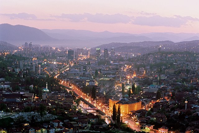
Sarajevo ( ; cyrl, ąĪą░čĆą░čśąĄą▓ąŠ, ; ''see Names of European cities in different languages (QŌĆōT)#S, names in other languages'') is the Capital city, capital and largest city of Bosnia and Herzegovina, with a population of 275,524 in its administrative limits. The Sarajevo metropolitan area including Sarajevo Canton, Isto─Źno Sarajevo, East Sarajevo and nearby municipalities is home to 555,210 inhabitants. Located within the greater Sarajevo valley of Bosnia (region), Bosnia, it is surrounded by the Dinaric Alps and situated along the Miljacka River in the heart of the Balkans, a region of Southern Europe. Sarajevo is the political, financial, social and cultural center of Bosnia and Herzegovina and a prominent center of culture in the Balkans. It exerts region-wide influence in entertainment, media, fashion and the arts. Due to its long history of religious and cultural diversity, Sarajevo is sometimes called the "Jerusalem of Europe" or "Jerusalem of the Balkans". It is o ... [...More Info...] [...Related Items...] OR: [Wikipedia] [Google] [Baidu] |
Bosnia And Herzegovina
Bosnia and Herzegovina ( sh, / , ), abbreviated BiH () or B&H, sometimes called BosniaŌĆōHerzegovina and often known informally as Bosnia, is a country at the crossroads of south and southeast Europe, located in the Balkans. Bosnia and Herzegovina borders Serbia to the east, Montenegro to the southeast, and Croatia to the north and southwest. In the south it has a narrow coast on the Adriatic Sea within the Mediterranean, which is about long and surrounds the town of Neum. Bosnia, which is the inland region of the country, has a moderate continental climate with hot summers and cold, snowy winters. In the central and eastern regions of the country, the geography is mountainous, in the northwest it is moderately hilly, and in the northeast it is predominantly flat. Herzegovina, which is the smaller, southern region of the country, has a Mediterranean climate and is mostly mountainous. Sarajevo is the capital and the largest city of the country followed by Banja Luka, Tu ... [...More Info...] [...Related Items...] OR: [Wikipedia] [Google] [Baidu] |
Ganja, Azerbaijan
Ganja (; az, G╔Önc╔Ö ) is Azerbaijan's third largest city, with a population of around 335,600.Az╔Örbaycan Respublikas─▒. ŌĆö 2. Az╔Örbaycan Respublikas─▒n─▒n iqtisadi v╔Ö inzibati rayonlar─▒. ŌĆö 2.4. Az╔Örbaycan Respublikas─▒n─▒n iqtisadi v╔Ö inzibati rayonlar─▒n─▒n ╔Örazisi, ╔Öhalisinin say─▒ v╔Ö s─▒xl─▒─¤─▒, s╔Öhif╔Ö 66. /Az╔Örbaycan─▒n ╔Öhalisi (statistik b├╝lleten) M├╝╔Öllifi: State Statistics Committee, Az╔Örbaycan Respublikas─▒n─▒n D├Čvl╔Öt Statistika Komit╔Ösi. Burax─▒l─▒┼¤a m╔Ösul ┼¤╔Öxs: Rza Allahverdiyev. Bak─▒ ŌĆö 2015, 134 s╔Öhif╔Ö. The city has been a historic and cultural center throughout most of its existence. It was the capital of the Ganja Khanate until 1804; after Qajar Iran ceded it to the Russian Empire following the Treaty of Gulistan in 1813, it became part of the administrative divisions of the Georgia Governorate, Georgia-Imeretia Governorate, Tiflis Governorate, and Elizavetpol Governorate. Following the dissolution of the Russian Empire and the Transc ... [...More Info...] [...Related Items...] OR: [Wikipedia] [Google] [Baidu] |
Baku
Baku (, ; az, Bak─▒ ) is the capital and largest city of Azerbaijan, as well as the largest city on the Caspian Sea and of the Caucasus region. Baku is located below sea level, which makes it the lowest lying national capital in the world and also the largest city in the world located below sea level. Baku lies on the southern shore of the Absheron Peninsula, alongside the Bay of Baku. Baku's urban population was estimated at two million people as of 2009. Baku is the primate city of AzerbaijanŌĆöit is the sole metropolis in the country, and about 25% of all inhabitants of the country live in Baku's metropolitan area. Baku is divided into twelve administrative raions and 48 townships. Among these are the townships on the islands of the Baku Archipelago, and the town of Oil Rocks built on stilts in the Caspian Sea, away from Baku. The Inner City of Baku, along with the Shirvanshah's Palace and Maiden Tower, were inscribed as a UNESCO World Heritage Site in 2000. The c ... [...More Info...] [...Related Items...] OR: [Wikipedia] [Google] [Baidu] |
Azerbaijan
Azerbaijan (, ; az, Azərbaycan ), officially the Republic of Azerbaijan, , also sometimes officially called the Azerbaijan Republic is a transcontinental country located at the boundary of Eastern Europe and Western Asia. It is a part of the South Caucasus region and is bounded by the Caspian Sea to the east, Russia (Republic of Dagestan) to the north, Georgia to the northwest, Armenia and Turkey to the west, and Iran to the south. Baku is the capital and largest city. The Azerbaijan Democratic Republic proclaimed its independence from the Transcaucasian Democratic Federative Republic in 1918 and became the first secular democratic Muslim-majority state. In 1920, the country was incorporated into the Soviet Union as the Azerbaijan SSR. The modern Republic of Azerbaijan proclaimed its independence on 30 August 1991, shortly before the dissolution of the Soviet Union in the same year. In September 1991, the ethnic Armenian majority of the Nagorno-Karabakh region formed the ... [...More Info...] [...Related Items...] OR: [Wikipedia] [Google] [Baidu] |
Yerevan
Yerevan ( , , hy, įĄųĆųćšĪšČ , sometimes spelled Erevan) is the capital and largest city of Armenia and one of the world's List of oldest continuously inhabited cities, oldest continuously inhabited cities. Situated along the Hrazdan River, Yerevan is the administrative, cultural, and industrial center of the country, as its primate city. It has been the Historical capitals of Armenia, capital since 1918, the Historical capitals of Armenia, fourteenth in the history of Armenia and the seventh located in or around the Ararat Plain. The city also serves as the seat of the Araratian Pontifical Diocese, which is the largest diocese of the Armenian Apostolic Church and one of the oldest dioceses in the world. The history of Yerevan dates back to the 8th century BCE, with the founding of the fortress of Erebuni Fortress, Erebuni in 782 BCE by King Argishti I of Urartu, Argishti I of Urartu at the western extreme of the Ararat Plain. Erebuni was "designed as a great administrative an ... [...More Info...] [...Related Items...] OR: [Wikipedia] [Google] [Baidu] |
Gjumri
Gyumri ( hy, į│šĄšĖųéš┤ųĆš½, ) is an urban municipal community and the second-largest city in Armenia, serving as the administrative center of Shirak Province in the northwestern part of the country. By the end of the 19th century, when the city was known as Alexandropol,; hy, į▒š¼šźųäšĮšĪšČšżųĆšĪš║šĖš¼ it became the largest city of Russian-ruled Eastern Armenia with a population above that of Yerevan. The city became renown as a cultural hub, while also carrying significance as a major center of Russian troops during Russo-Turkish wars of the 19th century. The city underwent a tumultuous period during and after World War 1. While Russian forces withdrew from the South Caucasus due to the October Revolution, the city became host to large numbers of Armenian refugees fleeing the Armenian Genocide, in particular hosting 22,000 orphaned children in around 170 orphanage buildings. It was renamed to Leninakan; russian: ąøąĄąĮąĖąĮą░ą║ą░ąĮ during the Soviet period and became a major in ... [...More Info...] [...Related Items...] OR: [Wikipedia] [Google] [Baidu] |


