|
Loki-Fögrufjöll
The Loki-Fögrufjöll ( volcanic system; also known as Hamarinn after its central volcano or Lokahryggur ) is a subglacial volcano under the Vatnajökull glacier. The subglacial volcano is found within the Bárðarbunga fissure volcanic system, but is outside the caldera of Bárðarbunga itself. Earthquake swarms associated with the volcano are separate in time and place from other swarms in the Bárðarbunga system. The fissure swarm extending south-west towards Torfajökull has not had recent earthquakes or erupted in the Holocene. A geothermally and seismically active ridge called Lokahryggur or the Loki Ridge, extends eastward from Hamarinn under the ice to where in 1996 the 1996 eruption of Gjálp, Gjálp volcanic fissure erupted between Bárðarbunga and Grímsvötn and produced a large jökulhlaup. The last confirmed eruption was in 1910 when tephra was erupted, but the system may also have had subglacial eruptions in 1986, 1991, 2006, 2008 and 2011. See also * Volcan ... [...More Info...] [...Related Items...] OR: [Wikipedia] [Google] [Baidu] |
List Of Volcanic Eruptions In Iceland
This is an incomplete list of volcanic eruptions in Iceland. Please see External links below for databases of Icelandic eruptions which include over 530 events. ''For latest information about the current/ongoing series of eruptions near Grindavik on the Reykjanes peninsula - See 2023–2025 Sundhnúkur eruptions'' Index map of eruptions, fissures, glaciers and notable sites Alphabetic index of eruptions, fissures and notable sites Rome wasn't built in a day, (''Under construction.'') There are about 32 volcanic systems in Iceland. Volcanic system means a volcano-tectonic fissure system and – very often a bigger volcano, a so-called central volcano which in most cases is a stratovolcano and may contain a caldera. [...More Info...] [...Related Items...] OR: [Wikipedia] [Google] [Baidu] |
1996 Eruption Of Gjálp
Gjálp () is a hyaloclastite ridge (tindar) in Iceland under the Vatnajökull glacier shield. Its present form resulted from an eruption series in 1996 and it is probably part of the Grímsvötn volcanic system.Snæbjörn Guðmundsson: ''Vegavísir um jarðfræði Íslands.'' Reykjavík 2015, p. 280-281 However, not all the scientists were of this opinion, as seismic studies are consistent with a lateral dike intrusion at about depth from Bárðarbunga being the trigger event. This does not exclude a shallower secondary intrusion from Grímsvötn being important in the subaerial eruption itself. Importance The eruption was of importance, because it was for the first time that a subglacial eruption under a thick ice cover as well as the connected jökulhlaup could be observed and analyzed by modern technique. Geography Eruption location The subglacial eruption fissure is to be found in the northwest corner of Vatnajökull ice cap more or less halfway between the central ... [...More Info...] [...Related Items...] OR: [Wikipedia] [Google] [Baidu] |
Bárðarbunga
Bárðarbunga (, alternative name Veiðivötn), is an active and productive stratovolcano located under Vatnajökull in Vatnajökull National Park which is Iceland's most extensive glacier. The second highest mountain in Iceland, above sea level, Bárðarbunga is also part of the Bárðarbunga-Veiðivötn volcanic system that is approximately long and wide. Bárðarbunga erupted in late August 2014, the eruption style effusive, which is common in Iceland, but had not been seen for a few years. Lava covered the surrounding landscape northwest of the Vatnajökull glacier. Description Bárðarbunga is a subglacial stratovolcano and central volcano under the ice cap of Vatnajökull glacier in the Vatnajökull National Park in Iceland. It is one of the six volcanic systems under Vatnajökull. The central volcano has a rim that rises to about above sea level, making it the second highest mountain in Iceland, being lower than Hvannadalshnjúkur. The caldera is about , u ... [...More Info...] [...Related Items...] OR: [Wikipedia] [Google] [Baidu] |
List Of Volcanoes In Iceland
There are too many presumed extinct or now inactive volcanic features to list all of these below, so most monogenetic volcanoes can not be mentioned individually. This list of volcanoes in Iceland only includes major active and dormant volcano, volcanic mountains, of which at least 18 vents have erupted since human settlement of Iceland began around 900 AD. Subsequent to the main list a list is presented that classifies the volcanoes into zones, systems and types. This is in the context that there are several classification systems and many of the volcanoes may have separate shallow magma chambers and a deeper common magma source. Where a major vent is part of a larger volcano this is indicated in the list comment. Since some of these vent eruptions have been very large, disruptive or been regarded in popular culture as a separate volcano they have been included in the list but where this is not the case it is not appropriate to duplicate or create entries. So for minor vent eru ... [...More Info...] [...Related Items...] OR: [Wikipedia] [Google] [Baidu] |
Subglacial Volcano
A subglacial volcano, also known as a glaciovolcano, is a volcanic form produced by subglacial eruptions or eruptions beneath the surface of a glacier or ice sheet which is then melted into a lake by the rising lava. Today they are most common in Iceland and Antarctica; older formations of this type are found also in British Columbia and Yukon Territory, Canada. During the eruption, the heat of the lava from the subglacial volcano melts the overlying ice. The water quickly cools the lava, resulting in pillow lava shapes similar to those of underwater volcanoes. When the pillow lavas break off and roll down the volcano slopes, pillow breccia, tuff breccia, and hyaloclastite form. The meltwater may be released from below the ice as happened in Iceland in 1996 when the Grímsvötn caldera erupted, melting 3 km3 of ice and giving rise to a large glacial lake outburst flood. The shape of subglacial volcanoes tends to be quite characteristic and unusual, with a flattened t ... [...More Info...] [...Related Items...] OR: [Wikipedia] [Google] [Baidu] |
Vatnajökull
Vatnajökull ( Icelandic pronunciation: , literally "Glacier of Lakes"; sometimes translated as Vatna Glacier in English) is the largest and most voluminous ice cap in Iceland, and the second largest in area in Europe after the Severny Island ice cap of Novaya Zemlya. It is in the south-east of the island, covering approximately 10% of the country. Size With an area of 7,700 km2, Vatnajökull is the second largest ice cap in Europe by volume (about 3,000 km3) and area (after the still larger Severny Island ice cap of Novaya Zemlya, Russia, which is in the extreme northeast of Europe). On 7 June 2008, it became a part of the Vatnajökull National Park. The average thickness of the ice is , with a maximum thickness of . Iceland's highest peak, Hvannadalshnúkur (), as part of the Öræfajökull, is in the southern periphery of Vatnajökull, near Skaftafell. Peaks Hrútsfjallstindar is a series of Icelandic peaks rising from Vatnajökull between Svínafellsjök ... [...More Info...] [...Related Items...] OR: [Wikipedia] [Google] [Baidu] |
Torfajökull
Torfajökull ( Icelandic for "Torfi's glacier"; ) is a rhyolitic stratovolcano, with a large caldera (central volcano) capped by a glacier of the same name and associated with a complex of subglacial volcanoes. Torfajökull last erupted in 1477 and consists of the largest area of silicic extrusive rocks in Iceland. This is now known to be due to a VEI 5 eruption 55,000 years ago. Geography The volcano is located north of Mýrdalsjökull and south of Þórisvatn Lake, Iceland. To its south-west is the volcano and glacier of Tindfjallajökull and almost directly to its west is the volcano of Hekla. Adjacent to the southern edge of its glacier of Torfajökull it has a peak of but the south-eastern caldera margin also extends to the glacier of Kaldaklofsjökull which is on the western slopes of a peak called Háskerðingur that is high. Laufafell dome at is at the north-western edge of the Torfajökull volcanic system and almost halfway between Hekla and the glacier of Torfajö ... [...More Info...] [...Related Items...] OR: [Wikipedia] [Google] [Baidu] |
Holocene
The Holocene () is the current geologic time scale, geological epoch, beginning approximately 11,700 years ago. It follows the Last Glacial Period, which concluded with the Holocene glacial retreat. The Holocene and the preceding Pleistocene together form the Quaternary period. The Holocene is an interglacial period within the ongoing Ice age, glacial cycles of the Quaternary, and is equivalent to Marine isotope stages, Marine Isotope Stage 1. The Holocene correlates with the last maximum axial tilt towards the Sun of the Earth#Axial tilt and seasons, Earth's obliquity. The Holocene corresponds with the rapid proliferation, growth, and impacts of the human species worldwide, including Recorded history, all of its written history, technological revolutions, development of major civilizations, and overall significant transition towards urban culture, urban living in the present. The human impact on modern-era Earth and its ecosystems may be considered of global significance for th ... [...More Info...] [...Related Items...] OR: [Wikipedia] [Google] [Baidu] |
Grímsvötn
Grímsvötn (; ''vötn'' = "waters", singular: ) is an active volcano with a (partially subglacial) fissure system located in Vatnajökull National Park, Iceland. The central volcano is completely subglacial and located under the northwestern side of the Vatnajökull ice cap. The subglacial caldera is at , at an elevation of . Beneath the caldera is the magma chamber of the Grímsvötn volcano. Grímsvötn is a basaltic volcano which has the highest eruption frequency of all the volcanoes in Iceland. It has a southwest-northeast-trending fissure system. The massive climate-impacting Laki fissure eruption of 1783–1784 took place in a part of the same Grímsvötn-Laki volcanic system. Grímsvötn was erupting at the same time as Laki during 1783, but continued to erupt until 1785. Because most of the volcanic system lies underneath Vatnajökull, most of its eruptions have been Subglacial eruption, subglacial and the interaction of magma and meltwater from the ice causes phreatomagm ... [...More Info...] [...Related Items...] OR: [Wikipedia] [Google] [Baidu] |
Jökulhlaup
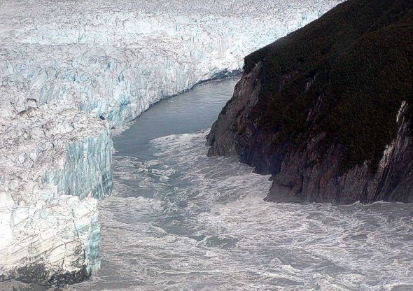
A jökulhlaup ( ) (literally "glacial run") is a type of glacial outburst flood. It is an Icelandic term that has been adopted in glaciological terminology in many languages. It originally referred to the well-known subglacial outburst floods from Vatnajökull, Iceland, which are triggered by geothermal heating and occasionally by a volcanic subglacial eruption, but it is now used to describe any large and abrupt release of water from a subglacial or proglacial lake/reservoir. Since jökulhlaups emerge from hydrostatically sealed lakes with floating levels far above the threshold, their peak discharge can be much larger than that of a marginal or extra-marginal lake burst. The hydrograph of a jökulhlaup from Vatnajökull typically either climbs over a period of weeks with the largest flow near the end, or it climbs much faster during the course of some hours. These patterns are suggested to reflect channel melting, and sheet flow under the front, respectively. Similar p ... [...More Info...] [...Related Items...] OR: [Wikipedia] [Google] [Baidu] |


