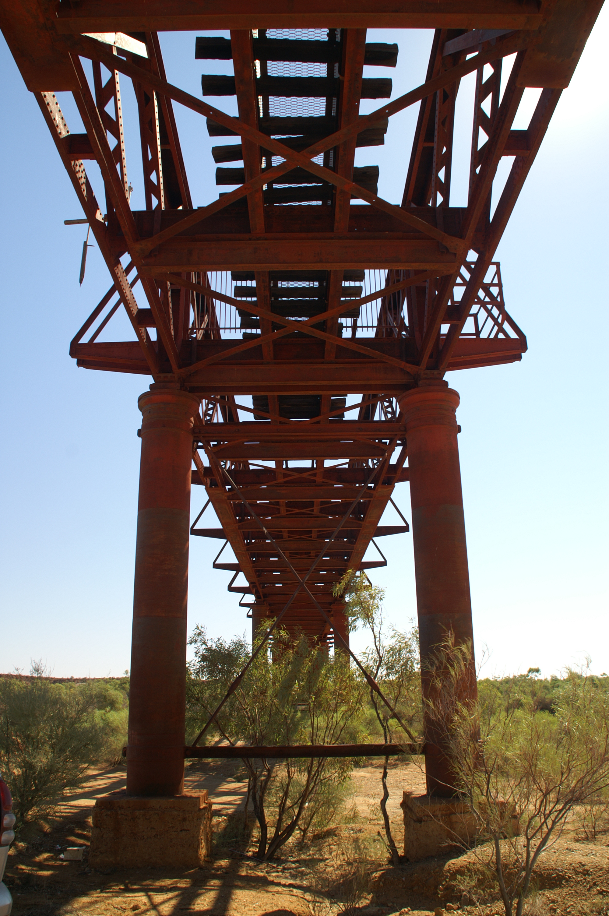
Algebuckina Bridge on:
[Wikipedia]
[Google]
[Amazon]
 The Algebuckina Bridge is a
Listing
on the (now defunct) Register of the National Estate {{Australian railway bridges, state=autocollapse Former railway bridges in Australia 1892 establishments in Australia Railway bridges in South Australia South Australian places listed on the defunct Register of the National Estate South Australian Heritage Register Far North (South Australia)
 The Algebuckina Bridge is a
 Victorian era
In the history of the United Kingdom and the British Empire, the Victorian era was the period of Queen Victoria's reign, from 20 June 1837 until her death on 22 January 1901. The era followed the Georgian period and preceded the Edwardia ...
railway bridge in the Australian state of South Australia
South Australia (commonly abbreviated as SA) is a state in the southern central part of Australia. It covers some of the most arid parts of the country. With a total land area of , it is the fourth-largest of Australia's states and territories ...
located about south-east of the town of Oodnadatta
Oodnadatta is a small, remote outback town and locality in the Australian state of South Australia, located north-north-west of the state capital of Adelaide by road or direct, at an altitude of . The unsealed Oodnadatta Track, an outback roa ...
in the locality of Allandale Station on the route of the now-closed Central Australia Railway
The former Central Australia Railway, which was built between 1878 and 1929 and closed in 1980, was a 1067 mm narrow gauge railway between Port Augusta and Alice Springs. A standard gauge line duplicated the southern section from Port Aug ...
. It opened in January 1892.Infornmation plaque at the bridge, pictured at http://letsgotravelaustralia.com/algebuckina-bridge-2/ It was the longest bridge in South Australia
South Australia (commonly abbreviated as SA) is a state in the southern central part of Australia. It covers some of the most arid parts of the country. With a total land area of , it is the fourth-largest of Australia's states and territories ...
until construction of the Seaford suburban rail line across the Onkaparinga River
The Onkaparinga River, known as Ngangkiparri or Ngangkiparingga ("place of the women’s river") in the Kaurna language, is a river located in the Southern Adelaide region in the Australian state of South Australia. Rising in the Mount Lofty Ran ...
south of Adelaide in 2014.
The bridge consists of 19 spans of length and which are of lattice wrought iron construction, sitting on cast iron cylindrical piers. It was strengthened in 1926 to allow it to carry heavier trains.
It was built by a team of around 350 men, working in extreme desert heat. Several graves are nearby, and one of them is for David Saunders, who died in January 1890 from “heart disease accelerated by heat apoplexy.”
The bridge crosses the floodplain of the Neales River
The Neales River is a watercourse located in the Far North region of the Australian state of South Australia.
The river is a tributary of Lake Eyre. The Central Australia Railway, on which The Ghan passenger train operated until 1980, crossed ...
, which is prone to seasonal flooding, and replaced a surface-level railway which was frequently washed away. After a severe flood in 1974, which almost reached the bridge decks, the line was closed in 1981 and a new route built 100 miles further west.
The bridge was listed on the now-defunct Register of the National Estate on 28 September 1982 and listed as a state heritage place on the South Australian Heritage Register
The South Australian Heritage Register, also known as the SA Heritage Register, is a statutory register of historic places in South Australia
South Australia (commonly abbreviated as SA) is a state in the southern central part of Australia. ...
on 20 November 1986.
References
External links
Listing
on the (now defunct) Register of the National Estate {{Australian railway bridges, state=autocollapse Former railway bridges in Australia 1892 establishments in Australia Railway bridges in South Australia South Australian places listed on the defunct Register of the National Estate South Australian Heritage Register Far North (South Australia)