|
Central Australia Railway
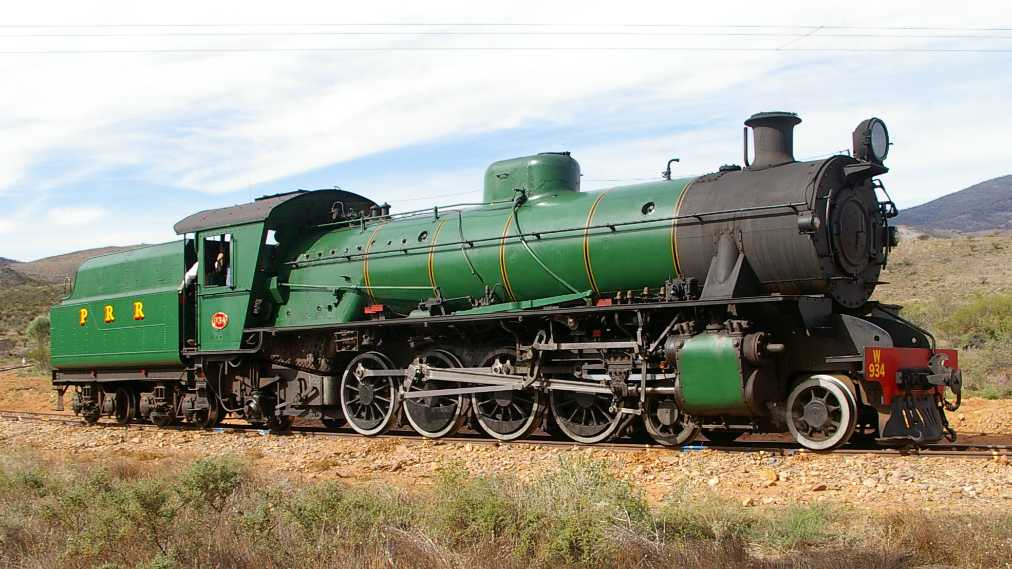
The former Central Australia Railway, which was built between 1878 and 1929 and closed in 1980, was a 1067 mm narrow gauge railway between Port Augusta and Alice Springs. A standard gauge line duplicated the southern section from Port Augusta to Maree in 1957 on a new nearby alignment. The entire Central Australia Railway was superseded in 1980 after the standard gauge Tarcoola–Alice Springs Railway was opened, using a new route up to 200 km to the west. A small southern section of the original line between Port Augusta and Quorn has been preserved as the Pichi Richi Tourist Railway. Naming Whilst officially the ''Central Australia Railway'', it has been known by a number of names. Initially the northern end point had not be determined. Government acts and the press used a number of terms prior to construction including * The Port Augusta Railway * The Northern Railway * The Port Augusta to (far) North Railway After construction, railway was referred to as ''Po ... [...More Info...] [...Related Items...] OR: [Wikipedia] [Google] [Baidu] |
Narrow Gauge Railway
A narrow-gauge railway (narrow-gauge railroad in the US) is a railway with a track gauge narrower than standard . Most narrow-gauge railways are between and . Since narrow-gauge railways are usually built with tighter curves, smaller structure gauges, and lighter rails, they can be less costly to build, equip, and operate than standard- or broad-gauge railways (particularly in mountainous or difficult terrain). Lower-cost narrow-gauge railways are often used in mountainous terrain, where engineering savings can be substantial. Lower-cost narrow-gauge railways are often built to serve industries as well as sparsely populated communities where the traffic potential would not justify the cost of a standard- or broad-gauge line. Narrow-gauge railways have specialised use in mines and other environments where a small structure gauge necessitates a small loading gauge. In some countries, narrow gauge is the standard; Japan, Indonesia, Taiwan, New Zealand, South Africa, and the ... [...More Info...] [...Related Items...] OR: [Wikipedia] [Google] [Baidu] |
Pichi Richi Railway
The Pichi Richi Railway is a narrow-gauge heritage railway in the southern Flinders Ranges of South Australia between Quorn and Port Augusta. For much of its length the line lies in the picturesque Pichi Richi Pass, where the line was completed in 1879 as work proceeded north to build a railway to the "Red Centre" of Australia – the Central Australia Railway. The Commonwealth Railways ran trains through the pass until 1980, when it ceased its by then meagre services. In July 1973 the not-for-profit Pichi Richi Railway Preservation Society Inc. was incorporated, initially to ensure conservation of the fine dry stone walls and the bridges in the Pichi Richi Pass. It became evident that the prospect of operating heritage trains was possible and after undertaking restoration of deteriorated sections of the line the Society then tentatively operated its first trains, from 1974. By 1979, following further track repairs, trains were able to travel to Stirling North – at th ... [...More Info...] [...Related Items...] OR: [Wikipedia] [Google] [Baidu] |
South Australian Register
''The Register'', originally the ''South Australian Gazette and Colonial Register'', and later ''South Australian Register,'' was South Australia's first newspaper. It was first published in London in June 1836, moved to Adelaide in 1837, and folded into '' The Advertiser'' almost a century later in February 1931. The newspaper was the sole primary source for almost all information about the settlement and early history of South Australia. It documented shipping schedules, legal history and court records at a time when official records were not kept. According to the National Library of Australia, its pages contain "one hundred years of births, deaths, marriages, crime, building history, the establishment of towns and businesses, political and social comment". All issues are freely available online, via Trove. History ''The Register'' was conceived by Robert Thomas, a law stationer, who had purchased for his family of land in the proposed South Australian province after be ... [...More Info...] [...Related Items...] OR: [Wikipedia] [Google] [Baidu] |
Burra, South Australia
Burra is a pastoral centre and historic tourist town in the mid-north of South Australia. It lies east of the Clare Valley in the Bald Hills range, part of the northern Mount Lofty Ranges, and on Burra Creek. The town began as a single company mining township that, by 1851, was a set of townships (company, private and government-owned) collectively known as "The Burra". The Burra mines supplied 89% of South Australia's and 5% of the world's copper for 15 years, and the settlement has been credited (along with the mines at Kapunda) with saving the economy of the struggling new colony of South Australia. The Burra Burra Copper Mine was established in 1848 mining the copper deposit discovered in 1845. Miners and townspeople migrated to Burra primarily from Cornwall, Wales, Scotland and Germany. The mine first closed in 1877, briefly opened again early in the 20th century and for a last time from 1970 to 1981. When the mine was exhausted and closed the population shrank dramatic ... [...More Info...] [...Related Items...] OR: [Wikipedia] [Google] [Baidu] |
Beltana
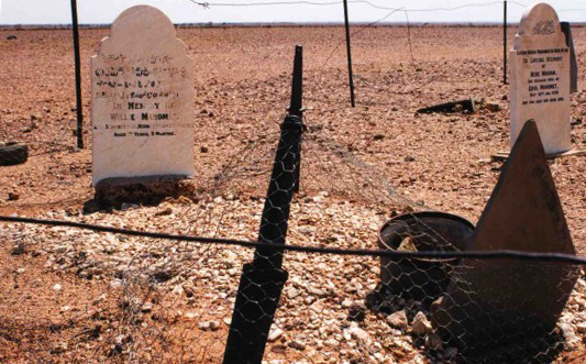
Beltana is a town north of Adelaide, South Australia. Beltana is known for continuing to exist long after the reasons for its existence had ceased. The town's history began in the 1870s with the advent of copper mining in the area, construction of the Australian Overland Telegraph Line and The Ghan railway and began to decline in 1941 with the beginning of coal mining at Leigh Creek. The fortune of the town was sealed by the 1983 realignment of the main road away from the town. The town, adjacent cemetery and railway structures are now part of a designated State Heritage Area declared in 1987. Beltana has important links with the overland telegraph, transcontinental railway, mining, outback services, Australian Inland Mission and also has "Afghan" sites relating to its past as a camel-based transport centre. The town has had horse racing since 1876, and the annual picnic races and gymkhana and biennial pastoral field day are still continued. There are services and acco ... [...More Info...] [...Related Items...] OR: [Wikipedia] [Google] [Baidu] |
Yudnamutana, South Australia
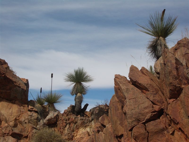
Yudnamutana ( ) is an historic mining valley in the Northern Flinders Ranges, located at Mount Freeling, North West of Arkaroola on the edge of the wilderness sanctuary. It is accessible by four-wheel drive from the south. Ancient mining sites give the opportunity for ecologically responsible bush camping, but no supplies are available. Walks across the crests of the mountains deliver splendid views over the Flinders Ranges into the plains of the outback. The northern pass hosts black rocks of magnetite. History Indigenous people This area was inhabited by the Adnyamathanha tribe, of Indigenous Australians prior to Europeans. They were Stone Age hunter-gatherers and inhabited much of the area to the south. European settlement This area was first settled by pastoralists in the 1850s but prospectors followed shortly after, hoping for another Burra style deposit. A copper deposit was found, in 1859, by A Frost and H Gleeson. [...More Info...] [...Related Items...] OR: [Wikipedia] [Google] [Baidu] |
Farina, South Australia
Farina, formerly ''Farina Town'', is a town and locality in the Australian state of South Australia. At the 2006 census, Farina had a population of 55. On the edge of the desert, it sits within the Lake Eyre Basin and it is situated on the old alignment of the Ghan railway, north of Lyndhurst and south of Marree where the Oodnadatta Track and the Birdsville Track commence. History Originally called The Gums or Government Gums, Farina was settled in 1878 by optimistic farmers hoping that '' rain follows the plough''. The town was the railhead for a time until 1884 before the railway was extended to Marree. During the wet years of the 1880s, plans were laid out for a town with 432 ¼-acre blocks. It was believed that it would be good for growing wheat and barley, however normal rainfall is nowhere near enough to grow these crops. Several silver and copper mines were dug in the surrounding area. Farina grew to reach a peak population of approximately 600 in the late 18 ... [...More Info...] [...Related Items...] OR: [Wikipedia] [Google] [Baidu] |
The Ghan
''The Ghan'' is an experiential travel, experiential tourism oriented passenger train service that operates between the northern and southern coasts of Australia, through the cities of Adelaide Parklands Terminal, Adelaide, Alice Springs railway station, Alice Springs and Darwin railway station, Darwin on the Adelaide–Darwin rail corridor. Operated by Journey Beyond Rail Expeditions, its scheduled travelling time, including extended stops for passengers to do off-train tours, is 53 hours 15 minutes to travel the .Timetables Great Southern Rail The Ghan has been described as one of the world's great passenger trains. Etymology The service's name is an abbreviated version of its previous nickname, ''The Afghan Express''. The nickname is reputed to have been bestowed in 1923 by ...[...More Info...] [...Related Items...] OR: [Wikipedia] [Google] [Baidu] |
Afghan (Australia)
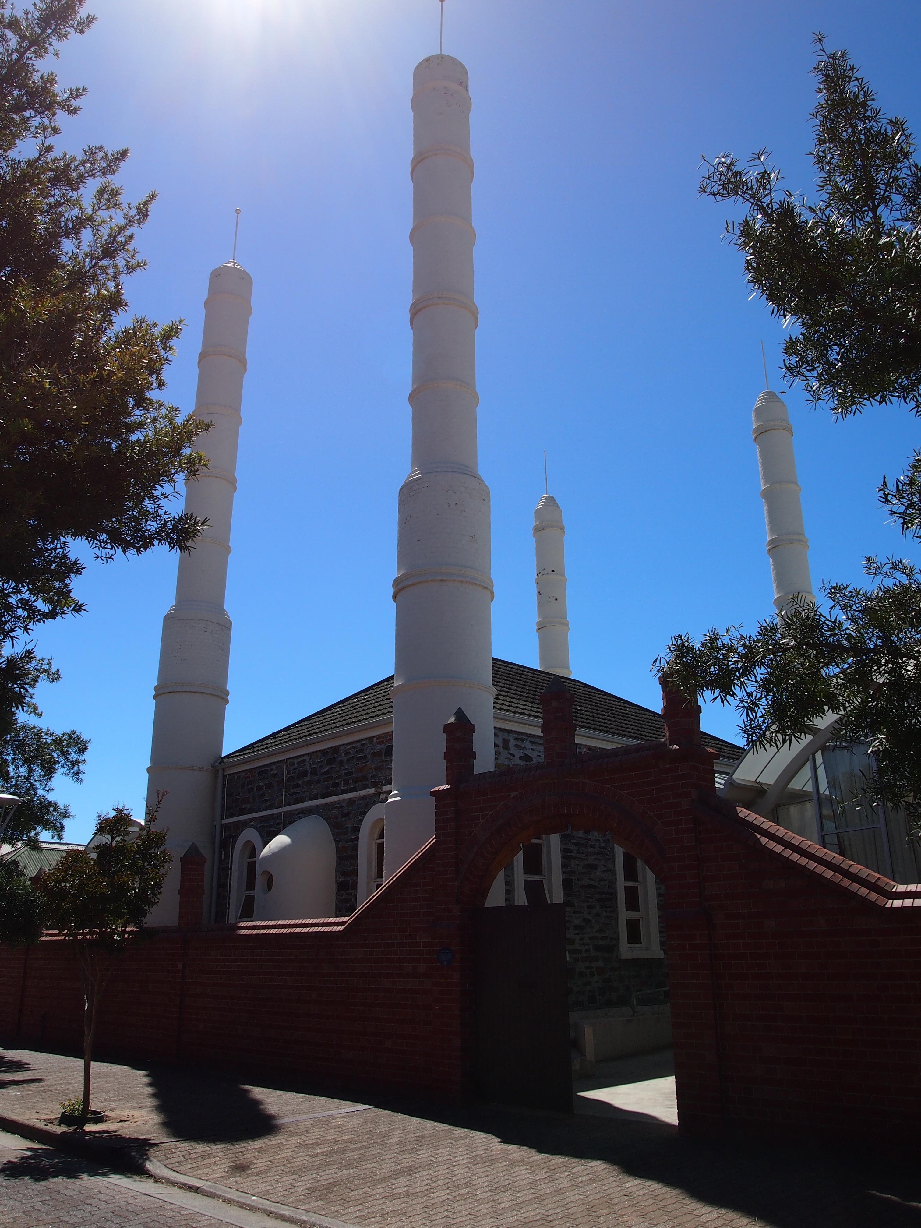
Afghan cameleers in Australia, also known as "Afghans" ( ps, افغانان) or "Ghans" ( ps, غانز), were camel drivers who worked in Outback Australia from the 1860s to the 1930s. Small groups of cameleers were shipped in and out of Australia at three-year intervals, to service the Australian inland pastoral industry by carting goods and transporting wool bales by camel trains. They were commonly referred to as "Afghans", even though a lot of them originated from the far western parts of British India, primarily Balochistan and the NWFP (now Pakistan), which was inhabited by ethnic Pashtuns and Balochs. Nonetheless, many were from Afghanistan itself as well. In addition, there were also some with origins in Egypt and Turkey.Afghan cameleers in Australia 3rd September 2009. Aust ... [...More Info...] [...Related Items...] OR: [Wikipedia] [Google] [Baidu] |
The Barrier Miner
''The Barrier Miner'' was a daily broadsheet newspaper published in Broken Hill in far western New South Wales from 1888 to 1974. History First published on 28 February 1888, ''The Barrier Miner'' was published continuously until 25 November 1974. Copies are available on microfilm and online via Trove Digitised Newspapers. The paper was revived briefly in 2005; an index to births deaths and marriages has been prepared which also notes additional publication dates between 16 December 2005 and 31 July 2008. The paper closed down for a second time in 2008 with the managing director, Margaret McBride stating that "...due to commercial reasons the paper would no longer service Broken Hill and the region...". ''The Barrier Miner'' served the growing mining community of Broken Hill, when the area was found to have lead ore and traces of silver. It was not until late 1884 or early 1885 that rich quantities of silver were found and the Broken Hill Proprietary Company (BHP) was floated ... [...More Info...] [...Related Items...] OR: [Wikipedia] [Google] [Baidu] |


.jpg)


