|
Kuwait City
Kuwait City ( ar, مدينة الكويت) is the capital and largest city of Kuwait. Located at the heart of the country on the south shore of Kuwait Bay on the Persian Gulf, it is the political, cultural and economic centre of the emirate, containing Kuwait's Seif Palace, government offices, and the headquarters of most Kuwaiti corporations and banks. It is one of the hottest cities in summer on Earth, with average summer high temperatures over 45 °C (113 °F) for three months of the year. the metropolitan area had roughly three million inhabitants (more than 70% of the country's population). The city itself has no administrative status. All six governorates of the country comprise parts of the urban agglomeration, which is subdivided into numerous areas. In a narrower sense, ''Kuwait City'' can also refer only to the town's historic core, which nowadays is part of the Capital Governorate and seamlessly merges with the adjacent urban areas. Kuwait City's tr ... [...More Info...] [...Related Items...] OR: [Wikipedia] [Google] [Baidu] |
Capital City
A capital city or capital is the municipality holding primary status in a country, state, province, Department (country subdivision), department, or other subnational entity, usually as its seat of the government. A capital is typically a city that physically encompasses the government's offices and meeting places; the status as capital is often designated by its law or constitution. In some jurisdictions, including several countries, different branches of government are in different settlements. In some cases, a distinction is made between the official (constitutional) capital and the seat of government, which is List of countries with multiple capitals, in another place. English language, English-language news media often use the name of the capital city as an alternative name for the government of the country of which it is the capital, as a form of metonymy. For example, "relations between Washington, D.C., Washington and London" refer to "United Kingdom–United States rel ... [...More Info...] [...Related Items...] OR: [Wikipedia] [Google] [Baidu] |
Bani Utub
The Bani Utbah ( ar, بني عتبة, banī ʿUtbah, plural Utub; ar, العتوب ', singular Utbi; ar, العتبي ') is an Arab tribal confederation that originated in Najd. The confederation is thought to have been formed when a group of Arab clans migrated to Eastern Arabia from Najd in the 16th century. Bani Utbah belongs to the larger Anizah tribe. The Al Bin Ali along with current ruling families of Bahrain and Kuwait were the rulers of the federation. The name of confederation is found in the form Attoobee or Uttoobee in English sources up to the late 19th century. History Invasion of Oman (1697) The Shia Iranian Safavids asked for the assistance of the Utub in invading Oman in 1697; however, they were defeated, as they were already engaged in another war with the Ottomans for the control of Basra. Some Utub and Huwala at that time were serving as mariners in the Persian navy, but they revolted of maltreatment and took possession of some ships and drove away. ... [...More Info...] [...Related Items...] OR: [Wikipedia] [Google] [Baidu] |
Red Sea
The Red Sea ( ar, البحر الأحمر - بحر القلزم, translit=Modern: al-Baḥr al-ʾAḥmar, Medieval: Baḥr al-Qulzum; or ; Coptic: ⲫⲓⲟⲙ ⲛ̀ϩⲁϩ ''Phiom Enhah'' or ⲫⲓⲟⲙ ⲛ̀ϣⲁⲣⲓ ''Phiom ǹšari''; Tigrinya: ቀይሕ ባሕሪ ''Qeyih Bahri''; ) is a seawater inlet of the Indian Ocean, lying between Africa and Asia. Its connection to the ocean is in the south, through the Bab el Mandeb strait and the Gulf of Aden. To its north lie the Sinai Peninsula, the Gulf of Aqaba, and the Gulf of Suez (leading to the Suez Canal). It is underlain by the Red Sea Rift, which is part of the Great Rift Valley. The Red Sea has a surface area of roughly 438,000 km2 (169,100 mi2), is about 2250 km (1398 mi) long, and — at its widest point — 355 km (220.6 mi) wide. It has an average depth of 490 m (1,608 ft), and in the central ''Suakin Trough'' it reaches its maximum depth of . The Red Sea also has exten ... [...More Info...] [...Related Items...] OR: [Wikipedia] [Google] [Baidu] |
East Africa
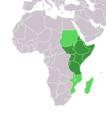
East Africa, Eastern Africa, or East of Africa, is the eastern subregion of the African continent. In the United Nations Statistics Division scheme of geographic regions, 10-11-(16*) territories make up Eastern Africa: Due to the historical Omani Empire and colonial territories of the British East Africa Protectorate and German East Africa, the term ''East Africa'' is often (especially in the English language) used to specifically refer to the area now comprising the three countries of Kenya, Tanzania, and Uganda. However, this has never been the convention in many other languages, where the term generally had a wider, strictly geographic context and therefore typically included Djibouti, Eritrea, Ethiopia, and Somalia.Somaliland is not included in the United Nations geoscheme, as it is internationally recognized as a part of Somalia. *Tanzania, Kenya, Uganda, Rwanda, Burundi, Democratic Republic of Congo and South Sudan are members of the East African Community. The firs ... [...More Info...] [...Related Items...] OR: [Wikipedia] [Google] [Baidu] |
Boat Building
Boat building is the design and construction of boats and their systems. This includes at a minimum a hull, with propulsion, mechanical, navigation, safety and other systems as a craft requires. Construction materials and methods Wood Wood is the traditional boat building material used for hull and spar construction. It is buoyant, widely available and easily worked. It is a popular material for small boats (of e.g. length; such as dinghies and sailboats). Its abrasion resistance varies according to the hardness and density of the wood and it can deteriorate if fresh water or marine organisms are allowed to penetrate the wood. Woods such as Teak, Totara and some cedars have natural chemicals which prevent rot whereas other woods, such as Pinus radiata, will rot very quickly. The hull of a wooden boat usually consists of planking fastened to frames and a keel. Keel and frames are traditionally made of hardwoods such as oak while planking can be oak but is more often softw ... [...More Info...] [...Related Items...] OR: [Wikipedia] [Google] [Baidu] |
Kuwait Harbour 1961
Kuwait (; ar, الكويت ', or ), officially the State of Kuwait ( ar, دولة الكويت '), is a country in Western Asia. It is situated in the northern edge of Eastern Arabia at the tip of the Persian Gulf, bordering Iraq to the north and Saudi Arabia to the south. Kuwait also shares maritime borders with Iran. Kuwait has a coastal length of approximately . Most of the country's population reside in the urban agglomeration of the capital city Kuwait City. , Kuwait has a population of 4.45 million people of which 1.45 million are Kuwaiti citizens while the remaining 3.00 million are foreign nationals from over 100 countries. Historically, most of present-day Kuwait was part of ancient Mesopotamia. Pre-oil Kuwait was a strategic trade port between Mesopotamia, Persia and India. Oil reserves were discovered in commercial quantities in 1938. In 1946, crude oil was exported for the first time. From 1946 to 1982, the country underwent large-scale modernization, largely b ... [...More Info...] [...Related Items...] OR: [Wikipedia] [Google] [Baidu] |
East India Company
The East India Company (EIC) was an English, and later British, joint-stock company founded in 1600 and dissolved in 1874. It was formed to trade in the Indian Ocean region, initially with the East Indies (the Indian subcontinent and Southeast Asia), and later with East Asia. The company seized control of large parts of the Indian subcontinent, colonised parts of Southeast Asia and Hong Kong. At its peak, the company was the largest corporation in the world. The EIC had its own armed forces in the form of the company's three Presidency armies, totalling about 260,000 soldiers, twice the size of the British army at the time. The operations of the company had a profound effect on the global balance of trade, almost single-handedly reversing the trend of eastward drain of Western bullion, seen since Roman times. Originally chartered as the "Governor and Company of Merchants of London Trading into the East-Indies", the company rose to account for half of the world's trade duri ... [...More Info...] [...Related Items...] OR: [Wikipedia] [Google] [Baidu] |
Constantinople
la, Constantinopolis ota, قسطنطينيه , alternate_name = Byzantion (earlier Greek name), Nova Roma ("New Rome"), Miklagard/Miklagarth (Old Norse), Tsargrad ( Slavic), Qustantiniya (Arabic), Basileuousa ("Queen of Cities"), Megalopolis ("the Great City"), Πόλις ("the City"), Kostantiniyye or Konstantinopolis ( Turkish) , image = Byzantine Constantinople-en.png , alt = , caption = Map of Constantinople in the Byzantine period, corresponding to the modern-day Fatih district of Istanbul , map_type = Istanbul#Turkey Marmara#Turkey , map_alt = A map of Byzantine Istanbul. , map_size = 275 , map_caption = Constantinople was founded on the former site of the Greek colony of Byzantion, which today is known as Istanbul in Turkey. , coordinates = , location = Fatih, İstanbul, Turkey , region = Marmara Region , type = Imperial city , part_of = , length = , width ... [...More Info...] [...Related Items...] OR: [Wikipedia] [Google] [Baidu] |
Smyrna
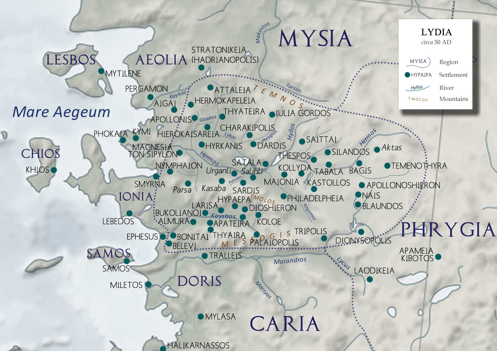
Smyrna ( ; grc, Σμύρνη, Smýrnē, or , ) was a Greek city located at a strategic point on the Aegean coast of Anatolia. Due to its advantageous port conditions, its ease of defence, and its good inland connections, Smyrna rose to prominence. The name of the city since about 1930 is İzmir. Two sites of the ancient city are today within Izmir's boundaries. The first site, probably founded by indigenous peoples, rose to prominence during the Archaic Period as one of the principal ancient Greek settlements in western Anatolia. The second, whose foundation is associated with Alexander the Great, reached metropolitan proportions during the period of the Roman Empire. Most of the present-day remains of the ancient city date from the Roman era, the majority from after a second-century AD earthquake. In practical terms, a distinction is often made between these. ''Old Smyrna'' was the initial settlement founded around the 11th century BC, first as an Aeolian settlement, and l ... [...More Info...] [...Related Items...] OR: [Wikipedia] [Google] [Baidu] |
Ottoman–Persian War (1775–1776)
The Ottoman–Persian War of 1775–1776 was fought between the Ottoman Empire and the Zand dynasty of Persia. The Persians, ruled by Karim Khan and led by his brother Sadeq Khan Zand, invaded southern Iraq and after besieging Basra for a year, took the city from the Ottomans in 1776. The Ottomans, unable to send troops, were dependent on the Mamluk governors to defend that region. In an attempt to raise troops and provisions for this war, Ottoman Sultan Abdülhamid I, made Suleiman al-Jalili ''mubayaaci'' (official of provisions), ordering him to send provisions to Baghdad, which he ignored, instead he restricted merchants from selling their goods. As a result, the Persians held Basra until 1779 when the Ottomans, under Sulayman Agha, retook the city, following Karim Khan's death.Dionisius A. Agius, ''In the Wake of the Dhow: The Arabian Gulf and Oman'', (Ithaca Press, 2010), 15. See also * Safavid occupation of Basra *Ottoman–Persian Wars The Ottoman–Persian Wars o ... [...More Info...] [...Related Items...] OR: [Wikipedia] [Google] [Baidu] |
Aleppo
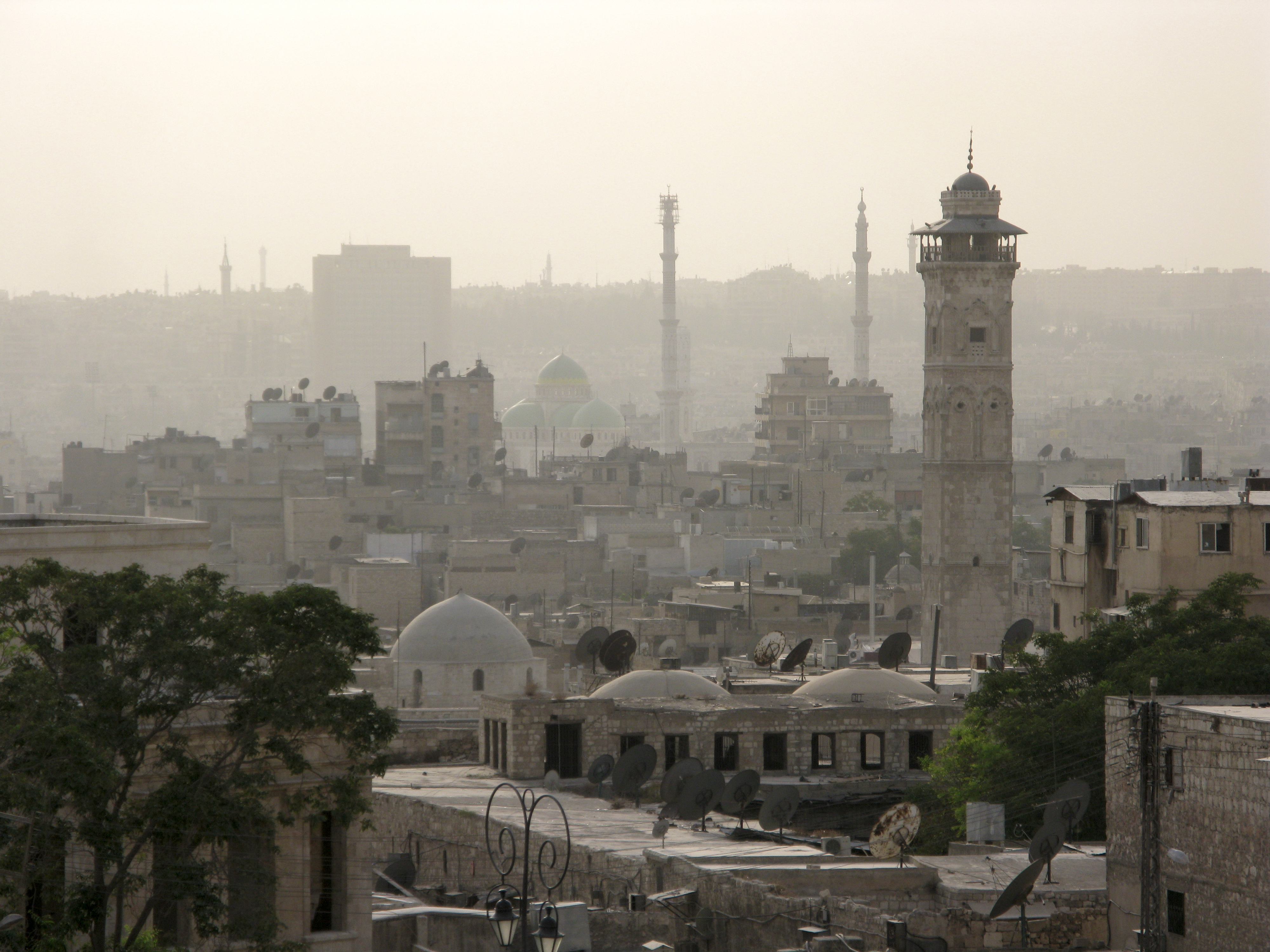
)), is an adjective which means "white-colored mixed with black". , motto = , image_map = , mapsize = , map_caption = , image_map1 = , mapsize1 = , map_caption1 = , pushpin_map = Syria#Mediterranean east#Asia#Syria Aleppo , pushpin_label_position = left , pushpin_relief = yes , pushpin_mapsize = , pushpin_map_caption = Location of Aleppo in Syria , coordinates = , subdivision_type = Country , subdivision_name = , subdivision_type1 = Governorate , subdivision_type2 = District , subdivision_type3 = Subdistrict , subdivision_name1 = Aleppo Governorate , subdivision_name2 = Mount Simeon (Jabal Semaan) , subdivision_name3 = Mount Simeon ( ... [...More Info...] [...Related Items...] OR: [Wikipedia] [Google] [Baidu] |
Arabia
The Arabian Peninsula, (; ar, شِبْهُ الْجَزِيرَةِ الْعَرَبِيَّة, , "Arabian Peninsula" or , , "Island of the Arabs") or Arabia, is a peninsula of Western Asia, situated northeast of Africa on the Arabian Plate. At , the Arabian Peninsula is the largest peninsula in the world. Geographically, the Arabian Peninsula includes Bahrain, Kuwait, Oman, Qatar, Saudi Arabia, the United Arab Emirates (UAE), and Yemen, as well as the southern portions of Iraq and Jordan. The largest of these is Saudi Arabia. In the classical era, the southern portions of modern-day Syria, Jordan, and the Sinai Peninsula were also considered parts of Arabia (see Arabia Petraea). The Arabian Peninsula formed as a result of the rifting of the Red Sea between 56 and 23 million years ago, and is bordered by the Red Sea to the west and southwest, the Persian Gulf and the Gulf of Oman to the northeast, the Levant and Mesopotamia to the north and the Arabian Sea and the Indian Oce ... [...More Info...] [...Related Items...] OR: [Wikipedia] [Google] [Baidu] |


.png)