|
Zuidvleugel
Zuidvleugel (, literally "south wing") is the band of cities and towns located along the southern wing of the Randstad in the Netherlands. It is that part of the Randstad that is located in the Province of South Holland. This developing conurbation extends around 60 kilometres from Dordrecht to Leiden. The two main focal points are the area around Rotterdam (called Rijnmond) and the area around The Hague (called Haaglanden).Some of this article has been translated from the Dutch version of this page. Some of it was taken from the Randstad article. With a population of around 3.5 million people, the Zuidvleugel is one of the largest urban areas in Europe. The centre of the Zuidvleugel lies in the middle of Rotterdam and The Hague, near Delft. Zuidvleugel includes the following: *the Drechtsteden and some more of the Hoeksche Waard: Binnenmaas, Oud-Beijerland *the region of Zuid-Holland West *the Rijnmond area around Rotterdam *the Haaglanden area around The Hague *a small ... [...More Info...] [...Related Items...] OR: [Wikipedia] [Google] [Baidu] |
Randstad
The Randstad (; "Rim" or "Edge" City) is a roughly crescent-shaped conurbation in the central-western Netherlands, consisting primarily of the four largest Dutch cities (Amsterdam, Rotterdam, The Hague, and Utrecht); their suburbs, and many towns in between, that all grew and merged into each other, containing almost half the country's population. Among other things, it includes the Port of Rotterdam (the busiest seaport outside of Asia), the Port of Amsterdam (Europe's fourth-busiest seaport), and Amsterdam Airport Schiphol (the List of busiest airports by aircraft movements, busiest airport in Europe by aircraft movements). With a population of approximately 8.4 million people it is one of the largest metropolitan area, metropolitan regions in Europe, comparable in population size to the Rhine-Ruhr metropolitan region or the San Francisco Bay Area, and covers an area of approximately . The Randstad had a gross regional product of €397 billion in 2017, making it the third most ... [...More Info...] [...Related Items...] OR: [Wikipedia] [Google] [Baidu] |
Randstad ZW
The Randstad (; "Rim" or "Edge" City) is a roughly crescent-shaped conurbation in the central-western Netherlands, consisting primarily of the four largest Dutch cities (Amsterdam, Rotterdam, The Hague, and Utrecht); their suburbs, and many towns in between, that all grew and merged into each other, containing almost half the country's population. Among other things, it includes the Port of Rotterdam (the busiest seaport outside of Asia), the Port of Amsterdam (Europe's fourth-busiest seaport), and Amsterdam Airport Schiphol (the busiest airport in Europe by aircraft movements). With a population of approximately 8.4 million people it is one of the largest metropolitan regions in Europe, comparable in population size to the Rhine-Ruhr metropolitan region or the San Francisco Bay Area, and covers an area of approximately . The Randstad had a gross regional product of €397 billion in 2017, making it the third most productive region in the European Union, behind the Paris Regi ... [...More Info...] [...Related Items...] OR: [Wikipedia] [Google] [Baidu] |
Rotterdam
Rotterdam ( , , , lit. ''The Dam on the River Rotte'') is the second largest city and municipality in the Netherlands. It is in the province of South Holland, part of the North Sea mouth of the Rhine–Meuse–Scheldt delta, via the ''"New Meuse"'' inland shipping channel, dug to connect to the Meuse first, but now to the Rhine instead. Rotterdam's history goes back to 1270, when a dam was constructed in the Rotte. In 1340, Rotterdam was granted city rights by William IV, Count of Holland. The Rotterdam–The Hague metropolitan area, with a population of approximately 2.7 million, is the 10th-largest in the European Union and the most populous in the country. A major logistic and economic centre, Rotterdam is Europe's largest seaport. In 2020, it had a population of 651,446 and is home to over 180 nationalities. Rotterdam is known for its university, riverside setting, lively cultural life, maritime heritage and modern architecture. The near-complete destruction ... [...More Info...] [...Related Items...] OR: [Wikipedia] [Google] [Baidu] |
South Holland
South Holland ( nl, Zuid-Holland ) is a province of the Netherlands with a population of over 3.7 million as of October 2021 and a population density of about , making it the country's most populous province and one of the world's most densely populated areas. Situated on the North Sea in the west of the Netherlands, South Holland covers an area of , of which is water. It borders North Holland to the north, Utrecht and Gelderland to the east, and North Brabant and Zeeland to the south. The provincial capital is the Dutch seat of government The Hague, while its largest city is Rotterdam. The Rhine-Meuse-Scheldt delta drains through South Holland into the North Sea. Europe's busiest seaport, the Port of Rotterdam, is located in South Holland. History Early history Archaeological discoveries in Hardinxveld-Giessendam indicate that the area of South Holland has been inhabited since at least c. 7,500 years before present, probably by nomadic hunter-gatherers. Agriculture and perman ... [...More Info...] [...Related Items...] OR: [Wikipedia] [Google] [Baidu] |
The Hague
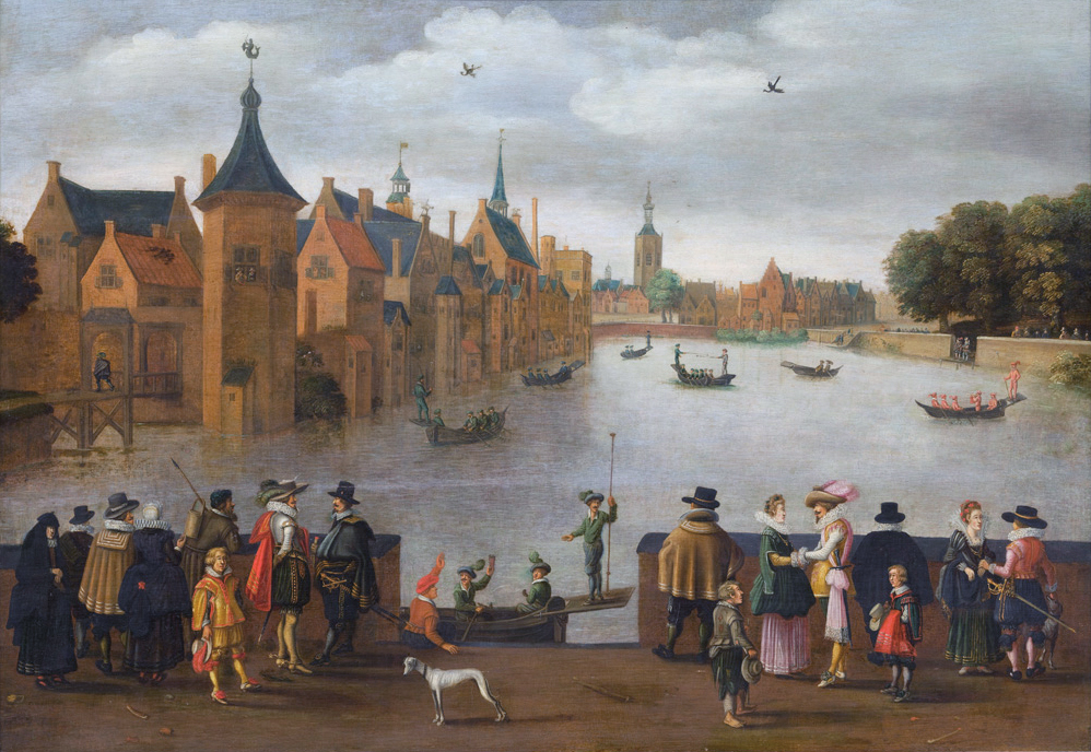
The Hague ( ; nl, Den Haag or ) is a city and municipality of the Netherlands, situated on the west coast facing the North Sea. The Hague is the country's administrative centre and its seat of government, and while the official capital of the Netherlands is Amsterdam, The Hague has been described as the country's de facto capital. The Hague is also the capital of the province of South Holland, and the city hosts both the International Court of Justice and the International Criminal Court. With a population of over half a million, it is the third-largest city in the Netherlands, after Amsterdam and Rotterdam. The Hague is the core municipality of the Greater The Hague urban area, which comprises the city itself and its suburban municipalities, containing over 800,000 people, making it the third-largest urban area in the Netherlands, again after the urban areas of Amsterdam and Rotterdam. The Rotterdam–The Hague metropolitan area, with a population of approximately 2.6&n ... [...More Info...] [...Related Items...] OR: [Wikipedia] [Google] [Baidu] |
Haaglanden
:''Parts of this article have been translated from the Dutch version of this page'' Haaglanden (, literally ''Haguelands'') was a conurbation surrounding The Hague in the Netherlands from 1992 until 2015. The city's position as the country's seat of government made the region prominent in the Netherlands. Located on the west coast of the province of South Holland, the region had a population of 1,050,543 in September 2013, and covered an area of 405 km². ''Haaglanden'' was an official term referring to an urban region"Urban region" referring to the Dutch terms ''stadsgewest'', ''stadsregio'' and ''plusregio'', which were more or less used interchangeably. literally called ''Haaglanden Urban Region'' (''Stadsgewest Haaglanden''). The official website of Haaglanden used the English translation ''The Hague Region''. Another translation would have been the ''Greater Hague Area''. The term was also sometimes used to refer to the conurbation of The Hague in a general, informal sense; ... [...More Info...] [...Related Items...] OR: [Wikipedia] [Google] [Baidu] |
Hoeksche Waard
The Hoekse Waard (; pre-1947 spelling: Hoeksche Waard) is an island between the Oude Maas, Dordtsche Kil, Hollands Diep, Haringvliet and Spui rivers in the province of South Holland in the Netherlands. The island, part of the namesake municipality of Hoeksche Waard, is a mostly agricultural region, south of the outskirts of Rotterdam. The Hoeksche Waard consists of reclaimed land (polders): after the Saint Elisabeth flood of 1421 most of the area was flooded. The land has been reclaimed gradually in the following centuries. Former municipalities The Hoeksche Waard formerly consisted of the following municipalities until these were merged on 1 January 2019: * Binnenmaas (villages Blaaksedijk, Heinenoord, Goidschalxoord, Maasdam, Mijnsheerenland, Puttershoek, Westmaas and 's-Gravendeel) * Cromstrijen (villages Klaaswaal and Numansdorp) * Korendijk (villages Goudswaard, Nieuw-Beijerland, Piershil and Zuid-Beijerland, and the island of Tiengemeten) * Oud-Beijerland * Str ... [...More Info...] [...Related Items...] OR: [Wikipedia] [Google] [Baidu] |
Amstelland
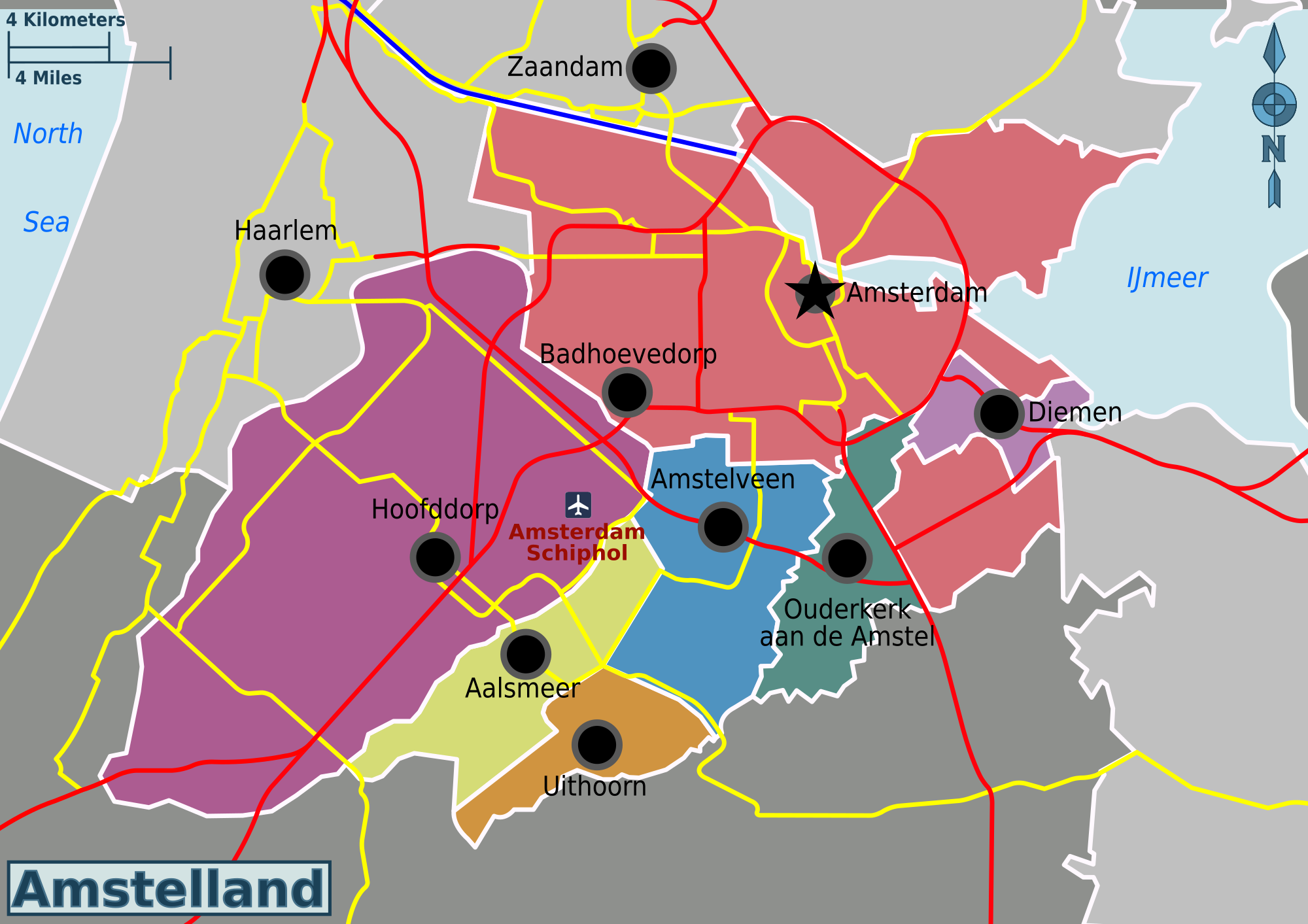
Amstelland is the area along the river Amstel in the Netherlands, beginning in South Holland and running north towards Amsterdam in southern North Holland. History Amstelland's history is inextricably linked with the Amstel river and the growth of Amsterdam. Its history is essentially the history of Amstelveen, Aalsmeer, Ouderkerk aan de Amstel and the other towns. The river was important in medieval times as a waterway leading to the south and to Utrecht. The oldest settlement in the area was Ouderkerk aan de Amstel, which dated from the 11th century (and thus is older than Amsterdam). Amsterdam at this time was a small fishing village at the mouth of the Amstel. A part of Utrecht, this area was part of the seigniory ( heerlijkheid) of the Van Aemstel family. At one point the right bank of the Amstel was being referred to as the "Old Amstel" (Ouder-Amstel), the left bank as the "New Amstel" (Nieuwer-Amstel). Peat was an important source of fuel at the time. The fens around th ... [...More Info...] [...Related Items...] OR: [Wikipedia] [Google] [Baidu] |
Amsterdam
Amsterdam ( , , , lit. ''The Dam on the River Amstel'') is the Capital of the Netherlands, capital and Municipalities of the Netherlands, most populous city of the Netherlands, with The Hague being the seat of government. It has a population of 907,976 within the city proper, 1,558,755 in the City Region of Amsterdam, urban area and 2,480,394 in the Amsterdam metropolitan area, metropolitan area. Located in the Provinces of the Netherlands, Dutch province of North Holland, Amsterdam is colloquially referred to as the "Venice of the North", for its large number of canals, now designated a World Heritage Site, UNESCO World Heritage Site. Amsterdam was founded at the mouth of the Amstel River that was dammed to control flooding; the city's name derives from the Amstel dam. Originally a small fishing village in the late 12th century, Amsterdam became a major world port during the Dutch Golden Age of the 17th century, when the Netherlands was an economic powerhouse. Amsterdam is th ... [...More Info...] [...Related Items...] OR: [Wikipedia] [Google] [Baidu] |
Zuid-Holland Oost
Zuid-Holland Oost (literally ''East South Holland'') is an official region of the province of South Holland in the Netherlands. The region consists of the following subregions: * Alblasserwaard-Vijfheerenlanden, municipalities: Gorinchem, Hardinxveld-Giessendam, and Molenlanden. * Gouwestreek, municipalities: Bodegraven-Reeuwijk, Gouda, Waddinxveen, Zuidplas, and Boskoop (former municipality) * Krimpenerwaard (region), municipality: Krimpenerwaard Krimpen aan den IJssel also belongs to the Krimpenerwaard region, but is part of Rijnmond. * Rijnstreek, municipalities: Alphen aan den Rijn (incl. Rijnwoude), Nieuwkoop, and Jacobswoude (former municipality) See also * Rijnmond * Zuid-Holland West * Zuid-Holland Zuid Zuid-Holland Zuid (literally ''South South Holland'') is an official region of the province of South Holland in the Netherlands. It consists of the following subregions: * Drechtsteden, municipalities: Alblasserdam, Dordrecht, Hendrik-Ido-Ambacht ... Notes Ref ... [...More Info...] [...Related Items...] OR: [Wikipedia] [Google] [Baidu] |
Zuid-Holland West
Zuid-Holland West (literally ''West South Holland'') is an official region of the province of South Holland in the Netherlands. It consists of the following subregions: * Haaglanden, municipalities: Delft, Leidschendam-Voorburg, Midden-Delfland, Pijnacker-Nootdorp, Rijswijk, The Hague, Wassenaar, Westland and Zoetermeer * Regio Holland Rijnland, municipalities: Hillegom, Kaag en Braassem,Although the former municipality of Jacobswoude makes part of Kaag en Braassem, it belongs to the Rijnstreek. Katwijk, Leiden, Leiderdorp, Lisse, Noordwijk, Oegstgeest, Teylingen, Voorschoten and Zoeterwoude See also * Rijnmond * Zuid-Holland Oost * Zuid-Holland Zuid Zuid-Holland Zuid (literally ''South South Holland'') is an official region of the province of South Holland in the Netherlands. It consists of the following subregions: * Drechtsteden, municipalities: Alblasserdam, Dordrecht, Hendrik-Ido-Ambacht, ... Notes References *Zuid-Holland West Province of South Holland Regio ... [...More Info...] [...Related Items...] OR: [Wikipedia] [Google] [Baidu] |


.jpg)