|
York Franciscan Friary
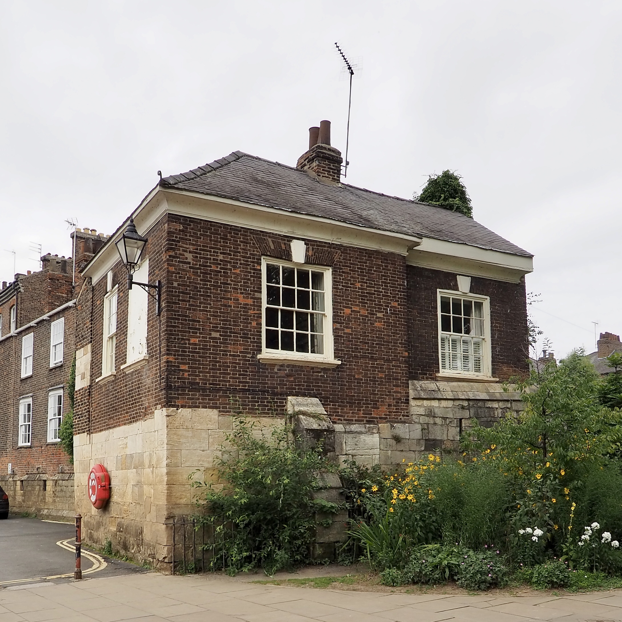
York Franciscan Friary was a friary in York, North Yorkshire, England. It was located between York Castle and the River Ouse. In 1538, it fell victim to Henry VIII's Dissolution of the Monasteries. All that now remains of it is a stone wall on King's Staith, adjacent to the Davy Tower on the York city walls. Burials * Robert de Neville *Thomas de Mowbray, 4th Earl of Norfolk Thomas de Mowbray, 4th Earl of Norfolk, 2nd Earl of Nottingham, 8th Baron Segrave, 7th Baron Mowbray (17 September 1385 – 8 June 1405), English nobleman and rebel, was the son of Thomas de Mowbray, 1st Duke of Norfolk, and Lady Elizabeth F ... References Monasteries in North Yorkshire History of York 1538 disestablishments in England Franciscan monasteries in England {{UK-Christian-monastery-stub ... [...More Info...] [...Related Items...] OR: [Wikipedia] [Google] [Baidu] |
York
York is a cathedral city with Roman origins, sited at the confluence of the rivers Ouse and Foss in North Yorkshire, England. It is the historic county town of Yorkshire. The city has many historic buildings and other structures, such as a minster, castle, and city walls. It is the largest settlement and the administrative centre of the wider City of York district. The city was founded under the name of Eboracum in 71 AD. It then became the capital of the Roman province of Britannia Inferior, and later of the kingdoms of Deira, Northumbria, and Scandinavian York. In the Middle Ages, it became the northern England ecclesiastical province's centre, and grew as a wool-trading centre. In the 19th century, it became a major railway network hub and confectionery manufacturing centre. During the Second World War, part of the Baedeker Blitz bombed the city; it was less affected by the war than other northern cities, with several historic buildings being gutted and restore ... [...More Info...] [...Related Items...] OR: [Wikipedia] [Google] [Baidu] |
North Yorkshire
North Yorkshire is the largest ceremonial counties of England, ceremonial county (lieutenancy area) in England, covering an area of . Around 40% of the county is covered by National parks of the United Kingdom, national parks, including most of the Yorkshire Dales and the North York Moors. It is one of four counties in England to hold the name Yorkshire; the three other counties are the East Riding of Yorkshire, South Yorkshire and West Yorkshire. North Yorkshire may also refer to a non-metropolitan county, which covers most of the ceremonial county's area () and population (a mid-2016 estimate by the Office for National Statistics, ONS of 602,300), and is administered by North Yorkshire County Council. The non-metropolitan county does not include four areas of the ceremonial county: the City of York, Middlesbrough, Redcar and Cleveland and the southern part of the Borough of Stockton-on-Tees, which are all administered by Unitary authorities of England, unitary authorities. ... [...More Info...] [...Related Items...] OR: [Wikipedia] [Google] [Baidu] |
England
England is a country that is part of the United Kingdom. It shares land borders with Wales to its west and Scotland to its north. The Irish Sea lies northwest and the Celtic Sea to the southwest. It is separated from continental Europe by the North Sea to the east and the English Channel to the south. The country covers five-eighths of the island of Great Britain, which lies in the North Atlantic, and includes over 100 smaller islands, such as the Isles of Scilly and the Isle of Wight. The area now called England was first inhabited by modern humans during the Upper Paleolithic period, but takes its name from the Angles, a Germanic tribe deriving its name from the Anglia peninsula, who settled during the 5th and 6th centuries. England became a unified state in the 10th century and has had a significant cultural and legal impact on the wider world since the Age of Discovery, which began during the 15th century. The English language, the Anglican Church, and Engli ... [...More Info...] [...Related Items...] OR: [Wikipedia] [Google] [Baidu] |
York Castle
York Castle is a fortified complex in the city of York, England. It consists of a sequence of castles, prisons, law courts and other buildings, which were built over the last nine centuries on the south side of the River Foss. The now-ruined keep of the medieval Norman castle is commonly referred to as Clifford's Tower. Built originally on the orders of William I to dominate the former Viking city of Jórvík, the castle suffered a tumultuous early history before developing into a major fortification with extensive water defences. After a major explosion in 1684 rendered the remaining military defences uninhabitable, York Castle continued to be used as a jail and prison until 1929. The first motte and bailey castle on the site was built in 1068 following the Norman conquest of York. After the destruction of the castle by rebels and a Viking army in 1069, York Castle was rebuilt and reinforced with extensive water defences, including a moat and an artificial lake. York Castle f ... [...More Info...] [...Related Items...] OR: [Wikipedia] [Google] [Baidu] |
River Ouse, Yorkshire
The River Ouse ( ) is a river in North Yorkshire, England. Hydrologically, the river is a continuation of the River Ure, and the combined length of the River Ure and River Ouse makes it, at , the sixth-longest river of the United Kingdom and (including the Ure) the longest to flow entirely in one county. The length of the Ouse alone is about but the total length of the river is disputed. It is a matter of opinion as to whether the River Ouse is formed at the confluence of the River Ure and the much-smaller Ouse Gill Beck at Cuddy Shaw Reach near Linton-on-Ouse, about six miles downstream of the confluence of the River Swale with the River Ure. An alternative opinion is recorded in a publication published in ''The Yorkshire Post'' in a series dated 1891, written and illustrated by Tom Bradley. His description and bird's-eye-view maps—specifically in his account of the River Swale—suggests that the River Ouse starts at the confluence of the Swale and the Ure. His narrative ... [...More Info...] [...Related Items...] OR: [Wikipedia] [Google] [Baidu] |
Henry VIII Of England
Henry VIII (28 June 149128 January 1547) was King of England from 22 April 1509 until his death in 1547. Henry is best known for his six marriages, and for his efforts to have his first marriage (to Catherine of Aragon) annulled. His disagreement with Pope Clement VII about such an annulment led Henry to initiate the English Reformation, separating the Church of England from papal authority. He appointed himself Supreme Head of the Church of England and dissolved convents and monasteries, for which he was excommunicated by the pope. Henry is also known as "the father of the Royal Navy" as he invested heavily in the navy and increased its size from a few to more than 50 ships, and established the Navy Board. Domestically, Henry is known for his radical changes to the English Constitution, ushering in the theory of the divine right of kings in opposition to papal supremacy. He also greatly expanded royal power during his reign. He frequently used charges of treason and ... [...More Info...] [...Related Items...] OR: [Wikipedia] [Google] [Baidu] |
King's Staith
King's Staith is a street in the city centre of York, in England. History The street was constructed in 1366 as the main quay for the city, replacing various small timber wharves. Its name has been connected to royals visiting the city in the 14th-century, but the name was not recorded until the 17th-century. The King's Staith formed the water front end of three long, narrow medieval streets known as The Water Lanes. These lanes were demolished as part of a slum clearance program in 1852 but the three modern streets King Street, Cumberland Street and Lower Friargate follow roughly the same layout. Several buildings on King's Staith survived the clearances and remain to this day, including Cumberland House and the Kings Arms Pub which, from early-17th century formed the water front end of First Water Lane. Pudding Holes, a public washing site, lay at the southern end of the street, just north of the walls of the York Franciscan Friary. In the 17th-century, the street was ... [...More Info...] [...Related Items...] OR: [Wikipedia] [Google] [Baidu] |
Davy Tower
The Davy Tower is a feature of the York city walls in England. The stone tower was built around 1250, probably at the end of a wall or earthwork leading to Castlegate, around the moat of York Castle York Castle is a fortified complex in the city of York, England. It consists of a sequence of castles, prisons, law courts and other buildings, which were built over the last nine centuries on the south side of the River Foss. The now-ruined .... It was first recorded in 1315, and by 1424 the part of the city inside the walls was occupied by the York Franciscan Friary. Until 1553, a chain could be strung across the River Ouse from the tower to a now-demolished tower near Skeldergate. From 1607, a public toilet adjoined the tower, on the river side, known as the "Sugar House". In 1732, it was replaced by a stone arch, the Friargate Postern. Around 1730, the tower was altered, when a summerhouse was constructed in its southern corner: the basement in stone, and the rais ... [...More Info...] [...Related Items...] OR: [Wikipedia] [Google] [Baidu] |
York City Walls
York has, since Roman times, been defended by walls of one form or another. To this day, substantial portions of the walls remain, and York has more miles of intact wall than any other city in England. They are known variously as York City Walls, the Bar Walls and the Roman walls (though this last is a misnomer as very little of the extant stonework is of Roman origin, and the course of the wall has been substantially altered since Roman times). The walls are generally 13 feet (4m) high and 6 feet (1.8m) wide. History Roman walls The original walls were built around 71 AD, when the Romans erected a fort (castra) occupying about 50 acres or 21.5 hectares near the banks of the River Ouse. The rectangle of walls was built as part of the fort's defences. The foundations and the line of about half of these Roman walls form part of the existing walls, as follows: *a section (the west corner, including the Multangular Tower) in the Museum Gardens *the north-west and north-ea ... [...More Info...] [...Related Items...] OR: [Wikipedia] [Google] [Baidu] |
Robert De Neville
Robert de Neville, 2nd Baron Neville of Raby (c. 1223–1282), was a medieval English nobleman. Background The Neville family in England go back to at least the 11th century, and the historian Horace Round speculated that they were part of the pre-Norman aristocracy of Northumbria. By the 13th century, the Nevilles had become, through shrewd marriages and royal patronage, major landholders, and concomitantly rose to a position of regional hegemony regularly being appointed to the important royal offices. By the time Neville reached adulthood, and for the rest of his life, English politics was in a state of partisanship; the King, Henry III was increasingly unpopular with his nobility and the tension between them, never resolved, erupted in constitutional crisis and eventually civil war. Simon de Montfort, previously a favourite of Henry's, who had married his sister Eleanor, led the opposition. Early life Robert de Neville was the eldest son of Geoffrey fitz Robert (later ... [...More Info...] [...Related Items...] OR: [Wikipedia] [Google] [Baidu] |


