|
Window Prostitution
Window prostitution is a form of prostitution that is fairly common in the Netherlands and surrounding countries. The prostitute rents a window plus workspace off a window operator for a certain period of time, often per day or part of a day. The prostitute is also independent and recruits her own customers and also negotiates the price and the services to be provided. Dutch situation Window prostitution was originally a typical Dutch form of prostitution. This form arose through the ban on soliciting on the street or in doorways in the old red-light district in Amsterdam around the old church. In the beginning the curtains were completely closed, as sexual morality became less strict, the curtains opened even further. When the curtains were completely open, the process continued in the form of fewer and fewer pieces of clothing that the prostitute wore. In current times, the curtains are only closed when the prostitute has a customer. There are around 1270 windows used for prost ... [...More Info...] [...Related Items...] OR: [Wikipedia] [Google] [Baidu] |
Deventer
Deventer (; Sallands: ) is a city and municipality in the Salland historical region of the province of Overijssel, Netherlands. In 2020, Deventer had a population of 100,913. The city is largely situated on the east bank of the river IJssel, but it also has a small part of its territory on the west bank. In 2005 the municipality of Bathmen (with a population of about 5,000 people) was merged with Deventer as part of a national effort to reduce bureaucracy in the country. Deventer is one of the oldest cities in the Netherlands. The place is already mentioned in 9th-century sources of the Diocese of Utrecht. In a charter from 877 AD mentions seven hooves in ''Daventre portu'' (the Deventer harbor). In 952 AD, Deventer is mentioned as a city in a gift certificate from King Otto I. After the place had acquired more and more rights and privileges over time, it received the municipal lands from Emperor Henry V in 1123. This is considered by historians to be the moment of Deventer o ... [...More Info...] [...Related Items...] OR: [Wikipedia] [Google] [Baidu] |
Charleroi
Charleroi ( , , ; wa, Tchålerwè ) is a city and a municipality of Wallonia, located in the province of Hainaut, Belgium. By 1 January 2008, the total population of Charleroi was 201,593.Statistics Belgium; ''Population de droit par commune au 1 janvier 2008'' (excel-file) Population of all municipalities in Belgium, as of 1 January 2008. Retrieved on 19 October 2008. The metropolitan area, including the outer commuter zone, covers an area of with a total population of 522,522 by 1 January 2008, ranking it as the 5th most populous in |
Ostend
Ostend ( nl, Oostende, ; french: link=no, Ostende ; german: link=no, Ostende ; vls, Ostende) is a coastal city and municipality, located in the province of West Flanders in the Flemish Region of Belgium. It comprises the boroughs of Mariakerke, Raversijde, Stene and Zandvoorde, and the city of Ostend proper – the largest on the Belgian coast. History Origin to Middle Ages In the Early Middle Ages, Ostend was a small village built on the east-end () of an island (originally called Testerep) between the North Sea and a beach lake. Although small, the village rose to the status of "town" around 1265, when the inhabitants were allowed to hold a market and to build a market hall. The major source of income for the inhabitants was fishing. The North Sea coastline has always been rather unstable due to the power of the water. In 1395 the inhabitants decided to build a new Ostend behind large dikes and further away from the always-threatening sea. 15th to 18th century The s ... [...More Info...] [...Related Items...] OR: [Wikipedia] [Google] [Baidu] |
Ghent
Ghent ( nl, Gent ; french: Gand ; traditional English: Gaunt) is a city and a municipality in the Flemish Region of Belgium. It is the capital and largest city of the East Flanders province, and the third largest in the country, exceeded in size only by Brussels and Antwerp. It is a port and university city. The city originally started as a settlement at the confluence of the Rivers Scheldt and Leie and in the Late Middle Ages became one of the largest and richest cities of northern Europe, with some 50,000 people in 1300. The municipality comprises the city of Ghent proper and the surrounding suburbs of Afsnee, Desteldonk, Drongen, Gentbrugge, Ledeberg, Mariakerke, Mendonk, Oostakker, Sint-Amandsberg, Sint-Denijs-Westrem, Sint-Kruis-Winkel, Wondelgem and Zwijnaarde. With 262,219 inhabitants at the beginning of 2019, Ghent is Belgium's second largest municipality by number of inhabitants. The metropolitan area, including the outer commuter zone, covers an area of and had ... [...More Info...] [...Related Items...] OR: [Wikipedia] [Google] [Baidu] |
Aarschotstraat
Rue d'Aerschot (French) or Aarschotstraat (Dutch) is a street in the Schaerbeek municipality of Brussels, Belgium. It is known as a hotspot of the city's underground nightlife and famous for its brothels. The street is also known for its inexpensive lodging. Rue d'Aerschot is close to Brussels' city centre, and is adjacent to the financial and business district, where the Brussels World Trade Center is located. The street is located on the edge of the Turkish Quarter, and next to Brussels-North Station, one of the three main train stations in Brussels. The station's buildings and tracks occupy the whole western side of the street. The rear entrance of the neoclassical Church of Saints John and Nicholas is also located on the street. History Rue d'Aerschot was built around 1839 when the North Station was constructed and the surrounding streets developed. The station was originally called Gare de Cologne, and the street Rue de Cologne. After World War I, due to strong anti-Ger ... [...More Info...] [...Related Items...] OR: [Wikipedia] [Google] [Baidu] |
Brussels
Brussels (french: Bruxelles or ; nl, Brussel ), officially the Brussels-Capital Region (All text and all but one graphic show the English name as Brussels-Capital Region.) (french: link=no, Région de Bruxelles-Capitale; nl, link=no, Brussels Hoofdstedelijk Gewest), is a region of Belgium comprising 19 municipalities, including the City of Brussels, which is the capital of Belgium. The Brussels-Capital Region is located in the central portion of the country and is a part of both the French Community of Belgium and the Flemish Community, but is separate from the Flemish Region (within which it forms an enclave) and the Walloon Region. Brussels is the most densely populated region in Belgium, and although it has the highest GDP per capita, it has the lowest available income per household. The Brussels Region covers , a relatively small area compared to the two other regions, and has a population of over 1.2 million. The five times larger metropolitan area of Brusse ... [...More Info...] [...Related Items...] OR: [Wikipedia] [Google] [Baidu] |
Antwerp
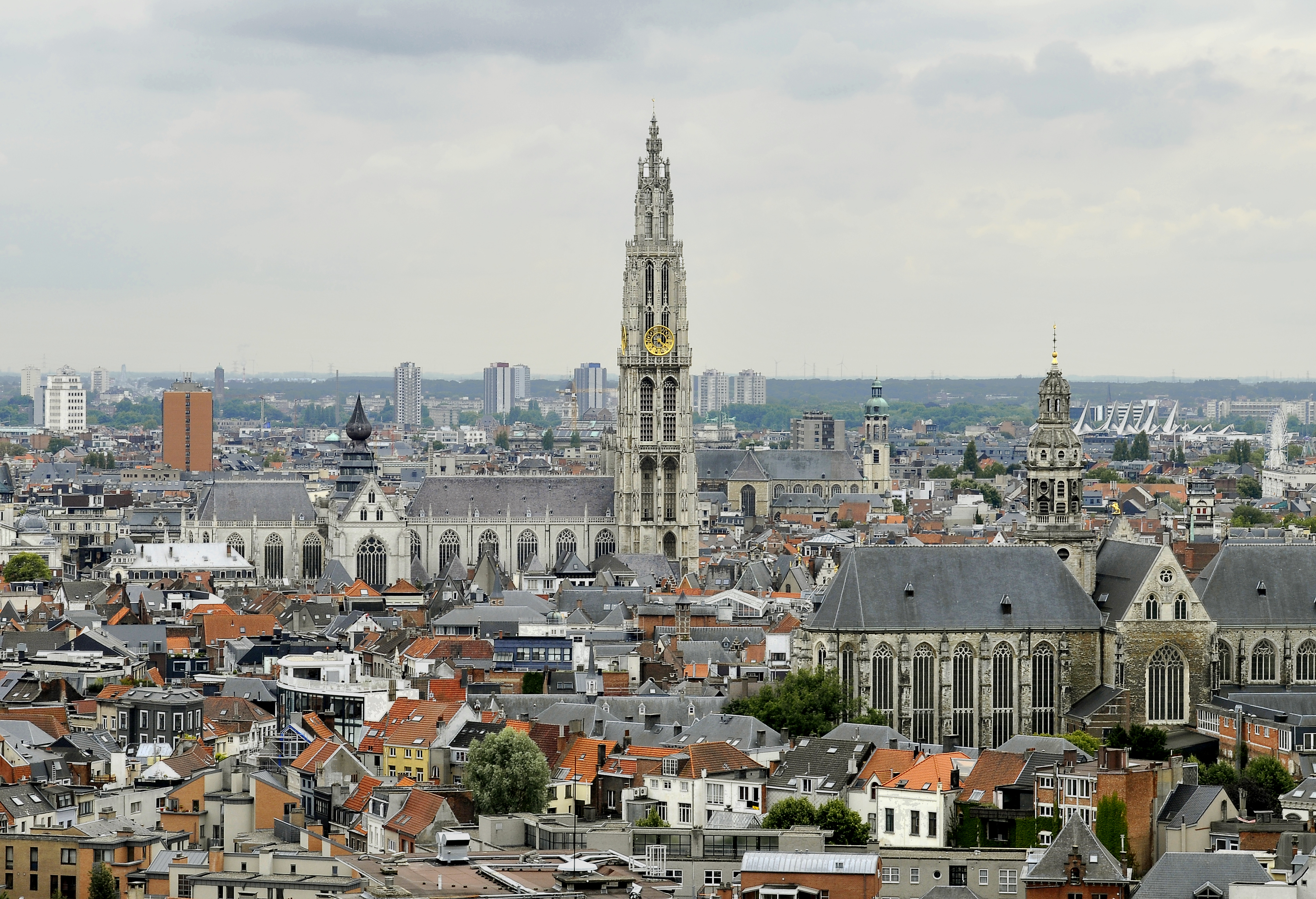
Antwerp (; nl, Antwerpen ; french: Anvers ; es, Amberes) is the largest city in Belgium by area at and the capital of Antwerp Province in the Flemish Region. With a population of 520,504,Statistics Belgium; ''Loop van de bevolking per gemeente'' (Excel file) Population of all municipalities in Belgium, . Retrieved 1 November 2017. it is the most populous municipality in Belgium, and with a metropolitan population of around 1,200,000 people, it is the second-largest metrop ... [...More Info...] [...Related Items...] OR: [Wikipedia] [Google] [Baidu] |
Nijmegen
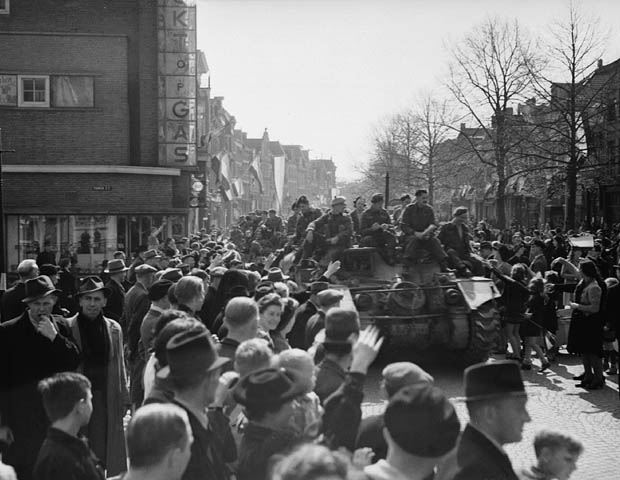
Nijmegen (;; Spanish and it, Nimega. Nijmeegs: ''Nimwèège'' ) is the largest city in the Dutch province of Gelderland and tenth largest of the Netherlands as a whole, located on the Waal river close to the German border. It is about 60 km south east of Utrecht and 50 km north east of Eindhoven. Nijmegen is the oldest city in the Netherlands, the second to be recognized as such in Roman times, and in 2005 celebrated 2,000 years of existence. Nijmegen became a free imperial city in 1230 and in 1402 a Hanseatic city. Since 1923 it has been a university city with the opening of a Catholic institution now known as the Radboud University Nijmegen. The city is well known for the International Four Days Marches Nijmegen event. Its population in 2022 was 179,000; the municipality is part of the Arnhem–Nijmegen metropolitan area, with 736,107 inhabitants in 2011. Population centres The municipality is formed by the city of Nijmegen, incorporating the former villages of Ha ... [...More Info...] [...Related Items...] OR: [Wikipedia] [Google] [Baidu] |
Leeuwarden
Leeuwarden (; fy, Ljouwert, longname=yes /; Town Frisian: ''Liwwadden''; Leeuwarder dialect: ''Leewarden'') is a city and municipality in Friesland, Netherlands, with a population of 123,107 (2019). It is the provincial capital and seat of the Provincial Council of Friesland. It is located about 50 km west of Groningen and 110 km north east from the Dutch capital Amsterdam (as the crow flies). The region has been continuously inhabited since the 10th century. It came to be known as Leeuwarden in the early 9th century AD and was granted city privileges in 1435. It is the main economic hub of Friesland, situated in a green and water-rich environment. Leeuwarden is a former royal residence and has a historic city centre, many historically relevant buildings, and a large shopping centre with squares and restaurants. Leeuwarden was awarded the title European Capital of Culture for 2018. The Elfstedentocht (Eleven Cities Tour), an ice skating tour passing the eleven cities of Fri ... [...More Info...] [...Related Items...] OR: [Wikipedia] [Google] [Baidu] |
Heerenveen
Heerenveen (, fry, It Hearrenfean ) is a town and municipality in the province of Friesland (Fryslân), in the Northern Netherlands. In 2021, the town had a population of 29,790 (1 January) while the municipality had a population 50,859 (1 July). History The town was established in 1551 by three lords as a location for the purpose of digging peat which was used for fuel, hence the name (''heer'' is "lord", ''veen'' is "peat"). Heerenveen was not one of the traditional eleven cities in Friesland (Fryslân) as it did not have so-called city rights. However, it is now one of the larger municipalities of the province. The windmill ''Welgelegen'' or ''Tjepkema's Molen'' is the only survivor of seventeen which have stood in Heerenveen. Population centres Population as of 1 January 2018: Heerenveen (32,900), Akkrum (3406), Aldeboarn (1479), Bontebok (445), De Knipe (1470), Gersloot (280, together with Gersloot-Polder), Hoornsterzwaag (815), Jubbega (3510), Katlijk (630), Luinj ... [...More Info...] [...Related Items...] OR: [Wikipedia] [Google] [Baidu] |
Haarlem
Haarlem (; predecessor of ''Harlem'' in English) is a city and municipality in the Netherlands. It is the capital of the province of North Holland. Haarlem is situated at the northern edge of the Randstad, one of the most populated metropolitan areas in Europe; it is also part of the Amsterdam metropolitan area, being located about 15 km to the west of the core city of Amsterdam. Haarlem had a population of in . Haarlem was granted city status or '' stadsrechten'' in 1245, although the first city walls were not built until 1270. The modern city encompasses the former municipality of Schoten as well as parts that previously belonged to Bloemendaal and Heemstede. Apart from the city, the municipality of Haarlem also includes the western part of the village of Spaarndam. Newer sections of Spaarndam lie within the neighbouring municipality of Haarlemmermeer. Geography Haarlem is located on the river Spaarne, giving it its nickname 'Spaarnestad' (Spaarne city). It is situated a ... [...More Info...] [...Related Items...] OR: [Wikipedia] [Google] [Baidu] |


