|
William Calder (engineer)
William Calder, (31 July 1860 – 18 February 1928), engineer, was born at Lovell's Flat, Milton near Dunedin, New Zealand, only son of Arthur Calder and his wife Margaret Milne, née Strachan. Calder was educated in New Zealand (Milton local school and the Otago Boys' High School in Dunedin 1876-77), and then attended Otago University. He became a cadet in the Government Survey Department in October 1883 and after five years of practical training, he passed the authorized surveyors' examination with credit in July 1888, and was responsible for much road construction and exploration in the North and South islands of the Dominion.Calder, William (1860–1928) ''Australian Dictionary of Biography'', Online Edition Migration to Australia In 1888 he came to |
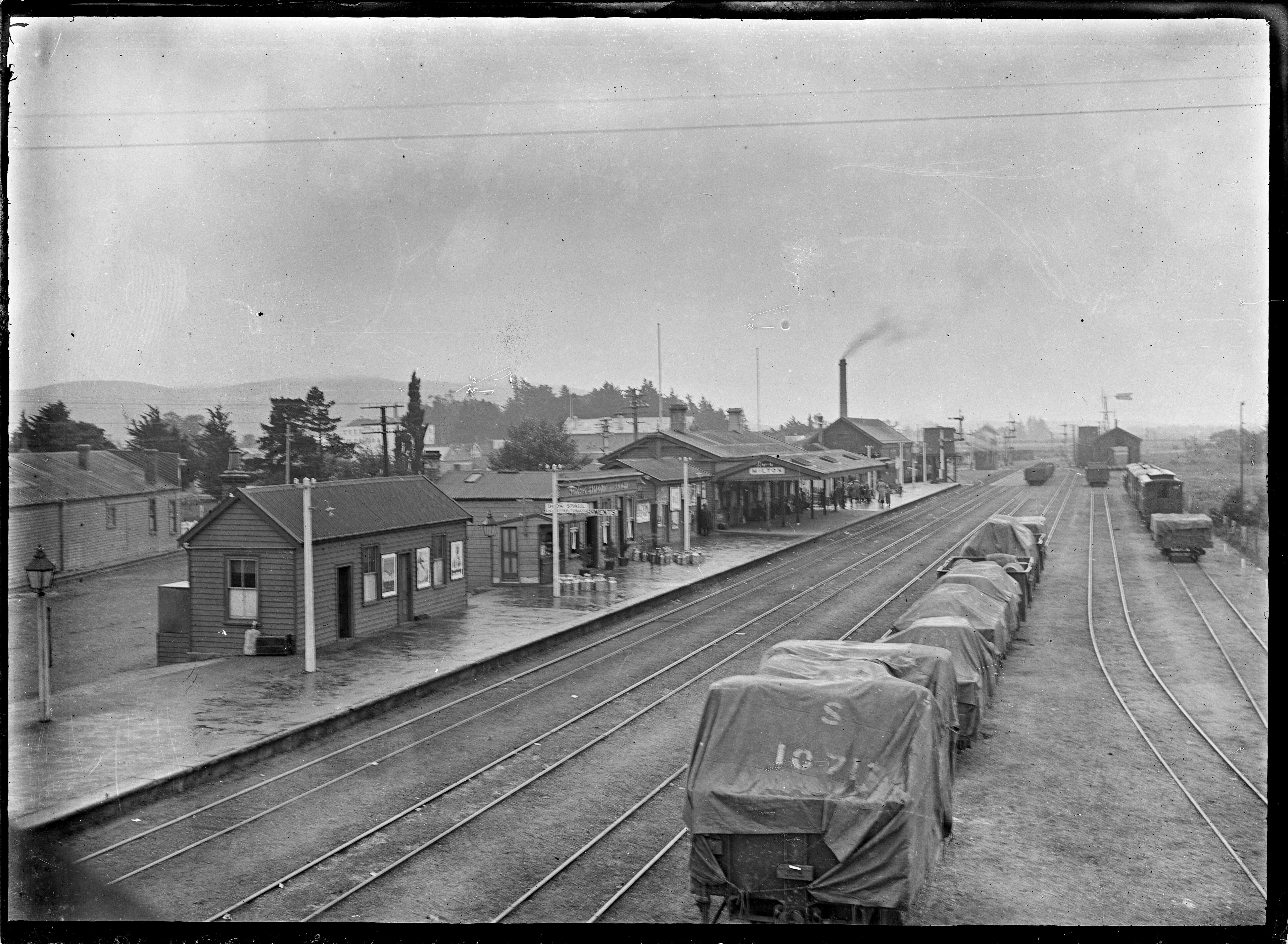
Milton, New Zealand
Milton, formerly known as Tokomairiro or Tokomairaro, is a town of over 2,000 people, located on State Highway 1, 50 kilometres to the south of Dunedin in Otago, New Zealand. It lies on the floodplain of the Tokomairaro River, one branch of which loops past the north and south ends of the town. This river gives its name to many local features, notably the town's only secondary school, Tokomairiro High School. Founded as a milling town in the 1850s, there has long been dispute as to the naming of the settlement. The town's streets are named for prominent British poets, and it is possible that the town's original intended name of Milltown became shortened by association with the poet of the same name. It is equally possible, however, that the name Milton inspired the choice of poets' names for the streets. History Milton's early history was strongly affected by the discovery of gold by Gabriel Read at Gabriel's Gully close to the nearby township of Lawrence. As Milton stood clo ... [...More Info...] [...Related Items...] OR: [Wikipedia] [Google] [Baidu] |
Geelong
Geelong ( ) (Wathawurrung: ''Djilang''/''Djalang'') is a port city in the southeastern Australian state of Victoria, located at the eastern end of Corio Bay (the smaller western portion of Port Phillip Bay) and the left bank of Barwon River, about southwest of Melbourne, the state capital of Victoria. Geelong is the second largest Victorian city (behind Melbourne) with an estimated urban population of 268,277 as of June 2018, Estimated resident population, 30 June 2018. and is also Australia's second fastest-growing city. Geelong is also known as the "Gateway City" due to its critical location to surrounding western Victorian regional centres like Ballarat in the northwest, Torquay, Great Ocean Road and Warrnambool in the southwest, Hamilton, Colac and Winchelsea to the west, providing a transport corridor past the Central Highlands for these regions to the state capital Melbourne in its northeast. The City of Greater Geelong is also a member of thGateway Cities Allian ... [...More Info...] [...Related Items...] OR: [Wikipedia] [Google] [Baidu] |
1860 Births
Year 186 ( CLXXXVI) was a common year starting on Saturday (link will display the full calendar) of the Julian calendar. At the time, it was known as the Year of the Consulship of Aurelius and Glabrio (or, less frequently, year 939 ''Ab urbe condita''). The denomination 186 for this year has been used since the early medieval period, when the Anno Domini calendar era became the prevalent method in Europe for naming years. Events By place Roman Empire * Peasants in Gaul stage an anti-tax uprising under Maternus. * Roman governor Pertinax escapes an assassination attempt, by British usurpers. New Zealand * The Hatepe volcanic eruption extends Lake Taupō and makes skies red across the world. However, recent radiocarbon dating by R. Sparks has put the date at 233 AD ± 13 (95% confidence). Births * Ma Liang, Chinese official of the Shu Han state (d. 222) Deaths * April 21 – Apollonius the Apologist, Christian martyr * Bian Zhang, Chinese official and ... [...More Info...] [...Related Items...] OR: [Wikipedia] [Google] [Baidu] |
Australian Dictionary Of Biography
The ''Australian Dictionary of Biography'' (ADB or AuDB) is a national co-operative enterprise founded and maintained by the Australian National University (ANU) to produce authoritative biographical articles on eminent people in Australia's history. Initially published in a series of twelve hard-copy volumes between 1966 and 2005, the dictionary has been published online since 2006 by the National Centre of Biography at ANU, which has also published ''Obituaries Australia'' (OA) since 2010. History The ADB project has been operating since 1957. Staff are located at the National Centre of Biography in the History Department of the Research School of Social Sciences at the Australian National University. Since its inception, 4,000 authors have contributed to the ADB and its published volumes contain 9,800 scholarly articles on 12,000 individuals. 210 of these are of Indigenous Australians, which has been explained by Bill Stanner's "cult of forgetfulness" theory around the co ... [...More Info...] [...Related Items...] OR: [Wikipedia] [Google] [Baidu] |
Victorian Historical Journal
The ''Victorian Historical Journal'' is a biannual peer-reviewed academic journal covering the history of the Australian state of Victoria. It is the "official journal of record and scholarly publication" of the Royal Historical Society of Victoria. The journal was first published in 1911 as the ''Victorian Historical Magazine'' and has a long-standing policy of encouraging well-researched papers by non-professional historians. Its early editions have many articles by Victorian pioneers who had first-hand experience of the events they describe from the formation of the colony and later state of Victoria. The early editions of the journal up to 1954 have been digitised and can be found on the State Library of Victoria's website. Past editors have included Judith Smart (RMIT), Richard Broome (La Trobe University La Trobe University is a public research university based in Melbourne, Victoria, Australia. Its main campus is located in the suburb of Bundoora. The university was ... [...More Info...] [...Related Items...] OR: [Wikipedia] [Google] [Baidu] |
Ringwood, Victoria
Ringwood is an eastern suburb of Melbourne, Victoria, Australia, east of Melbourne's Central Business District, located within the City of Maroondah local government area. Ringwood recorded a population of 19,144 at the 2021 census. Ringwood has many parks and reserves, most notably, Ringwood Lake. As of July 2012, the average house price in Ringwood was $583,500 and $390,000 for a unit. As of September 2019, the average sale price for a house in Ringwood was $866,000. For a unit, the average sale price was $533,000. The average weekly rent for a house was $435, and for a unit it was $370. History Ringwood village emerged in the mid to late 19th century, following the 1850s land sales. Before this, Ringwood was used primarily for agriculture. The post office opened on 2 August 1875, in the then rural area. In 1882, the construction of the Hawthorn to Lilydale railway through the suburb caused Ringwood to emerge as a more notable town. 1924 marked major growth for Ringwood. ... [...More Info...] [...Related Items...] OR: [Wikipedia] [Google] [Baidu] |
VicRoads
VicRoads is a government joint venture in the state of Victoria, Australia. In the state, it is responsible for driver licensing and vehicle registration. It is owned and operated through a joint venture between the Victorian government and a consortium made up of Aware Super, Australian Retirement Trust and Macquarie Asset Management. Before July 2019, it was the road and traffic authority in Victoria, responsible also for maintenance and construction of the arterial road network, and road safety policy and research. These functions were transferred or delegated to the Department of Transport on 1 July 2019. The main VicRoads administration is located in the Rialto Towers in Melbourne. There is also a regional administration office in Ballarat, which is now home to the VicRoads call centre. In addition VicRoads operates many offices servicing the public in registration and licensing throughout metropolitan Melbourne and regional Victoria. Governance In 1983, the Country Roa ... [...More Info...] [...Related Items...] OR: [Wikipedia] [Google] [Baidu] |
Tom Roberts
Thomas William Roberts (8 March 185614 September 1931) was an English-born Australian artist and a key member of the Heidelberg School art movement, also known as Australian impressionism. After studying in Melbourne, he travelled to Europe in 1881 to further his training, and returned home in 1885, "primed with whatever was the latest in art". A leading proponent of painting ''en plein air'', he joined Frederick McCubbin in founding the Box Hill artists' camp, the first of several ''plein air'' camps frequented by members of the Heidelberg School. He also encouraged other artists to capture the national life of Australia, and while he is best known today for his "national narratives"—among them ''Shearing the Rams'' (1890), '' A break away!'' (1891) and ''Bailed Up'' (1895)—he earned a living as a portraitist, and in 1903 completed the commissioned work '' The Big Picture'', the most famous visual representation of the first Australian Parliament. Life Roberts was born ... [...More Info...] [...Related Items...] OR: [Wikipedia] [Google] [Baidu] |
Moe, Victoria
Moe ( ) is a town in the Latrobe Valley in the Gippsland region of Victoria, Australia. It is approximately east of the central business district of Melbourne, due south of the peak of Mount Baw Baw in the Great Dividing Range and features views of the Baw Baw Ranges to the north and Strzelecki Ranges to the south. At June 2018, Moe had an estimated urban population of 16,812 Estimated resident population, 30 June 2018. (including Newborough). The population has been slowly shrinking with an average annual rate of -0.1% year-on-year for the five years to 2018. It is administered by the Latrobe City Council. Moe was originally known as ''The Mowie'', then ''Little Moi''. The town's name is believed to derive from a Kurnai (local Indigenous) word meaning "swamp land". Moe is a navigation point and stopover for tourists en route to Erica, the historic goldfields township of Walhalla, the Walhalla Goldfields Railway and Mount Baw Baw. Lake Narracan is nearby, and Moe is home t ... [...More Info...] [...Related Items...] OR: [Wikipedia] [Google] [Baidu] |
Frankston, Victoria
Frankston is a suburb in Melbourne, Victoria, Australia, south-east of Melbourne's Central Business District, located within the City of Frankston local government area. Frankston recorded a population of 37,331 at the 2021 census. Due to its geographic location north of the Mornington Peninsula, it is often referred to as "the gateway to the Mornington Peninsula". European settlement of Frankston began around the same time as the foundation of Melbourne in 1835—initially as an unofficial fishing village serving the early Melbourne township. Prior to its settlement, the Frankston area was primarily inhabited by the Mayone-bulluk clan from the Bunurong tribe of the Kulin nation. The official village of Frankston was established in 1854, with its first land sales taking place on 29 May. It has subsequently given its name to the broader Frankston local government area since 1893, and serves as both its activity and administrative centre. Situated on the eastern shoreline ... [...More Info...] [...Related Items...] OR: [Wikipedia] [Google] [Baidu] |
Drouin, Victoria
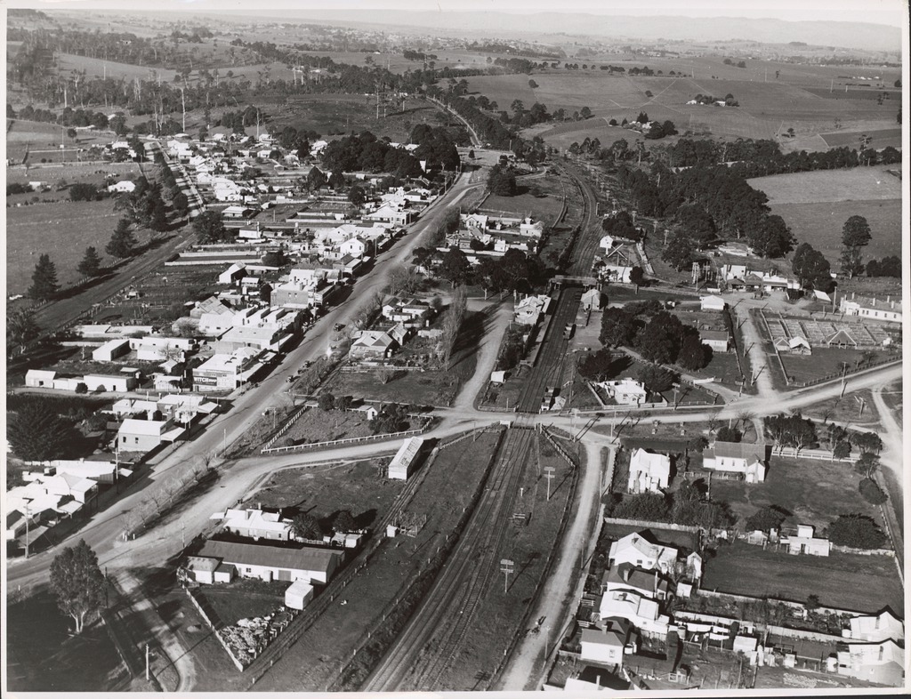
Drouin is a town in the West Gippsland region, east of Melbourne, in the Australian state of Victoria. Its local government area is the Shire of Baw Baw, and is home to the shire council’s headquarters despite being the second-largest town in the shire, behind neighbouring Warragul. The town’s name is believed to be an Aboriginal word meaning "north wind". New housing developments have accelerated the town's residential growth in recent years. As at the , Drouin had a population of people. History Settlement in this part of Gippsland was rather delayed due to the dense forest. Pastoral runs were taken up but little developed. In 1867, a coaching station was established on the track into Gippsland at Brandy Creek, about north-east of present Drouin. By the early 1870s, a small settlement had developed and land was being selected in the area. A post office opened on 5 April 1876, later renamed to Jindivick in 1878. Between 1877 and 1879, the Gippsland railway line was co ... [...More Info...] [...Related Items...] OR: [Wikipedia] [Google] [Baidu] |
Princes Highway
Princes Highway is a major road in Australia, extending from Sydney via Melbourne to Adelaide through the states of New South Wales, Victoria (Australia), Victoria and South Australia. It has a length of (along Highway 1) or via the former alignments of the highway, although these routes are slower and connections to the bypassed sections of the original route are poor in many cases. The highway follows the coastline for most of its length, and thus takes quite an indirect and lengthy route. For example, it is from Sydney to Melbourne on Highway 1 (Australia), Highway 1 as opposed to on the more direct Hume Highway (National Highway (Australia), National Highway 31), and from Melbourne to Adelaide compared to on the Western Highway, Victoria, Western and Dukes Highways (National Highway (Australia), National Highway 8). Because of the rural nature and lower traffic volumes over much of its length, Princes Highway is a more scenic and leisurely route than the main highwa ... [...More Info...] [...Related Items...] OR: [Wikipedia] [Google] [Baidu] |


