|
Whitefish Lake (Thunder Bay District)
Whitefish Lake is located in the Thunder Bay District in Northwestern Ontario, Canada, near the village of Nolalu. The lake contains walleye, pike, and small mouth bass but is noted for its perch fishing. The average depth of Whitefish Lake is seven feet. Access to the lake is a public launch located on Highway 588 and many independent tourist resorts. Whitefish Lake is and has a maximum depth of .Surveys and Mapping Branch, Department of Energy, Mines and Natural Resources, Kakabeka Falls, Topographical map,1:50,000 series The lake drains into Lake Superior Lake Superior in central North America is the largest freshwater lake in the world by surface areaThe Caspian Sea is the largest lake, but is saline, not freshwater. and the third-largest by volume, holding 10% of the world's surface fresh wa ... via the Little Whitefish River. References Lakes of Thunder Bay District {{NorthernOntario-geo-stub ... [...More Info...] [...Related Items...] OR: [Wikipedia] [Google] [Baidu] |
Thunder Bay District
Thunder Bay District is a district and census division in Northwestern Ontario in the Canadian province of Ontario. The district seat is Thunder Bay. In 2016, the population was 146,048. The land area is ; the population density was . Most of the district (93.5%) is unincorporated and part of the Unorganized Thunder Bay District. History Thunder Bay District was created in 1871 by provincial statute from the western half of Algoma District, named after a large bay on the north shore of Lake Superior. Its northern and western boundaries were uncertain until Ontario's right to Northwestern Ontario was determined by the Judicial Committee of the Privy Council. Until about 1902 it was often called Algoma West from the name of the provincial constituency established in 1885. The following districts include areas that were formerly part of Thunder Bay District: * Rainy River, created in 1885 * Kenora, created in 1907 from Rainy River District * Cochrane, created in 1921 Subdivisio ... [...More Info...] [...Related Items...] OR: [Wikipedia] [Google] [Baidu] |
Northwestern Ontario
Northwestern Ontario is a secondary region of Northern Ontario in the Canadian province of Ontario which lies north and west of Lake Superior and west of Hudson Bay and James Bay. It includes most of subarctic Ontario. Its western boundary is the Canadian province of Manitoba, which disputed Ontario's claim to the western part of the region. Ontario's right to Northwestern Ontario was determined by the Judicial Committee of the Privy Council in 1884ONTARIO-MANITOBA BOUNDARY CASE and confirmed by the Canada (Ontario Boundary) Act, 1889, of the Parliament of the United Kingdom. In 1912, the Parliament of Canada by the ''Ontario Boundaries Extension Act'' gave jurisdiction over the District of Patricia to Ontario, thereby extending the northern boundary of the province to Hudson Bay. For some purposes, Northwestern Ontario and Northeastern Ontario are treated as separate regions, while for other purposes they are grouped together as Northern Ontario. Geographic subdivisions Northwe ... [...More Info...] [...Related Items...] OR: [Wikipedia] [Google] [Baidu] |
Northern Ontario
Northern Ontario is a primary geographic and quasi-administrative region of the Canadian province of Ontario, the other primary region being Southern Ontario. Most of the core geographic region is located on part of the Superior Geological Province of the Canadian Shield, a vast rocky plateau located mainly north of Lake Huron (including Georgian Bay), the French River, Lake Nipissing, and the Mattawa River. The statistical region extends south of the Mattawa River to include all of the District of Nipissing. The southern section of this district lies on part of the Grenville Geological Province of the Shield which occupies the transitional area between Northern and Southern Ontario. The extended federal and provincial quasi-administrative regions of Northern Ontario have their own boundaries even further south in the transitional area that vary according to their respective government policies and requirements. Ontario government departments and agencies such as the Growth Pl ... [...More Info...] [...Related Items...] OR: [Wikipedia] [Google] [Baidu] |
Canada
Canada is a country in North America. Its ten provinces and three territories extend from the Atlantic Ocean to the Pacific Ocean and northward into the Arctic Ocean, covering over , making it the world's second-largest country by total area. Its southern and western border with the United States, stretching , is the world's longest binational land border. Canada's capital is Ottawa, and its three largest metropolitan areas are Toronto, Montreal, and Vancouver. Indigenous peoples have continuously inhabited what is now Canada for thousands of years. Beginning in the 16th century, British and French expeditions explored and later settled along the Atlantic coast. As a consequence of various armed conflicts, France ceded nearly all of its colonies in North America in 1763. In 1867, with the union of three British North American colonies through Confederation, Canada was formed as a federal dominion of four provinces. This began an accretion of provinces an ... [...More Info...] [...Related Items...] OR: [Wikipedia] [Google] [Baidu] |
Lake
A lake is an area filled with water, localized in a basin, surrounded by land, and distinct from any river or other outlet that serves to feed or drain the lake. Lakes lie on land and are not part of the ocean, although, like the much larger oceans, they do form part of the Earth's water cycle. Lakes are distinct from lagoons, which are generally coastal parts of the ocean. Lakes are typically larger and deeper than ponds, which also lie on land, though there are no official or scientific definitions. Lakes can be contrasted with rivers or streams, which usually flow in a channel on land. Most lakes are fed and drained by rivers and streams. Natural lakes are generally found in mountainous areas, rift zones, and areas with ongoing glaciation. Other lakes are found in endorheic basins or along the courses of mature rivers, where a river channel has widened into a basin. Some parts of the world have many lakes formed by the chaotic drainage patterns left over from the la ... [...More Info...] [...Related Items...] OR: [Wikipedia] [Google] [Baidu] |
Nolalu
The Whitefish River Valley is located in the unorganized area of Thunder Bay District, Ontario, and is named for the Whitefish River that flows through it. The valley is home to several small communities that developed when land was opened for homesteading along the Port Arthur, Duluth and Western Railway line at the turn of the 20th century and many people, particularly those from Finland, settled in the area.Port Arthur, Duluth and Western Railway Retrieved November 30, 2008 Today it has a population of approximately 1,362.Archive of Nolalu profile at Broadband Canada Retrieved on November 30, 200 ... [...More Info...] [...Related Items...] OR: [Wikipedia] [Google] [Baidu] |
Walleye
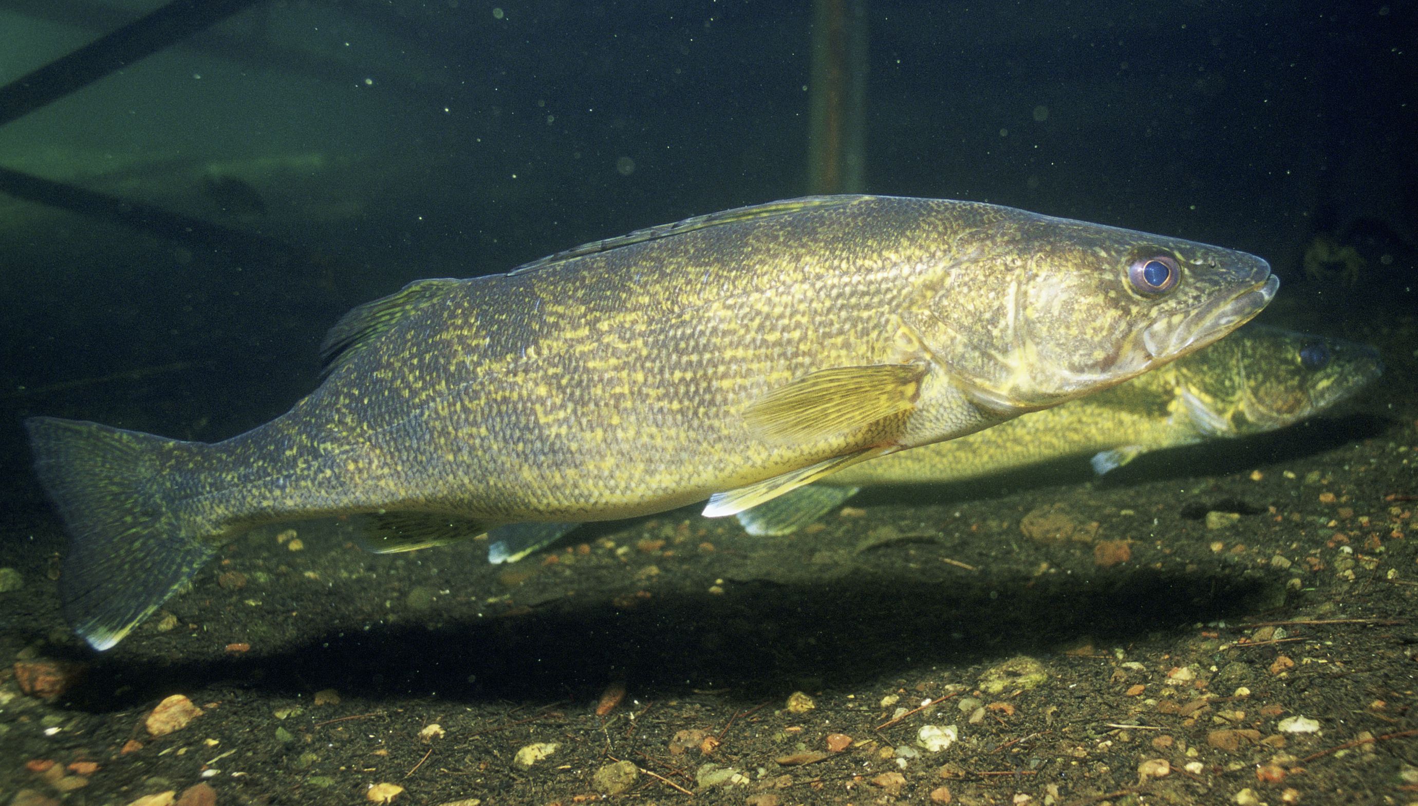
The walleye (''Sander vitreus'', synonym ''Stizostedion vitreum''), also called the yellow pike or yellow pickerel, is a freshwater perciform fish native to most of Canada and to the Northern United States. It is a North American close relative of the European zander, also known as the pikeperch. The walleye is sometimes called the yellow walleye to distinguish it from the blue walleye, which is a color morph that was once found in the southern Ontario and Quebec regions, but is now presumed extinct. However, recent genetic analysis of a preserved (frozen) 'blue walleye' sample suggests that the blue and yellow walleye were simply phenotypes within the same species and do not merit separate taxonomic classification. In parts of its range in English-speaking Canada, the walleye is known as a pickerel, though the fish is not related to the true pickerels, which are members of the family ''Esocidae''. Walleyes show a fair amount of variation across watersheds. In general, fis ... [...More Info...] [...Related Items...] OR: [Wikipedia] [Google] [Baidu] |
Esox
''Esox'' is a genus of freshwater fish commonly known as pike or pickerel. It is the type genus of the family Esocidae. The type species of the genus is ''Esox lucius'', the northern pike. ''Esox'' has been present in Laurentia (which later became North America) and Eurasia since the Paleocene. Modern large pike species are native to the Palearctic and Nearctic realms, ranging across Northern America and from Western Europe to Siberia in North Asia. Pikes have the elongated, torpedo-like shape typical of predatory fishes, with sharply pointed heads and sharp teeth. Their coloration is typically grey-green with a mottled or spotted appearance with stripes along their backs, providing camouflage among underwater weeds, and each individual pike marking patterns are unique like fingerprints. Pikes can grow to a maximum recorded length of , reaching a maximum recorded weight of . Etymology The generic name ''Esox'' (pike fish) derives from the Greek ἴσοξ (''ee-soks'', a ... [...More Info...] [...Related Items...] OR: [Wikipedia] [Google] [Baidu] |
Perch
Perch is a common name for fish of the genus ''Perca'', freshwater gamefish belonging to the family Percidae. The perch, of which three species occur in different geographical areas, lend their name to a large order of vertebrates: the Perciformes, from the el, πέρκη (), simply meaning perch, and the Latin ''forma'' meaning shape. Many species of freshwater gamefish more or less resemble perch, but belong to different genera. In fact, the exclusively saltwater-dwelling red drum is often referred to as a red perch, though by definition perch are freshwater fish. Though many fish are referred to as perch as a common name, to be considered a true perch, the fish must be of the family Percidae. The type species for this genus is the European perch, ''P. fluviatilis''. Species Most authorities recognize three species within the perch genus: * The European perch (''P. fluviatilis'') is primarily found in Europe, but a few can also be found in South Africa, and even as far ea ... [...More Info...] [...Related Items...] OR: [Wikipedia] [Google] [Baidu] |
Highway 588 (Ontario)
This is a list of secondary highways in Thunder Bay District, most of which serve as logging roads or provide access to the isolated and sparsely populated areas in the Thunder Bay District of northern Ontario. Highway 527 Secondary Highway 527, commonly referred to as Highway 527 is a provincial maintained secondary highway in the Canadian province of Ontario. It is one of the longest secondary highways in the province; only Highway 599 is longer. Highway 527 spans a distance of from a junction with Highway 11 and Highway 17, the Trans-Canada Highway, in the community of Shuniah just outside Thunder Bay, to the small, remote community of Armstrong and neighbouring Whitesand Indian Reserve. The Gull Bay First Nation occupies one of the few permanent settlements on Highway 527, Gull Bay Reserve, situated on the western shore of Lake Nipigon about 70 kilometres south of Armstrong. The highway also passes the start of Highway 811 along its route. H ... [...More Info...] [...Related Items...] OR: [Wikipedia] [Google] [Baidu] |
Lake Superior
Lake Superior in central North America is the largest freshwater lake in the world by surface areaThe Caspian Sea is the largest lake, but is saline, not freshwater. and the third-largest by volume, holding 10% of the world's surface fresh water. The northern and westernmost of the Great Lakes of North America, it straddles the Canada–United States border with the province of Ontario to the north and east, and the states of Minnesota to the northwest and Wisconsin and Michigan to the south. It drains into Lake Huron via St. Marys River, then through the lower Great Lakes to the St. Lawrence River and the Atlantic Ocean. Name The Ojibwe name for the lake is ''gichi-gami'' (in syllabics: , pronounced ''gitchi-gami'' or ''kitchi-gami'' in different dialects), meaning "great sea". Henry Wadsworth Longfellow wrote this name as "Gitche Gumee" in the poem ''The Song of Hiawatha'', as did Gordon Lightfoot in his song " The Wreck of the ''Edmund Fitzgerald''". According to oth ... [...More Info...] [...Related Items...] OR: [Wikipedia] [Google] [Baidu] |

.jpg)


.png)

