|
Weisdale
Weisdale is a bay, hamlet and ancient parish on Mainland in Shetland, Scotland. The bay opens near the northern extremity of Scalloway Bay, and strikes four and a half miles to the north north east. The hamlet lies at the bay's head, about twelve miles north west of Lerwick. History Weisdale was the scene of a series of evictions of crofters in favour of large scale sheep farming in the 19th century. Approximately three hundred and eighteen crofters were evicted from the Weisdale valley in what is described as the clearances. Local author John J. Graham wrote two novels on this theme. Sites of Interest * Weisdale Voe - a lovely and long stretch of water containing small isles ( Greena, Flotta, Hoy, North Havra, Junk, Hoggs of Hoy and Hildasay). The head is a good place to see wading birds. * Weisdale Valley - a beautiful stretch of land including the Weisdale Mill, Kergord Woods & Kergord House that are detailed below. The remains of some of the houses that were targeted durin ... [...More Info...] [...Related Items...] OR: [Wikipedia] [Google] [Baidu] |
Weisdale Mill
Weisdale Mill is a watermill in the village of Weisdale, Shetland, Scotland. It is located near the head of Weisdale Voe on the west of the island, a twenty-minute drive from the main town of Lerwick. History Weisdale Mill was built in 1855 and was Shetland's largest corn mill A gristmill (also: grist mill, corn mill, flour mill, feed mill or feedmill) grinds cereal grain into flour and middlings. The term can refer to either the grinding mechanism or the building that holds it. Grist is grain that has been separated .... The Weisdale Mill was a busy working mill for many years until the early 1930s. Crofters and farmers came from some considerable distance to get their oats and corn ground into meal and flour. With very little in the way of transport people walked long distances with their crops which then had to be left at the mill and collected at a later date. Some crofters came up the Weidale Voe by boat as far as they could and then walked the short distance to the mi ... [...More Info...] [...Related Items...] OR: [Wikipedia] [Google] [Baidu] |
Greena
Greena is a small island off the west coast of Mainland, Shetland. It is 10m at its highest point, and is north of Flotta, Shetland. It is in Weisdale Voe Weisdale is a bay, hamlet and ancient parish on Mainland in Shetland, Scotland. The bay opens near the northern extremity of Scalloway Bay, and strikes four and a half miles to the north north east. The hamlet lies at the bay's head, about twelv .... References * Venables, Ursula & Llewellyn, ''Tempestuous Eden'', Museum Press, London 1952. Uninhabited islands of Shetland {{Shetland-geo-stub ... [...More Info...] [...Related Items...] OR: [Wikipedia] [Google] [Baidu] |
Shetland
Shetland, also called the Shetland Islands and formerly Zetland, is a subarctic archipelago in Scotland lying between Orkney, the Faroe Islands and Norway. It is the northernmost region of the United Kingdom. The islands lie about to the northeast of Orkney, from mainland Scotland and west of Norway. They form part of the border between the Atlantic Ocean to the west and the North Sea to the east. Their total area is ,Shetland Islands Council (2012) p. 4 and the population totalled 22,920 in 2019. The islands comprise the Shetland (Scottish Parliament constituency), Shetland constituency of the Scottish Parliament. The local authority, the Shetland Islands Council, is one of the 32 council areas of Scotland. The islands' administrative centre and only burgh is Lerwick, which has been the capital of Shetland since 1708, before which time the capital was Scalloway. The archipelago has an oceanic climate, complex geology, rugged coastline, and many low, rolling hills. The lar ... [...More Info...] [...Related Items...] OR: [Wikipedia] [Google] [Baidu] |
Shetland Bus
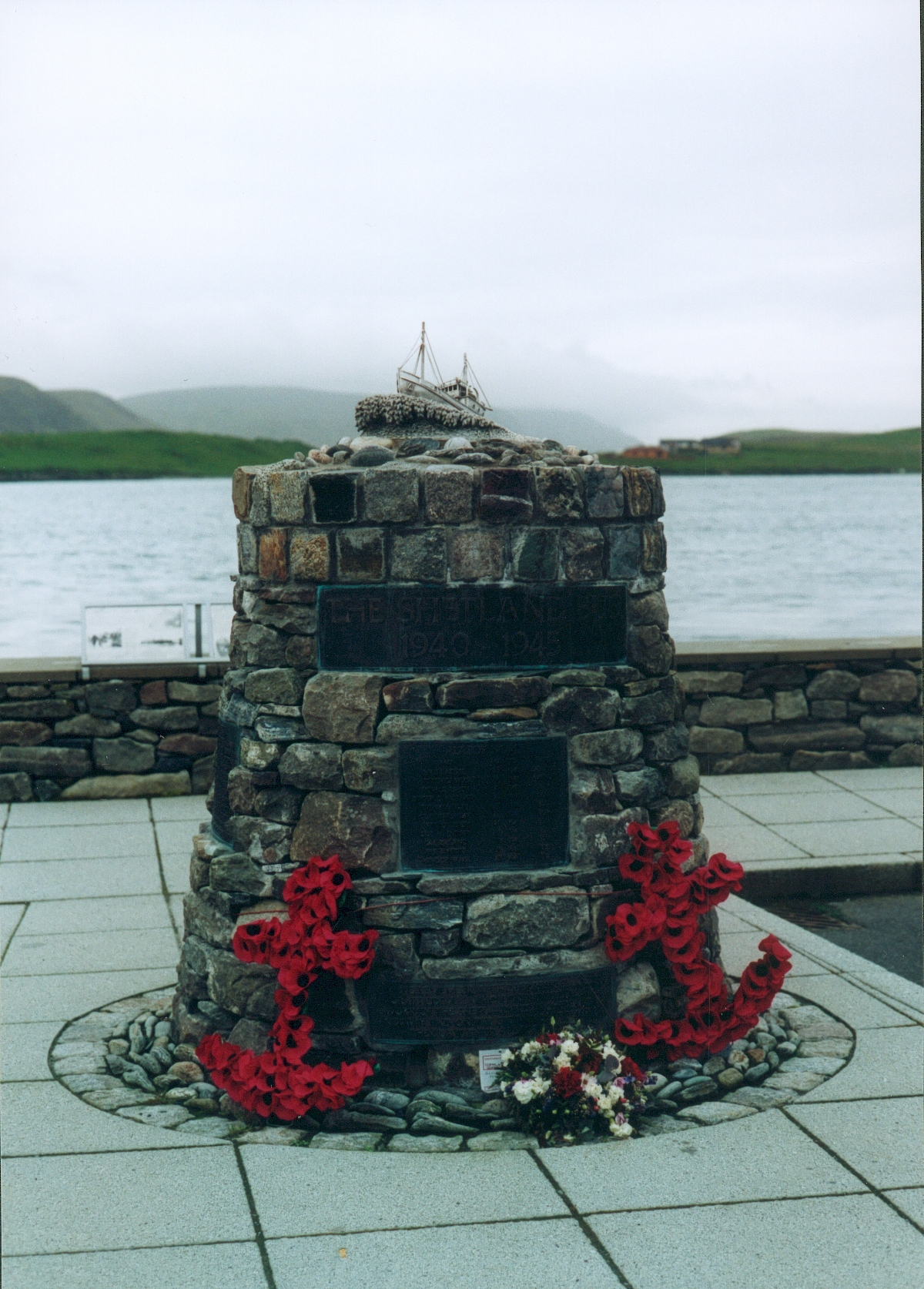
The Shetland Bus (Norwegian Bokmål: ''Shetlandsbussene'', def. pl.) was the nickname of a clandestine special operations group that made a permanent link between Mainland Shetland in Scotland and German-occupied Norway from 1941 until the surrender of Nazi Germany on 8 May 1945. From mid-1942, the group's official name was the Norwegian Naval Independent Unit (NNIU). In October 1943, it became an official part of the Royal Norwegian Navy and was renamed the Royal Norwegian Naval Special Unit (RNNSU). The unit was operated initially by a large number of small fishing boats and later augmented by three fast and well-armed submarine chasers – , and . Crossings were mostly made during the winter under the cover of darkness. This meant the crews and passengers had to endure very heavy North Sea conditions, with no lights and constant risk of discovery by German aircraft or patrol boats. There was also the possibility of being captured whilst carrying out the mission on the Norw ... [...More Info...] [...Related Items...] OR: [Wikipedia] [Google] [Baidu] |
Orkney And Shetland (UK Parliament Constituency)
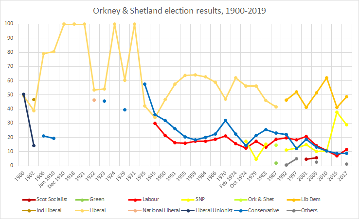
Orkney and Shetland is a constituency of the House of Commons of the Parliament of the United Kingdom. It elects one Member of Parliament (MP) by the first past the post system of election. In the Scottish Parliament, Orkney and Shetland are separate constituencies. The constituency was historically known as Orkney and Zetland (an alternative name for Shetland). In the 2014 Scottish independence referendum, 65.4% of the constituency's electors voted for Scotland to stay part of the United Kingdom. Creation The British parliamentary constituency was created in 1708 following the Acts of Union, 1707 and replaced the former Parliament of Scotland shire constituency of Orkney & Zetland. Boundaries The constituency is made up of the two northernmost island groups of Scotland, Orkney and Shetland. A constituency of this name has existed continuously since 1708. However, before 1918 the town of Kirkwall (the capital of Orkney) formed part of the Northern Burghs constituency. It i ... [...More Info...] [...Related Items...] OR: [Wikipedia] [Google] [Baidu] |
Tingwall, Shetland
Tingwall, ( non, Þingvǫllr = Field of the Thing assembly) is a parish in Shetland, Scotland. Located mostly on the Shetland Mainland, the centre lies about 2 miles north of Scalloway. Tingwall Airport is located in the village. Parish Tingwall parish includes the settlements of Scalloway, Whiteness, Veensgarth and Gott, and the Vallafield housing estate. The centre of the parish was the Tingwall Kirk. It comprehends a section of Mainland, stretching from the Atlantic at Scalloway, to the North Sea at Rova Head and includes the formerly inhabited islands of Hildasay, Langa, Linga, Papa and Oxna. The Mainland section is divided into two districts by a hill ridge, and comprises two parallel valleys (nearly at right angles from the ridge). The Tingwall valley extends north from near Scalloway to the south end of Lax Firth. It is diversified by the lochs of Tingwall, Girlsta, Asta, Strom and some others. It is so indented by the sea as to contain no point farther than from ... [...More Info...] [...Related Items...] OR: [Wikipedia] [Google] [Baidu] |
Shetland (Scottish Parliament Constituency)
Shetland is a constituency of the Scottish Parliament ( Holyrood) covering the council area of Shetland. It elects one Member of the Scottish Parliament (MSP) by the first past the post method of election. It is also one of eight constituencies in the Highlands and Islands electoral region, which elects seven additional members, in addition to the eight constituency MSPs, to produce a form of proportional representation for the region as a whole. Shetland has been held by the Liberal Democrats at all elections since the formation of the Scottish Parliament in 1999, with the current MSP being Beatrice Wishart, who won the seat at a 2019 by-election held following the resignation of former party leader Tavish Scott. Electoral region Shetland is part of the Highlands and Islands electoral region; the other seven constituencies of are Argyll and Bute, Caithness, Sutherland and Ross, Inverness and Nairn, Moray, Na h-Eileanan an Iar, Orkney and Skye, Lochaber and Badenoch ... [...More Info...] [...Related Items...] OR: [Wikipedia] [Google] [Baidu] |
Mainland, Shetland
The Mainland is the main island of Shetland, Scotland. The island contains Shetland's only burgh, Lerwick, and is the centre of Shetland's ferry and air connections. Geography It has an area of , making it the third-largest Scottish island and the fifth largest of the British Isles after Great Britain, Ireland, Lewis and Harris and Skye. Mainland is the second most populous of the Scottish islands (only surpassed by Lewis and Harris), and had 18,765 residents in 2011 compared to 17,550 in 2001. The mainland can be broadly divided into four sections: *The long southern peninsula, south of Lerwick, has a mixture of moorland and farmland and contains many important archaeological sites. **Bigton, Cunningsburgh, Sandwick, Scalloway, and Sumburgh *The Central Mainland has more farmland and some woodland plantations. *The West Mainland **Aith, Walls, and Sandness *The North Mainland – in particular the large Northmavine peninsula, connected to Mainland by a narrow isthmus at ... [...More Info...] [...Related Items...] OR: [Wikipedia] [Google] [Baidu] |
Scalloway
Scalloway ( non, Skálavágr, "bay with the large house(s)") is the largest settlement on the west coast of the Mainland, the largest island of the Shetland Islands, Scotland. The village had a population of roughly 900, at the 2011 census. Now a fishing port, until 1708 it was the capital of the Shetland Islands (now Lerwick, on the east coast of the Shetland Mainland). It contains one of the two castles built in Shetland; this one was constructed in 1600. Scalloway is the location of the North Atlantic Fisheries College (part of the University of the Highlands and Islands), which offers courses and supports research programmes in fisheries sciences, aquaculture, marine engineering and coastal management. It is also home to the Centre for Nordic Studies. NAFC Marine Centre at Ness of Westshore offers courses in "nautical studies, marine science and technology, and seafood quality". Nearby are the Scalloway Islands, which derive their name from the village. The village has a ... [...More Info...] [...Related Items...] OR: [Wikipedia] [Google] [Baidu] |
Lerwick
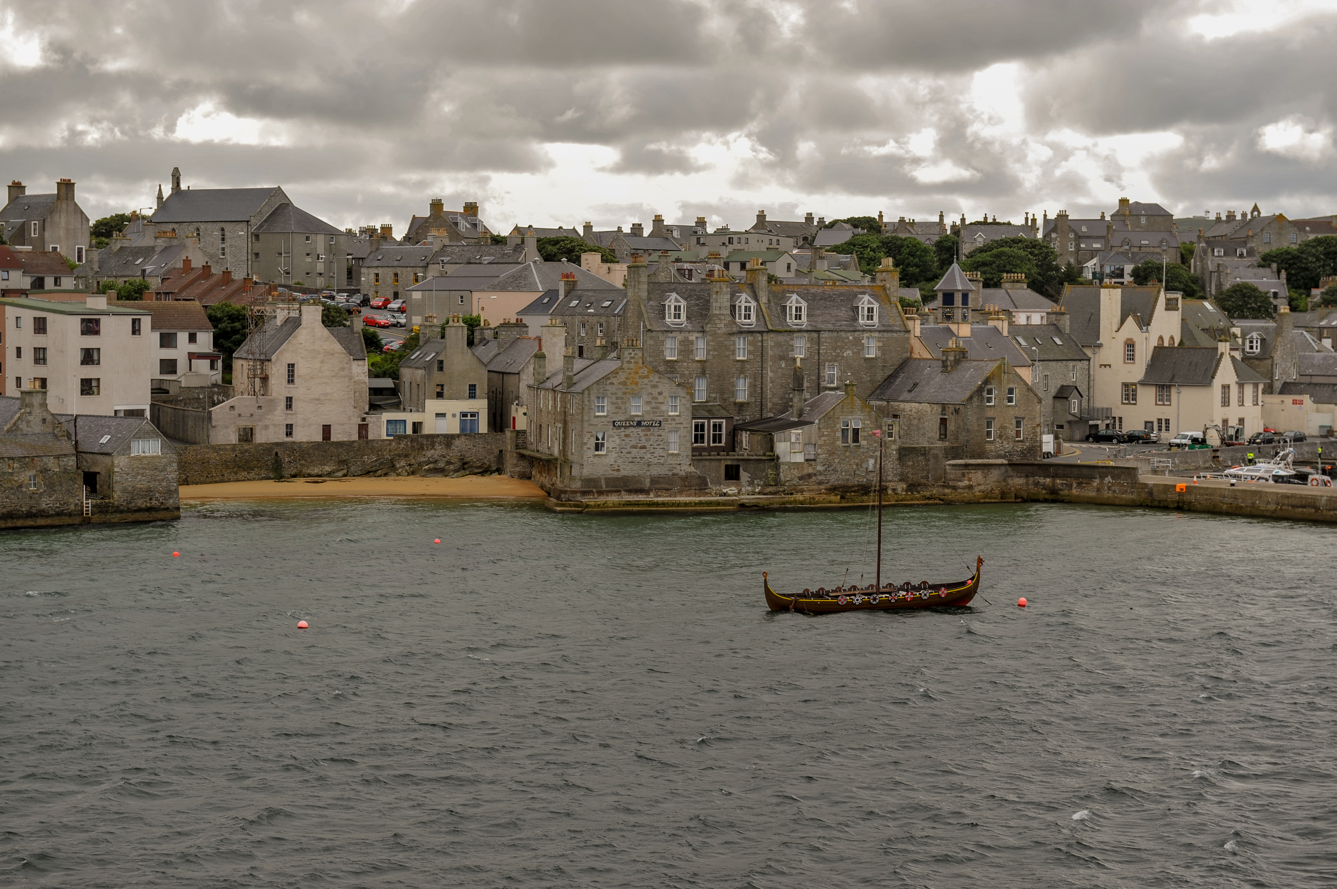
Lerwick (; non, Leirvik; nrn, Larvik) is the main town and port of the Shetland archipelago, Scotland. Shetland's only burgh, Lerwick had a population of about 7,000 residents in 2010. Centred off the north coast of the Scottish mainland and on the east coast of the Shetland Mainland, Lerwick lies north-by-northeast of Aberdeen; west of the similarly sheltered port of Bergen in Norway; and south east of Tórshavn in the Faroe Islands. One of the UK's coastal weather stations is situated there, with the local climate having small seasonal variation due to the maritime influence. Being located further north than Saint Petersburg and the three mainland Nordic capitals, Lerwick's nights in the middle of summer only get dark twilight and winters have below six hours of complete daylight. History Lerwick is a name with roots in Old Norse and its local descendant, Norn, which was spoken in Shetland until the mid-19th century. The name "Lerwick" means ''bay of clay''. The c ... [...More Info...] [...Related Items...] OR: [Wikipedia] [Google] [Baidu] |
Highland Clearances
The Highland Clearances ( gd, Fuadaichean nan Gàidheal , the "eviction of the Gaels") were the evictions of a significant number of tenants in the Scottish Highlands and Islands, mostly in two phases from 1750 to 1860. The first phase resulted from agricultural improvement, driven by the need for landlords to increase their income – many had substantial debts, with actual or potential bankruptcy being a large part of the story of the clearances. This involved the enclosure of the open fields managed on the run rig system and shared grazing. These were usually replaced with large-scale pastoral farms on which much higher rents were paid. The displaced tenants were expected to be employed in industries such as fishing, quarrying or the kelp industry. Their reduction in status from farmer to crofter was one of the causes of resentment. The second phase involved overcrowded crofting communities from the first phase that had lost the means to support themselves, through famine ... [...More Info...] [...Related Items...] OR: [Wikipedia] [Google] [Baidu] |
Flotta
Flotta () is a small island in Orkney, Scotland, lying in Scapa Flow. The island is known for its large oil terminal and is linked by Orkney Ferries to Houton on the Orkney Mainland, Lyness on Hoy and Longhope on South Walls. The island has a population of 80. History At the turn of the 20th century, the island was a quiet rural community like many other small islands of Orkney, but its sheltered location led to three major upheavals in the island in the century. Until 1914, Flotta was a quiet farming community. In 1910, a population of 431 included two blacksmiths, four carpenters and three dressmakers. World Wars Everything changed with the arrival of the Royal Navy in Scapa Flow at the start of the First World War. There is a photograph held by the Imperial War Museum in London that shows a boxing match taking place on Flotta in front of a wartime audience of 10,000 people. During the First World War, the island was home to a naval base. The dreadnought HMS ''Vanguar ... [...More Info...] [...Related Items...] OR: [Wikipedia] [Google] [Baidu] |


.jpg)