|
Warrington Corporation Tramways
Warrington Corporation Tramways was the owner and operator of an electric tramway system in the early 20th century serving the town of Warrington, at the time a county borough of Lancashire, England. History Construction The town of Warrington was already well served by railways, canals and turnpike roads when in 1880, Gillham & Wiseman 2003, p.4–5 a private company approached Warrington Corporation about the possibility of laying a horse tramway within the town. After an investigation into existing horse tramways in operation in Bristol and Hull, the corporation declined the offer, not wanting outsiders making a profit from the residents. It was not until the construction of a power generating station at Howley in 1900 that the corporation was encouraged to apply to Parliament for powers to lay down and operate an electric tramway system along the five main arterial roads within the town boundary. Phillips 2002, p.4 This was granted as the Tramways Orders Confirmation (No. ... [...More Info...] [...Related Items...] OR: [Wikipedia] [Google] [Baidu] |
England
England is a country that is part of the United Kingdom. It shares land borders with Wales to its west and Scotland to its north. The Irish Sea lies northwest and the Celtic Sea to the southwest. It is separated from continental Europe by the North Sea to the east and the English Channel to the south. The country covers five-eighths of the island of Great Britain, which lies in the North Atlantic, and includes over 100 smaller islands, such as the Isles of Scilly and the Isle of Wight. The area now called England was first inhabited by modern humans during the Upper Paleolithic period, but takes its name from the Angles, a Germanic tribe deriving its name from the Anglia peninsula, who settled during the 5th and 6th centuries. England became a unified state in the 10th century and has had a significant cultural and legal impact on the wider world since the Age of Discovery, which began during the 15th century. The English language, the Anglican Church, and Engli ... [...More Info...] [...Related Items...] OR: [Wikipedia] [Google] [Baidu] |
Sankey Bridges
Sankey Bridges is part of the Parish of Holy Trinity in Warrington, a unitary authority in the north-west of England. Located on the turnpike road between Warrington, Prescot and Liverpool over the Sankey Brook, which was the boundary of Great Sankey and The County Borough of Warrington, it became home to many industries after the opening of the Sankey Canal, the first wholly artificial canal built in England during the Industrial Revolution. When opened, the canal entered the River Mersey through a set of locks Lock(s) may refer to: Common meanings *Lock and key, a mechanical device used to secure items of importance *Lock (water navigation), a device for boats to transit between different levels of water, as in a canal Arts and entertainment * ''Lock ... situated here, although the canal was subsequently extended to locks further downstream, at Fiddlers Ferry and Runcorn Gap. Geography of Warrington Bridges across the River Mersey {{Cheshire-geo-stub ... [...More Info...] [...Related Items...] OR: [Wikipedia] [Google] [Baidu] |
Stretton, Warrington
Stretton is a village and civil parish in the Borough of Warrington, Cheshire, England. The parish includes the village of Lower Stretton. It is at the very southern tip of Warrington, about south of the town centre. It has a large hotel (Park Royal Hotel) and is the site of Warrington's private hospital, run by Spire Healthcare. The village is near junction 10 of the M56 motorway. The Royal Navy Air Station HMS Blackcap existed at Stretton between June 1942 and November 1958. Stretton means "settlement on a Roman Road" (from the Old English stræt and tun). In this case the road ran Northwich to Warrington. See also * Listed buildings in Stretton, Warrington *St Matthew's Church, Stretton St Matthew's Church is in the village of Stretton, Cheshire, England. The church is recorded in the National Heritage List for England as a designated Grade II listed building. It is an active Anglican parish church in the diocese of Ch ... References External links ... [...More Info...] [...Related Items...] OR: [Wikipedia] [Google] [Baidu] |
Catch Points
Catch points and trap points are types of turnout which act as railway safety devices. Both work by guiding railway carriages and trucks from a dangerous route onto a separate, safer track. Catch points are used to derail vehicles which are out of control (known as ''runaways'') on steep slopes. Trap points are used to protect main railway lines from unauthorised vehicles moving onto them from sidings or branch lines. Either of these track arrangements may lead the vehicles into a sand drag or safety siding, track arrangements which are used to safely stop them after they have left the main tracks. A derail is another device used for the same purposes as catch and trap points. Trap points ''Trap points'' are found at the exit from a siding or where a secondary track joins a main line. A facing turnout is used to prevent any unauthorised movement that may otherwise obstruct the main line. The trap points also prevent any damage that may be done by a vehicle passin ... [...More Info...] [...Related Items...] OR: [Wikipedia] [Google] [Baidu] |
Swing Bridge
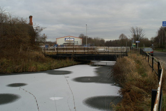
A swing bridge (or swing span bridge) is a movable bridge that has as its primary structural support a vertical locating pin and support ring, usually at or near to its center of gravity, about which the swing span (turning span) can then pivot horizontally as shown in the animated illustration to the right. Small swing bridges as found over canals may be pivoted only at one end, opening as would a gate, but require substantial underground structure to support the pivot. In its closed position, a swing bridge carrying a road or railway over a river or canal, for example, allows traffic to cross. When a water vessel needs to pass the bridge, road traffic is stopped (usually by traffic signals and barriers), and then motors rotate the bridge horizontally about its pivot point. The typical swing bridge will rotate approximately 90 degrees, or one-quarter turn; however, a bridge which intersects the navigation channel at an oblique angle may be built to rotate only 45 degrees, or ... [...More Info...] [...Related Items...] OR: [Wikipedia] [Google] [Baidu] |
Light Railways Act 1896
The Light Railways Act 1896 (59 & 60 Vict. c.48) was an Act of the Parliament of the United Kingdom of Great Britain and Ireland. History Before the Act each new railway line built in the country required a specific Act of Parliament to be obtained by the company that wished to construct it, which greatly added to the cost and time it took to construct new railways. The economic downturn of the 1880s had hit agriculture and rural communities in the United Kingdom especially hard and the government wished to facilitate the construction of railways in rural areas, especially to facilitate the transport of goods. The 1896 Act defined a class of railways which did not require specific legislation to construct – companies could simply plan a line under the auspices of the new Act, and, having obtained a light railway order, build and operate it. By reducing the legal costs and allowing new railways to be built quickly the government hoped to encourage companies to build the new 'l ... [...More Info...] [...Related Items...] OR: [Wikipedia] [Google] [Baidu] |
Northwich
{{Infobox UK place , static_image_name = Northwich - Town Bridge.jpg , static_image_caption = Town Bridge, the River Weaver and the spire of Holy Trinity Church , official_name = Northwich , country = England , region = North West England , population = 50,531 , population_ref = (2021){{NOMIS2021 , id=E35001305 Overview Profile: Northwich Town Council"; downloaded fro.gov.uk/find_out_more/datasets_and_statistics/statistics/census_2011/population_profiles Cheshire West and Chester: Population Profiles 16 May 2019 , os_grid_reference = SJ651733 , coordinates = {{coord, 53.259, -2.518, display=inline,title , post_town = NORTHWICH , postcode_area = CW , postcode_district = CW8,CW9 , dial_code = 01606 , constituency_westminster = Weaver Vale , constituency_westminster1 = Tatton , civil_pa ... [...More Info...] [...Related Items...] OR: [Wikipedia] [Google] [Baidu] |
Cheshire
Cheshire ( ) is a ceremonial and historic county in North West England, bordered by Wales to the west, Merseyside and Greater Manchester to the north, Derbyshire to the east, and Staffordshire and Shropshire to the south. Cheshire's county town is the cathedral city of Chester, while its largest town by population is Warrington. Other towns in the county include Alsager, Congleton, Crewe, Ellesmere Port, Frodsham, Knutsford, Macclesfield, Middlewich, Nantwich, Neston, Northwich, Poynton, Runcorn, Sandbach, Widnes, Wilmslow, and Winsford. Cheshire is split into the administrative districts of Cheshire West and Chester, Cheshire East, Halton, and Warrington. The county covers and has a population of around 1.1 million as of 2021. It is mostly rural, with a number of towns and villages supporting the agricultural and chemical industries; it is primarily known for producing chemicals, Cheshire cheese, salt, and silk. It has also had an impact on popular culture, producin ... [...More Info...] [...Related Items...] OR: [Wikipedia] [Google] [Baidu] |
Manchester Ship Canal
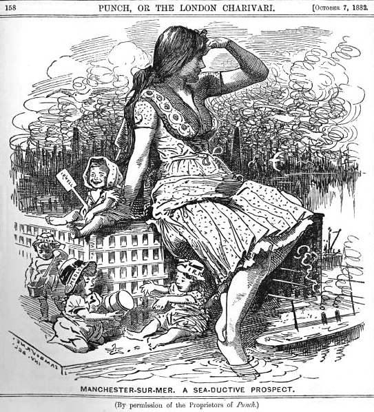
The Manchester Ship Canal is a inland waterway in the North West of England linking Manchester to the Irish Sea. Starting at the Mersey Estuary at Eastham, near Ellesmere Port, Cheshire, it generally follows the original routes of the rivers Mersey and Irwell through the historic counties of Cheshire and Lancashire. Several sets of locks lift vessels about to the canal's terminus in Manchester. Landmarks along its route include the Barton Swing Aqueduct, the world's only swing aqueduct, and Trafford Park, the world's first planned industrial estate and still the largest in Europe. The rivers Mersey and Irwell were first made navigable in the early 18th century. Goods were also transported on the Runcorn extension of the Bridgewater Canal (from 1776) and the Liverpool and Manchester Railway (from 1830), but by the late 19th century the Mersey and Irwell Navigation had fallen into disrepair and was often unusable. In addition, Manchester's business community viewed the cha ... [...More Info...] [...Related Items...] OR: [Wikipedia] [Google] [Baidu] |
Northwich Road Swing Bridge, Warrington
{{Infobox UK place , static_image_name = Northwich - Town Bridge.jpg , static_image_caption = Town Bridge, the River Weaver and the spire of Holy Trinity Church , official_name = Northwich , country = England , region = North West England , population = 50,531 , population_ref = (2021){{NOMIS2021 , id=E35001305 Overview Profile: Northwich Town Council"; downloaded fro.gov.uk/find_out_more/datasets_and_statistics/statistics/census_2011/population_profiles Cheshire West and Chester: Population Profiles 16 May 2019 , os_grid_reference = SJ651733 , coordinates = {{coord, 53.259, -2.518, display=inline,title , post_town = NORTHWICH , postcode_area = CW , postcode_district = CW8,CW9 , dial_code = 01606 , constituency_westminster = Weaver Vale , constituency_westminster1 = Tatton , civil_pa ... [...More Info...] [...Related Items...] OR: [Wikipedia] [Google] [Baidu] |
Longford
Longford () is the county town of County Longford in Ireland. It has a population of 10,008 according to the 2016 census. It is the biggest town in the county and about one third of the county's population lives there. Longford lies at the meeting of Ireland's N4 road (Ireland), N4 and N5 road (Ireland), N5 National primary road, National Primary Route roads, which means that traffic travelling between Dublin and County Mayo, or north County Roscommon passes around the town. Longford railway station, on the Dublin-Sligo railway line, Dublin-Sligo line, is used heavily by commuters. History The town is built at a fording point on the banks of the River Camlin (), which is a tributary of the River Shannon. According to several sources, the name Longford is an Anglicization of the Irish , referring to a fortress or fortified house. The area came under the sway of the local clan which controlled the south and middle of the County of Longford (historically called or ) and hence, th ... [...More Info...] [...Related Items...] OR: [Wikipedia] [Google] [Baidu] |
Stockton Heath
Stockton Heath is a civil parish and suburb of Warrington, in the Borough of Warrington, Cheshire, England. It is located to the north of the Bridgewater Canal and to the south of the Manchester Ship Canal, which divides Stockton Heath from Latchford and north Warrington. It has a total resident population of 6,396. Victoria Square is at the centre of Stockton Heath and is on the crossroads of the A49 and A56. Until the 1970s, the Victoria Hotel stood on this square but its location has been redeveloped. North of the square is the main shopping area which includes the Forge Shopping Centre, developed on the site of the old forge (Caldwell's). Stockton Heath is home to a number of modern bars and restaurants, as well as traditional public houses. The Red Lion Inn dates back to the early 19th century and the Mulberry Tree on Victoria Square, opened in its present building (replacing earlier premises dating from 1725) in March 190 Since 1988, much of the centre of Stockton Heath h ... [...More Info...] [...Related Items...] OR: [Wikipedia] [Google] [Baidu] |


