|
Wanrong, Hualien
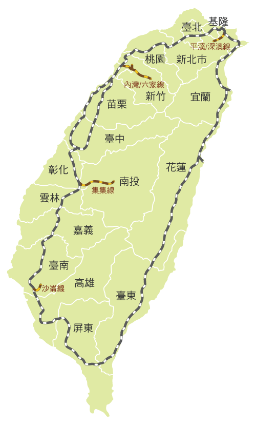
Wanrong Township or Wanrung Township () is a mountain indigenous township located in the west of Hualien County, Taiwan, and has a population of 6,154 inhabitants and 8 villages. The elevation and climate changes greatly with the mountains of Central Range, and the adverse elevation is about 600 m. The main inhabitants are Truku people, Bunun people and Atayal people of the Taiwanese aborigines, and most economic activity is agriculture, which located in the small plain near Fenglin Township. The abundant resources of tourism has not been developed. Administrative divisions The township comprises six villages: Hongye, Jianqing, Mayuan, Mingli, Wanrong and Xilin. Tourist attractions * Hongye Hot Spring * Lintian Mountain Forestry Center * Mount Erzih Hot Spring * Qicai Lake * Wanrong Hot Spring * Fuyuan National Forest Recreation Area (Butterfly Valley) * Lintianshan (molisaka) Lumbering Culture Area Transportation *Wanrong Station, Hualien-Taitung Line of TRA (locat ... [...More Info...] [...Related Items...] OR: [Wikipedia] [Google] [Baidu] |
Taiwan
Taiwan, officially the Republic of China (ROC), is a country in East Asia, at the junction of the East and South China Seas in the northwestern Pacific Ocean, with the People's Republic of China (PRC) to the northwest, Japan to the northeast, and the Philippines to the south. The territories controlled by the ROC consist of 168 islands, with a combined area of . The main island of Taiwan, also known as ''Formosa'', has an area of , with mountain ranges dominating the eastern two-thirds and plains in the western third, where its highly urbanised population is concentrated. The capital, Taipei, forms along with New Taipei City and Keelung the largest metropolitan area of Taiwan. Other major cities include Taoyuan, Taichung, Tainan, and Kaohsiung. With around 23.9 million inhabitants, Taiwan is among the most densely populated countries in the world. Taiwan has been settled for at least 25,000 years. Ancestors of Taiwanese indigenous peoples settled the isla ... [...More Info...] [...Related Items...] OR: [Wikipedia] [Google] [Baidu] |
Provincial Highway 16 (Taiwan)
Provincial Highway 16 () is an East-West highway from Mingjian to Xinyi in Nantou County, Taiwan. The total length of the highway is 41.349 km. A plan to extend the highway for another 96.2 km which will pass through the Central Range was abandoned due to environmental issues and difficulty of construction. Route Description The highway begins at the intersection with PH 3 in Mingjian. It then continues eastbound towards downtown Jiji and Shuili. In Shuili the highway has a brief concurrency with PH 21 until the latter continues in north-south direction. After leaving Shuili, the highway turns into a mountainous 1-lane road all the way towards its terminus in the aboriginal township of Xinyi, in front of Sunhai Bridge (孫海橋), which was destroyed by Typhoon Sinlaku in 2008. The section in Xinyi is closed daily from 5:30 pm to 7:00 am the next day. The original plan of the highway was to continue from Xinyi all the way to Fenglin, Hualien Fenglin Township, () ... [...More Info...] [...Related Items...] OR: [Wikipedia] [Google] [Baidu] |
Provincial Highway 9 (Taiwan)
Provincial Highway 9 is an important highway across eastern Taiwan from Taipei City to Fangshan, Pingtung, Pingtung County. This provincial highway, at 476.1 km long, is the longest provincial highway in Taiwan and passes the regions of Taipei City, New Taipei City, Yilan County, Hualien County, Taitung County and Pingtung County. Route Description The highway begins in front of Executive Yuan in downtown Taipei. It continues along Zhongshan South Road (中山南路) and Roosevelt Road (羅斯福路) until it reaches Xindian, New Taipei. From there the highway follows Beixin Road (北新路) and later becomes Bei-Yi Highway (北宜公路). The highway passes through mountainous regions, enters Shiding and Pinglin in New Taipei City before reaching Yilan County. In Yilan County, the highway finally leaves the mountainous region and enters Yilan Plain, but not before a stretch of curvy mountain roads. The highway passes through Toucheng, Jiaoxi, Yilan City, Wujie, Luod ... [...More Info...] [...Related Items...] OR: [Wikipedia] [Google] [Baidu] |
Taiwan Railway Administration
Taiwan Railways Administration (TRA) is a railway operator in Taiwan. It is an agency of the Ministry of Transportation and Communications, responsible for managing, maintaining, and running conventional passenger and freight railway services on 1097 km of track in Taiwan. Since Taiwan is heavily urbanised with a high population density, railways have played an important part in domestic transportation since the late 19th century. Passenger traffic in 2018 was 231,267,955. The agency's headquarters are in Zhongzheng District, Taipei. Overview Railway services between Keelung and Hsinchu began in 1891 under China's Qing dynasty. Because the railway was completely rebuilt and substantially expanded under the operated by Formosa's Japanese colonial government (1895–1945), the network's Japanese influence and heritage persists. Similarities between the TRA and the Japan Railways (JR) companies can be noted in signal aspects, signage, track layout, fare controls, sta ... [...More Info...] [...Related Items...] OR: [Wikipedia] [Google] [Baidu] |
Hualien-Taitung Line
The Taitung Line (), also known as the Hua-Tung line (), is the southern section of the Eastern Line of the Taiwan Railways Administration. The line starts at the Hualien station and ends at the Taitung station. It is 161.5 km long, including the main segment of 155.7 km between Hualien and Taitung. The coastal branch lines of Hualien and Taitung were discarded after the broadening plan in 1982. The broadcasts of the station names on Taitung line are made in five languages: Mandarin, Taiwanese Hokkien, Hakka, English, and Amis. The Taitung Line is the only line in Taiwan where broadcasts are made in the Amis language. History The north segment from Karenkō (, now Hualien City) to Poshiko (, then Tamazato, now Yuli) was built in 1909 and completed in 1917. The south segment from Hinan (, then Taitō, now Taitung City) to Rirō (, now Guanshan) was opened in 1919 by the Taitō Development Company (). In 1922, the Taitō Development Company bought the railroad from ... [...More Info...] [...Related Items...] OR: [Wikipedia] [Google] [Baidu] |
Wanrong Hot Spring
Wanrong (; 13 November 1906 – 20 June 1946), of the Manchu Plain White Banner Gobulo clan, was the wife and empress consort of Puyi, the last Emperor of China, sometimes anachronistically called the “Xuantong Empress”, referring to Puyi’s era name. She was titular empress consort of the Qing dynasty from 1922 until her death, and later became the empress consort of the Japanese puppet state of Manchukuo from 1934 until abolition of the monarchy in 1945. She was posthumously honored with the title Empress Xiaokemin. During the Soviet invasion of Manchuria at the end of the Second Sino-Japanese War in 1945, Wanrong was captured by Chinese Communist guerrillas and transferred to various locations before she was placed in a prison camp in Yanji, Jilin. She died in prison in June 1946 and her remains were never found. On 23 October 2006, Wanrong's younger brother, Runqi, conducted a ritual burial for her in the Western Qing tombs. Names Wanrong's full birth name ... [...More Info...] [...Related Items...] OR: [Wikipedia] [Google] [Baidu] |
Mount Erzih Hot Spring
Mount is often used as part of the name of specific mountains, e.g. Mount Everest. Mount or Mounts may also refer to: Places * Mount, Cornwall, a village in Warleggan parish, England * Mount, Perranzabuloe, a hamlet in Perranzabuloe parish, Cornwall, England * Mounts, Indiana, a community in Gibson County, Indiana, United States People * Mount (surname) * William L. Mounts (1862–1929), American lawyer and politician Computing and software * Mount (computing), the process of making a file system accessible * Mount (Unix), the utility in Unix-like operating systems which mounts file systems Displays and equipment * Mount, a fixed point for attaching equipment, such as a hardpoint on an airframe * Mounting board, in picture framing * Mount, a hanging scroll for mounting paintings * Mount, to display an item on a heavy backing such as foamcore, e.g.: ** To pin a biological specimen, on a heavy backing in a stretched stable position for ease of dissection or displa ... [...More Info...] [...Related Items...] OR: [Wikipedia] [Google] [Baidu] |
Lintian Mountain Forestry Center
Lintian is a helper tool used in conjunction with dpkg, the Debian package management system. It checks Debian software packages for common inconsistencies and errors. As of Nov 10th 2022, the latest version complies to Debian standards version 4.6.0.1. In 2009, the Debian FTP masters announced that they would use Lintian to automatically reject packages uploaded to Debian. They acknowledged that some of the issues diagnosed by Lintian had rare exceptions, which could be overridden by the maintainer. The idea to use Lintian as an automatic rejection mechanism was proposed already in 1998 by Christian Schwarz, when he announced the creation of Lintian. Linda was another application that was intended to overcome many difficulties with Lintian. It was written in Python and was faster than current versions of Lintian. However, Lintian was better known and underwent many fixes to overcome past difficulties. See also * dpkg * deb (file format) * Debian build toolchain * lint Li ... [...More Info...] [...Related Items...] OR: [Wikipedia] [Google] [Baidu] |
Fenglin, Hualien
Fenglin Township, () is an urban township in central Hualien County, Taiwan. It is located in Huatung Valley bordering Shoufeng Township on the north and Guangfu Township on the south. It has a population of around 10,552 inhabitants in 12 villages. Geography The administration area here is 120.518 km2, and located in the Huatung Valley plain between Central Mountain Range and Hai'an Range (Coastal Range). Administrative divisions Fengren, Fengyi, Fengli, Fengzhi, Fengxin, Shanxing, Darong, Beilin, Nanping, Linrong, Zhangqiao and Senrong Village. Education Fenglin Township has 3 junior high schools and 8 elementary schools. Fenglin Senior High School and 1 university are planning for construction. Tourist attractions * Fenglin Hakka Cultural Museum * Fenglin Recreation Area * Fenglin Road Park * Fenglin Township Vegetable Area * Jianying Park * Linrong Recreation Area * Lintian Police Substation and Old Lintian Police Station * Cilakaiyan Tribe (吉拉卡樣部落 ... [...More Info...] [...Related Items...] OR: [Wikipedia] [Google] [Baidu] |
Hualien County
Hualien County (Mandarin Wade–Giles: Hua¹-lien² Hsien⁴; Pīnyīn: ''Huālián Xiàn''; Hokkien POJ: ''Hoa-lian-koān'' or ''Hoa-liân-koān''; Hakka PFS: ''Fâ-lièn-yen''; Amis: ''Kalingko'') is a county on the east coast of Taiwan. It is the largest county by area, yet due to its mountainous terrain, has one of the lowest populations in the country. The county seat and largest city is Hualien City. Most of the population resides in the Huadong Valley, which runs north to south, sandwiched between the Central and Hai'an mountain ranges. Due to the rural nature of the county, Hualien attracts many visitors for its natural environment, which includes Taroko Gorge, Qingshui Cliff and Qixingtan Beach. History Early history Modern-day Hualien City was originally called ''Kilai'' (), after the Sakiraya Taiwanese aborigines and their settlement. Spanish settlers arrived in 1622 to pan for gold. Picking up the sounds of native words, these settlers called the area ''Turumoa ... [...More Info...] [...Related Items...] OR: [Wikipedia] [Google] [Baidu] |


