|
Provincial Highway 9 (Taiwan)
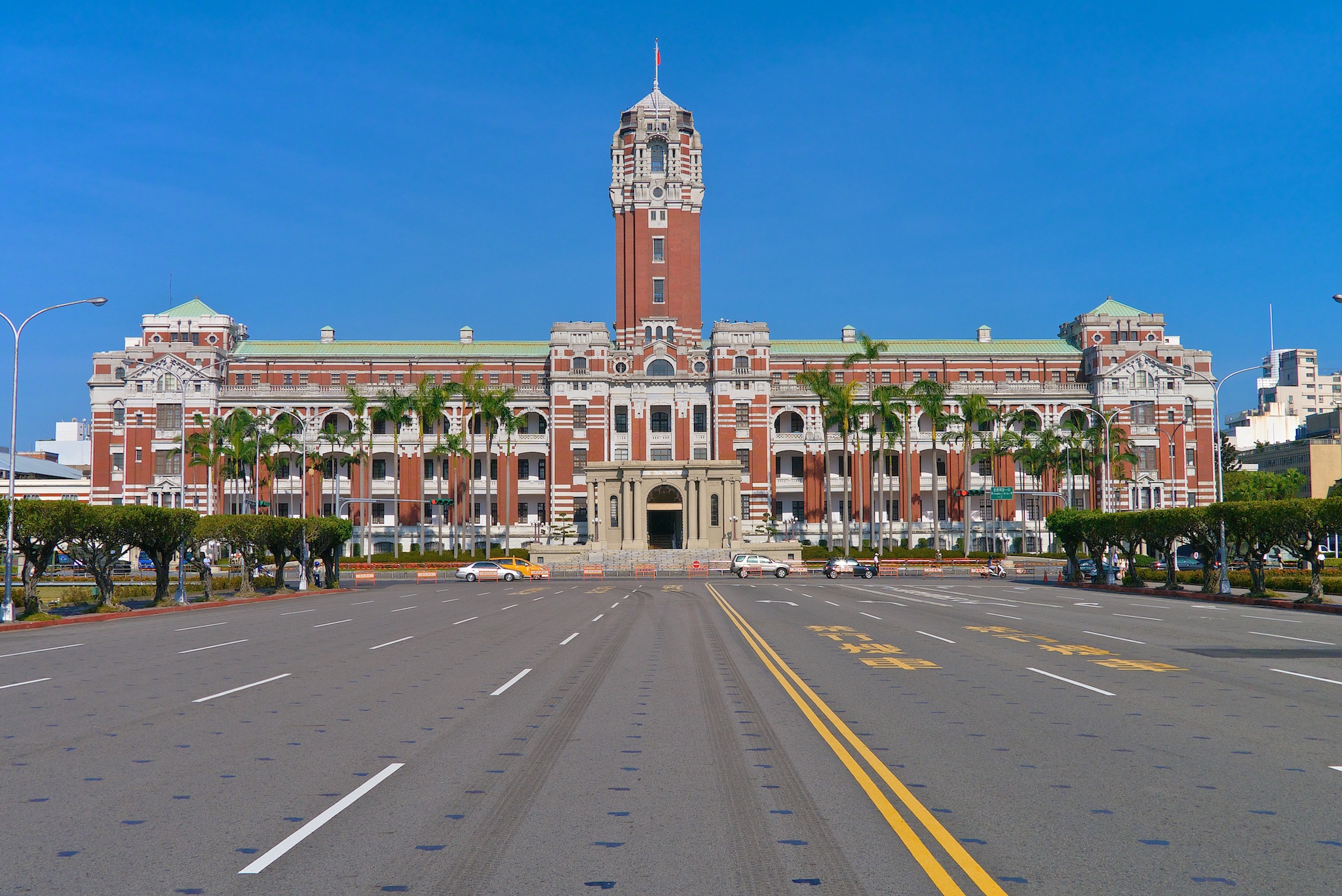
Provincial Highway 9 is an important highway across eastern Taiwan from Taipei City to Fangshan, Pingtung, Pingtung County. This provincial highway, at 476.1 km long, is the longest provincial highway in Taiwan and passes the regions of Taipei City, New Taipei City, Yilan County, Hualien County, Taitung County and Pingtung County. Route Description The highway begins in front of Executive Yuan in downtown Taipei. It continues along Zhongshan South Road (中山南路) and Roosevelt Road (羅斯福路) until it reaches Xindian, New Taipei. From there the highway follows Beixin Road (北新路) and later becomes Bei-Yi Highway (北宜公路). The highway passes through mountainous regions, enters Shiding and Pinglin in New Taipei City before reaching Yilan County. In Yilan County, the highway finally leaves the mountainous region and enters Yilan Plain, but not before a stretch of curvy mountain roads. The highway passes through Toucheng, Jiaoxi, Yilan City, Wujie, Luod ... [...More Info...] [...Related Items...] OR: [Wikipedia] [Google] [Baidu] |
Zhongzheng District
Zhongzheng District (also Jhongjheng District) is a District (Taiwan), district in Taipei. It is home to most of the national government buildings of the Taiwan, Republic of China (Taiwan), including the Presidential Office Building, Taipei, Presidential Office, the Executive Yuan, the Control Yuan, the Legislative Yuan, the Judicial Yuan and various government ministries. Overview The district is named after Generalissimo and the late President of the Republic of China Chiang Kai-shek. This district has many cultural and educational sites including the Taipei Botanical Garden, the National Taiwan Museum, the National Museum of History, the National Central Library, National Theater and Concert Hall (Taiwan), National Theater and Concert Hall and the Taiwan Film and Audiovisual Institute. Other museums include the Chunghwa Postal Museum, the Taipei City Traffic Museum for Children, and the Taipei Museum of Drinking Water. Much of the Qing dynasty, Qing-era city of Walls of Ta ... [...More Info...] [...Related Items...] OR: [Wikipedia] [Google] [Baidu] |
Shiding District
Shiding District () is a rural district in southern New Taipei City, Taiwan. History Shiding used to be a thriving town during the Qing Dynasty due to its geographically favorable condition as a resting place on the way to Yilan and its coal mine resources and tea trading. Shiding was a rural township of Taipei County until the upgrade of the county to become the New Taipei municipality on 25 December 2010, Shiding became a district. Geography *Area: 144.35 km2 *Population: 7,857 people (January 2016) Education * Huafan University * New Taipei Municipal ShiDing High School Tourist attractions * Huafan Culture Gallery * Lumantan Forest Bath * Putty Painting House * Shiding Danlan Culture Hall * Shiding East Street * Shiding West Street Transportation The district is accessible by bus from Jingmei Station of Taipei Metro Taipei Mass Rapid Transit (MRT), branded as Metro Taipei, is a rapid transit system serving the areas of Taipei and New Taipei City, New Taip ... [...More Info...] [...Related Items...] OR: [Wikipedia] [Google] [Baidu] |
Central Cross-Island Highway
The Central Cross-Island Highway () or Provincial Highway 8 is one of three highway systems that connect the west coast with the east of Taiwan. Construction The construction of the Central Cross-Island Highway began on July 7, 1956 and was first opened to traffic on May 9, 1960. Route The route of the highway begins in the west at Dongshi District in Taichung. The highway originally continued up into the Central Mountain Range following the Dajia River valley through the townships of Guguan (谷關) and Cingshan (青山). However, the section between Guguan and Lishan is permanently closed to non-residents due to earthquake and typhoon damage. At Lishan there is a branch that heads north to Yilan City. Passing through the mountains it reaches Dayuling (大禹嶺) which is the highest point of the route. Here another branch of the highway runs south from Dayuling to Puli via Wuling (武嶺). Continuing east from Dayuling the highway route now begins its descent into th ... [...More Info...] [...Related Items...] OR: [Wikipedia] [Google] [Baidu] |
Xincheng, Hualien
Xincheng Township or Sincheng Township () is a rural township located in north of Hualien County, Taiwan, and has a population of 20,286 inhabitants and 8 villages. It is also the smallest township in Hualien County. History Formerly called ''Toloboan'' (). Administrative divisions The township comprises eight villages: Beipu, Dahan, Jiali, Jialin, Jiaxin, Kangle, Shunan and Xincheng. Climate * Subtropical monsoon and humid climate * Average temperature: * Average precipitation: Economy The township is home to the cement mining operated by Asia Cement Corporation and its cement plant. Education * Dahan Institute of Technology Tourist attractions * Qixingtan Beach * Chihsing Tan Katsuo Museum * Tzu Chi Jing She (Temple of Tzu Chi Foundation) * Asia Cement Ecological Park Transportation Air * Hualien Airport Rail * TRA Beipu Station (North-link line) * TRA Sincheng (Taroko) Station (North-link line) Road * Provincial Highway No.9 * County road No.193 Notable ... [...More Info...] [...Related Items...] OR: [Wikipedia] [Google] [Baidu] |
Xiulin, Hualien
Xiulin Township / Sioulin Township () is a mountain indigenous township of Hualien County, Taiwan. It is located northwest of Hualien City, and is the largest township in Taiwan by area (1,641.86 km²) with 9 villages. It has a population of 15,494, most of which are the indigenous Taroko people. Because of its location beside the Central Mountain Range, the climate changes by altitude. Taroko National Park is located in Xiulin Township. In recent years, people in Xiulin have lobbied to change its name to "Taroko Township" (太魯閣鄉). The Hualien train derailment, the second deadliest train disaster in Taiwan's history, happened here in 2021. Administrative divisions The township comprises nine villages: Chongde, Fushi, Heping, Jiamin, Jingmei, Shuiyuan, Tongmen, Wenlan and Xiulin. Tourist attractions * Taroko National Park * Qingshui Cliff * Sanchan Creek Scenic Area * Mukumugi ecological Trail and preserve area * Kilai Mountain (3607 m) * Dayu Mountain ( ... [...More Info...] [...Related Items...] OR: [Wikipedia] [Google] [Baidu] |
Nan'ao, Yilan
Nan'ao Township () is a mountain indigenous township in the southern part of Yilan County, Taiwan. It is the largest township in the county. History The township was formerly the "Aboriginal Area" of Suō District, Taihoku Prefecture during Japanese rule. It was the site of the Sayun incident made famous through the movie '' Sayon's Bell''. Geography The population consists mainly of the indigenous Atayal people. Many residents of Aohua Village still speak the Japanese language in daily life. Nan'ao Township contains part of the mountainous terrain of the Central Mountain Range. * Area: 740.65 km² * Population: 6,147 people in 1902 households (December 2014) Administrative divisions Nanao is divided into seven villages (from north to south): * Dongyue * Nan'ao * Biho * Jinyue * Wuta * Jinyang * Aohua Tourist attractions * Cueifong Lake Transportation Nan'ao is served by the North-Link Line of Taiwan Railway Administration at three stations: Dong'ao Station, Hanben ... [...More Info...] [...Related Items...] OR: [Wikipedia] [Google] [Baidu] |
Suhua Highway
The Suhua Highway (), also called the Suao-Hualien Highway, is a section of the Provincial Highway 9 in Taiwan, starting at Su'ao Township, Yilan County and ending at Hualien City, Hualien County. With a portion built alongside very steep cliffs high above the Pacific Ocean, it is considered to be one of Taiwan's most dangerous but also most scenic drives. Famous stops along the way include the Qingshui Cliffs and Taroko Gorge, located at the southern end of the highway. History A footpath between Su'ao and Hualien was first built by the Qing Dynasty government between 1874 and 1876, as part of a program to assert its sovereignty over eastern Taiwan – hitherto inhabited mostly by Taiwanese aborigines – after the Taiwan Expedition of 1874 by Japan. The narrowness of the footpath, dictated by the extreme cliffside topography, meant that its military value far outweighed its economic benefit, and it was subsequently abandoned and rebuilt several times. Eventually it was wi ... [...More Info...] [...Related Items...] OR: [Wikipedia] [Google] [Baidu] |
Hualien City
Hualien City (; Wade-Giles: Hua¹-lien² Shih⁴; Hokkien POJ: ''Hoa-lian-chhī'' or ''Hoa-liân-chhī'') is a county-administered city and the county seat of Hualien County, Taiwan. It is located on the east coast of Taiwan on the Pacific Ocean, and has a population of 106,368 inhabitants. Name Hualien County annals () record that the city was called "Kilai" () until the early twentieth century. This name refers to the Sakiraya Taiwanese aborigines and their settlement. After Taiwan came under Japanese rule in 1895 its governors sought to change the name because "Kilai" is pronounced the same as the Japanese word for . The name was eventually changed to . After World War II the incoming Kuomintang-led Republic of China retained the Kanji spelling but shortened the name to just , or ''Hualien'' via Chinese romanization. History The Spaniards built mines for gold in Hualien in 1622. Permanent settlements began in 1851, when 2,200 Han Chinese farmers led by Huang A-fong (黃� ... [...More Info...] [...Related Items...] OR: [Wikipedia] [Google] [Baidu] |
Dongshan, Yilan
Dongshan Township () is a rural township in the central part of Yilan County, Taiwan. Geography * Area: 79.86 km2 * Population: 53,482 people (December 2014) Administrative divisions Zhenzhu, Bucheng, Sanji, Daxing, Tungcheng, Xianghe, Nanxing, Anping, Dongshan, Taihe, Babao, Wanshan, Zhongshan, Shunan, Yongmei, Wuyuan, Qunying, Qinggou, Lupu, Dean, Guangxing, Guangan, Kelin and Dajin Village. Economy The main industry in Dongshan Township are agriculture and tourism. In agriculture, tea and pomelo are the specialties for this township. While the tourism industry creates more business in leisure, food and beverages and farm tourism. Tourist attractions * Meihua Lake * Shangri-La Leisure Farm Transportation The township is accessible by the Dongshan Station of the Taiwan Railway Administration. Notable natives * Lee Chin-lung, Minister of Council of Agriculture (2002–2006) * Liao Feng-teh, politician * Yu Shyi-kun, Premier of the Republic of China The ... [...More Info...] [...Related Items...] OR: [Wikipedia] [Google] [Baidu] |
Luodong
Luodong Township () is an urban township An urban township is a designation of a unit of local government in several countries. United States The term is called ''urban township'' Michigan, Minnesota and Ohio and urban town in Wisconsin. Generally, an urban township is afforded more loca ... in the central part of Yilan County, Taiwan, Yilan County, Taiwan. Luodong is the smallest township in the county. Naming Its name and former name () derive from the Kavalan language, Kavalan word ''lutung, rutung'', meaning "monkey", referring to a large population of monkeys there half century ago. History Qing Dynasty In 1804, Taiwanese Plains Aborigines, Pingpu tribe chiefs Pan Xian Wen and Maoge from Changhua County, Changhua led a group of people to settle in the Luodong area, where they established Alishih and Ashushih communities and developed agriculture on a large scale. In 1812, Taiwan under Qing rule, Qing Dynasty officer Fan Bang Gan was assigned to Luodong. Two years later, ... [...More Info...] [...Related Items...] OR: [Wikipedia] [Google] [Baidu] |
Wujie, Yilan
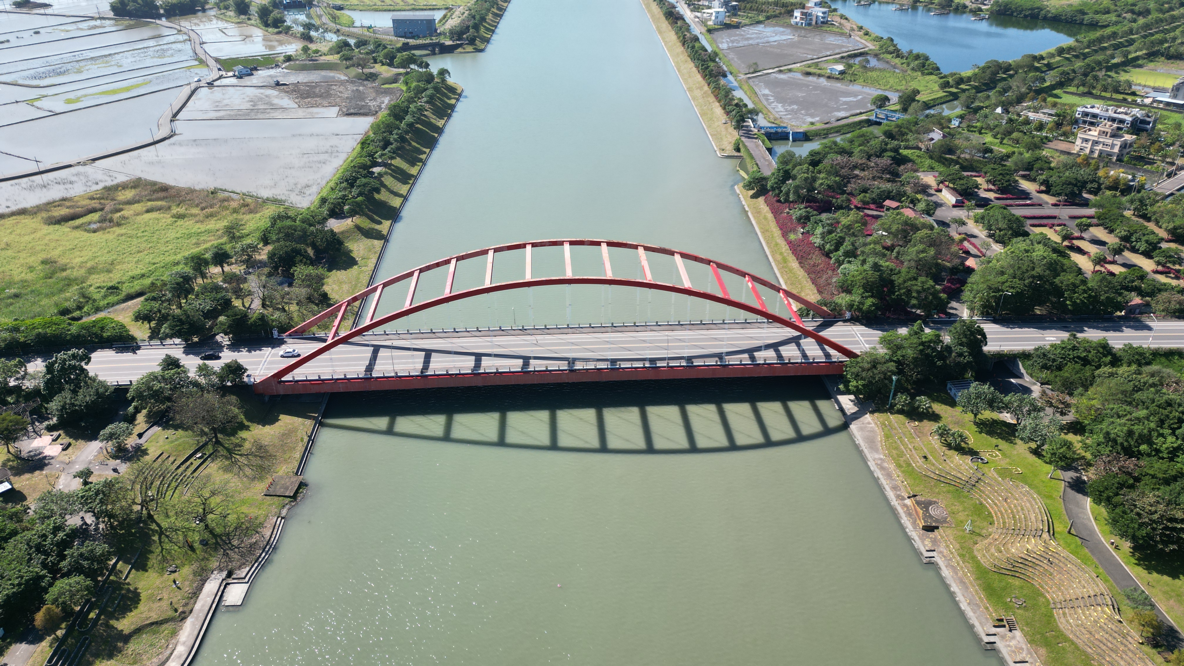
Wujie Township () is a rural township in the eastern part of Yilan County, Taiwan. Geography * Area: 38.87 km2 * Population: 39,378 people (2014) Administrative divisions The township comprises 15 villages: Chengxing, Daji, Erjie, Fuxing, Jinzhong, Jixin, Lize, Sanxing, Shangsi, Sijie, Wujie, Xiaowei, Xiehe, Zengan and Zhongxing. Tourist attractions * Chung Hsing Cultural and Creative Park * Dongshan River Water Park * Erjie Rice Barn * Lizejian Yong'an Temple * National Center for Traditional Arts Festivals * Yilan International Children's Folklore and Folkgame Festival Transportation The Erjie Station and Zhongli Station of Taiwan Railways is located in the township. Notable natives * Lin Yi-hsiung Lin Yi-hsiung (; born 24 August 1941) is a politician from Taiwan. He was a major leader of the democratization movement in Taiwan. He graduated from the Department of Law of National Taiwan University. He was first exposed to politics in 1976 ..., Chairperson of ... [...More Info...] [...Related Items...] OR: [Wikipedia] [Google] [Baidu] |
Yilan City
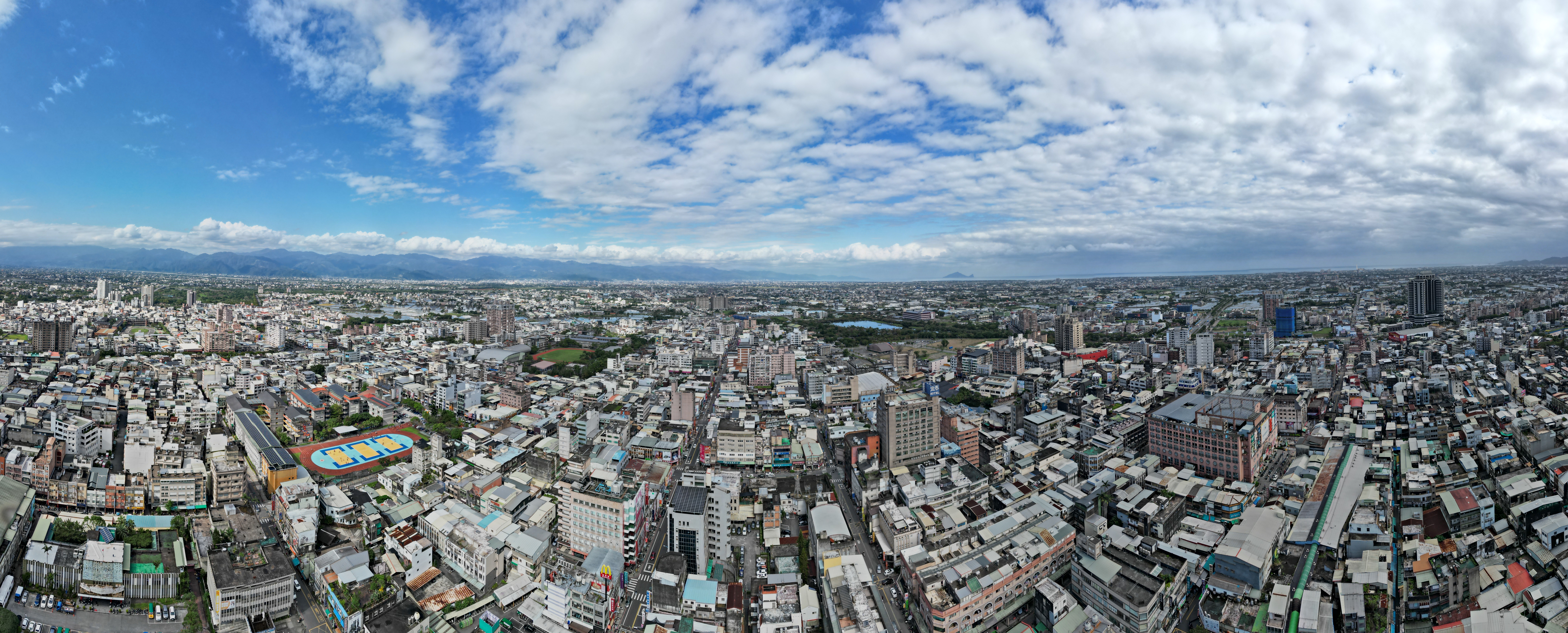
Yilan City (Mandarin pinyin: ''Yílán Shì''; Hokkien POJ: ''Gî-lân-chhī'') is a county-administered city and the county seat of Yilan County, Taiwan Province, Republic of China. The city lies on the north side of the Lanyang River. History The Yilan Plain in which the city is located has historically been referred to as Kapalan (), Kapsulan (; also 甲子蘭), Komalan (), etc. These names, as well as that of Yilan itself, were given to the sites by the Kavalan tribe of Taiwanese aborigines. Later arrivals included Han Chinese settlers during the Qing Dynasty in China (1802) and settlers from Okinawa during Taiwan's Japanese era (1895-1945). Qing Dynasty In 1810 under Qing dynasty rule, a formal administration office was established at Wuwei (五圍) and "Komalan Subprefecture" () was at the present day location of Yilan City. Construction of the city wall was completed a year later. After a few years once the basic infrastructure was ready, the city assumed the politic ... [...More Info...] [...Related Items...] OR: [Wikipedia] [Google] [Baidu] |


