|
Villamaría, Caldas
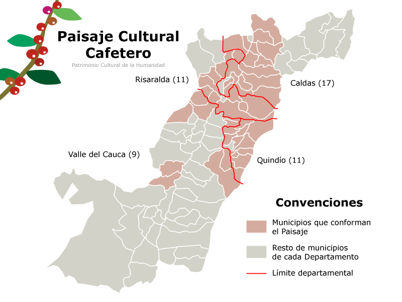
Villamaría is a town and municipality in the Colombian Department of Caldas. Located in the Colombian coffee growing axis, it was made part of the "Coffee Cultural Landscape" UNESCO World Heritage Site in 2011. Climate The city of Villamaría and the lower parts of the municipality have a subtropical highland climate (Köppen ''Cfb''). While the higher parts of the municipality have an alpine tundra climate (''ETH'') and the highest part has an ice cap climate An ice cap climate is a polar climate where no mean monthly temperature exceeds . The climate covers areas in or near the high latitudes (65° latitude) to polar regions (70–90° north and south latitude), such as Antarctica, some of the northe ... (''EFH''). References Municipalities of Caldas Department {{Caldas-geo-stub ... [...More Info...] [...Related Items...] OR: [Wikipedia] [Google] [Baidu] |
Municipalities Of Colombia
The Municipalities of Colombia are decentralized subdivisions of the Republic of Colombia. Municipalities make up most of the departments of Colombia with 1,122 municipalities (''municipios''). Each one of them is led by a mayor (''alcalde'') elected by popular vote and represents the maximum executive government official at a municipality level under the mandate of the governor of their department which is a representative of all municipalities in the department; municipalities are grouped to form departments. The municipalities of Colombia are also grouped in an association called the ''Federación Colombiana de Municipios'' (Colombian Federation of Municipalities), which functions as a union under the private law and under the constitutional right to free association to defend their common interests. Categories Conforming to the law 1551/12 that modified the sixth article of the law 136/94 Article 7 http://www.alcaldiabogota.gov.co/sisjur/normas/Norma1.jsp?i=48267 the mu ... [...More Info...] [...Related Items...] OR: [Wikipedia] [Google] [Baidu] |
Departments Of Colombia
Colombia is a unitary state, unitary republic made up of thirty-two departments (Spanish language, Spanish: ''departamentos'', sing. ''departamento'') and a Capital District (''Capital districts and territories, Distrito Capital''). Each department has a governor (''gobernador'') and an Assembly (''Asamblea Departamental''), elected by popular vote for a four-year period. The governor cannot be re-elected in consecutive periods. Departments are administrative division, country subdivisions and are granted a certain degree of autonomy. Departments are formed by a grouping of municipalities of Colombia, municipalities (''municipios'', sing. ''municipio''). Municipal government is headed by mayor (''alcalde'') and administered by a municipal council (''concejo municipal''), both of which are elected for four-year periods. Some departments have subdivisions above the level of municipalities, commonly known as provinces of Colombia, provinces. Chart of departments Each one of th ... [...More Info...] [...Related Items...] OR: [Wikipedia] [Google] [Baidu] |
Caldas Department
Caldas () is a department of Colombia named after Colombian patriotic figure Francisco José de Caldas. It is part of the Paisa Region and its capital is Manizales. The population of Caldas is 998,255, and its area is 7,291 km². Caldas is also part of the Colombian Coffee-Growers Axis region along with the Risaralda and Quindio departments. Subdivisions Municipalities # Aguadas # Anserma # Aranzazu # Belalcázar # Chinchiná # Filadelfia # La Dorada # La Merced # Manizales # Manzanares # Marmato # Marquetalia # Marulanda # Neira # Norcasia # Pácora # Palestina # Pensilvania # Riosucio # Risaralda # Salamina # Samaná # San José # Supía # Victoria # Villamaría # Viterbo Viterbo (; Viterbese: ; lat-med, Viterbium) is a city and ''comune'' in the Lazio region of central Italy, the capital of the province of Viterbo. It conquered and absorbed the neighboring town of Ferento (see Ferentium) in its early history. ... Districts Caldas has 6 dist ... [...More Info...] [...Related Items...] OR: [Wikipedia] [Google] [Baidu] |
Colombia
Colombia (, ; ), officially the Republic of Colombia, is a country in South America with insular regions in North America—near Nicaragua's Caribbean coast—as well as in the Pacific Ocean. The Colombian mainland is bordered by the Caribbean Sea to the north, Venezuela to the east and northeast, Brazil to the southeast, Ecuador and Peru to the south and southwest, the Pacific Ocean to the west, and Panama to the northwest. Colombia is divided into 32 departments and the Capital District of Bogotá, the country's largest city. It covers an area of 1,141,748 square kilometers (440,831 sq mi), and has a population of 52 million. Colombia's cultural heritage—including language, religion, cuisine, and art—reflects its history as a Spanish colony, fusing cultural elements brought by immigration from Europe and the Middle East, with those brought by enslaved Africans, as well as with those of the various Amerindian civilizations that predate colonization. Spanish is th ... [...More Info...] [...Related Items...] OR: [Wikipedia] [Google] [Baidu] |
Colombian Coffee Growing Axis
The Colombian coffee region ( es, Eje Cafetero), also known as the Coffee Triangle ( es, Triángulo del Café) is a part of the Paisa region in the rural area of Colombia. It is famous for growing and producing the majority of Colombian coffee. There are four departments in the area: Caldas, Quindío, Risaralda and the north municipalities of Tolima and Valle del Cauca. The most visited cities are Manizales, Armenia, Pereira, and Ibagué. History of coffee Coffee was first grown commercially in Colombia in Salazar de las Palmas, north of Santander, and over the twentieth century grew to be Colombia's primary export. When coffee was first brought into the country, the leaders tried to push the farming of coffee beans, but was met with resistance from the people because it takes about 5 years until the first harvest of the bean. In 1999 coffee revenues represented 3.7% of gross domestic product (gdp) and 37% of agricultural employment. The main coffee-producing departments ... [...More Info...] [...Related Items...] OR: [Wikipedia] [Google] [Baidu] |
UNESCO
The United Nations Educational, Scientific and Cultural Organization is a specialized agency of the United Nations (UN) aimed at promoting world peace and security through international cooperation in education, arts, sciences and culture. It has 193 member states and 12 associate members, as well as partners in the non-governmental, intergovernmental and private sector. Headquartered at the World Heritage Centre in Paris, France, UNESCO has 53 regional field offices and 199 national commissions that facilitate its global mandate. UNESCO was founded in 1945 as the successor to the League of Nations's International Committee on Intellectual Cooperation.English summary). Its constitution establishes the agency's goals, governing structure, and operating framework. UNESCO's founding mission, which was shaped by the Second World War, is to advance peace, sustainable development and human rights by facilitating collaboration and dialogue among nations. It pursues this objective t ... [...More Info...] [...Related Items...] OR: [Wikipedia] [Google] [Baidu] |
World Heritage Site
A World Heritage Site is a landmark or area with legal protection by an international convention administered by the United Nations Educational, Scientific and Cultural Organization (UNESCO). World Heritage Sites are designated by UNESCO for having cultural, historical, scientific or other form of significance. The sites are judged to contain " cultural and natural heritage around the world considered to be of outstanding value to humanity". To be selected, a World Heritage Site must be a somehow unique landmark which is geographically and historically identifiable and has special cultural or physical significance. For example, World Heritage Sites might be ancient ruins or historical structures, buildings, cities, deserts, forests, islands, lakes, monuments, mountains, or wilderness areas. A World Heritage Site may signify a remarkable accomplishment of humanity, and serve as evidence of our intellectual history on the planet, or it might be a place of great natural beauty. A ... [...More Info...] [...Related Items...] OR: [Wikipedia] [Google] [Baidu] |
Subtropical Highland Climate
An oceanic climate, also known as a marine climate, is the humid temperate climate sub-type in Köppen classification ''Cfb'', typical of west coasts in higher middle latitudes of continents, generally featuring cool summers and mild winters (for their latitude), with a relatively narrow annual temperature range and few extremes of temperature. Oceanic climates can be found in both hemispheres generally between 45 and 63 latitude, most notably in northwestern Europe, northwestern America, as well as New Zealand. Precipitation Locations with oceanic climates tend to feature frequent cloudy conditions with precipitation, low hanging clouds, and frequent fronts and storms. Thunderstorms are normally few, since strong daytime heating and hot and cold air masses meet infrequently in the region. In most areas with an oceanic climate, precipitation comes in the form of rain for the majority of the year. However, some areas with this climate see some snowfall annually during winter. M ... [...More Info...] [...Related Items...] OR: [Wikipedia] [Google] [Baidu] |
Köppen Climate Classification
The Köppen climate classification is one of the most widely used climate classification systems. It was first published by German-Russian climatologist Wladimir Köppen (1846–1940) in 1884, with several later modifications by Köppen, notably in 1918 and 1936. Later, the climatologist Rudolf Geiger (1894–1981) introduced some changes to the classification system, which is thus sometimes called the Köppen–Geiger climate classification system. The Köppen climate classification divides climates into five main climate groups, with each group being divided based on seasonal precipitation and temperature patterns. The five main groups are ''A'' (tropical), ''B'' (arid), ''C'' (temperate), ''D'' (continental), and ''E'' (polar). Each group and subgroup is represented by a letter. All climates are assigned a main group (the first letter). All climates except for those in the ''E'' group are assigned a seasonal precipitation subgroup (the second letter). For example, ''Af'' indi ... [...More Info...] [...Related Items...] OR: [Wikipedia] [Google] [Baidu] |
Tundra Climate
The tundra climate is a polar climate sub-type located in high latitudes and high mountains. undra climate https://www.britannica.com/science/tundra-climateThe Editors of Encyclopaedia Britannica, 2019 It is classified as ET according to Köppen climate classification. It is a climate which at least one month has an average temperature high enough to melt snow (), but no month with an average temperature in excess of . Despite the potential diversity of climates in the ''ET'' category involving precipitation, extreme temperatures, and relative wet and dry seasons, this category is rarely subdivided. Rainfall and snowfall are generally slight due to the low vapor pressure of water in the chilly atmosphere, but as a rule potential evapotranspiration is extremely low, allowing soggy terrain of swamps and bogs even in places that get precipitation typical of deserts of lower and middle latitudes. The amount of native tundra biomass depends more on the local temperature than the amoun ... [...More Info...] [...Related Items...] OR: [Wikipedia] [Google] [Baidu] |
Ice Cap Climate
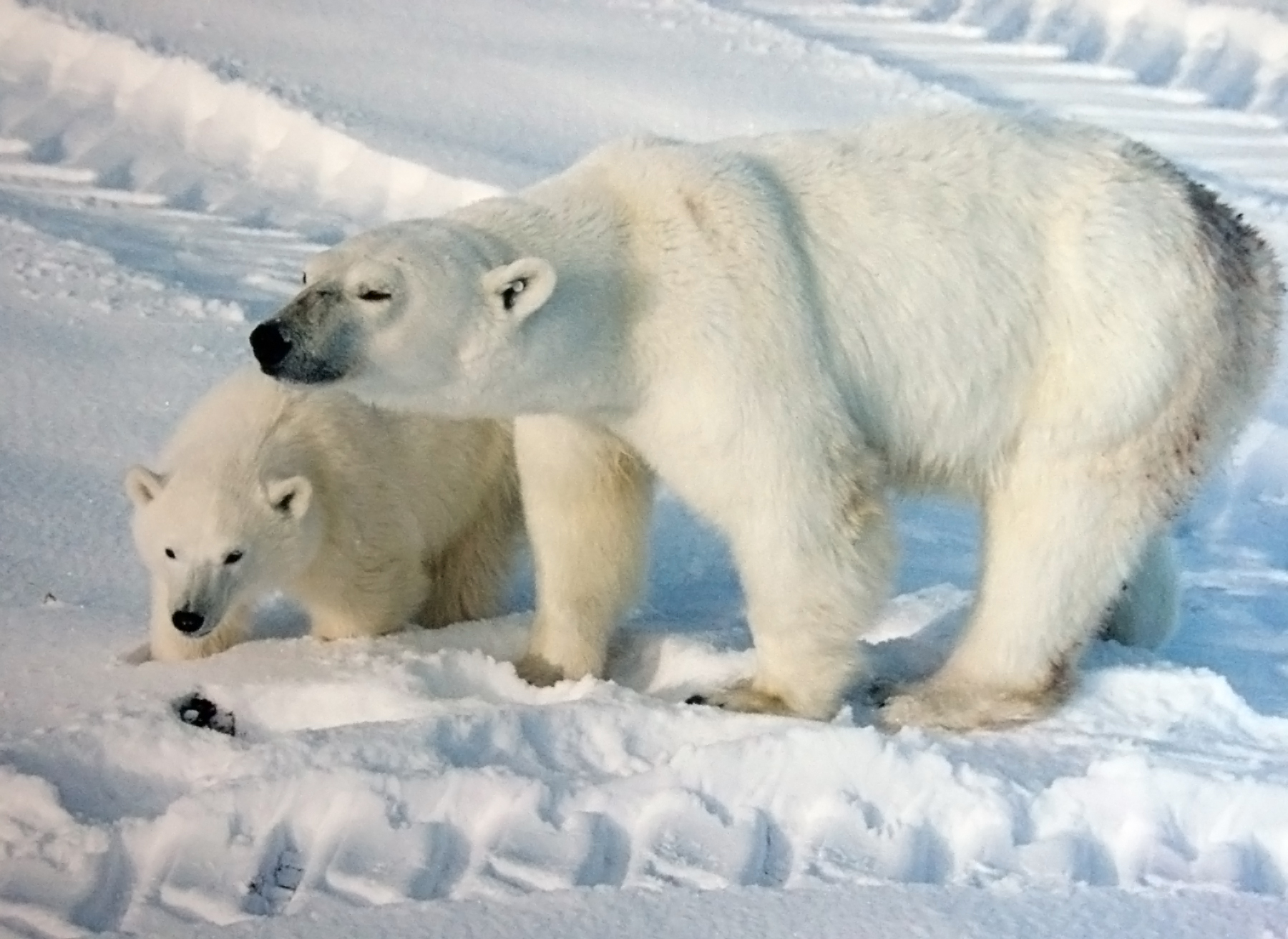
An ice cap climate is a polar climate where no mean monthly temperature exceeds . The climate covers areas in or near the high latitudes (65° latitude) to polar regions (70–90° north and south latitude), such as Antarctica, some of the northernmost islands of Canada and Russia, Greenland, along with some regions and islands of Norway's Svalbard Archipelago that have vast deserts of snow and ice. Areas with ice cap climates are normally covered by a permanent layer of ice and have no vegetation. There is limited animal life in most ice cap climates, usually found near the oceanic margins. Although ice cap climates are inhospitable to human life, there are some small research stations scattered in Antarctica and interior Greenland. Description Under the Köppen climate classification, the ice cap climate is denoted as ''EF''. Ice caps are defined as a climate with no months above . Such areas are found around the north and south pole, and on the top of many high mountains. S ... [...More Info...] [...Related Items...] OR: [Wikipedia] [Google] [Baidu] |


