|
Vailoa
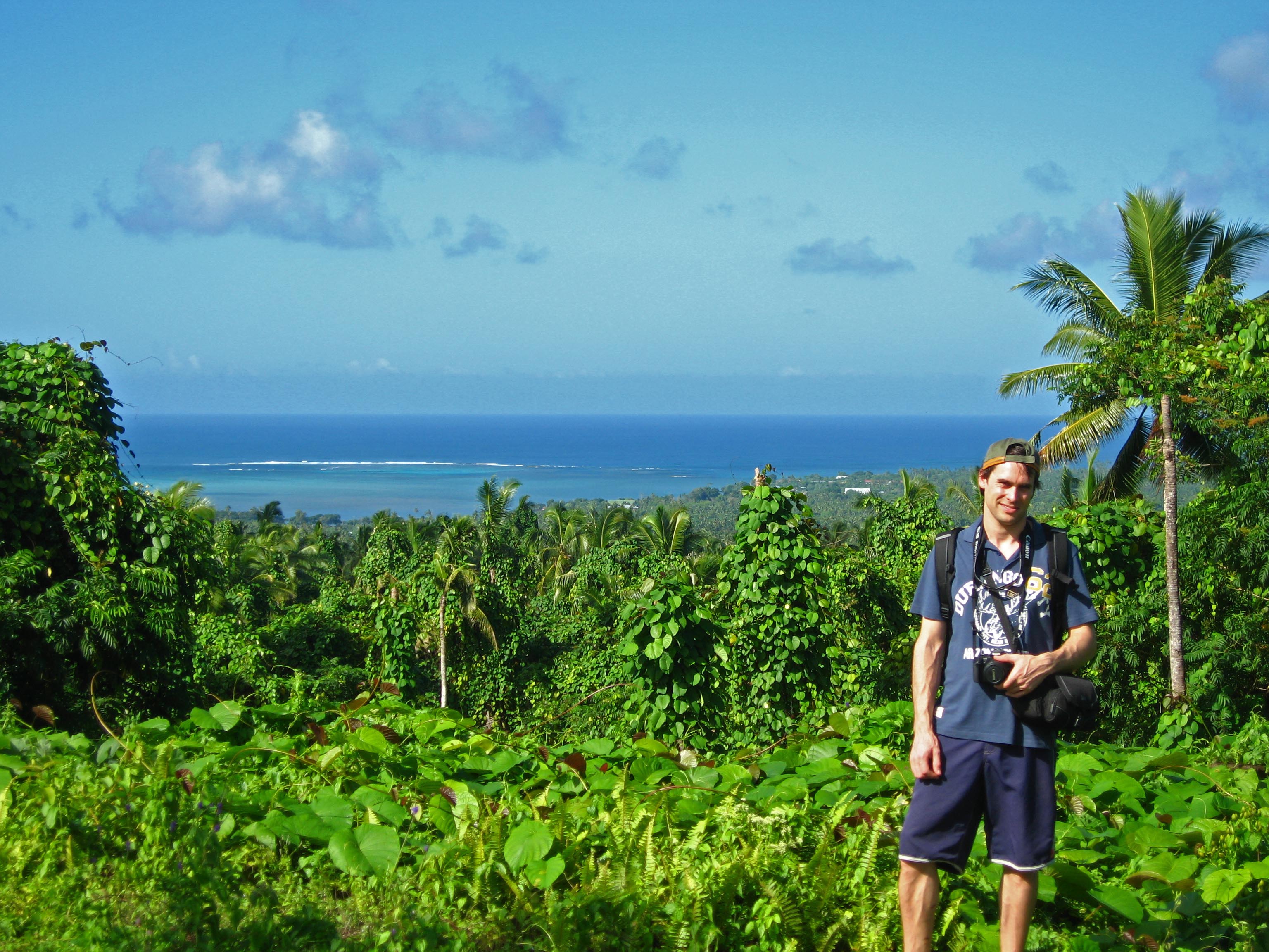
Vailoa (Vailoa i Palauli) is a village on the island of Savaiʻi in Samoa. Vailoa is the capital of Palauli district on the south east of the island. The Growth and Collapse of Pacific Island Societies by Patrick Vinton Kirch, Jean-Louis Rallu, p.222. Retrieved 6 November 2009 The population is 784. Vailoa attained the status of ''Pule'' (traditional political authority) sometime in the 19th century. The village is associated with the chiefly title of Lilomaiava. It is referred to as ''Vailoa i Palauli'' (Vailoa in Palau district). Like most villages in Samoa, the local economy is based on subsistence living. The people live off their land from crops grown in plantations behind the village or fishing. Customary land claim In recent years, vill ...[...More Info...] [...Related Items...] OR: [Wikipedia] [Google] [Baidu] |
Palauli
Palauli is a district and village of Samoa, with a population (2016 Census) of 9,300. It consists of two sections on the southern side of Savai'i. The capital is Vailoa which is also referred to as Vailoa i Palauli (Vailoa in Palauli district). Geological formations of lava tubes have created the Taga Blowholes on the coast of Taga village and attracts visitors and tourists. In recent years, the inland village of Sili has refused to let the government of Samoa build a hydroelectric power plant on traditional land due to conservation and cultural concerns. The paramount title of this district is Lilomaiava, which is conferred in Vailoa. As part of the selection process for the title-holder, Vailoa must consult Safotu village in the Gagaifomauga political district. Safotu is the northern base of the Lilomaiava title in Savai'i. Archaeology Extensive pre-historic settlements have been surveyed and studied in the Palauli district where the Pulemelei Mound is situated. [...More Info...] [...Related Items...] OR: [Wikipedia] [Google] [Baidu] |
Savaiʻi
Savaii is the largest (area 1,694 km2) and highest ( Mt Silisili at 1,858 m) island both in Samoa and in the Samoan Islands chain. The island is also the sixth largest in Polynesia, behind the three main islands of New Zealand and the Hawaiian Islands of Hawaii and Maui. Samoans sometimes refer to the island of Savaii as Salafai: This is its classical Samoan name, and is used in formal oratory and prose. The island is home to 43,958 people (2016 census), and they make up 24% of the population of Samoa. The island’s only township and ferry terminal is called Salelologa. It is the main point of entry to the island, and is situated at the east end of Savaii. A tar sealed road serves as the single main highway, connecting most of the villages. Local bus routes also operate, reaching most settlements. Savaii is made up of six ''itūmālō'' ( political districts). Each district is made up of villages that have strong traditional ties with each other — of kinship, h ... [...More Info...] [...Related Items...] OR: [Wikipedia] [Google] [Baidu] |
Samoa
Samoa, officially the Independent State of Samoa; sm, Sāmoa, and until 1997 known as Western Samoa, is a Polynesian island country consisting of two main islands (Savai'i and Upolu); two smaller, inhabited islands (Manono Island, Manono and Apolima); and several smaller, uninhabited islands, including the Aleipata Islands (Nu'utele, Nu'ulua, Fanuatapu and Namua). Samoa is located west of American Samoa, northeast of Tonga (closest foreign country), northeast of Fiji, east of Wallis and Futuna, southeast of Tuvalu, south of Tokelau, southwest of Hawaii, and northwest of Niue. The capital city is Apia. The Lapita culture, Lapita people discovered and settled the Samoan Islands around 3,500 years ago. They developed a Samoan language and Samoan culture, Samoan cultural identity. Samoa is a Unitary state, unitary Parliamentary system, parliamentary democracy with 11 Administrative divisions of Samoa, administrative divisions. It is a sovereign state and a member of the ... [...More Info...] [...Related Items...] OR: [Wikipedia] [Google] [Baidu] |
Pulemelei Mound
The Pulemelei mound (also known as Tia Seu Ancient Mound) is the largest and most ancient structure in the Samoan Islands. It is situated in Letolo Plantation in the Palauli district, at the east end of Savai'i island in Samoa. The stone mound is a pyramid constructed of basalt stones and at its base measures and has a height of about on the south edge and on the north edge, and appears to have been oriented to the cardinal directions. Excavations have revealed that it was probably constructed sometime between 1100–1400 AD and was no longer used by 1700–1800 AD. The mound was constructed with a base platform made of volcanic stones, and appears to be built on vertically placed foundations stones. On top of the base stone there are three platforms on top of each other, with vertical or slightly sloping side walls. The top platform surface was level and paved with rounded stream stones, and more than 40 stone cairns were found of recent origin distributed on the top. Local i ... [...More Info...] [...Related Items...] OR: [Wikipedia] [Google] [Baidu] |
Uale Mai
Uale Mai Vala (born 20 July 1978) is a retired rugby union player who played for the country's national teams, Manu Samoa and Samoa Sevens. He is a former captain of the Samoa Sevens team which represent Samoa internationally in the IRB Sevens World Series. He was at the time of his retirement sevens rugby's most capped player (a record since surpassed by New Zealand's DJ Forbes), and Mai is considered one of the greats in the international sport. Mai has been one of the top points scorers in the IRB World Sevens Series. Mai is from Vailoa village in Palauli district on the island of Savai'i. Mai was the first Samoan to be awarded the IRB International Sevens Player of the Year, which he received for the 2005–06 World Sevens Series. The ceremony took place in Glasgow on 26 November 2006. Mai was awarded Player of the Tournament at the 2007 Hong Kong Sevens. In 2008, he was awarded the Samoan Senior Player of the Year and also received a nomination for the IRB International S ... [...More Info...] [...Related Items...] OR: [Wikipedia] [Google] [Baidu] |
Countries Of The World
The following is a list providing an overview of sovereign states around the world with information on their status and recognition of their sovereignty. The 206 listed states can be divided into three categories based on membership within the United Nations System: 193 member states of the United Nations, UN member states, 2 United Nations General Assembly observers#Present non-member observers, UN General Assembly non-member observer states, and 11 other states. The ''sovereignty dispute'' column indicates states having undisputed sovereignty (188 states, of which there are 187 UN member states and 1 UN General Assembly non-member observer state), states having disputed sovereignty (16 states, of which there are 6 UN member states, 1 UN General Assembly non-member observer state, and 9 de facto states), and states having a political status of the Cook Islands and Niue, special political status (2 states, both in associated state, free association with New Zealand). Compi ... [...More Info...] [...Related Items...] OR: [Wikipedia] [Google] [Baidu] |
Marina Alofagia McCartney
A marina (from Spanish language, Spanish , Portuguese language, Portuguese and Italian language, Italian : ''marina'', "coast" or "shore") is a Dock (maritime), dock or basin with moorings and supplies for yachts and small boats. A marina differs from a port in that a marina does not handle large passenger ships or cargo from freighters. The word ''marina'' may also refer to an inland wharf on a river or canal that is used exclusively by non-industrial pleasure craft such as canal narrowboats. Emplacement Marinas may be located along the banks of rivers connecting to lakes or seas and may be inland. They are also located on coastal harbors (natural or man made) or coastal lagoons, either as stand alone facilities or within a port complex. History In the 19th century, the few existing pleasure craft shared the same facilities as merchant ship, trading and fishing vessels. The marina appeared in the 20th century with the popularization of yachting. Facilities and services A ... [...More Info...] [...Related Items...] OR: [Wikipedia] [Google] [Baidu] |
Miss Universe New Zealand
Miss Universe New Zealand is the New Zealand national Beauty pageant which feeds into the international Miss Universe competition. Qualification for Miss Universe New Zealand is based on regional pageants and/or personal interviews (necessary due to lack of regional pageant in some areas). History New Zealanders have contested 44 Miss Universe pageants since its inception in 1952 and is one of 33 countries to win the title. After no entrants were sent to Miss Universe in 2004 and 2005, a new national pageant, Miss Universe New Zealand, was created in 2006. New Zealand's most successful entrant came in 1983 when Lorraine Downes won the Miss Universe title. The country's only other top five placing came when Delyse Nottle was second runner-up to Shawn Weatherly in 1980. New Zealand has also had three semi-finalist placings, in 1962, 1981 and 1992. New Zealand is one of only 12 countries to win two or more Miss Photogenic awards, won by Carole Robinson (1969), Delyse Nottle ( ... [...More Info...] [...Related Items...] OR: [Wikipedia] [Google] [Baidu] |
England
England is a country that is part of the United Kingdom. It shares land borders with Wales to its west and Scotland to its north. The Irish Sea lies northwest and the Celtic Sea to the southwest. It is separated from continental Europe by the North Sea to the east and the English Channel to the south. The country covers five-eighths of the island of Great Britain, which lies in the North Atlantic, and includes over 100 smaller islands, such as the Isles of Scilly and the Isle of Wight. The area now called England was first inhabited by modern humans during the Upper Paleolithic period, but takes its name from the Angles, a Germanic tribe deriving its name from the Anglia peninsula, who settled during the 5th and 6th centuries. England became a unified state in the 10th century and has had a significant cultural and legal impact on the wider world since the Age of Discovery, which began during the 15th century. The English language, the Anglican Church, and Engli ... [...More Info...] [...Related Items...] OR: [Wikipedia] [Google] [Baidu] |
Newcastle Upon Tyne
Newcastle upon Tyne ( RP: , ), or simply Newcastle, is a city and metropolitan borough in Tyne and Wear, England. The city is located on the River Tyne's northern bank and forms the largest part of the Tyneside built-up area. Newcastle is also the most populous city of North East England. Newcastle developed around a Roman settlement called Pons Aelius and the settlement later took the name of a castle built in 1080 by William the Conqueror's eldest son, Robert Curthose. Historically, the city’s economy was dependent on its port and in particular, its status as one of the world's largest ship building and repair centres. Today, the city's economy is diverse with major economic output in science, finance, retail, education, tourism, and nightlife. Newcastle is one of the UK Core Cities, as well as part of the Eurocities network. Famous landmarks in Newcastle include the Tyne Bridge; the Swing Bridge; Newcastle Castle; St Thomas’ Church; Grainger Town including G ... [...More Info...] [...Related Items...] OR: [Wikipedia] [Google] [Baidu] |
Pitonu'u
Pitonu'u is a village on the island of Savai'i in Samoa. It is situated on the south coast of the island in the district of Satupa'itea and the electoral district of Satupa'itea. The population is 283. The word ''pito nu'u'' means "a smaller part of a larger village" in the Samoan language Samoan ( or ; ) is a Polynesian language spoken by Samoans of the Samoan Islands. Administratively, the islands are split between the sovereign country of Samoa and the United States territory of American Samoa. It is an official language, alon .... References Populated places in Samoa {{Samoa-geo-stub ... [...More Info...] [...Related Items...] OR: [Wikipedia] [Google] [Baidu] |


