|
Tsawarong
Cawarong or Tsawarong (; ) is a township in Zayü County, Tibet Autonomous Region of China China, officially the People's Republic of China (PRC), is a country in East Asia. It is the world's most populous country, with a population exceeding 1.4 billion, slightly ahead of India. China spans the equivalent of five time zones and .... Wu Zhenhua (武振华), Xizang Diming (西藏地名; Place Names in Tibet), p.65, Chinese Zangxue Press (中国藏学出版社) 1996, It lies at an altitude of 2,003 metres (6,574 feet). Formerly known as Tsarung, it was traditionally a southern gateway and trade route into Tibet from Yunnan, forming part of the tea-horse road ( ''Chá-Mǎ Gǔdào''). It is a very arid area with little rainfall. An unsealed road cut into the cliffs above the Nu River links it to Bingzhongluo in Yunnan. Cawarong is a major step on the Khora of the Khawa Karpo. Government Its Chinese zoning code is 542626202. Subdivisions The town comprises 28 vil ... [...More Info...] [...Related Items...] OR: [Wikipedia] [Google] [Baidu] |
Tibetan
Tibetan may mean: * of, from, or related to Tibet * Tibetan people, an ethnic group * Tibetan language: ** Classical Tibetan, the classical language used also as a contemporary written standard ** Standard Tibetan, the most widely used spoken dialect ** Tibetan pinyin, a method of writing Standard Tibetan in Latin script ** Tibetan script ** any other of the Tibetic languages Tibetan may additionally refer to: Culture * Old Tibetan, an era of Tibetan history * Tibetan art * Music of Tibet * Tibetan rug * Tibetan culture * Tibetan cuisine Religion * Tibetan Buddhism * Tibetan Muslims Other uses * Tibetan alphabet * Tibetan (Unicode block) * Tibetan name * Tibetan calendar * Tibetan Spaniel, a breed of dog * Tibetan Mastiff, a breed of dog See also * Tibetan Bells (other) * Traditional Tibetan medicine Traditional Tibetan medicine (), also known as Sowa-Rigpa medicine, is a centuries-old traditional medical system that employs a complex approach to diagnosis ... [...More Info...] [...Related Items...] OR: [Wikipedia] [Google] [Baidu] |
Tibet Autonomous Region
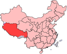
The Tibet Autonomous Region or Xizang Autonomous Region, often shortened to Tibet or Xizang, is a province-level autonomous region of the People's Republic of China in Southwest China. It was overlayed on the traditional Tibetan regions of Ü-Tsang and Kham. It was formally established in 1965 to replace the Tibet Area, the former administrative division of the People's Republic of China (PRC) established after the annexation of Tibet. The establishment was about five years after the 1959 Tibetan uprising and the dismissal of the Kashag, and about 13 years after the original annexation. The current borders of the Tibet Autonomous Region were generally established in the 18th century and include about half of historic Tibet, or the ethno-cultural Tibet. The Tibet Autonomous Region spans over and is the second-largest province-level division of China by area, after Xinjiang. Due to its harsh and rugged terrain, it is sparsely populated at just over 3.6 million people ... [...More Info...] [...Related Items...] OR: [Wikipedia] [Google] [Baidu] |
Nyingchi Prefecture
Nyingchi (), also known as Linzhi and as Nyingtri, is a prefecture-level city in the southeast of the Tibet Autonomous Region in China. The administrative seat of Nyingchi is Bayi District. Nyingchi is the location of Buchu Monastery. Economy Tourism The average elevation of Nyingchi is 3,040 meters (9,974 feet), which is the lowest compared with the other prefectures in Tibet. So, the risk of getting high-altitude sickness is relatively lower than other parts on the plateau. Guangdong province announced in 2012 that it plans to invest more than RMB 400 million (US$63 million) in Nyingchi's tourism industry. According to the plan, Guangdong will help build 22 "prosperous model villages" in Nyingchi in counties such as Bomê and Zayü. Transportation It takes about 5 hours to travel from Lhasa to Nyingchi by a highway opened at the end of 2018. Nyingchi is connected to Lhasa by the 435-kilometer Lhasa–Nyingchi railway, completed in 2021. The journey from Lhasa by train ... [...More Info...] [...Related Items...] OR: [Wikipedia] [Google] [Baidu] |
Townships In China
Townships (), formally township-level divisions (), are the basic level (fourth-level administrative units) of political divisions in China. They are similar to municipalities and communes in other countries and in turn may contain village committees and villages. In 1995 there were 29,502 townships and 17,532 towns (a total of 47,034 township-level divisions) in China. Much like other levels of government in mainland China, the township's governance is divided between the Communist Party Township Secretary, and the "county magistrate" (). The township party secretary, along with the township's party committee, determines policy. The magistrate is in charge of administering the daily affairs of government and executing policies as determined by the party committee. A township official is the lowest-level ranked official in the civil service hierarchy; in practice, however, the township party secretary and magistrate can amass high levels of personal power. A township government ... [...More Info...] [...Related Items...] OR: [Wikipedia] [Google] [Baidu] |
China
China, officially the People's Republic of China (PRC), is a country in East Asia. It is the world's List of countries and dependencies by population, most populous country, with a Population of China, population exceeding 1.4 billion, slightly ahead of India. China spans the equivalent of five time zones and Borders of China, borders fourteen countries by land, the List of countries and territories by land borders, most of any country in the world, tied with Russia. Covering an area of approximately , it is the world's third List of countries and dependencies by area, largest country by total land area. The country consists of 22 provinces of China, provinces, five autonomous regions of China, autonomous regions, four direct-administered municipalities of China, municipalities, and two special administrative regions of China, Special Administrative Regions (Hong Kong and Macau). The national capital is Beijing, and the List of cities in China by population, most populous cit ... [...More Info...] [...Related Items...] OR: [Wikipedia] [Google] [Baidu] |
Altitude
Altitude or height (also sometimes known as depth) is a distance measurement, usually in the vertical or "up" direction, between a reference datum and a point or object. The exact definition and reference datum varies according to the context (e.g., aviation, geometry, geographical survey, sport, or atmospheric pressure). Although the term ''altitude'' is commonly used to mean the height above sea level of a location, in geography the term elevation is often preferred for this usage. Vertical distance measurements in the "down" direction are commonly referred to as depth. In aviation In aviation, the term altitude can have several meanings, and is always qualified by explicitly adding a modifier (e.g. "true altitude"), or implicitly through the context of the communication. Parties exchanging altitude information must be clear which definition is being used. Aviation altitude is measured using either mean sea level (MSL) or local ground level (above ground leve ... [...More Info...] [...Related Items...] OR: [Wikipedia] [Google] [Baidu] |
Yunnan
Yunnan , () is a landlocked province in the southwest of the People's Republic of China. The province spans approximately and has a population of 48.3 million (as of 2018). The capital of the province is Kunming. The province borders the Chinese provinces of Guizhou, Sichuan, autonomous regions of Guangxi, and Tibet as well as Southeast Asian countries: Vietnam, Laos, and Myanmar. Yunnan is China's fourth least developed province based on disposable income per capita in 2014. Yunnan is situated in a mountainous area, with high elevations in the northwest and low elevations in the southeast. Most of the population lives in the eastern part of the province. In the west, the altitude can vary from the mountain peaks to river valleys by as much as . Yunnan is rich in natural resources and has the largest diversity of plant life in China. Of the approximately 30,000 species of higher plants in China, Yunnan has perhaps 17,000 or more. Yunnan's reserves of aluminium, lead, ... [...More Info...] [...Related Items...] OR: [Wikipedia] [Google] [Baidu] |
Nu River
, ''Mae Nam Salawin'' ( , name_etymology = , image = Sweet_View_of_Salween_River_in_Tang_Yan_Township,_Shan_State,_Myanmar.jpg , image_size = , image_caption = Salween River in Shan State, Myanmar , map = Salween river basin map.png , map_size = , map_caption = Map of the Salween River basin , pushpin_map = , pushpin_map_size = , pushpin_map_caption= , subdivision_type1 = Country , subdivision_name1 = China, Myanmar (Burma), Thailand , subdivision_type2 = Provinces of China, Provinces (PRC) , subdivision_name2 = Tibet Autonomous Region, Yunnan , subdivision_type3 = States of Burma, States (Myanmar) , subdivision_name3 = Shan State, Shan, Kayah State, Karenni (Kayah), Kayin State, Karen (Kayin), Mon State, Mon , subdivision_type4 = Provinces of Thailand, Province (Thailand) , subdivision_name4 = Mae Hong Son Province, Mae Hong Son , length = Lehner, B., Verdin, K., ... [...More Info...] [...Related Items...] OR: [Wikipedia] [Google] [Baidu] |
Kawagarbo
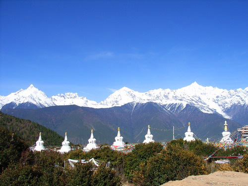
Kawa Garbo or Khawa Karpo (; also transcribed as Kawadgarbo, Khawakarpo, Moirig Kawagarbo, Kawa Karpo or Kha-Kar-Po), as it is known by local residents and pilgrims, or Kawagebo Peak (), is the highest mountain in the Chinese province of Yunnan. It is located on the border between Dêqên County, Yunnan, and the counties of Zogang and Zayü of the Tibet Autonomous Region. It rises about west of Shengping (升平镇), the seat of Dêqên County, which lies on China National Highway 214. What is now Dêqên County has been part of Yunnan since the 1720s, when the current border with Tibet was established by the early Qing Dynasty. Kawagarbo is one of the most sacred peaks in the Tibetan world Keith Dowman. 1997. The Sacred Life of Tibet. San Francisco, California, USA: Thorsons. and is often referred to as Nyainqênkawagarbo to show its sacredness and avoid ambiguousness with the other Kawagarbo in the Anung-Derung-speaking Gongshan County. Geography Kawagarbo is the high poi ... [...More Info...] [...Related Items...] OR: [Wikipedia] [Google] [Baidu] |
List Of Towns And Villages In Tibet
This is an alphabetical list of all populated places, including cities, towns and villages, in the Tibet Autonomous Region of western China. A *Alamdo *Alhar *Arza *Asog B * Baga *Bagar * Baidi *Baima *Baimai *Baixoi *Bamda *Banag *Banbar *Banggaidoi *Bangkor *Bangru * Bangxing * Baqên *Bar *Bêba *Bei *Bênqungdo *Bilung *Birba * Biru *Bogkamba *Boindoi * Bolo *Bongba *Boqê *Bumgyê *Bungona’og * Bünsum * Burang *Bushêngcaka C * Caina *Cakaxiang *Camco *Cawarong * Cazê *Cêgnê *Cêngdo *Cêri *Cêrwai *Chabug *Chacang *Chagla * Chagna *Chagyoi *Cha’gyüngoinba *Chalükong *Chamco *Chamda *Chamoling *Changgo *Changlung *Changmar *Charing *Chatang *Chawola *Chêcang *Chênggo *Chepzi *Chibma *Chido *Chigu *Chongkü *Chongsar *Chowa *Chubalung *Chubarong *Chuka *Chumba *Chumbu *Chunduixiang *Co Nyi *Cocholung * Codoi *Cogo * Coka *Comai *Cona (Tsona) *Co’nga *Congdü *Conggo * Coqên *Coyang * Cuoma *Cuozheqiangma D *Dagdong *Dagmo *Dagri *Dagring *Dagzhuka ... [...More Info...] [...Related Items...] OR: [Wikipedia] [Google] [Baidu] |


