|
Taveta, Kenya
Taveta is a town in the Taita-Taveta County, Kenya. Location Taveta town is wedged into a projection of Kenyan territory bordered on the north and west by Tanzania. The town lies at the border with Tanzania, directly across from the town of Holili. This is approximately , by road, west of Voi, the nearest large town, on the Arusha–Holili–Taveta–Voi Road. This lies approximately , by road southeast of Nairobi, the capital and largest city in Kenya. The coordinates of the town are:3°23'44.0"S, 37°40'34.0"E (Latitude:-3.395565; Longitude:37.676113). In addition to Mount Kilimanjaro, Taveta also enjoys proximity to Lake Chala, a volcanic freshwater lake of extraordinary depth. First World War In 1914, Taveta was the scene of the first military action in East Africa between forces of the British and German empires. On 15 August, a German force of about 300 soldiers, led by Captain Tom von Prince, advanced across the border and seized the town of Taveta. The objective ... [...More Info...] [...Related Items...] OR: [Wikipedia] [Google] [Baidu] |
Kenya
) , national_anthem = "Ee Mungu Nguvu Yetu"() , image_map = , map_caption = , image_map2 = , capital = Nairobi , coordinates = , largest_city = Nairobi , official_languages = Constitution (2009) Art. 7 ational, official and other languages"(1) The national language of the Republic is Swahili. (2) The official languages of the Republic are Swahili and English. (3) The State shall–-–- (a) promote and protect the diversity of language of the people of Kenya; and (b) promote the development and use of indigenous languages, Kenyan Sign language, Braille and other communication formats and technologies accessible to persons with disabilities." , languages_type = National language , languages = Swahili , ethnic_groups = , ethnic_groups_year = 2019 census , religion = , religion_year = 2019 census , demonym = ... [...More Info...] [...Related Items...] OR: [Wikipedia] [Google] [Baidu] |
Mombasa
Mombasa ( ; ) is a coastal city in southeastern Kenya along the Indian Ocean. It was the first capital of the British East Africa, before Nairobi was elevated to capital city status. It now serves as the capital of Mombasa County. The town is known as "the white and blue city" in Kenya. It is the country's oldest (circa 900 AD) and second-largest List of cities in Kenya, cityThe World Factbook . Cia.gov. Retrieved on 17 August 2013. after the capital Nairobi, with a population of about 1,208,333 people according to the 2019 census. Its metropolitan region is the second-largest in the country, and has a population of 3,528,940 people. Mombasa's location on the Indian Ocean made it a historical trading centre, and it has been controlled by ma ... [...More Info...] [...Related Items...] OR: [Wikipedia] [Google] [Baidu] |
Populated Places In Kenya
Population typically refers to the number of people in a single area, whether it be a city or town, region, country, continent, or the world. Governments typically quantify the size of the resident population within their jurisdiction using a census, a process of collecting, analysing, compiling, and publishing data regarding a population. Perspectives of various disciplines Social sciences In sociology and population geography, population refers to a group of human beings with some predefined criterion in common, such as location, race, ethnicity, nationality, or religion. Demography is a social science which entails the statistical study of populations. Ecology In ecology, a population is a group of organisms of the same species who inhabit the same particular geographical area and are capable of interbreeding. The area of a sexual population is the area where inter-breeding is possible between any pair within the area and more probable than cross-breeding with ind ... [...More Info...] [...Related Items...] OR: [Wikipedia] [Google] [Baidu] |
Railway Stations In Tanzania
ARailway stations in Tanzania include: *Tanzania Standard Gauge Railway Maps UN Map- Tanga and Kidatu lines not shown. Railways in southern AfricaUNHCR Map* Interactive map of Tanzania railways * Look for the MSN Map at the bottom of pages of many towns, or look for the Map Button at the top and scroll down the MSN map. Towns served by rail Tanzania Railways Corporation ( all gauge) Central Line # Dar es Salaam - ocean port - former national capital - 8 km from TAZARA line # Ruvu (75m) - junction to Tanga line # Morogoro (510m) - junction to north # Kilosa (572m) - junction going south to TAZARA # Gulwe (680m) # Igandu (985m) # Dodoma (1148m) - The national capital # Manyoni (1244m) - junction going north to Singida # Itigi (1306m) # Ikungu (1289m) # Tabora (1212m) - junction going north to Mwanza # Kaliua (1112m) - junction going south to Mpanda # Kigoma (775m) - terminal and port on Lake Tanganyika Kidatu Line # (Not shown on map) # Kilosa (572m) - j ... [...More Info...] [...Related Items...] OR: [Wikipedia] [Google] [Baidu] |
Railway Stations In Kenya
Railway stations in Kenya include: Maps * UN Map * UNHCR Atlas Map * Prondis Map * Railway Gazette International June 2012, p31 * KRC Map Towns served by metre gauge railways * Mombasa - ocean port * Changamwe * Miritini * Mazeras * Mariakani * Maji ya Chumvi * Samburu, Kenya, Samburu * Taru, Kenya, Taru * Mackinnon Road * Mwanatibu * Buchuma * Wangala, Kenya, Wangala * Maungu * Ndara * Voi - junction ** Mwatate ** Bura, Taita-Taveta District, Kenya, Bura ** Mashoti ** Maktau ** Murka ** Ziwani ** Taveta, Kenya, Taveta - across Tanzania border from Moshi, Kilimanjaro, Moshi * Irima * Ndi * Manyani * Tsavo * Kyulu * Kenani * Kanga, Kenya, Kanga * Mtito Andei * Kathekani * Darajani * Ngwata * Masongaleni * Kikumbulyu * Kibwezi * Mbuinzau * Makindu * Ikoyo * Kiboko, Kenya, Kiboko * Simba, Kenya, Simba * Kabati * Emali * Nzai * Sultan Hamud * Kima, Kenya, Kima * Kalembwani * Kiu * Ulu, Kenya, Ulu * Konza, Kenya, Konza - junction for Magadi ** Kajiado ** Kenya Marble Quarry ** El ... [...More Info...] [...Related Items...] OR: [Wikipedia] [Google] [Baidu] |
Kamba People
The Kamba or Akamba (sometimes called Wakamba) people are a Bantu ethnic group who predominantly live in the area of Kenya stretching from Nairobi to Tsavo and north to Embu, in the southern part of the former Eastern Province. This land is called ''Ukambani'' and constitutes Makueni County, Kitui County and Machakos County. They also form the second largest ethnic group in 8 counties including Nairobi and Mombasa counties. Origin The Kamba are of Bantu origin.Joseph Bindloss, Tom Parkinson, Matt Fletcher, ''Lonely Planet Kenya'', (Lonely Planet: 2003), p.35. They are closely related in language and culture to the Kikuyu, the Embu, the Mbeere and the Meru, and to some extent relate closely to the Digo and the Giriama of the Kenyan coast. Kambas are concentrated in the lowlands of southeast Kenya from the vicinity of Mount Kenya to the coast. The first group of Kamba people settled in the present-day Mbooni Hills in the Machakos District of Kenya in the second half of ... [...More Info...] [...Related Items...] OR: [Wikipedia] [Google] [Baidu] |
Taveta People
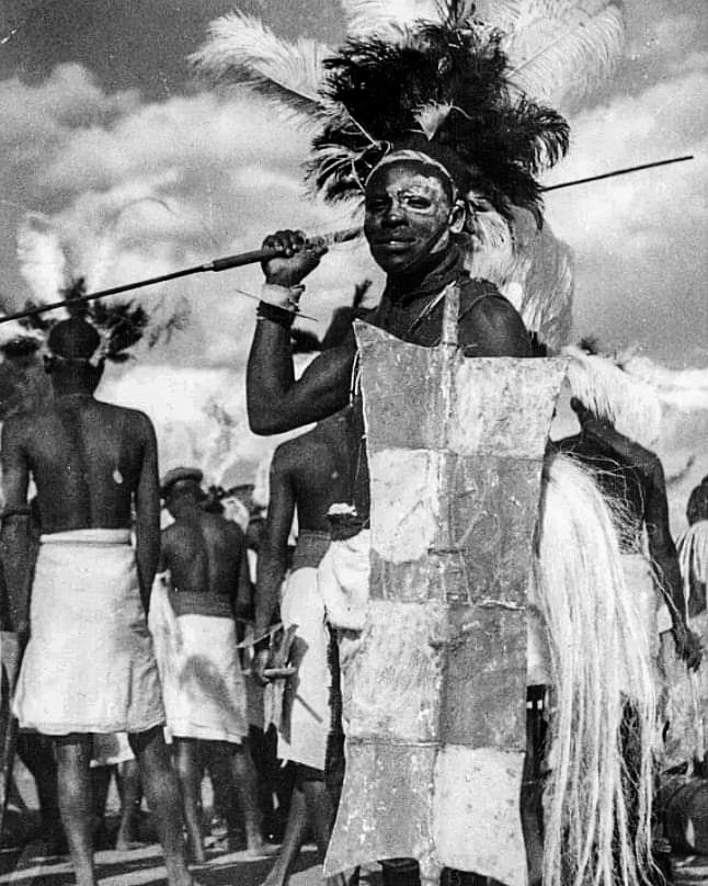
:''There is also a town in Taita-Taveta District called Taveta'' Taveta is the name of a tribe found in Kenya. It is also the name of the principal town in the land of the Taveta people, and the name of the surrounding subdistrict of Kenya. The people of Taveta The Taveta tribe is one of the Bantu tribes found in Southern Kenya in the Taita Taveta County. The people are sometimes referred to as the 'Wataveta', which is the plural name of the people in their own language, Kitaveta. It has been argued that the Taveta population is commingled with other tribes, notably the Taita, Pare, Chagga, Kamba and Maasai. In addition, the inhabitants reveal migration occurred back and forth throughout the history of these groups, and the Taveta people should be viewed as a part of the bigger population inhabiting the entire Kilimanjaro Corridor. Because of their frequent contact with other tribes, most Tavetans are fluent in (Ki) Swahili as a second language, and may also acquire some En ... [...More Info...] [...Related Items...] OR: [Wikipedia] [Google] [Baidu] |
East African Community
The East African Community (EAC) is an intergovernmental organisation composed of seven countries in the Great Lakes region of East Africa: the Democratic Republic of the Congo, the United Republic of Tanzania, the Republics of Kenya, Burundi, Rwanda, South Sudan, and Uganda. Évariste Ndayishimiye, the president of Burundi, is the current EAC chairman. The organisation was founded in 1967, collapsed in 1977, and was revived on 7 July 2000. In 2008, after negotiations with the Southern African Development Community (SADC) and the Common Market for Eastern and Southern Africa (COMESA), the EAC agreed to an expanded free trade area including the member states of all three organizations. The EAC is an integral part of the African Economic Community. The capital of the EAC is Arusha, Tanzania. The EAC is a potential precursor to the establishment of the East African Federation, a proposed federation of its members into a single sovereign state. In 2010, the EAC launched its own ... [...More Info...] [...Related Items...] OR: [Wikipedia] [Google] [Baidu] |
Central Business District
A central business district (CBD) is the commercial and business centre of a city. It contains commercial space and offices, and in larger cities will often be described as a financial district. Geographically, it often coincides with the "city centre" or "downtown". However, these concepts are not necessarily synonymous: many cities have a central ''business'' district located away from its commercial and or cultural centre and or downtown/city centre, and there may be multiple CBDs within a single urban area. The CBD will often be characterised by a high degree of accessibility as well as a large variety and concentration of specialised goods and services compared to other parts of the city. For instance, Midtown Manhattan, New York City, is the largest central business district in the city and in the United States. London's city centre is usually regarded as encompassing the historic City of London and the medieval City of Westminster, while the City of London and the transform ... [...More Info...] [...Related Items...] OR: [Wikipedia] [Google] [Baidu] |
Coffee
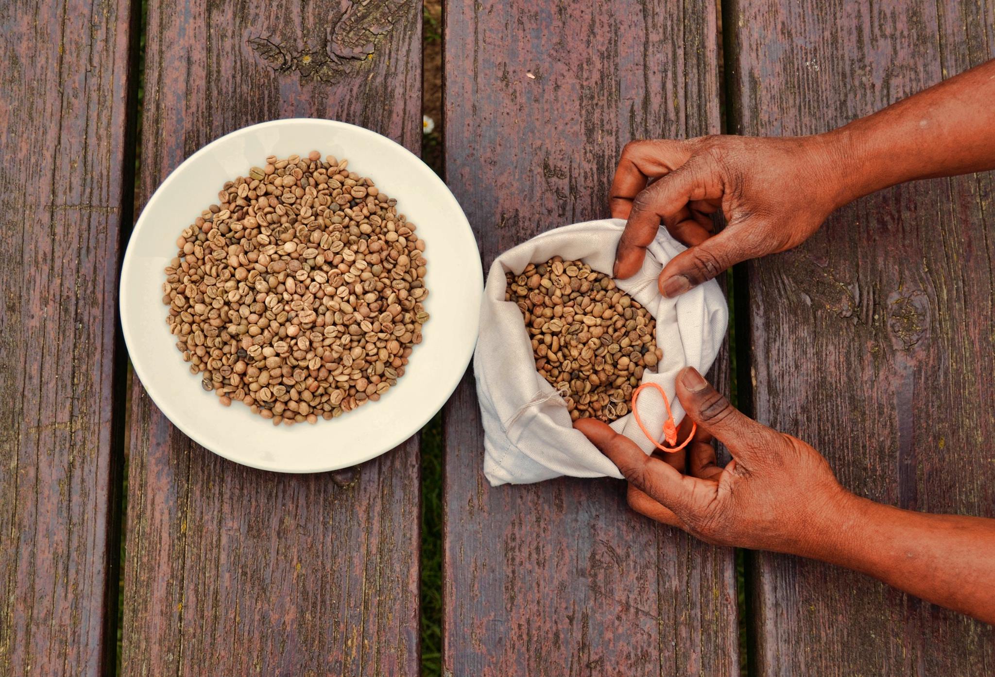
Coffee is a drink prepared from roasted coffee beans. Darkly colored, bitter, and slightly acidic, coffee has a stimulant, stimulating effect on humans, primarily due to its caffeine content. It is the most popular hot drink in the world. Seeds of the ''Coffea'' plant's fruits are separated to produce unroasted green coffee beans. The beans are Coffee roasting, roasted and then ground into fine particles that are typically steeped in hot water before being filtered out, producing a cup of coffee. It is usually served hot, although chilled or iced coffee is common. Coffee can be prepared and presented in a variety of ways (e.g., espresso, French press, caffè latte, or already-brewed canned coffee). Sugar, sugar substitutes, milk, and cream are often used to mask the bitter taste or enhance the flavor. Though coffee is now a global commodity, it has a History of coffee, long history tied closely to food traditions around the Red Sea. The earliest credible evidence of coffee d ... [...More Info...] [...Related Items...] OR: [Wikipedia] [Google] [Baidu] |
Rubies
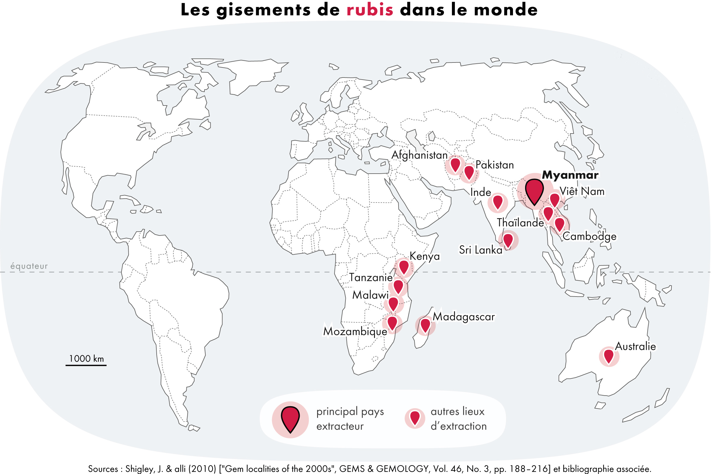
A ruby is a pinkish red to blood-red colored gemstone, a variety of the mineral corundum ( aluminium oxide). Ruby is one of the most popular traditional jewelry gems and is very durable. Other varieties of gem-quality corundum are called sapphires. Ruby is one of the traditional cardinal gems, alongside amethyst, sapphire, emerald, and diamond. The word ''ruby'' comes from ''ruber'', Latin for red. The color of a ruby is due to the element chromium. Some gemstones that are popularly or historically called rubies, such as the Black Prince's Ruby in the British Imperial State Crown, are actually spinels. These were once known as "Balas rubies". The quality of a ruby is determined by its color, cut, and clarity, which, along with carat weight, affect its value. The brightest and most valuable shade of red, called blood-red or pigeon blood, commands a large premium over other rubies of similar quality. After color follows clarity: similar to diamonds, a clear stone will comman ... [...More Info...] [...Related Items...] OR: [Wikipedia] [Google] [Baidu] |
British Colony
The British Overseas Territories (BOTs), also known as the United Kingdom Overseas Territories (UKOTs), are fourteen territories with a constitutional and historical link with the United Kingdom. They are the last remnants of the former British Empire and do not form part of the United Kingdom itself. The permanently inhabited territories are internally self-governing, with the United Kingdom retaining responsibility for defence and foreign relations. Three of the territories are inhabited only by a transitory population of military or scientific personnel. All but one of the rest are listed by the UN Special Committee on Decolonization as non-self-governing territories. All fourteen have the British monarch as head of state. three territories (the Falkland Islands, Gibraltar and the Sovereign Base Areas of Akrotiri and Dhekelia on the island of Cyprus) are the responsibility of the minister of state for Europe and the Americas; the minister responsible for the remaining ... [...More Info...] [...Related Items...] OR: [Wikipedia] [Google] [Baidu] |


.jpg)

