|
Trou Du Diable
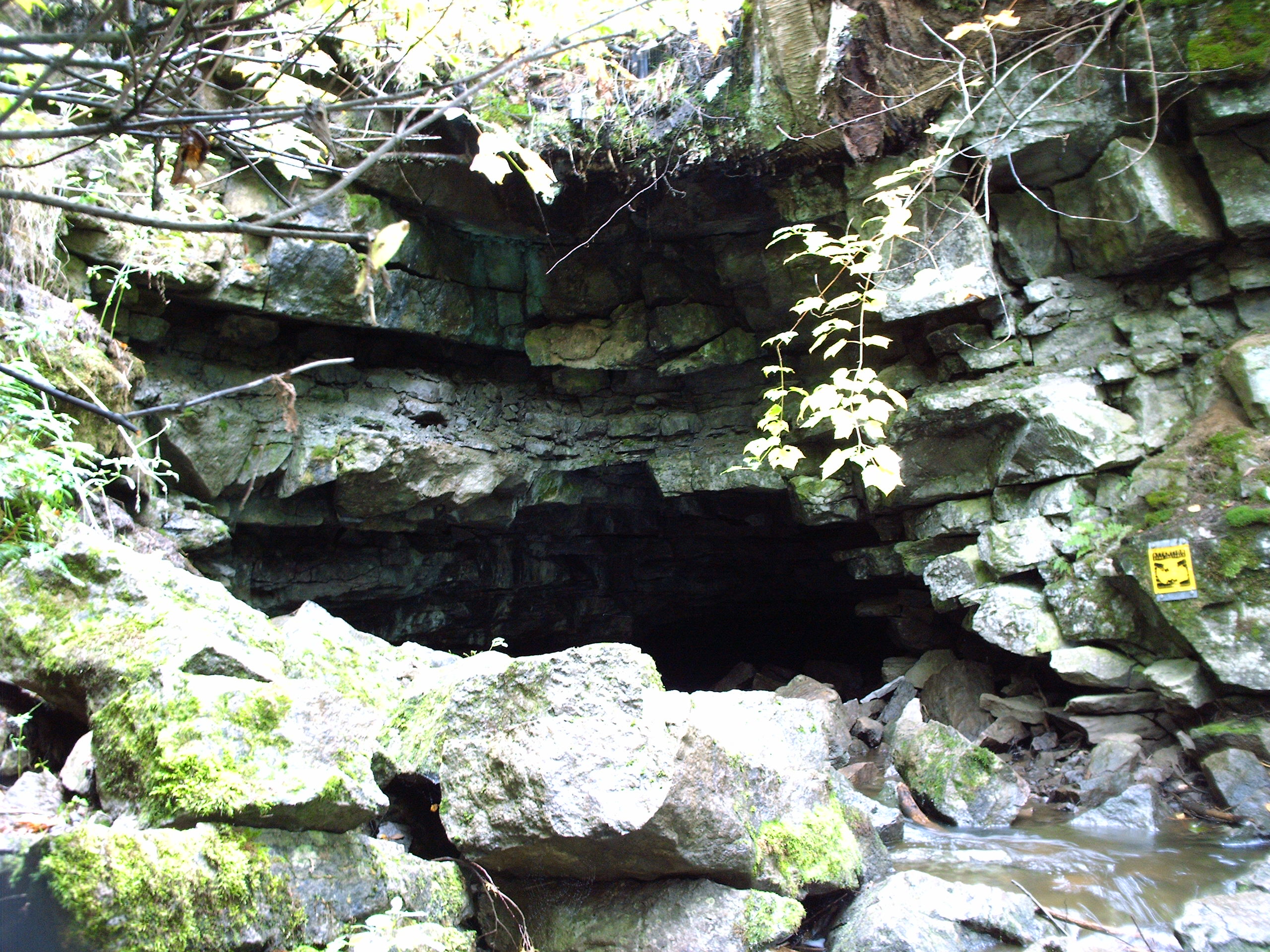
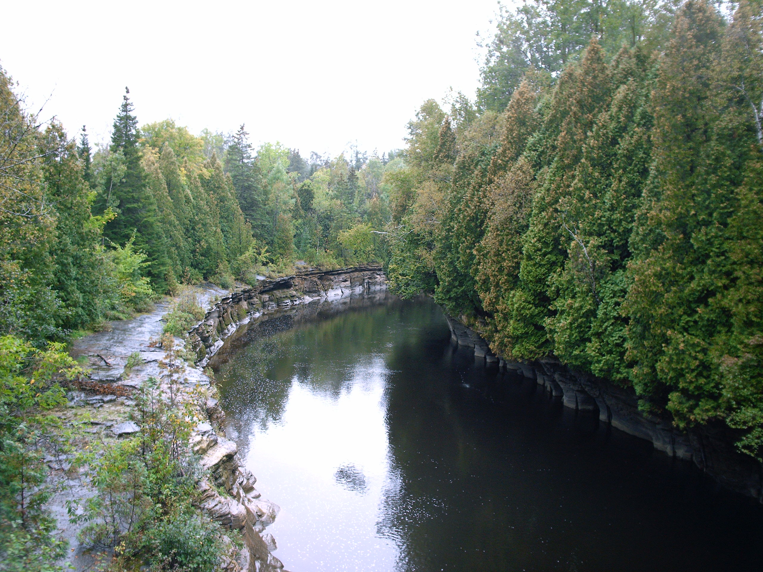
The Trou du Diable (translated in English as Devil's Hole) is a cave situated in St-Casimir, in the province of Quebec, Canada Canada is a country in North America. Its ten provinces and three territories extend from the Atlantic Ocean to the Pacific Ocean and northward into the Arctic Ocean, covering over , making it the world's second-largest country by tot .... The Trou du Diable is in fact a creek of which the last 980 meters are underground, which makes it the second longest in Quebec. It is tributary of the Rivière Ste-Anne, about four kilometers upstream of St-Casimir. Its highest point is 6.8 metres above the bottom of the cave, and at some places visitors have to crawl to move forward. External links Description and images from Nichole Ouellette [...More Info...] [...Related Items...] OR: [Wikipedia] [Google] [Baidu] |
Cave
A cave or cavern is a natural void in the ground, specifically a space large enough for a human to enter. Caves often form by the weathering of rock and often extend deep underground. The word ''cave'' can refer to smaller openings such as sea caves, rock shelters, and grottos, that extend a relatively short distance into the rock and they are called ''exogene'' caves. Caves which extend further underground than the opening is wide are called ''endogene'' caves. Speleology is the science of exploration and study of all aspects of caves and the cave environment. Visiting or exploring caves for recreation may be called ''caving'', ''potholing'', or ''spelunking''. Formation types The formation and development of caves is known as ''speleogenesis''; it can occur over the course of millions of years. Caves can range widely in size, and are formed by various geological processes. These may involve a combination of chemical processes, erosion by water, tectonic forces, microorgani ... [...More Info...] [...Related Items...] OR: [Wikipedia] [Google] [Baidu] |
Saint-Casimir, Quebec
Saint-Casimir is a small village of about 1800 people in the Portneuf Regional County Municipality in the province of Quebec, Canada. It is located on the Sainte-Anne River, about southwest of Quebec City and northeast of Trois-Rivières. It was founded in 1836 by people who came from Ste-Anne-de-la-Pérade following to the east along the Sainte-Anne. The name of Saint-Casimir was given in honour of Mr. Casimir Déry, a notary who paid for the construction of the church, which is in the top 10 of the most beautiful churches in the province of Québec. In turn, the church, and the town, is named after Saint Casimir, a patron saint of Poland, Lithuania, and youth. Two provincial numbered roads go through St-Casimir: Route 354 (east-west - from Ste-Anne de la Pérade to St-Raymond) and Route 363 (south-north - from Deschambault to Lac-aux-Sables). Both roads lead to Autoroute 40, the Montreal-Québec City link on the north shore. Five rivers run in Saint-Casimir: Sainte-An ... [...More Info...] [...Related Items...] OR: [Wikipedia] [Google] [Baidu] |
Quebec
Quebec ( ; )According to the Canadian government, ''Québec'' (with the acute accent) is the official name in Canadian French and ''Quebec'' (without the accent) is the province's official name in Canadian English is one of the thirteen provinces and territories of Canada. It is the largest province by area and the second-largest by population. Much of the population lives in urban areas along the St. Lawrence River, between the most populous city, Montreal, and the provincial capital, Quebec City. Quebec is the home of the Québécois nation. Located in Central Canada, the province shares land borders with Ontario to the west, Newfoundland and Labrador to the northeast, New Brunswick to the southeast, and a coastal border with Nunavut; in the south it borders Maine, New Hampshire, Vermont, and New York in the United States. Between 1534 and 1763, Quebec was called ''Canada'' and was the most developed colony in New France. Following the Seven Years' War, Quebec b ... [...More Info...] [...Related Items...] OR: [Wikipedia] [Google] [Baidu] |
Canada
Canada is a country in North America. Its ten provinces and three territories extend from the Atlantic Ocean to the Pacific Ocean and northward into the Arctic Ocean, covering over , making it the world's second-largest country by total area. Its southern and western border with the United States, stretching , is the world's longest binational land border. Canada's capital is Ottawa, and its three largest metropolitan areas are Toronto, Montreal, and Vancouver. Indigenous peoples have continuously inhabited what is now Canada for thousands of years. Beginning in the 16th century, British and French expeditions explored and later settled along the Atlantic coast. As a consequence of various armed conflicts, France ceded nearly all of its colonies in North America in 1763. In 1867, with the union of three British North American colonies through Confederation, Canada was formed as a federal dominion of four provinces. This began an accretion of provinces an ... [...More Info...] [...Related Items...] OR: [Wikipedia] [Google] [Baidu] |
Sainte-Anne River
The Sainte-Anne River is a tributary of the north shore of the Saint Lawrence River, whose mouth is located at Sainte-Anne-de-la-Pérade. This river flows in the province of Quebec, Canada, in the administrative regions of: * Capitale-Nationale: ** La Jacques-Cartier Regional County Municipality (municipalities of Stoneham-et-Tewkesbury, Saint-Gabriel-de-Valcartier); ** Portneuf Regional County Municipality (municipalities of Saint-Raymond, Saint-Léonard-de-Portneuf, Sainte-Christine-d'Auvergne, Quebec, Sainte-Christine-d'Auvergne, Saint-Gilbert, Quebec, Saint-Gilbert, Saint-Alban, Quebec, Saint-Alban, Saint-Casimir); *Mauricie: Les Chenaux Regional County Municipality (municipality of Sainte-Anne-de-la-Pérade Sainte-Anne-de-la-Pérade () is a municipality in the Les Chenaux Regional County Municipality, in the Mauricie region of the province of Quebec in Canada. The town is located near the mouth of the Sainte-Anne River along the ''Chemin du Roy'', ...). It is well known ... [...More Info...] [...Related Items...] OR: [Wikipedia] [Google] [Baidu] |


