|
Tremont Street
Tremont Street is a major thoroughfare in Boston, Massachusetts. Tremont Street begins at Government Center in Boston's city center as a continuation of Cambridge Street, and forms the eastern edge of Boston Common. Continuing in a roughly southwesterly direction, it passes through Boston's Theater District, crosses the Massachusetts Turnpike, and becomes a broad boulevard in the South End neighborhood. It then turns to the west as a narrower four-lane street, running through Mission Hill and terminating at Brigham Circle, where it intersects Huntington Avenue. The street name zigzags across several physical roads, often requiring a sharp turn to remain on the street, as a result of changes made to the street grid during urban renewal. Etymology The name is a variation of one of the original appellations of the city, "Trimountaine", a reference to a hill that formerly had three peaks. Beacon Hill, with its single peak, is all that remains of the Trimountain. Much of the Tr ... [...More Info...] [...Related Items...] OR: [Wikipedia] [Google] [Baidu] |
Trimountaine
The written history of Boston begins with a letter drafted by the first European inhabitant of the Shawmut Peninsula, William Blaxton. This letter is dated 7 September 1630 and was addressed to the leader of the Puritan settlement of Charlestown, Isaac Johnson. The letter acknowledged the difficulty in finding potable water on that side of Back Bay. As a remedy, Blaxton advertised an excellent spring at the foot of what is now Beacon Hill and invited the Puritans to settle with him on Shawmut. Boston was named and officially incorporated on September 30, 1630 (Old Style). The city quickly became the political, commercial, financial, religious and educational center of Puritan New England and grew to play a central role in the history of the United States. When harsh British retaliation for the Boston Tea Party resulted in further violence by the colonists, the American Revolution erupted in Boston. Colonists besieged the British in the city, fighting a famous battle at Breed's ... [...More Info...] [...Related Items...] OR: [Wikipedia] [Google] [Baidu] |
Brigham Circle (MBTA Station)
Brigham Circle is a station on the light rail MBTA Green Line "E" branch, located just east of Brigham Circle in the Mission Hill neighborhood of Boston, Massachusetts. With raised platforms installed in a 2001-03 renovation, the station is accessible when served by low-floor streetcars. The two side platform A side platform (also known as a marginal platform or a single-face platform) is a platform positioned to the side of one or more railway tracks or guideways at a railway station, tram stop, or transitway. A station having dual side platform ...s are staggered, with the outbound platform further west. Crosswalks across Huntington Avenue to the station are present at Brigham Circle (to the outbound platform), between the two platforms, and at Wigglesworth Street (to the inbound platform). East of Brigham Circle, the E branch runs in a dedicated reservation in the median of Huntington Avenue; west of the circle is street running in mixed traffic to the terminus at ... [...More Info...] [...Related Items...] OR: [Wikipedia] [Google] [Baidu] |
Tremont Temple
The Tremont Temple on 88 Tremont Street is a Baptist church in Boston, affiliated with the American Baptist Churches, USA. The existing multi-storey, Renaissance Revival structure was designed by architect Clarence Blackall of Boston, and opened in May 1896. It replaced a much smaller, 1827 structure that had repeatedly suffered damage by fires. The new facility was designed with a large auditorium, ground-floor retail shops, and upper-story offices, all of which could be leased commercially so that the congregation could welcome all worshippers for free. The building is currently under study for landmark status by the Boston Landmarks Commission.https://www.cityofboston.gov/images_documents/PETSTATS_June2016_tcm3-53570.pdf History On 28 December 1843, the Free Church Baptists bought the Tremont Theatre, built in 1827 in Greek Revival style. They renamed it the Tremont Temple and adapted it for use for religious worship. They did not charge for attending their church and had a ... [...More Info...] [...Related Items...] OR: [Wikipedia] [Google] [Baidu] |
King's Chapel
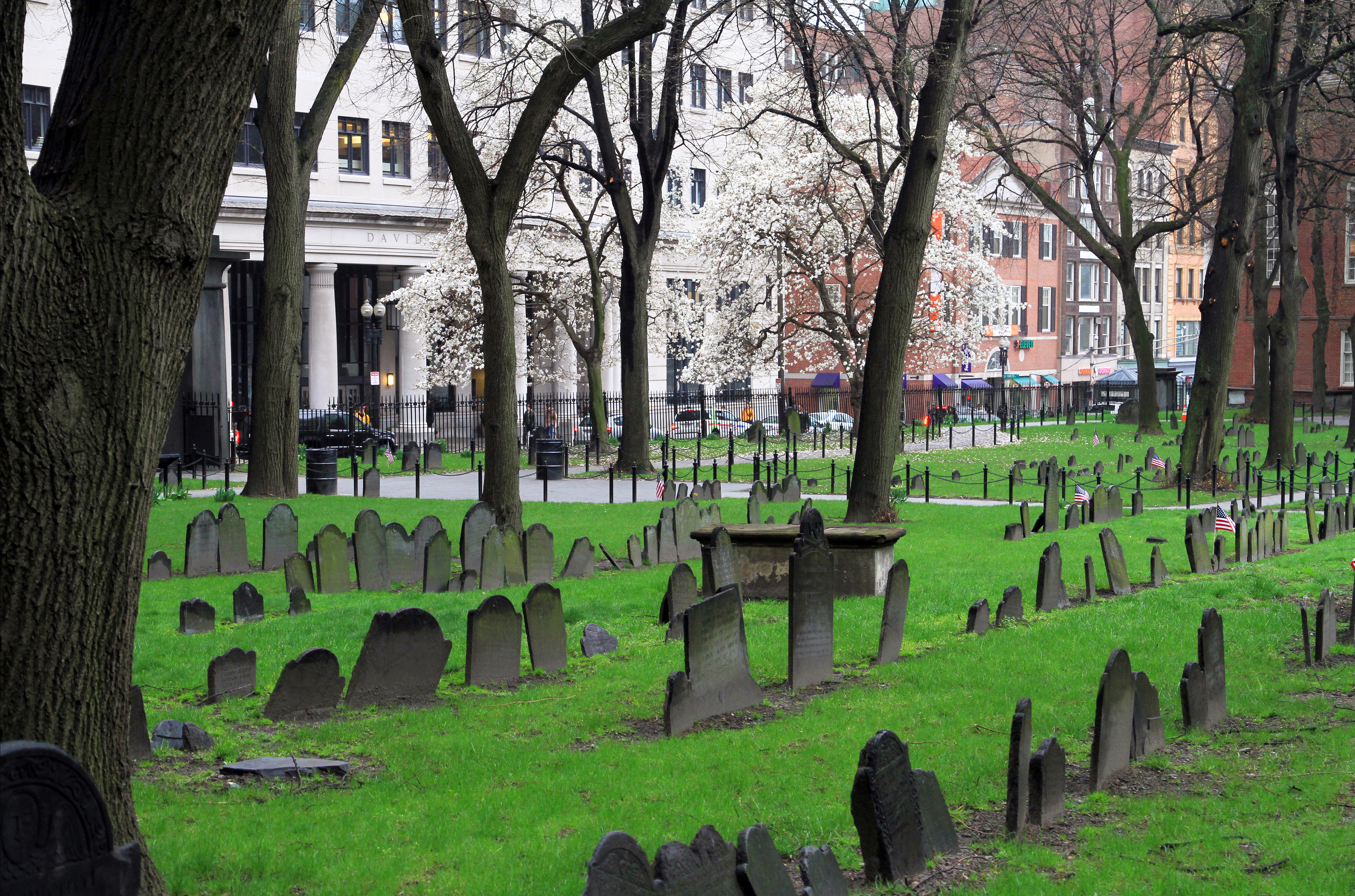
King's Chapel is an American independent christianity, Christian unitarianism, unitarian congregation affiliated with the Unitarian Universalist Association that is "unitarian Christian in theology, anglicanism, Anglican in worship, and congregationalist polity, congregational in governance." It is housed in what was for a time after the Revolution called the "Stone Chapel", an 18th-century structure at the corner of Tremont Street and School Street in Boston, Massachusetts. The chapel building, completed in 1754, is one of the finest designs of the noted colonial architect Peter Harrison (architect), Peter Harrison, and was designated a National Historic Landmark in 1960 for its architectural significance. Despite its name, the adjacent King's Chapel Burying Ground is not affiliated with the chapel or any other church; it pre-dates the present church by over a century. History The King's Chapel congregation was founded by Colonial government in the Thirteen Colonies, Royal ... [...More Info...] [...Related Items...] OR: [Wikipedia] [Google] [Baidu] |
Boston Common
The Boston Common (also known as the Common) is a public park in downtown Boston, Massachusetts. It is the oldest city park in the United States. Boston Common consists of of land bounded by Tremont Street (139 Tremont St.), Park Street, Beacon Street, Charles Street, and Boylston Street. The Common is part of the Emerald Necklace of parks and parkways that extend from the Common south to Franklin Park in Jamaica Plain, Roxbury, and Dorchester. The visitors' center for the city of Boston is located on the Tremont Street side of the park. The Central Burying Ground is on the Boylston Street side of Boston Common and contains the graves of the artist Gilbert Stuart and the composer William Billings. Also buried there are Samuel Sprague and his son, Charles Sprague, one of America's earliest poets. Samuel Sprague was a participant in the Boston Tea Party and fought in the Revolutionary War. The Common was designated as a Boston Landmark by the Boston Landmarks Commission ... [...More Info...] [...Related Items...] OR: [Wikipedia] [Google] [Baidu] |
Thomas Hyde Page
Sir Thomas Hyde Page, Fellow of the Royal Society#Fellows, FRS (1746–1821) was a decorated British military engineer and cartographer for the British crown. In 1777 he married Susanna, widow of Edmund Bastard of Kitley, Devon, and sister of Crawley-Boevey baronets, Sir Thomas Crawley-Boevey, baronet. In 1783 he married Mary Albinia (d. 1794), daughter of John Woodward (formerly captain in the 70th regiment) of Ringwould, Kent, and they had five children. His third marriage, to Mary, widow of Captain Everett RN, was childless. Early life He was born in Harley Street, City of Westminster in London, England and was the son of Robert Hyde Page (d. 1764), also a military engineer, and Elizabeth, daughter of Francis Morewood. Thomas Hyde Page attended the Royal Military Academy, Woolwich, receiving a gold medal from George III of the United Kingdom, King George III. Career In July 1769, Page was appointed as a practitioner engineer and second lieutenant in the Corps of Royal Engin ... [...More Info...] [...Related Items...] OR: [Wikipedia] [Google] [Baidu] |
Massachusetts State House
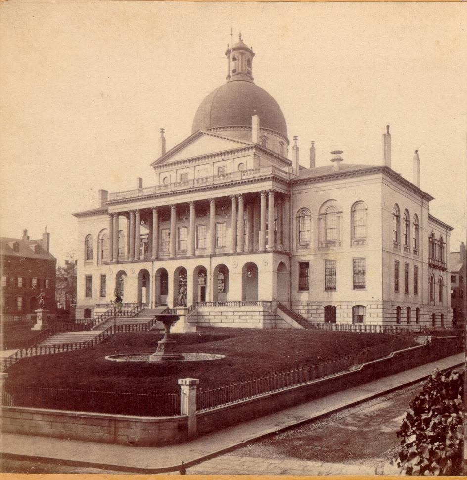
The Massachusetts State House, also known as the Massachusetts Statehouse or the New State House, is the List of state capitols in the United States, state capitol and seat of government for the Massachusetts, Commonwealth of Massachusetts, located in the Beacon Hill, Boston, Beacon Hill neighborhood of Boston. The building houses the Massachusetts General Court (State legislature (United States), state legislature) and the offices of the Governor of Massachusetts. The building, designed by architect Charles Bulfinch, was completed in January 1798 at a cost of $133,333 (more than five times the budget), and has repeatedly been enlarged since. It is one of the oldest state capitols in current use. It is considered a masterpiece of Federal architecture and among Bulfinch's finest works, and was designated a National Historic Landmark for its architectural significance. Building and grounds The building is situated on of land on top of Beacon Hill in Boston, Massachusetts, Bo ... [...More Info...] [...Related Items...] OR: [Wikipedia] [Google] [Baidu] |
Louisburg Square
Louisburg Square is a street in the Beacon Hill neighborhood of Boston, Massachusetts, bisected by a small private park. The park is maintained by the Louisburg Square Proprietors. While the Proprietors pay taxes to the City of Boston, the city does not own the park or its garden. Louisburg Square was named for the 1745 Battle of Louisbourg, in which Massachusetts militiamen led by William Pepperrell, who was made the first American baronet for his role, sacked the French Fortress of Louisbourg. Louisburg Square has become one of the most exclusive neighborhoods in the United States, with townhouses listing for over $15,000,000. Description The parl itself is a small grassy oval surrounded by a wrought-iron fence; there is no public access. There is a statue of Christopher Columbus at the north end and of Aristides the Just at the south end. History and residents The Greek Revival houses around the square reflect the rarefied privilege enjoyed by the 19th century upper class ... [...More Info...] [...Related Items...] OR: [Wikipedia] [Google] [Baidu] |
Pemberton Square
Pemberton Square (est. 1835) in the Government Center area of Boston, Massachusetts, was developed by P.T. Jackson in the 1830s as an architecturally uniform mixed-use enclave surrounding a small park. In the mid-19th century both private residences and businesses dwelt there. The construction in 1885 of the massive John Adams Courthouse changed the scale and character of the square, as did the Center Plaza building in the 1960s. History 1835–1885 In the mid-1830s land on Cotton Hill (also called Pemberton Hill) between Tremont Street and Somerset Street was developed as Phillips Place, "laid out on the estates late of the heirs of Messrs. onathanPhillips, ardinerGreene, and amesLloyd." "After Greene's death in 1832, Patrick Tracy Jackson ... purchased the property. Jackson ... cut down the top of Pemberton Hill in order to create a desirable residential area halfway down the slope, at the point where the mansion had stood. This massive grading operation took only 5 months a ... [...More Info...] [...Related Items...] OR: [Wikipedia] [Google] [Baidu] |
Shawmut Peninsula
Shawmut Peninsula is the promontory of land on which Boston, Massachusetts was built. The peninsula, originally a mere in area,Miller, Bradford A., "Digging up Boston: The Big Dig Builds on Centuries of Geological Engineering", GeoTimes, October 2002. more than doubled in size due to land reclamation efforts that were a feature of the history of Boston throughout the 19th century. Geology and original topography Like much of the Massachusetts landscape, the peninsula was shaped by glacial erosion and moraine deposits left by retreating glaciers at the end of the last ice age. When Europeans arrived, Shawmut was thickly forested. The pre-settlement topography of the peninsula was marked by three hills: Copps Hill, in what is now the North End; Fort Hill, in today's Financial District; and the Trimountain, today's Beacon Hill district. Of the three hills, the Trimountain was by far the largest, a steep-sided mass with three summits. Its name was eventually shortened to Tremont. ... [...More Info...] [...Related Items...] OR: [Wikipedia] [Google] [Baidu] |


_by_James_Northcote.jpeg)
