|
Tofu Cape
The Tofu Cape () is a Cape (geography), cape in Su'ao, Su'ao Township, Yilan County, Taiwan, Yilan County, Taiwan. Name The cape got its name because the rock on the area resembles tofu. Ecology The cape provides a natural shelter for the sea fish nearby. Activities There is hiking trail along the coastal line of the cape. The area is also popular for scuba diving. Transportation The cape is accessible within walking distance southeast of Su'ao railway station, Su'ao Station of Taiwan Railways Administration, Taiwan Railways. See also * Geology of Taiwan References Headlands of Taiwan Landforms of Yilan County, Taiwan Tourist attractions in Yilan County, Taiwan {{Taiwan-geo-stub ... [...More Info...] [...Related Items...] OR: [Wikipedia] [Google] [Baidu] |
Su'ao
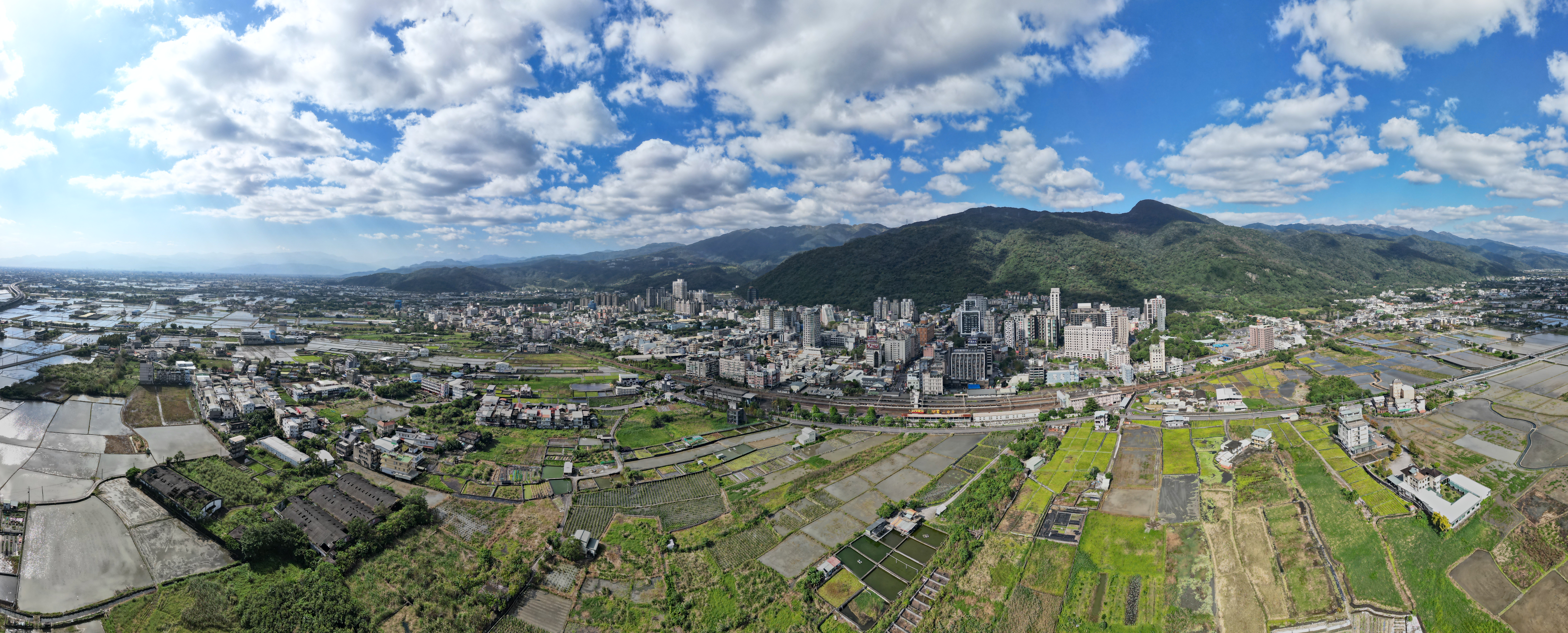
Su'ao Township (), alternately romanized as Su-ao, is located in southern Yilan County, Taiwan, is an urban township that is famous for its seafood restaurants and cold springs. It is a terminus of National Highway No. 5, the Su'ao-Hualien Express Way, and the North-Link Line of the Taiwan Railway Administration. It also has two large harbors: Su'ao Port, a multi-function seaport that also houses a naval base; and Nanfang-ao Port, a major fishing port of Taiwan. History Japanese rule During Japanese rule, the area was established as , Suō District, Taihoku Prefecture. Post-war After World War II, the town was converted to a township under Taipei County. In 1950, the township was put under the newly established Yilan County. Demographics As of December 2016, Su'ao had 14,109 households and a total population of 40,493, including 19,877 females and 20,616 males. The population of Su'ao Town has been decreasing on average since 1981 Villages The township comprises 26 vill ... [...More Info...] [...Related Items...] OR: [Wikipedia] [Google] [Baidu] |
Yilan County, Taiwan
Yilan County, alternately spelled I-lan, is a County (Taiwan), county in northeastern Taiwan, Republic of China. Name The name ''Yilan'' derives from the Taiwanese indigenous peoples, indigenous Kavalan people. Other former names in reference to this area in the Yilan Plain include ''Kabalan'', ''Kavalan'', ''Kavaland'', ''kap-a-lan'', ''Yiland'' and ''Gilan''. Before 2009, the county's official name was transliterated as Ilan. History Early history Since early ages, many people have traveled from far places to Yilan. Taiwanese aborigines, Indigenous tribes that have settled in Yilan are Kavalan people and Atayal people. The Kavalan people came by the sea and lived by the river at Yilan Plain since around 1,000 years ago. They mostly speak the Austronesian languages. Their settlements consisted of small villages along rivers with around 40-50 communities scattered around the area with a total population of approximately 10,000 people. The Atayal people came by crossing ... [...More Info...] [...Related Items...] OR: [Wikipedia] [Google] [Baidu] |
Taiwan
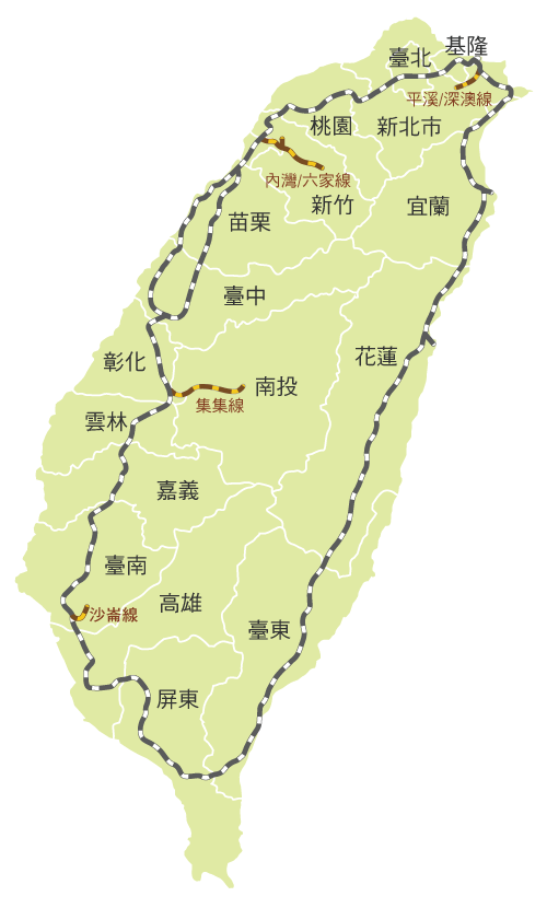
Taiwan, officially the Republic of China (ROC), is a country in East Asia, at the junction of the East and South China Seas in the northwestern Pacific Ocean, with the People's Republic of China (PRC) to the northwest, Japan to the northeast, and the Philippines to the south. The territories controlled by the ROC consist of 168 islands, with a combined area of . The main island of Taiwan, also known as ''Formosa'', has an area of , with mountain ranges dominating the eastern two-thirds and plains in the western third, where its highly urbanised population is concentrated. The capital, Taipei, forms along with New Taipei City and Keelung the largest metropolitan area of Taiwan. Other major cities include Taoyuan, Taichung, Tainan, and Kaohsiung. With around 23.9 million inhabitants, Taiwan is among the most densely populated countries in the world. Taiwan has been settled for at least 25,000 years. Ancestors of Taiwanese indigenous peoples settled the isla ... [...More Info...] [...Related Items...] OR: [Wikipedia] [Google] [Baidu] |
Cape (geography)
In geography, a cape is a headland or a promontory of large size extending into a body of water, usually the sea.Whittow, John (1984). ''Dictionary of Physical Geography''. London: Penguin, 1984, p. 80. . A cape usually represents a marked change in trend of the Coast, coastline, often making them important landmarks in sea navigation. This also makes them prone to natural forms of erosion, mainly tidal actions, which results in them having a relatively short geological lifespan. Capes can be formed by glaciers, volcanoes, and changes in sea level. Erosion plays a large role in each of these methods of formation. List of some well-known capes Gallery File:Cape Cornwall.jpg, Cape Cornwall, England File:Nasa photo cape fear.jpg, Satellite image of Cape Fear, North Carolina File:Cape McLear, Malawi (2499273862).jpg, Cape MacLear, Malawi File:Cape horn.png, Map depicting Cape Horn at the southernmost portion of South America File:Spain.Santander.Cabo.Mayor.jpeg, Photograph o ... [...More Info...] [...Related Items...] OR: [Wikipedia] [Google] [Baidu] |
Tofu
Tofu (), also known as bean curd in English, is a food prepared by coagulating soy milk and then pressing the resulting curds into solid white blocks of varying softness; it can be ''silken'', ''soft'', ''firm'', ''extra firm'' or ''super firm''. Beyond these broad textural categories, there are many varieties of tofu. It has a subtle flavor, so it can be used in savory and sweet dishes. It is often seasoned or marinated to suit the dish and its flavors, and due to its spongy texture, it absorbs flavors well. It is a traditional component of East Asian and Southeast Asian cuisines, and has been consumed in China for over 2,000 years. In modern western cooking, it is most often treated as a meat substitute. Nutritionally, tofu is low in calories, while containing a relatively large amount of protein. It is high in iron, and can have a high calcium or magnesium content depending on the coagulants (e.g. calcium chloride, calcium sulphate, magnesium sulphate) used in manufacturi ... [...More Info...] [...Related Items...] OR: [Wikipedia] [Google] [Baidu] |
Scuba Diving
Scuba diving is a mode of underwater diving whereby divers use breathing equipment that is completely independent of a surface air supply. The name "scuba", an acronym for "Self-Contained Underwater Breathing Apparatus", was coined by Christian J. Lambertsen in a patent submitted in 1952. Scuba divers carry their own source of breathing gas, usually compressed air, affording them greater independence and movement than surface-supplied divers, and more time underwater than free divers. Although the use of compressed air is common, a gas blend with a higher oxygen content, known as enriched air or nitrox, has become popular due to the reduced nitrogen intake during long and/or repetitive dives. Also, breathing gas diluted with helium may be used to reduce the likelihood and effects of nitrogen narcosis during deeper dives. Open circuit scuba systems discharge the breathing gas into the environment as it is exhaled, and consist of one or more diving cylinders containing breat ... [...More Info...] [...Related Items...] OR: [Wikipedia] [Google] [Baidu] |
Su'ao Railway Station
Su'ao () is a railway station on the Taiwan Railways Administration Yilan line. It is located in Su'ao Township, Yilan County, Taiwan and is the southern terminus of the Yilan line. History The station was opened on 24 March 1919. Structure There is one side platform. Around the station * Coral Museum * Nanfang'ao Bridge * Neipi Beach * Su'ao Cold Spring * Su'ao Fortress * Tofu Cape * Zhu Dayu Culture Museum See also * List of railway stations in Taiwan There are currently six operating railway systems in Taiwan: The two Inter-city rail systems, Taiwan Railways and Taiwan High Speed Rail, have several overlaps in station names. See below ''Taiwan High Speed Rail'' section for their relations in ... References External links TRA Su'ao Station 1919 establishments in Taiwan Railway stations in Yilan County, Taiwan Railway stations opened in 1919 Railway stations served by Taiwan Railways Administration {{Taiwan-railstation-stub ... [...More Info...] [...Related Items...] OR: [Wikipedia] [Google] [Baidu] |
Taiwan Railways Administration
Taiwan Railways Administration (TRA) is a railway operator in Taiwan. It is an agency of the Ministry of Transportation and Communications, responsible for managing, maintaining, and running conventional passenger and freight railway services on 1097 km of track in Taiwan. Since Taiwan is heavily urbanised with a high population density, railways have played an important part in domestic transportation since the late 19th century. Passenger traffic in 2018 was 231,267,955. The agency's headquarters are in Zhongzheng District, Taipei. Overview Railway services between Keelung and Hsinchu began in 1891 under China's Qing dynasty. Because the railway was completely rebuilt and substantially expanded under the operated by Formosa's Japanese colonial government (1895–1945), the network's Japanese influence and heritage persists. Similarities between the TRA and the Japan Railways (JR) companies can be noted in signal aspects, signage, track layout, fare controls, sta ... [...More Info...] [...Related Items...] OR: [Wikipedia] [Google] [Baidu] |
Geology Of Taiwan
The island of Taiwan was formed approximately 4 to 5 million years ago at a convergent boundary between the Philippine Sea Plate and the Eurasian Plate. In a boundary running the length of the island and continuing southwards, the Eurasian Plate is sliding under the Philippine Sea Plate. In the northeast of the island, the Philippine Sea Plate slides under the Eurasian Plate. Most of the island comprises a huge fault block tilted to the west. The island is active geologically, formed on a complex convergent boundary between the Yangtze Plate, Yangtze Subplate of the Eurasian Plate to the west and north, the Okinawa Plate on the north-east, the Philippine Sea Plate on the east and south, and the Sunda Plate to the southwest. Subduction changes direction at Taiwan. The upper part of the crust on the island is primarily made up of a series of terranes, mostly old island arcs which have been forced together by the collision of the forerunners of the Eurasian Plate and the Phili ... [...More Info...] [...Related Items...] OR: [Wikipedia] [Google] [Baidu] |
Headlands Of Taiwan
A headland, also known as a head, is a coastal landform, a point of land usually high and often with a sheer drop, that extends into a body of water. It is a type of promontory. A headland of considerable size often is called a cape.Whittow, John (1984). ''Dictionary of Physical Geography''. London: Penguin, 1984, pp. 80, 246. . Headlands are characterised by high, breaking waves, rocky shores, intense erosion, and steep sea cliff. Headlands and bays are often found on the same coastline. A bay is flanked by land on three sides, whereas a headland is flanked by water on three sides. Headlands and bays form on discordant coastlines, where bands of rock of alternating resistance run perpendicular to the coast. Bays form when weak (less resistant) rocks (such as sands and clays) are eroded, leaving bands of stronger (more resistant) rocks (such as chalk, limestone, and granite) forming a headland, or peninsula. Through the deposition of sediment within the bay and the erosion of the ... [...More Info...] [...Related Items...] OR: [Wikipedia] [Google] [Baidu] |
Landforms Of Yilan County, Taiwan
A landform is a natural or anthropogenic land feature on the solid surface of the Earth or other planetary body. Landforms together make up a given terrain, and their arrangement in the landscape is known as topography. Landforms include hills, mountains, canyons, and valleys, as well as shoreline features such as bays, peninsulas, and seas, including submerged features such as mid-ocean ridges, volcanoes, and the great ocean basins. Physical characteristics Landforms are categorized by characteristic physical attributes such as elevation, slope, orientation, stratification, rock exposure and soil type. Gross physical features or landforms include intuitive elements such as berms, mounds, hills, ridges, cliffs, valleys, rivers, peninsulas, volcanoes, and numerous other structural and size-scaled (e.g. ponds vs. lakes, hills vs. mountains) elements including various kinds of inland and oceanic waterbodies and sub-surface features. Mountains, hills, plateaux, and plains are the fou ... [...More Info...] [...Related Items...] OR: [Wikipedia] [Google] [Baidu] |


.jpg)