|
The Chevin
The Chevin is the name given to the ridge on the south side of Wharfedale in Leeds, West Yorkshire, England, overlooking the market town of Otley, and often known as Otley Chevin. Etymology The origins of the name ''Chevin'' are uncertain; the earliest attestation is in an eleventh-century copy of a charter from 972 which gives the spelling ''scefinc'', while a charter of around 1030 gives the form ''on Scefinge''. The most probable origin, according to a range of authorities, is a Brittonic word whose modern Welsh descendant is ''cefn'' ("back", "ridge", "ridge of high land"). This word appears in other hill-names, such as Cefn Cribwr and Cefn Bryn in Glamorgan amongst many others in Wales, and also, it has been argued, The Cheviot in Northumberland, and the Cévennes in France.Harry Parkin, ''Your City's Place-Names: Leeds'', English Place-Name Society City-Names Series, 3 (Nottingham: English Place-Name Society, 2017). One of the steep hillsides of the Chevin is called the ... [...More Info...] [...Related Items...] OR: [Wikipedia] [Google] [Baidu] |
Wharfedale
Wharfedale ( ) is the valley of the upper parts of the River Wharfe and one of the Yorkshire Dales. It is situated within the districts of Craven and Harrogate in North Yorkshire, and the cities of Leeds and Bradford in West Yorkshire. It is the upper valley of the River Wharfe. Towns and villages in Wharfedale (downstream, from west to east) include Buckden, Kettlewell, Conistone, Grassington, Hebden, Bolton Abbey, Addingham, Ilkley, Burley-in-Wharfedale, Otley, Pool-in-Wharfedale, Arthington, Collingham and Wetherby. Beyond Wetherby, the valley opens out and becomes part of the Vale of York. The section from the river's source to around Addingham is known as ''Upper Wharfedale'' and lies in North Yorkshire and in the Yorkshire Dales National Park. The first or so is known as Langstrothdale, including the settlements of Beckermonds, Yockenthwaite and Hubberholme, famous for its church, the resting place of the writer J. B. Priestley. As it turns southwards, the Wharfe the ... [...More Info...] [...Related Items...] OR: [Wikipedia] [Google] [Baidu] |
Calcaria
Calcaria was a town in the Roman province of Britannia. Today, it is known as Tadcaster, located in the England, English county of North Yorkshire. The Roman Empire, Romans founded the settlement and named it ''Calcaria'' from the Latin word for ''lime kilns'', reflecting the importance of the area's Magnesian Limestone geology as a natural resource for quarrying. The nature of the settlement is uncertain. It is possible that it started as an Imperial staging post with a mansio because of its location at a river crossing on the road from Danum (Doncaster) to Eburacum (York). Just to the north-west is the Roman fort at Newton Kyme (possibly Praesidium (Newton Kyme), Praesidium) dating from the 4th century. Mileages on the Antonine Itinerary suggest that Calcaria may have lain well west of Tadcaster. References Sources * * {{coord, 53.885, -1.263, scale:20000_region:GB, display=title History of North Yorkshire Roman towns and cities in England Tadcaster Roman sites in Nort ... [...More Info...] [...Related Items...] OR: [Wikipedia] [Google] [Baidu] |
Ebor Way
{{Infobox hiking trail , name=Ebor Way , photo=Ebor Way Sign Eccup 2016.jpg , caption=Signpost north of Eccup, Leeds , location=England: North Yorkshire, West Yorkshire , length_mi=70 , trailheads=Helmsley, North Yorkshire {{coord, 54.246, -1.063, display=inline, region:GB_scale:10000Ilkley, West Yorkshire{{coord, 53.925, -1.823, display=inline, region:GB_scale:10000 , use=Hiking , elev_change= , highest= , lowest= , difficulty= , season= , sights= , hazards= The Ebor Way is a 70-mile (112 km) long-distance footpath from Helmsley, North Yorkshire to Ilkley, West Yorkshire, via the city of York, England. It takes its name from Eboracum, the Roman name for York. This walk connects the Cleveland Way and Dales Way running across the Howardian Hills, through the low-lying vale of York and then up the Wharfe valley. It was first developed in the 1970s by the Ebor Acorn Rambling Club. From Helmsley, the walk heads south via Oswaldkirk, Cawton and Hovi ... [...More Info...] [...Related Items...] OR: [Wikipedia] [Google] [Baidu] |
Dales Way
The Dales Way is an long-distance footpath in Northern England, from (south-east to north-west) Ilkley, West Yorkshire, to Bowness-on-Windermere, Cumbria. This walk was initially devised by the West Riding Ramblers' Association with the 'leading lights' being Colin Speakman and Tom Wilcock (Footpath Secretary). The route was announced to the public in 1968 and the first recorded crossing was by a group of Bradford Grammar School Venture Scouts in 1969. The Dales Way passes through two National Parks: the Yorkshire Dales National Park and the Lake District National Park. The first half of the walk follows the River Wharfe upstream to the main watershed of Northern England at Ribblehead. The second half follows several river valleys (Dentdale, River Mint, River Kent) to descend to the shores of Windermere. Route The walk is shorter and less strenuous than better-known routes such as the Pennine Way and Coast to Coast Walk, being mostly along river valleys. It thus makes a go ... [...More Info...] [...Related Items...] OR: [Wikipedia] [Google] [Baidu] |
Rights Of Way In England And Wales
In England and Wales, other than in the 12 Inner London London boroughs, boroughs and the City of London, the right of way is a legally protected right of the public to pass and re-pass on specific paths. The law in England and Wales differs from Scots law in that rights of way exist only where they are so designated (or are able to be designated if not already), whereas in Scotland any route that meets certain conditions is rights of way in Scotland, defined as a right of way, and in addition, there is a general presumption of access to the countryside ("right to roam"). Private rights of way or easements also exist (see also Highways in England and Wales). Inner London Definitive maps of public rights of way have been compiled for all of England and Wales, as a result of the National Parks and Access to the Countryside Act 1949, except the 12 Inner London boroughs, which, along with the City of London, were not covered by the Act. Definitive maps exist for the Outer London bo ... [...More Info...] [...Related Items...] OR: [Wikipedia] [Google] [Baidu] |
Bouldering
Bouldering is a form of free climbing that is performed on small rock formations or artificial rock walls without the use of ropes or harnesses. While bouldering can be done without any equipment, most climbers use climbing shoes to help secure footholds, chalk to keep their hands dry and to provide a firmer grip, and bouldering mats to prevent injuries from falls. Unlike free solo climbing, which is also performed without ropes, bouldering problems (the sequence of moves that a climber performs to complete the climb) are usually less than tall. Traverses, which are a form of boulder problem, require the climber to climb horizontally from one end to another. Artificial climbing walls allow boulderers to climb indoors in areas without natural boulders. In addition, bouldering competitions take place in both indoor and outdoor settings. The sport was originally a method of training for roped climbs and mountaineering, so climbers could practice specific moves at a safe dist ... [...More Info...] [...Related Items...] OR: [Wikipedia] [Google] [Baidu] |
Climbing
Climbing is the activity of using one's hands, feet, or any other part of the body to ascend a steep topographical object that can range from the world's tallest mountains (e.g. the eight thousanders), to small boulders. Climbing is done for locomotion, sporting recreation, and for competition, and is also done in trades that rely on ascension; such as emergency rescue and military operations. Climbing is done indoors and outdoors and on natural (e.g. rock and ice) and artificial surfaces. Professional mountain guides or rock climbing guides (e.g. the UIAGM), were a significant element in developing the popularity of the sport in the natural environment, and remain so today. Since the 1980s, the development of competition climbing and the availability of artificial climbing walls have dramatically increased the popularity of rock climbing as a sport and led to the emergence of professional rock climbers, such as Wolfgang Güllich, Chris Sharma, Lynn Hill and Catherine ... [...More Info...] [...Related Items...] OR: [Wikipedia] [Google] [Baidu] |
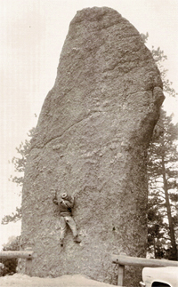
Otley Chevin Megalithic Stone Boundary
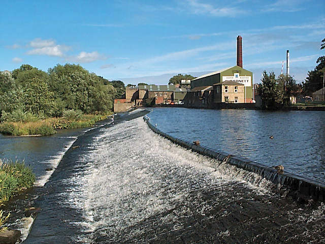
Otley is a market town and civil parish at a bridging point on the River Wharfe, in the City of Leeds metropolitan borough in West Yorkshire, England. Historically a part of the West Riding of Yorkshire, the population was 13,668 at the 2011 census. It is in two parts: south of the river is the historic town of Otley and to the north is Newall, which was formerly a separate township. The town is in lower Wharfedale on the A660 road which connects it to Leeds. The town is in the Otley and Yeadon ward of Leeds City Council and the Leeds North West parliamentary constituency. History Toponymy Otley's name is derived from Otto, Otho, Othe, or Otta, a Saxon personal name and ''leah'', a woodland clearing in Old English. It was recorded as ''Ottanlege'' in 972 and ''Otelai'' or ''Othelia'' in the ''Domesday Book'' of 1086. The name Chevin has close parallels to the early Brythonic Welsh term ''Cefn'' meaning ridge and may be a survival of the ancient Cumbric language. Earl ... [...More Info...] [...Related Items...] OR: [Wikipedia] [Google] [Baidu] |
Otley Urban District
Otley is a market town and civil parish at a bridging point on the River Wharfe, in the City of Leeds metropolitan borough in West Yorkshire, England. Historically a part of the West Riding of Yorkshire, the population was 13,668 at the 2011 census. It is in two parts: south of the river is the historic town of Otley and to the north is Newall, which was formerly a separate township. The town is in lower Wharfedale on the A660 road which connects it to Leeds. The town is in the Otley and Yeadon ward of Leeds City Council and the Leeds North West parliamentary constituency. History Toponymy Otley's name is derived from Otto, Otho, Othe, or Otta, a Saxon personal name and ''leah'', a woodland clearing in Old English. It was recorded as ''Ottanlege'' in 972 and ''Otelai'' or ''Othelia'' in the ''Domesday Book'' of 1086. The name Chevin has close parallels to the early Brythonic Welsh term ''Cefn'' meaning ridge and may be a survival of the ancient Cumbric language. Earl ... [...More Info...] [...Related Items...] OR: [Wikipedia] [Google] [Baidu] |
World War II
World War II or the Second World War, often abbreviated as WWII or WW2, was a world war that lasted from 1939 to 1945. It involved the vast majority of the world's countries—including all of the great powers—forming two opposing military alliances: the Allies and the Axis powers. World War II was a total war that directly involved more than 100 million personnel from more than 30 countries. The major participants in the war threw their entire economic, industrial, and scientific capabilities behind the war effort, blurring the distinction between civilian and military resources. Aircraft played a major role in the conflict, enabling the strategic bombing of population centres and deploying the only two nuclear weapons ever used in war. World War II was by far the deadliest conflict in human history; it resulted in 70 to 85 million fatalities, mostly among civilians. Tens of millions died due to genocides (including the Holocaust), starvation, ma ... [...More Info...] [...Related Items...] OR: [Wikipedia] [Google] [Baidu] |
Walter Fawkes
Walter Ramsden Hawkesworth Fawkes (2 March 1769 – 24 October 1825) was a Yorkshire landowner, writer and Member of Parliament (MP) for Yorkshire from 1806 to 1807. Biography Walter Fawkes was born at Hawkesworth Hall, near Guiseley, into an old West Riding family, as Walter Ramsden Hawkesworth, the son of Walter Beaumont Fawkes. He inherited Farnley Hall in 1792, at which point he assumed the surname Fawkes.before him. Early in life Fawkes became an active member of the advanced section of the whig party, being M.P. for the county of York from 1806 to 1807. He took a prominent part in the anti-slave trade movement, and spoke effectively in the debate which preceded the passing of Wilberforce's measure. In 1823 he filled the office of High Sheriff of Yorkshire. Fawkes is best remembered, however, as the intimate friend and one of the earliest patrons of J. M. W. Turner, the artist. Turner had a welcome and a home at Farnley Hall, Fawkes's Wharfedale residence, whenever ... [...More Info...] [...Related Items...] OR: [Wikipedia] [Google] [Baidu] |
Easter
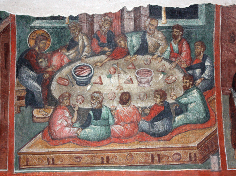
Easter,Traditional names for the feast in English are "Easter Day", as in the '' Book of Common Prayer''; "Easter Sunday", used by James Ussher''The Whole Works of the Most Rev. James Ussher, Volume 4'') and Samuel Pepys''The Diary of Samuel Pepys, Volume 2'') as well as the single word "Easter" in books printed i157515841586 also called Pascha (Aramaic, Greek, Latin) or Resurrection Sunday, is a Christian festival and cultural holiday commemorating the resurrection of Jesus from the dead, described in the New Testament as having occurred on the third day of his burial following his crucifixion by the Romans at Calvary . It is the culmination of the Passion of Jesus Christ, preceded by Lent (or Great Lent), a 40-day period of fasting, prayer, and penance. Easter-observing Christians commonly refer to the week before Easter as Holy Week, which in Western Christianity begins on Palm Sunday (marking the entrance of Jesus in Jerusalem), includes Spy Wednesday (on whic ... [...More Info...] [...Related Items...] OR: [Wikipedia] [Google] [Baidu] |


