|
Tadpatri
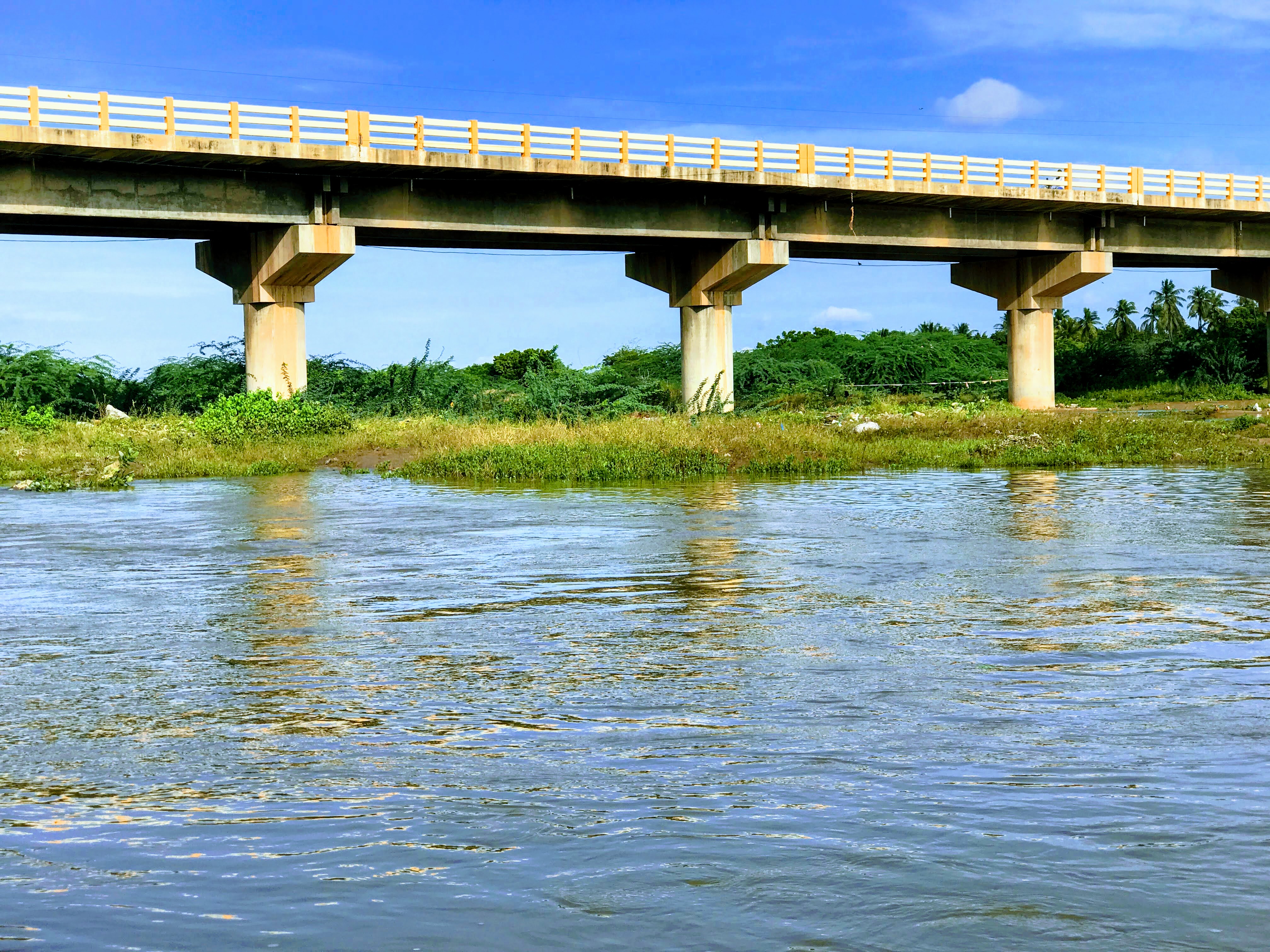
Tadipatri or Tadpatri is a city in Anantapur district of the Indian state of Andhra Pradesh at the border of Kurnool district and Kadapa district. It is the mandal headquarters of Tadipatri mandal in Anantapur revenue division. The Chintala Venkataramana Temple is located on a five acre site in Tadipatri. The Bugga Ramalingeswara Temple is located one kilometer from the town, overlooking the Penna River. Etymology Tadipatri was first a village called Tallapalle. It was developed into a town and renamed as Tadipatri by Pemmasani Ramalinga Nayudu I of the Pemmasani Nayaks, who made this town his seat of government and later developed as a major city in Anantapur district.: Geography Tadipatri is located at . Its average elevation is 223 metres or 731 feet. Tadipatri lies on the southern bank of Pennar River. Due to Mid Pennar Dam constructed upstream, the section of river in Tadipatri is usually dry throughout the year. Tadipatri is rich in cement grade limestone deposits. Th ... [...More Info...] [...Related Items...] OR: [Wikipedia] [Google] [Baidu] |
Tadipatri Municipal Office
Tadipatri or Tadpatri is a city in Anantapur district of the Indian state of Andhra Pradesh at the border of Kurnool district and Kadapa district. It is the mandal headquarters of Tadipatri mandal in Anantapur revenue division. The Chintala Venkataramana Temple is located on a five acre site in Tadipatri. The Bugga Ramalingeswara Temple is located one kilometer from the town, overlooking the Penna River. Etymology Tadipatri was first a village called Tallapalle. It was developed into a town and renamed as Tadipatri by Pemmasani Ramalinga Nayudu I of the Pemmasani Nayaks, who made this town his seat of government and later developed as a major city in Anantapur district.: Geography Tadipatri is located at . Its average elevation is 223 metres or 731 feet. Tadipatri lies on the southern bank of Pennar River. Due to Mid Pennar Dam constructed upstream, the section of river in Tadipatri is usually dry throughout the year. Tadipatri is rich in cement grade limestone deposits. Th ... [...More Info...] [...Related Items...] OR: [Wikipedia] [Google] [Baidu] |
Tadipatri Railway Station
Tadipatri or Tadpatri is a city in Anantapur district of the Indian state of Andhra Pradesh at the border of Kurnool district and Kadapa district. It is the mandal headquarters of Tadipatri mandal in Anantapur revenue division. The Chintala Venkataramana Temple is located on a five acre site in Tadipatri. The Bugga Ramalingeswara Temple is located one kilometer from the town, overlooking the Penna River. Etymology Tadipatri was first a village called Tallapalle. It was developed into a town and renamed as Tadipatri by Pemmasani Ramalinga Nayudu I of the Pemmasani Nayaks, who made this town his seat of government and later developed as a major city in Anantapur district.: Geography Tadipatri is located at . Its average elevation is 223 metres or 731 feet. Tadipatri lies on the southern bank of Pennar River. Due to Mid Pennar Dam constructed upstream, the section of river in Tadipatri is usually dry throughout the year. Tadipatri is rich in cement grade limestone deposits. Th ... [...More Info...] [...Related Items...] OR: [Wikipedia] [Google] [Baidu] |
Tadipatri Bus Depot
Tadipatri or Tadpatri is a city in Anantapur district of the Indian state of Andhra Pradesh at the border of Kurnool district and Kadapa district. It is the mandal headquarters of Tadipatri mandal in Anantapur revenue division. The Chintala Venkataramana Temple is located on a five acre site in Tadipatri. The Bugga Ramalingeswara Temple is located one kilometer from the town, overlooking the Penna River. Etymology Tadipatri was first a village called Tallapalle. It was developed into a town and renamed as Tadipatri by Pemmasani Ramalinga Nayudu I of the Pemmasani Nayaks, who made this town his seat of government and later developed as a major city in Anantapur district.: Geography Tadipatri is located at . Its average elevation is 223 metres or 731 feet. Tadipatri lies on the southern bank of Pennar River. Due to Mid Pennar Dam constructed upstream, the section of river in Tadipatri is usually dry throughout the year. Tadipatri is rich in cement grade limestone deposits. Th ... [...More Info...] [...Related Items...] OR: [Wikipedia] [Google] [Baidu] |
Anantapur District
Anantapur district officially: Anantapuramu district is one of the eight districts in the Rayalaseema region of the Indian state of Andhra Pradesh. The district headquarters is located at Anantapur city. It is one of the driest places in South India. census of India, it was the largest district in the state by area and with a population of 4,083,315. Later in the year 2022, as part of re-organisation of districts, Sri Sathya Sai district was carved out and so its area and population reduced by half. Etymology The name Anantapur was named after a big tank called ''Anantasagara''. It existed during reign of Vijayanagara Empire, which was named after ''Ananthamma'', wife of Bukkaraya, one of the founders of the empire. History Gooty fort was a stronghold of the Marathas, but was taken from them by Hyder Ali. In 1789 it was ceded by his son Tipu Sultan to the Nizam of Hyderabad, and in 1800 the nizam ceded the surrounding districts to the British in payment for a subsidi ... [...More Info...] [...Related Items...] OR: [Wikipedia] [Google] [Baidu] |
Pemmasani Ramalinga Nayudu I
Pemmasani Ramalinga Nayudu I was a member of the Pemmasani Nayak clan in the 15th century Vijayanagara Empire in southern India. He developed the hamlet of Tallapalle, renaming it to Tadipatri upon orders of the Vijayanagara emperor.: He built a fort in the town and the Bugga Ramalingeswara Temple. Another temple to Obaleswara in Kurnool District is also attributed to him. Ramalinga Nayudu used a considerable amount of government funds to build irrigation projects to irrigate paddy and ragi fields. Though Ramalinga developed Tadipatri, he also developed his ancestral estate consisting of Yadiki and its adjoining territories, which were previously governed by his father. Ramalinga Nayudu was the son of Pemmasani Timma Nayudu. He had two daughters, Govindamma and Rajagopalamma, and a son, Timmanayudu II. His two daughters each constructed a village and temple. Govindamma built the town of Vatraketaya, and Rajagoplamma built Ramalinganayanipalle, which is named after Ramaling ... [...More Info...] [...Related Items...] OR: [Wikipedia] [Google] [Baidu] |
Chintala Venkataramana Temple
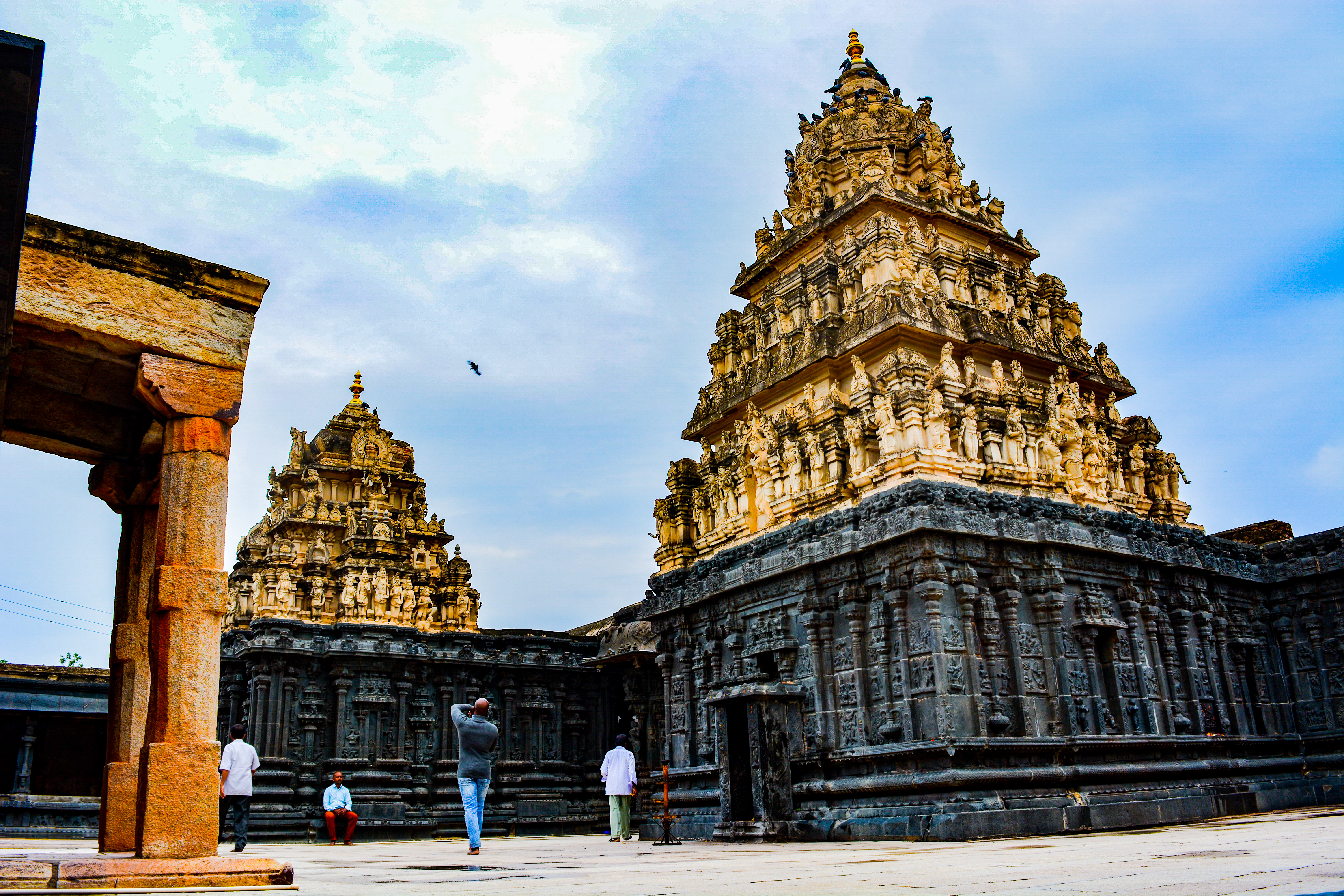
Chintalarayaswamy Temple or Sri Chintala Venkataramana Temple is a Hindu Vaishnavite temple situated at Tadipatri, a town in the Anantapur District of Andhra Pradesh, India. The Temple is dedicated to Venkateswara, a form of Vishnu, who is referred to as Chintala Venkataramana. The temple was built by Pemmasani Timmanayudu II of the Pemmasani Nayaks. It is situated on the bank of the Penna River, which passes through the town. The temple has granite sculptures and is classified as one of the Monuments of National Importance by Archaeological Survey of India (ASI). The temple has a ''Garuda Mandapa'' built as chariot with rotating granite wheels, which is similar to the one found in the Vithala Temple of Hampi. Etymology According to legend, the presiding deity Venkateswara was found in the Tamarind (Telugu: Chinta) tree and hence got the name Chintala Venkataramana. History The Temple was built during the reign of Vijayanagara empire in mid 16th Century by Pemmasani Timmanayudu ... [...More Info...] [...Related Items...] OR: [Wikipedia] [Google] [Baidu] |
Anantapur Revenue Division
Anantapur revenue division (or Anantapur division) is an administrative division in the Anantapur district of the Indian state of Andhra Pradesh. It is one of the 3 revenue divisions in the district with 12 mandals A tehsil (, also known as tahsil, taluka, or taluk) is a local unit of administrative division in some countries of South Asia. It is a subdistrict of the area within a district including the designated populated place that serves as its administr ... under its administration. The divisional headquarters is located at Anantapur. Administration There are 12 mandals administered under Anantapur revenue division are: See also * List of revenue divisions in Andhra Pradesh References Revenue divisions in Anantapur district {{Anantapur-geo-stub ... [...More Info...] [...Related Items...] OR: [Wikipedia] [Google] [Baidu] |
Penna River - Tadipatri
Penna may refer to: * 7mm Penna, a handgun cartridge * Monte Penna, a mountain in northern Italy * Penna (surname) * Penna, Tasmania, a suburb of Hobart, Tasmania, Australia * Penna in Teverina, a comune in Terni, Umbria, Italy * Penna River, a river of southern India * Penna., an abbreviation for Pennsylvania *Penda of Mercia, king of Mercia la, Merciorum regnum , conventional_long_name=Kingdom of Mercia , common_name=Mercia , status=Kingdom , status_text=Independent kingdom (527–879)Client state of Wessex () , life_span=527–918 , era=Heptarchy , event_start= , date_start= , ye ..., who is sometimes called Penna of Mercia. See also * Della Penna, a surname {{disambiguation ... [...More Info...] [...Related Items...] OR: [Wikipedia] [Google] [Baidu] |
Census Of India
The decennial Census of India has been conducted 16 times, as of 2021. While it has been undertaken every 10 years, beginning in 1872 under British Viceroy Lord Mayo, the first complete census was taken in 1881. Post 1949, it has been conducted by the Registrar General and Census Commissioner of India under the Ministry of Home Affairs, Government of India. All the censuses since 1951 were conducted under the 1948 Census of India Act. The last census was held in 2011, whilst the next was to be held in 2021. But it has been postponed due to the COVID-19 pandemic. Historically, there has been a long time between collection of data and dissemination of data. Census of India during British Rule List of censuses conducted in India before independence: * 1872 Census of india *1881 Census of India *1891 Census of India * 1901 Census of India *1911 Census of India * 1921 Census of India * 1931 Census of India *1941 Census of India Census of Republic of India List of censuses conduct ... [...More Info...] [...Related Items...] OR: [Wikipedia] [Google] [Baidu] |
Census
A census is the procedure of systematically acquiring, recording and calculating information about the members of a given population. This term is used mostly in connection with national population and housing censuses; other common censuses include censuses of agriculture, traditional culture, business, supplies, and traffic censuses. The United Nations (UN) defines the essential features of population and housing censuses as "individual enumeration, universality within a defined territory, simultaneity and defined periodicity", and recommends that population censuses be taken at least every ten years. UN recommendations also cover census topics to be collected, official definitions, classifications and other useful information to co-ordinate international practices. The UN's Food and Agriculture Organization (FAO), in turn, defines the census of agriculture as "a statistical operation for collecting, processing and disseminating data on the structure of agriculture, covering th ... [...More Info...] [...Related Items...] OR: [Wikipedia] [Google] [Baidu] |
Municipality
A municipality is usually a single administrative division having corporate status and powers of self-government or jurisdiction as granted by national and regional laws to which it is subordinate. The term ''municipality'' may also mean the governing body of a given municipality. A municipality is a general-purpose administrative subdivision, as opposed to a special-purpose district. The term is derived from French and Latin . The English word ''municipality'' derives from the Latin social contract (derived from a word meaning "duty holders"), referring to the Latin communities that supplied Rome with troops in exchange for their own incorporation into the Roman state (granting Roman citizenship to the inhabitants) while permitting the communities to retain their own local governments (a limited autonomy). A municipality can be any political jurisdiction, from a sovereign state such as the Principality of Monaco, to a small village such as West Hampton Dunes, New York. Th ... [...More Info...] [...Related Items...] OR: [Wikipedia] [Google] [Baidu] |


