|
St George, Hanover Square (UK Parliament Constituency)
Westminster St George's, originally named St George's, Hanover Square, was a United Kingdom constituencies, parliamentary constituency in Central London. It returned one Member of Parliament (United Kingdom), Member of Parliament (MP) to the House of Commons of the United Kingdom, House of Commons of the Parliament of the United Kingdom, elected by the first past the post system of election. History The constituency was created under the Redistribution of Seats Act 1885, and was then named "St George Hanover Square" after the parish of St George Hanover Square, the same name. It was renamed in 1918 as "Westminster St George's", and abolished in 1950. Boundaries 1885–1918 From 1885 to 1918, when the constituency was known as St George Hanover Square, it was defined as being coterminous with the civil parish of the same name. In 1900 the parish was included for local government purposes in the area of the Metropolitan Borough of Westminster. This did not affect the name or ... [...More Info...] [...Related Items...] OR: [Wikipedia] [Google] [Baidu] |
Westminster (UK Parliament Constituency)
Westminster was a parliamentary constituency in the Parliament of England to 1707, the Parliament of Great Britain 1707–1800 and the Parliament of the United Kingdom from 1801. It returned two members to 1885 and one thereafter. The constituency was first known to have been represented in Parliament in 1545 and continued to exist until the redistribution of seats in 1918. The constituency's most famous former representatives are John Stuart Mill and Charles James Fox. The most analogous contemporary constituency is Cities of London and Westminster. Boundaries and boundary changes The constituency was formed in 1545 from part of the county constituency of Middlesex and returned two members of parliament until 1885. The City of Westminster is a district of Inner London. Its southern boundary is on the north bank of the River Thames. It is today combined with Marylebone to the north. It is west of the diminutive City of London, fixed with four MPs in 1298, and the north part ... [...More Info...] [...Related Items...] OR: [Wikipedia] [Google] [Baidu] |
Regent Street
Regent Street is a major shopping street in the West End of London. It is named after George, the Prince Regent (later George IV) and was laid out under the direction of the architect John Nash and James Burton. It runs from Waterloo Place in St James's at the southern end, through Piccadilly Circus and Oxford Circus, to All Souls Church. From there Langham Place and Portland Place continue the route to Regent's Park. The street's layout was completed in 1825 and was an early example of town planning in England, replacing earlier roads including Swallow Street. Nash and Burton's street layout has survived, although all the original buildings except All Souls Church have been replaced following reconstruction in the late 19th century. The street is known for its flagship retail stores, including Liberty, Hamleys, Jaeger and the Apple Store. The Royal Polytechnic Institution, now the University of Westminster, has been based on Regent Street since 1838. Route Regent ... [...More Info...] [...Related Items...] OR: [Wikipedia] [Google] [Baidu] |
Pimlico
Pimlico () is an area of Central London in the City of Westminster, built as a southern extension to neighbouring Belgravia. It is known for its garden squares and distinctive Regency architecture. Pimlico is demarcated to the north by Victoria Station, by the River Thames to the south, Vauxhall Bridge Road to the east and the former Grosvenor Canal to the west. At its heart is a grid of residential streets laid down by the planner Thomas Cubitt, beginning in 1825 and now protected as the Pimlico Conservation Area. The most prestigious are those on garden squares, with buildings decreasing in grandeur away from St George's Square, Warwick Square, Eccleston Square and the main thoroughfares of Belgrave Road and St. George's Drive. Additions have included the pre–World War II Dolphin Square and the Churchill Gardens and Lillington and Longmoore Gardens estates, now conservation areas in their own right. The area has over 350 Grade II listed buildings and several Grade II* ... [...More Info...] [...Related Items...] OR: [Wikipedia] [Google] [Baidu] |
London Victoria Station
Victoria station, also known as London Victoria, is a central London railway terminus and connected London Underground station in Victoria, in the City of Westminster, managed by Network Rail. Named after the nearby Victoria Street (not the Queen), the main line station is a terminus of the Brighton Main Line to and and the Chatham Main Line to and Dover via . From the main lines, trains can connect to the Catford Loop Line, the Dartford Loop Line, and the Oxted line to and . Southern operates most commuter and regional services to south London, Sussex and parts of east Surrey, while Southeastern operates trains to south-east London and Kent, alongside limited services operated by Thameslink. Gatwick Express trains run direct to Gatwick. The Underground station is on the Circle and District lines between and , and the Victoria line between and . The area around the station is an important interchange for other forms of transport: a local bus station is in the forecour ... [...More Info...] [...Related Items...] OR: [Wikipedia] [Google] [Baidu] |
Buckingham Palace
Buckingham Palace () is a London royal residence and the administrative headquarters of the monarch of the United Kingdom. Located in the City of Westminster, the palace is often at the centre of state occasions and royal hospitality. It has been a focal point for the British people at times of national rejoicing and mourning. Originally known as ''Buckingham House'', the building at the core of today's palace was a large townhouse built for the Duke of Buckingham in 1703 on a site that had been in private ownership for at least 150 years. It was acquired by King George III in 1761 as a private residence for Queen Charlotte and became known as The Queen's House. During the 19th century it was enlarged by architects John Nash and Edward Blore, who constructed three wings around a central courtyard. Buckingham Palace became the London residence of the British monarch on the accession of Queen Victoria in 1837. The last major structural additions were made in the late 19 ... [...More Info...] [...Related Items...] OR: [Wikipedia] [Google] [Baidu] |
Belgravia
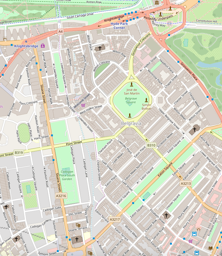
Belgravia () is a district in Central London, covering parts of the areas of both the City of Westminster and the Royal Borough of Kensington and Chelsea. Belgravia was known as the 'Five Fields' during the Tudor Period, and became a dangerous place due to highwaymen and robberies. It was developed in the early 19th century by Richard Grosvenor, 2nd Marquess of Westminster under the direction of Thomas Cubitt, focusing on numerous grand terraces centred on Belgrave Square and Eaton Square. Much of Belgravia, known as the Grosvenor Estate, is still owned by a family property company, the Duke of Westminster's Grosvenor Group, although owing to the Leasehold Reform Act 1967, the estate has been forced to sell many freeholds to its former tenants. Geography Belgravia is near the former course of the River Westbourne, a tributary of the River Thames. The area is mostly in the City of Westminster, with a small part of the western section in the Royal Borough of Kensington ... [...More Info...] [...Related Items...] OR: [Wikipedia] [Google] [Baidu] |
Royal Albert Hall
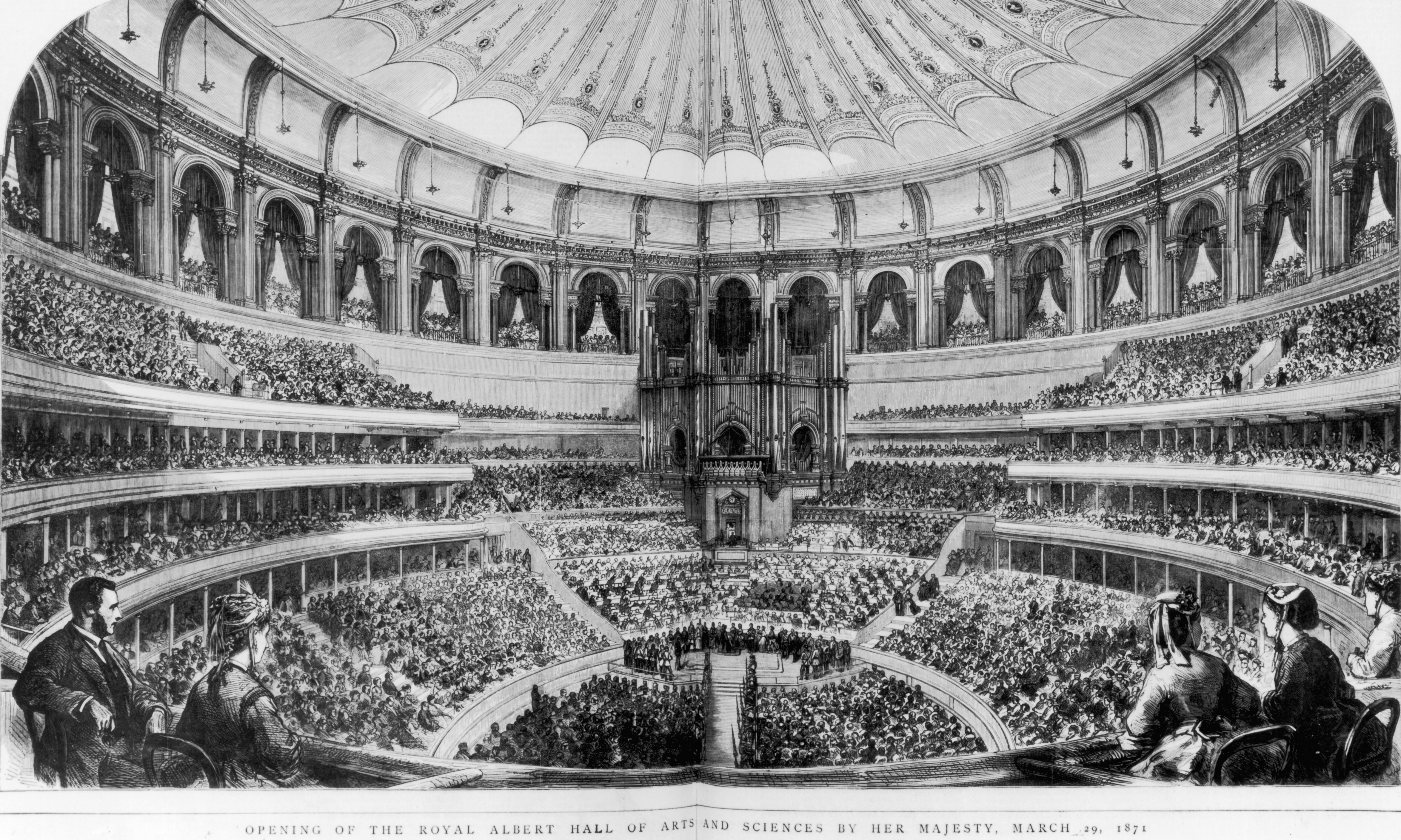
The Royal Albert Hall is a concert hall on the northern edge of South Kensington, London. One of the UK's most treasured and distinctive buildings, it is held in trust for the nation and managed by a registered charity which receives no government funding. It can seat 5,272. Since the hall's opening by Queen Victoria in 1871, the world's leading artists from many performance genres have appeared on its stage. It is the venue for the BBC Proms concerts, which have been held there every summer since 1941. It is host to more than 390 shows in the main auditorium annually, including classical, rock and pop concerts, ballet, opera, film screenings with live orchestral accompaniment, sports, awards ceremonies, school and community events, and charity performances and banquets. A further 400 events are held each year in the non-auditorium spaces. Over its 151 year history the hall has hosted people from various fields, including meetings by Suffragettes, speeches from Winston Churchi ... [...More Info...] [...Related Items...] OR: [Wikipedia] [Google] [Baidu] |
South Kensington
South Kensington, nicknamed Little Paris, is a district just west of Central London in the Royal Borough of Kensington and Chelsea. Historically it settled on part of the scattered Middlesex village of Brompton. Its name was supplanted with the advent of the railways in the late 19th century and the opening (and shutting) and naming of local tube stations. The area has many museums and cultural landmarks with a high number of visitors, such as the Natural History Museum, the Science Museum and the Victoria and Albert Museum. Adjacent affluent centres such as Knightsbridge, Chelsea and Kensington, have been considered as some of the most exclusive real estate in the world. Geography As is often the case in other areas of London, the boundaries for South Kensington are arbitrary and have altered with time. This is due in part to usage arising from the tube stops and other landmarks which developed across Brompton. A contemporary definition is the commercial area around th ... [...More Info...] [...Related Items...] OR: [Wikipedia] [Google] [Baidu] |
Knightsbridge
Knightsbridge is a residential and retail district in central London, south of Hyde Park. It is identified in the London Plan as one of two international retail centres in London, alongside the West End. Toponymy Knightsbridge is an ancient name, spelt in a variety of ways in Saxon and Old English, such as ''Cnihtebricge'' (c. 1050); ''Knichtebrig'' (1235); ''Cnichtebrugge'' (13th century); and ''Knyghtesbrugg'' (1364). The meaning is "bridge of the young men or retainers," from the Old English ''cniht'' (genitive case plural –a) and ''brycg''. ''Cniht'', in pre-Norman days, did not have the later meaning of a warrior on horseback, but simply meant a youth. The allusion may be to a place where ''cnihtas'' congregated: bridges and wells seem always to have been favourite gathering places of young people, and the original bridge was where one of the old roads to the west crossed the River Westbourne. However, there is possibly a more specific reference to the important ''cn ... [...More Info...] [...Related Items...] OR: [Wikipedia] [Google] [Baidu] |
Hyde Park, London
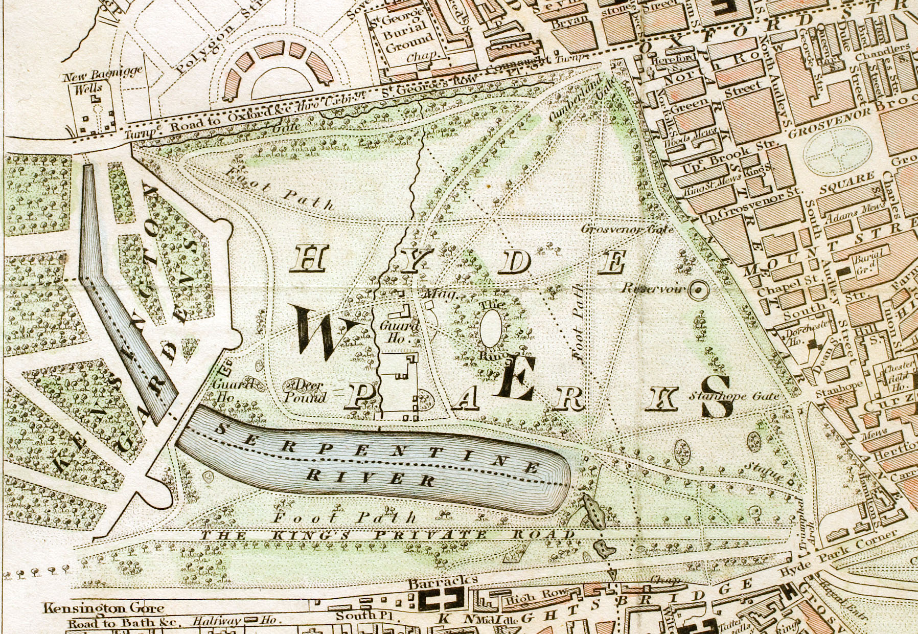
Hyde Park is a Grade I-listed major park in Westminster, Greater London, the largest of the four Royal Parks that form a chain from the entrance to Kensington Palace through Kensington Gardens and Hyde Park, via Hyde Park Corner and Green Park past the main entrance to Buckingham Palace. The park is divided by the Serpentine and the Long Water lakes. The park was established by Henry VIII in 1536 when he took the land from Westminster Abbey and used it as a hunting ground. It opened to the public in 1637 and quickly became popular, particularly for May Day parades. Major improvements occurred in the early 18th century under the direction of Queen Caroline. Several duels took place in Hyde Park during this time, often involving members of the nobility. The Great Exhibition of 1851 was held in the park, for which The Crystal Palace, designed by Joseph Paxton, was erected. Free speech and demonstrations have been a key feature of Hyde Park since the 19th century ... [...More Info...] [...Related Items...] OR: [Wikipedia] [Google] [Baidu] |
Mayfair
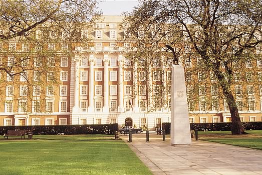
Mayfair is an affluent area in the West End of London towards the eastern edge of Hyde Park, in the City of Westminster, between Oxford Street, Regent Street, Piccadilly and Park Lane. It is one of the most expensive districts in the world. The area was originally part of the manor of Eia and remained largely rural until the early 18th century. It became well known for the annual "May Fair" that took place from 1686 to 1764 in what is now Shepherd Market. Over the years, the fair grew increasingly downmarket and unpleasant, and it became a public nuisance. The Grosvenor family (who became Dukes of Westminster) acquired the land through marriage and began to develop it under the direction of Thomas Barlow. The work included Hanover Square, Berkeley Square and Grosvenor Square, which were surrounded by high-quality houses, and St George's Hanover Square Church. By the end of the 18th century, most of Mayfair was built on with upper-class housing; unlike some nearby areas ... [...More Info...] [...Related Items...] OR: [Wikipedia] [Google] [Baidu] |
Piccadilly
Piccadilly () is a road in the City of Westminster, London, to the south of Mayfair, between Hyde Park Corner in the west and Piccadilly Circus in the east. It is part of the A4 road that connects central London to Hammersmith, Earl's Court, Heathrow Airport and the M4 motorway westward. St James's is to the south of the eastern section, while the western section is built up only on the northern side. Piccadilly is just under in length, and it is one of the widest and straightest streets in central London. The street has been a main thoroughfare since at least medieval times, and in the Middle Ages was known as "the road to Reading" or "the way from Colnbrook". Around 1611 or 1612, a Robert Baker acquired land in the area, and prospered by making and selling piccadills. Shortly after purchasing the land, he enclosed it and erected several dwellings, including his home, Pikadilly Hall. What is now Piccadilly was named Portugal Street in 1663 after Catherine of Braganza ... [...More Info...] [...Related Items...] OR: [Wikipedia] [Google] [Baidu] |


_p142_-_Victoria_Station_(plan).jpg)
.jpg)


