|
Southeast College
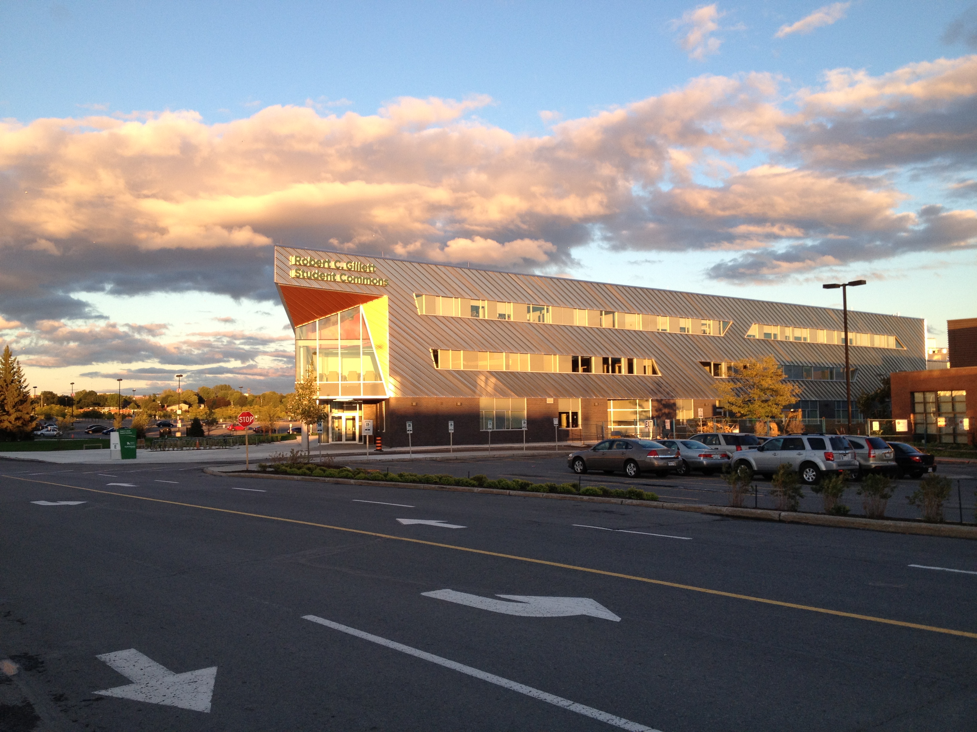
Southeast College (formerly Southeast Regional College) is a publicly funded regional college with six campuses in the southeast of the province of Saskatchewan, Canada. The college was created under the Regional Colleges Act of Saskatchewan. Its head office is located in Weyburn. The six campuses are located in Weyburn, Estevan, Moosomin, Assiniboia, Whitewood and Indian Head. See also *Higher education in Saskatchewan Historically, Saskatchewan's higher education system has been "significantly shaped" by demographics. In 1901, six years prior to the 1907 founding of a university in Saskatchewan, the urban population in Saskatchewan was 14,266 (16%) while the rur ... * List of colleges in Canada#Saskatchewan References External links * {{authority control Colleges in Saskatchewan Vocational education in Canada Weyburn ... [...More Info...] [...Related Items...] OR: [Wikipedia] [Google] [Baidu] |
College (Canada)
In Canadian English, the term college usually refers to a vocational college, technical, trade school, trades, college of applied arts or applied technology, or an applied science school. These are Tertiary education, post-secondary institutions granting Apprenticeship#Canada, apprenticeships, Academic certificate, certificates, diplomas, associate's degrees, Bachelor's degree, bachelor's degrees, and Graduate certificate, graduate certificates. Terminology In English Canada, the term "college" is usually used to refer to skilled trade, trade and technician, technical schools that offer specialized professional or vocational education in specific employment fields. They include vocational colleges, career colleges, Community_college#Canada, community colleges, Institute_of_technology#Canada, institutes of technology or science, technical schools, colleges of applied arts or applied technology, and in Quebec through collèges d’enseignement général et professionnel. There i ... [...More Info...] [...Related Items...] OR: [Wikipedia] [Google] [Baidu] |
Weyburn
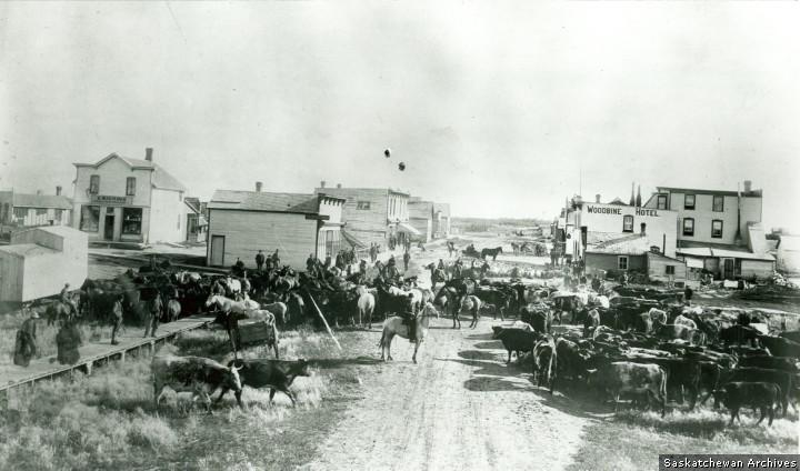
Weyburn is the eleventh-largest city in Saskatchewan, Canada. The city has a population of 10,870. It is on the Souris River southeast of the provincial capital of Regina, Saskatchewan, Regina and is north from the North Dakota border in the United States. The name is reputedly a corruption of the Scottish "wee burn," referring to a small creek. The city is surrounded by the Rural Municipality of Weyburn No. 67. History The Canadian Pacific Railway (CPR) reached the future site of Weyburn from Brandon, Manitoba in 1892 and the Soo Line Railroad, Soo Line from North Portal, Saskatchewan, North Portal on the US border in 1893. A post office opened in 1895 and a land office in 1899 in anticipation of the land rush which soon ensued. In 1899, Knox Presbyterian Church was founded with its building constructed in 1906 in the high-pitched gable roof and arches, standing as a testimony to the faith and optimism in the Weyburn area. Weyburn was legally constituted a village in 1900, ... [...More Info...] [...Related Items...] OR: [Wikipedia] [Google] [Baidu] |
Saskatchewan
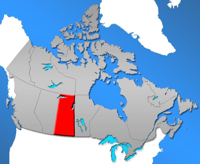
Saskatchewan ( ; ) is a Provinces and territories of Canada, province in Western Canada, western Canada, bordered on the west by Alberta, on the north by the Northwest Territories, on the east by Manitoba, to the northeast by Nunavut, and on the south by the United States, U.S. states of Montana and North Dakota. Saskatchewan and Alberta are the only landlocked provinces of Canada. In 2022, Saskatchewan's population was estimated at 1,205,119. Nearly 10% of Saskatchewan’s total area of is fresh water, mostly rivers, reservoirs and List of lakes in Saskatchewan, lakes. Residents primarily live in the southern prairie half of the province, while the northern half is mostly forested and sparsely populated. Roughly half live in the province's largest city Saskatoon or the provincial capital Regina, Saskatchewan, Regina. Other notable cities include Prince Albert, Saskatchewan, Prince Albert, Moose Jaw, Yorkton, Swift Current, North Battleford, Melfort, Saskatchewan, Melfort, and ... [...More Info...] [...Related Items...] OR: [Wikipedia] [Google] [Baidu] |
Canada
Canada is a country in North America. Its ten provinces and three territories extend from the Atlantic Ocean to the Pacific Ocean and northward into the Arctic Ocean, covering over , making it the world's second-largest country by total area. Its southern and western border with the United States, stretching , is the world's longest binational land border. Canada's capital is Ottawa, and its three largest metropolitan areas are Toronto, Montreal, and Vancouver. Indigenous peoples have continuously inhabited what is now Canada for thousands of years. Beginning in the 16th century, British and French expeditions explored and later settled along the Atlantic coast. As a consequence of various armed conflicts, France ceded nearly all of its colonies in North America in 1763. In 1867, with the union of three British North American colonies through Confederation, Canada was formed as a federal dominion of four provinces. This began an accretion of provinces an ... [...More Info...] [...Related Items...] OR: [Wikipedia] [Google] [Baidu] |
Assiniboia, Saskatchewan
Assiniboia is a town in the Canadian province of Saskatchewan. It is located south-southwest of Moose Jaw beside Highway 2 and Highway 13. History The Dominion Land Survey's description of the area around Assiniboia is Sec.18, Twp.8, R.29, W2. It was first settled by people of English, French, Romanian, Scottish, and Scandinavian descent. From 30 March 1908 to 23 November 1912, the post office at this location was named Leeville, Saskatchewan. The settlement of Assiniboia originated on 12 October 1912, when the Canadian Pacific Railway put 980 lots up for sale at the townsite as it built a branch line through southern Saskatchewan. The community grew rapidly and on 22 December 1912, it was incorporated as a village. In 1913, the population rose from 400 to 1400, and the community was incorporated as a town. The town's name comes from the former district of Assiniboia, in which the town is located. During the Great Depression, town officials employed out-of-work men to ... [...More Info...] [...Related Items...] OR: [Wikipedia] [Google] [Baidu] |
Estevan, Saskatchewan
Estevan is the eighth-largest city in Saskatchewan, Canada. It is approximately north of the Canada–United States border. The Souris River runs by the city. This city is surrounded by the Rural Municipality of Estevan No. 5. History The first settlers in what was to become Estevan arrived in 1892, along with the expansion of the Canadian Pacific Railway. It was incorporated as a village in 1899, and later became a town in 1906. On March 1, 1957, Estevan acquired the status of a city, which, in Saskatchewan terms, is any community of 5,000 or more. The name origin is attributed to George Stephen's registered telegraphic address, ''Estevan''. George Stephen was the first President of the Canadian Pacific Railway from 1881 to 1888. World War I military unit On December 22, 1915, the 152nd (Weyburn-Estevan) Battalion, CEF was authorised and recruited men from the area before departing to Great Britain on October 3, 1916. 1931 riot Estevan was the site of the notorious ... [...More Info...] [...Related Items...] OR: [Wikipedia] [Google] [Baidu] |
Indian Head, Saskatchewan
Indian Head is a town in southeast Saskatchewan, Canada, east of Regina, Saskatchewan, Regina on the Trans-Canada Highway. It "had its beginnings in 1882 as the first settlers, mainly of Scottish origin, pushed into the area in advance of the railroad, most traveling by ox-cart from Brandon, Manitoba, Brandon." "Indian" refers to Indigenous peoples in Canada. The town is known for its federally operated experimental farm and tree nursery, which has produced and distributed seedlings for windbreak, shelter belts since 1901. For many years the program was run by the Prairie Farm Rehabilitation Administration (PFRA). Indian Head was incorporated as a town in 1902 and the ''Canadian Journal'' noted that the community was the largest point of initial shipment of wheat in the world. Today it is run by the Agroforestry Development Centre. Today the town "has a range of professional services and tradespeople, financial institutions, and a large number of retail establishments." The Cana ... [...More Info...] [...Related Items...] OR: [Wikipedia] [Google] [Baidu] |
Moosomin, Saskatchewan
Moosomin () is a town in southern Saskatchewan founded in 1882. It is 20 kilometres west of the provincial boundary between Saskatchewan and Manitoba. History With the arrival of the Canadian Pacific Railway in 1882, Moosomin was established as the first Saskatchewan community on "steel". Originally known as "siding No. 4" and the "Moosomin Station", businesses began to establish and by 1884 the community had grown to include five general stores, five hotels, two livery stables, two blacksmiths, a doctor, a lawyer, butcher, and one printer, among other businesses. Moosomin was incorporated as a town in November 1887. R. D. McNaughton was the first merchant to arrive in Moosomin. He founded the R. D. McNaughton Company, a general store operation that played a vital role in early settlement. The town was named after Chief Moosomin, who became well known for leading his band into treaty status. He signed Treaty 6 at Battleford in 1880. The first issue of the ''Moosomin Cou ... [...More Info...] [...Related Items...] OR: [Wikipedia] [Google] [Baidu] |
Weyburn, Saskatchewan
Weyburn is the eleventh-largest city in Saskatchewan, Canada. The city has a population of 10,870. It is on the Souris River southeast of the provincial capital of Regina and is north from the North Dakota border in the United States. The name is reputedly a corruption of the Scottish "wee burn," referring to a small creek. The city is surrounded by the Rural Municipality of Weyburn No. 67. History The Canadian Pacific Railway (CPR) reached the future site of Weyburn from Brandon, Manitoba in 1892 and the Soo Line from North Portal on the US border in 1893. A post office opened in 1895 and a land office in 1899 in anticipation of the land rush which soon ensued. In 1899, Knox Presbyterian Church was founded with its building constructed in 1906 in the high-pitched gable roof and arches, standing as a testimony to the faith and optimism in the Weyburn area. Weyburn was legally constituted a village in 1900, a town in 1903 and finally as a city in 1913. From 1910 until 193 ... [...More Info...] [...Related Items...] OR: [Wikipedia] [Google] [Baidu] |
Whitewood, Saskatchewan
Whitewood is a town in the Canadian province of Saskatchewan. It is located approximately east of Regina on the Trans-Canada Highway Sk Hwy 1. It is situated at the crossroads of two major highways systems – the Trans-Canada, which runs east and west, and Sk Hwy 9, which runs north and south from the US border to Hudson Bay, Saskatchewan. Located midway between Brandon, Manitoba and Regina, Whitewood was and continues to be an ideal place to stop and rest. It is administrative headquarters of the First Nations band governments of the Ochapowace and the Chachacas Cree. History Where Whitewood now stands was once grasslands, travelled only by nomadic First Nations people, white traders, trappers and buffalo hunters. Native plants and wildlife thrived in perfect balance. The people who followed the trails between the Valley of the Qu'Appelle and the Pipestone Creek left no more permanent marks on the landscape than the tracks of their Red River carts. Before the settlem ... [...More Info...] [...Related Items...] OR: [Wikipedia] [Google] [Baidu] |
College
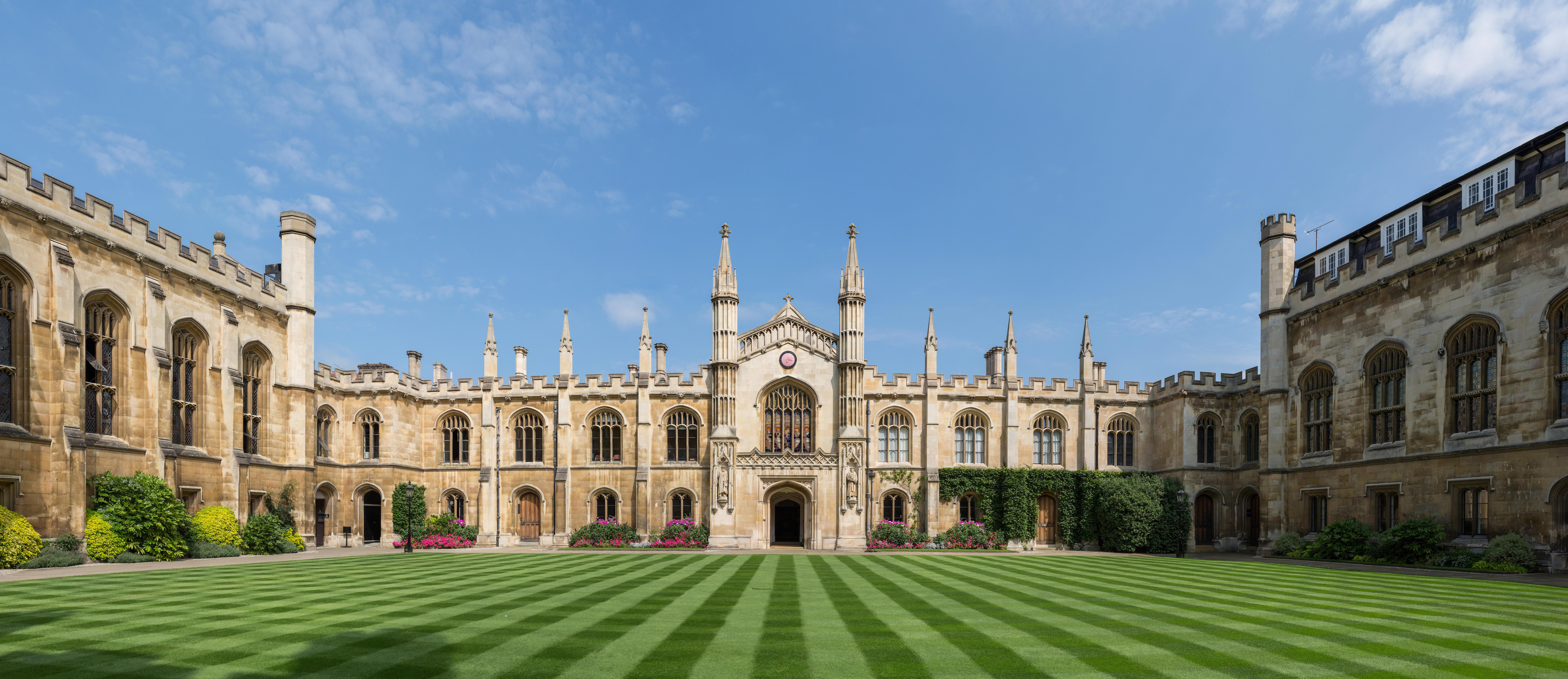
A college (Latin: ''collegium'') is an educational institution or a constituent part of one. A college may be a degree-awarding tertiary educational institution, a part of a collegiate or federal university, an institution offering vocational education, or a secondary school. In most of the world, a college may be a high school or secondary school, a college of further education, a training institution that awards trade qualifications, a higher-education provider that does not have university status (often without its own degree-awarding powers), or a constituent part of a university. In the United States, a college may offer undergraduate programs – either as an independent institution or as the undergraduate program of a university – or it may be a residential college of a university or a community college, referring to (primarily public) higher education institutions that aim to provide affordable and accessible education, usually limited to two-year as ... [...More Info...] [...Related Items...] OR: [Wikipedia] [Google] [Baidu] |
Higher Education In Saskatchewan
Historically, Saskatchewan's higher education system has been "significantly shaped" by demographics. In 1901, six years prior to the 1907 founding of a university in Saskatchewan, the urban population in Saskatchewan was 14,266 (16%) while the rural population was 77,013 (84%). One hundred years later, the proportions had changed significantly: urban population in 2001 was 629,036 (64%) while the rural population was 349,897 (36%). Over time the province's higher education system has changed significantly in response both to this demographic shift and to provincial politics. __TOC__ History Saskatchewan became a province on September 1, 1905. In 1907, the University Act created the University of Saskatchewan in Saskatoon. The Methodist Church established Regina College in 1911; fifteen Bible colleges were also established in Saskatchewan between 1928 and 1945. In 1944, following the election of Tommy Douglas and the CCF party, Teachers' colleges were moved into the University ... [...More Info...] [...Related Items...] OR: [Wikipedia] [Google] [Baidu] |


.jpg)


