|
Syrmia District
The Srem District ( sr, / , ) is one of seven administrative districts of the autonomous province of Vojvodina, Serbia. It lies in the geographical regions of Syrmia and Mačva. According to the 2011 census results, it has a population of 312,278 inhabitants. The administrative center is the city of Sremska Mitrovica. Name In Serbian, the district is known as ''Sremski okrug'' (), in Croatian as ''Srijemski okrug'', in Hungarian as ''Szerémségi Körzet'', in Slovak as ''Sriemskí okres'', in Rusyn as ''Srimski okruh'' (Сримски окрух), and in Romanian as ''Districtul Srem''. Administration The Srem District is one of seven districts (first-level administrative divisions) of Vojvodina (and 29 of Serbia). Districts are regional centers and do not have any form of self-government. The District includes the municipalities of: * Inđija * Irig * Pećinci * Ruma * Sremska Mitrovica * Stara Pazova * Šid History In Late antiquity, between the 3rd and 5th centur ... [...More Info...] [...Related Items...] OR: [Wikipedia] [Google] [Baidu] |
List Of Districts Of Serbia
An ''okrug'' is one of the first-level administrative divisions of Serbia, corresponding to a "district" in many other countries (Serbia also has two autonomous provinces at a higher level than districts). The term ''okrug'' (pl. ''okruzi)'' literally means "encircling" and corresponds to in German language. It can be translated as "county", though it is generally rendered by the Serbian government as "district". The Serbian local government reforms of 1992, going into effect the following year, created 29 districts, with the City of Belgrade holding similar authority. Following the 2008 Kosovo declaration of independence, the districts created by the UNMIK-Administration were adopted by Kosovo. The Serbian government does not recognize these districts. The districts of Serbia are generally named after historical and geographical regions, though some, such as the Pčinja District and the Nišava District, are named after local rivers. Their areas and populations vary, ranging ... [...More Info...] [...Related Items...] OR: [Wikipedia] [Google] [Baidu] |
Slovak Language
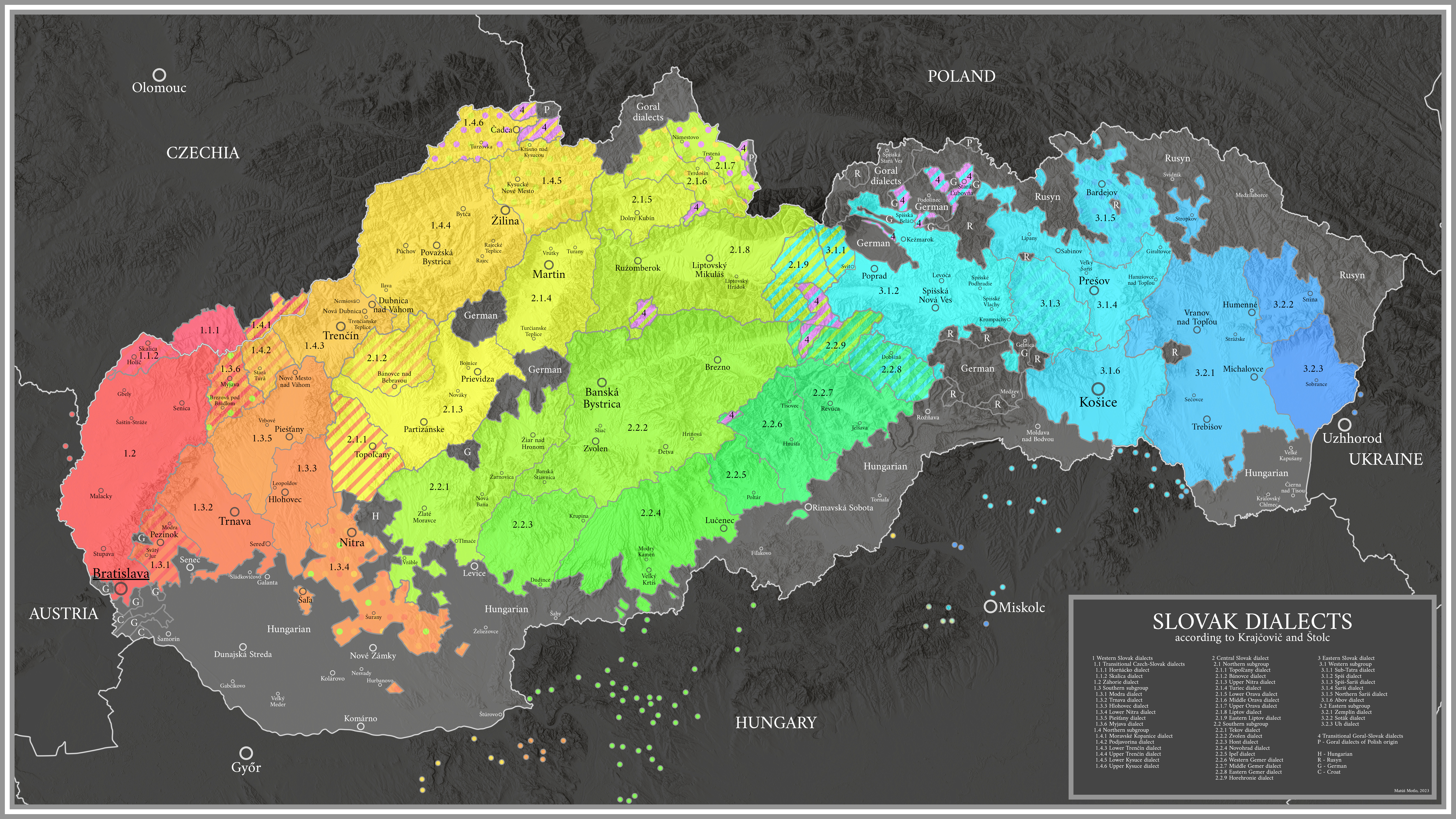
Slovak () , is a West Slavic language of the Czech–Slovak group, written in Latin script. It is part of the Indo-European language family, and is one of the Slavic languages, which are part of the larger Balto-Slavic branch. Spoken by approximately 5 million people as a native language, primarily ethnic Slovaks, it serves as the official language of Slovakia and one of the 24 official languages of the European Union. Slovak is closely related to Czech, to the point of mutual intelligibility to a very high degree, as well as Polish. Like other Slavic languages, Slovak is a fusional language with a complex system of morphology and relatively flexible word order. Its vocabulary has been extensively influenced by Latin and German and other Slavic languages. The Czech–Slovak group developed within West Slavic in the high medieval period, and the standardization of Czech and Slovak within the Czech–Slovak dialect continuum emerged in the early modern period. In the later mi ... [...More Info...] [...Related Items...] OR: [Wikipedia] [Google] [Baidu] |
Pannonia (Byzantine Province)
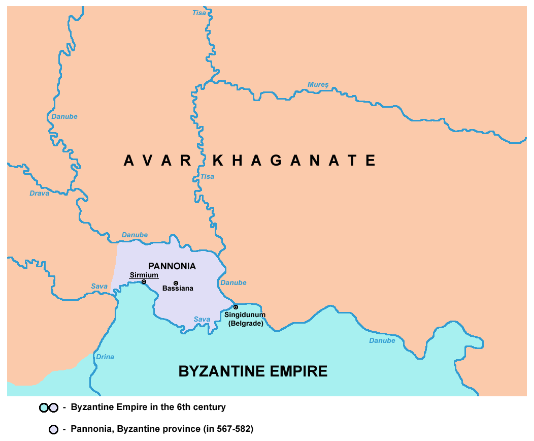
Pannonia was a Byzantine province, which existed in present-day Syrmia region of Serbia in the 6th century. Its capital was Sirmium (modern-day Sremska Mitrovica). It differed significantly in its area from the Roman province of Pannonia, and it was subordinate to the Diocese of Dacia. Geography The province was located between the Danube river in the north-east and Sava river in the south. The western border of Byzantine Pannonia stretched approximately to the estuary or river Drina into Sava. Important cities in the area were Sirmium and Bassianae. Byzantine Pannonia bordered Byzantine province of Moesia Prima in the south and Avar Khaganate in the west, north and east. History Background Byzantine Pannonia succeeded the name of much bigger classical Roman province of Pannonia. In other words, The Byzantine one covered only a small eastern part of ancient Roman Pannonia. In the 2nd century, the original Roman province was divided into two ones: Pannonia Inferior and Pannoni ... [...More Info...] [...Related Items...] OR: [Wikipedia] [Google] [Baidu] |
Pannonia Secunda
Pannonia Secunda was one of the provinces of the Roman Empire. It was formed in the year 296, during the reign of emperor Diocletian. The capital of the province was Sirmium (today Sremska Mitrovica). Pannonia Secunda included parts of present-day Serbia, Croatia, and Bosnia and Herzegovina. History Before the creation of this province, its territory was part of the province of Pannonia Inferior. In the year 296, Pannonia Inferior was divided into two provinces - Pannonia Secunda in the south and Pannonia Valeria in the north. The border between the two newly established provinces was the River Drava. The capital of Pannonia Secunda, Sirmium, was also one of the four capitals of the Roman Empire; several Roman emperors were born in or near this city. In the year 314, there was a battle between two pretenders to the imperial throne, Constantine the Great and Licinius. The battle occurred in Pannonia Secunda, near the town of Cibalae. Constantine had an army of 20,000 men, while ... [...More Info...] [...Related Items...] OR: [Wikipedia] [Google] [Baidu] |
Roman Empire
The Roman Empire ( la, Imperium Romanum ; grc-gre, Βασιλεία τῶν Ῥωμαίων, Basileía tôn Rhōmaíōn) was the post-Republican period of ancient Rome. As a polity, it included large territorial holdings around the Mediterranean Sea in Europe, North Africa, and Western Asia, and was ruled by emperors. From the accession of Caesar Augustus as the first Roman emperor to the military anarchy of the 3rd century, it was a Principate with Italia as the metropole of its provinces and the city of Rome as its sole capital. The Empire was later ruled by multiple emperors who shared control over the Western Roman Empire and the Eastern Roman Empire. The city of Rome remained the nominal capital of both parts until AD 476 when the imperial insignia were sent to Constantinople following the capture of the Western capital of Ravenna by the Germanic barbarians. The adoption of Christianity as the state church of the Roman Empire in AD 380 and the fall of the Western ... [...More Info...] [...Related Items...] OR: [Wikipedia] [Google] [Baidu] |
Sirmium
Sirmium was a city in the Roman province of Pannonia, located on the Sava river, on the site of modern Sremska Mitrovica in the Vojvodina autonomous provice of Serbia. First mentioned in the 4th century BC and originally inhabited by Illyrians and Celts, it was conquered by the Romans in the 1st century BC and subsequently became the capital of the Roman province of Pannonia Inferior. In 294 AD, Sirmium was proclaimed one of four capitals of the Roman Empire. It was also the capital of the Praetorian prefecture of Illyricum and of Pannonia Secunda. The site is protected as an archaeological Site of Exceptional Importance. The modern region of Syrmia (Srem or Srijem) was named after the city. Sirmium purportedly had 100,000 inhabitants and was one of the largest cities of its time. Colin McEvedy, whose estimates for ancient cities are much lower than the general consensus, however, put the population at only 7,000, based on the size of the archaeological site. The amount of grain ... [...More Info...] [...Related Items...] OR: [Wikipedia] [Google] [Baidu] |
Late Antiquity
Late antiquity is the time of transition from classical antiquity to the Middle Ages, generally spanning the 3rd–7th century in Europe and adjacent areas bordering the Mediterranean Basin. The popularization of this periodization in English has generally been credited to historian Peter Brown, after the publication of his seminal work '' The World of Late Antiquity'' (1971). Precise boundaries for the period are a continuing matter of debate, but Brown proposes a period between the 3rd and 8th centuries AD. Generally, it can be thought of as from the end of the Roman Empire's Crisis of the Third Century (235–284) to the early Muslim conquests (622–750), or as roughly contemporary with the Sasanian Empire (224–651). In the West its end was earlier, with the start of the Early Middle Ages typically placed in the 6th century, or earlier on the edges of the Western Roman Empire. The Roman Empire underwent considerable social, cultural and organizational changes starting wit ... [...More Info...] [...Related Items...] OR: [Wikipedia] [Google] [Baidu] |
Šid
Šid ( sr-cyr, Шид, ) is a town and municipality located in the Srem District of the autonomous province of Vojvodina, Serbia. It has a population of 14,893, while the municipality has 34,188 inhabitants. A border crossing between Serbia and Croatia is located in the town. Name In Serbian, the town is known as ''Šid'' (Шид), in Hungarian as ''Sid'', in German as ''Schid'', in Slovak as ''Šíd'', and in Rusyn as Шид. History Šid was firstly mentioned in 1702. At first, settlement was part of Danubian Military Frontier, but since the middle of the 18th century, it was part of the Syrmia County of the Habsburg Kingdom of Slavonia. In 1848-1849, Šid was part of Serbian Vojvodina, and in 1849-1860 part of Voivodeship of Serbia and Banat of Temeschwar. After the abolishment of the voivodeship in 1860, Šid was again incorporated into Syrmia County of the Kingdom of Slavonia. In 1868, Kingdom of Slavonia was joined with the Kingdom of Croatia into the Kingdom of Croatia- ... [...More Info...] [...Related Items...] OR: [Wikipedia] [Google] [Baidu] |
Stara Pazova
Stara Pazova (, ; hu, Ópazova) is a town and municipality located in the Srem District of the autonomous province of Vojvodina, Serbia. The town has a population of 64792, while Stara Pazova municipality has 65,792 inhabitants. The entrance into town from Inđija lies on 45th parallel north, it is half-way between the North pole and the equator. Name In Serbian, the town is known as ''Stara Pazova'' (Стара Пазова), formerly also ''Pazova'' (Пазова); in Slovak as ''Stará Pazova''; in German as ''Alt-Pasua'', ''Alt-Pazua'' or ''Pazua''; and in Hungarian as ''Ópazova''. History During the Ottoman administration (16th-18th century), Pazova was populated by ethnic Serbs and was part of the Ottoman Sanjak of Syrmia. In 1718, the town became part of the Habsburg monarchy. In the 18th century (after 1760) Lutheran Slovaks settled in Pazova, and in 1791 Germans arrived here as well. The Germans lived in a separate settlement known as Nova Pazova ("New Pazova"), thu ... [...More Info...] [...Related Items...] OR: [Wikipedia] [Google] [Baidu] |
Ruma
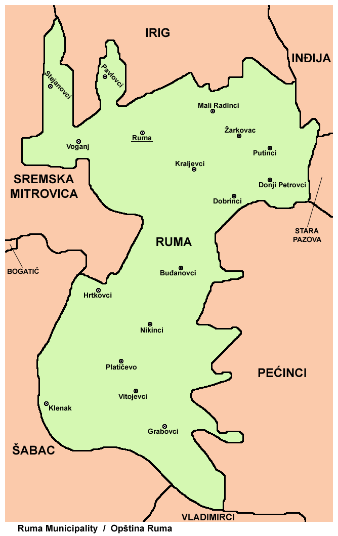
Ruma (; hu, Árpatarló) is a town and municipality in the Srem District of the Autonomous Province of Vojvodina, Serbia. As of 2011, the town has a population of 30,076, while the municipality has a population of 54,339. History Traces of organized human life on the territory of Ruma municipality date back as far as prehistory. The most important archaeological locality in the municipality is Bronze Age Gomolava near Hrtkovci, with two exclusive tombs of Bosut culture dating to the 9th century BC and 3000BC Vučedol culture pottery. The first known inhabitants of this area were various peoples of Illyrian and Celtic origin, such as the Amantini, Breuci, Scordisci, etc. During the Roman rule, local inhabitants lost their ethnic character and adopted Roman culture. There were no larger Roman settlements on the territory of Ruma, but a certain number of agricultural estates known as "villae rusticae" were located there. Migrations of Huns, Germanic peoples, Avars and Slavs des ... [...More Info...] [...Related Items...] OR: [Wikipedia] [Google] [Baidu] |
Pećinci
Pećinci (, ; hu, Pecsince) is a village and municipality located in the Srem District of the autonomous province of Vojvodina, Serbia. The village has a population of 2,581 (2011), while Pećinci municipality has 19,720 inhabitants. Name In Serbo-Croatian, the village is known as ''Pećinci'' (Пећинци), in Hungarian as ''Pecsince'', in German as ''Petschinzi'', in Slovak as ''Pečinci'', and in Rusyn as Печинци. Its name derived from the Serbian word "peć/пећ" ("furnace" in English), or "petlja/петља" ("loop" or "noose" in English). The name of the village in Serbo-Croatian is plural. History The village was first time recorded by the sources in 1416. After that time, there were no other records about this settlement until 1702. The village was under Ottoman administration until the Treaty of Passarowitz (1718), when it passed to Habsburg monarchy. During Habsburg administration, it was part of the Habsburg Military Frontier. From 1848 to 1849, ... [...More Info...] [...Related Items...] OR: [Wikipedia] [Google] [Baidu] |
Irig, Serbia
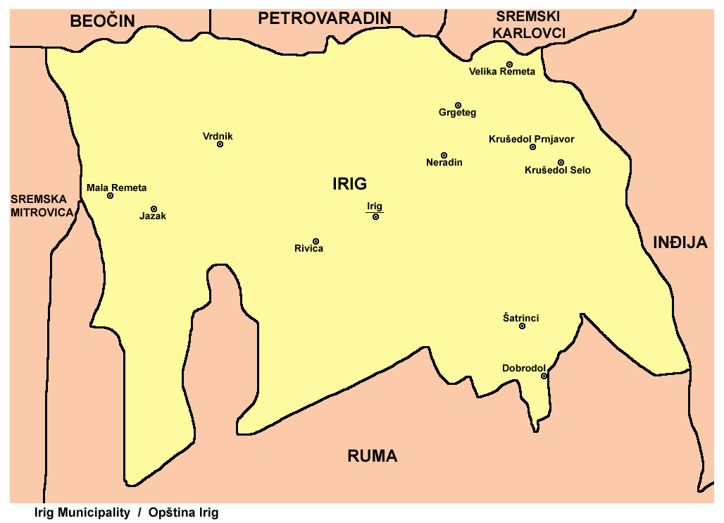
Irig (, ; hu, Ürög) is a town and municipality located in the Srem District of the autonomous province of Vojvodina, Serbia. The town has a population of 4,415, while Irig municipality has 10,866 inhabitants. Name In Serbian, the town is known as ''Irig'' (Ириг), in Croatian as ''Irig'', in Hungarian as ''Ireg'' or ''Ürög'', in German as ''Irick'', in Slovak as ''Irig'', and in Rusyn as Ириґ. History Irig was first mentioned in the historical documents in 1225. In the 15th century, the masters of the town were Serbian despots Vuk Grgurević, Đorđe Branković, and Jovan Branković. During the 15th and 16th century, ten Orthodox monasteries were built in the surrounding of Irig (Two of those were located just near the town). Between 1526 and 1699, the town was under Ottoman administration. During this time, it belonged to the Sanjak of Syrmia, and was the administrative seat of one of the seven nahijas in that sanjak. In 1665, the town had 2,000 houses, one m ... [...More Info...] [...Related Items...] OR: [Wikipedia] [Google] [Baidu] |

