|
Suguta
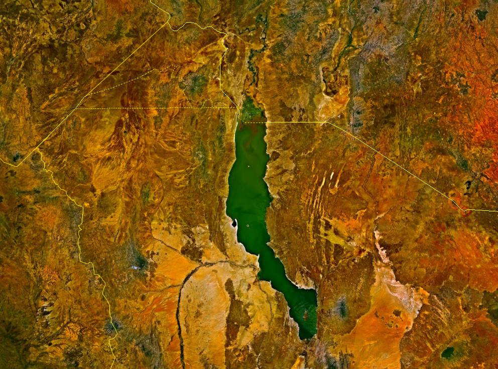
The Suguta Valley, also known as the Suguta Mud Flats, is an arid part of the Great Rift Valley in Kenya (Africa), directly south of Lake Turkana. Location The Suguta valley today is one of the driest parts of Kenya, with annual rainfall below . Lake Logipi seasonally fills a small part of the northern end of the valley. The valley has a relatively flat floor about above sea level. It is bordered by land to the east and west rising to and dotted with volcanic cinder cones. The Barrier Volcano, a broad volcanic complex, separates the valley from Lake Turkana. Mount Ngiro rises to the east of the Suguta valley. The Losiolo Escarpment, rising above the valley floor on the east side near Maralal provides one of the most dramatic views of the Kenyan rift valley. Namarunu, a volcano active in historic times, extends into the valley from the western wall. The Suguta Valley lies along the axis of the Gregory Rift, which has been faulting in this area since the Pliocene along a b ... [...More Info...] [...Related Items...] OR: [Wikipedia] [Google] [Baidu] |
Lake Suguta
Lake Suguta is a former lake in Africa. It formed in the Suguta Valley, which is part of the East African Rift, south of Lake Turkana during the Holocene African humid period. The lake existed a number of times during history, most recently during the early and middle Holocene when a stronger monsoon caused increased precipitation in the basin of the lake. The lake then reached a top elevation of above sea level, when it overflowed into the Kerio River and then into Lake Turkana. The lake possibly ultimately drained into the Nile. Between 8,000 and 5,000 years ago the lake progressively dried up; today only the small Lake Logipi occupies the area. Geography and geology Lake Suguta lies in the Kenya Rift, which is part of the East African Rift. Starting with the Miocene, plate tectonics resulted in the pulling apart of the crust and the formation of the rift valley along with volcanoes; these include The Barrier volcano which starting from 1.3 million years ago and defini ... [...More Info...] [...Related Items...] OR: [Wikipedia] [Google] [Baidu] |
Suguta River
The Suguta River is a seasonal river in the Great Rift Valley in Kenya (Africa), directly south of Lake Turkana. It flows northward through the Suguta Valley in the rainy season, forming the temporary Lake Alablad, a dry lake that combines with Lake Logipi at the northern end of the valley. The Suguta River originates in a stream of near-boiling water that emerges from the side of Mount Silali, an extinct volcano. Some geologists speculate that the Kapedo hot spring, which drops through a set of waterfalls to the Sugutu river, is the outlet from Lake Baringo to the south. At one point the Suguta River passes between two volcanoes and is fed from both sides by hot springs. In places the banks of the Suguta River are lined with palms. The river and its tributaries are home to a cichlid Cichlids are fish from the family Cichlidae in the order Cichliformes. Cichlids were traditionally classed in a suborder, the Labroidei, along with the wrasses ( Labridae), in the order Perc ... [...More Info...] [...Related Items...] OR: [Wikipedia] [Google] [Baidu] |
Namarunu
Namarunu is a shield volcano located in the Great Rift Valley, Kenya. Location Namarunu is located in the Suguta Valley, a section of the Kenyan Rift Valley just south of Lake Turkana. It extends from the western side of the rift past the center. The mountain forms a broad shield. The large basal part is about deep, made up of outward-dipping trachytic lavas, breccias and tuffs. A few thousand years ago the Suguta was filled by a major lake, but now it is extremely dry and hot, with only the small Lake Logipi at the northern end. Some of the recent cones on the floor of the rift valley and on the eastern side of the rift below the Tirr Tirr Plateau contain hot springs. Evolution Namarunu was mainly formed during the upper Pliocene, but has some material from the Holocene. It is a trachytic shield volcano topped by more recent parasitic cones and lava flows. The basal trachyte dates to roughly 6.8 million years ago, while the uppermost basalts date to around 500,000 years ag ... [...More Info...] [...Related Items...] OR: [Wikipedia] [Google] [Baidu] |
African Humid Period
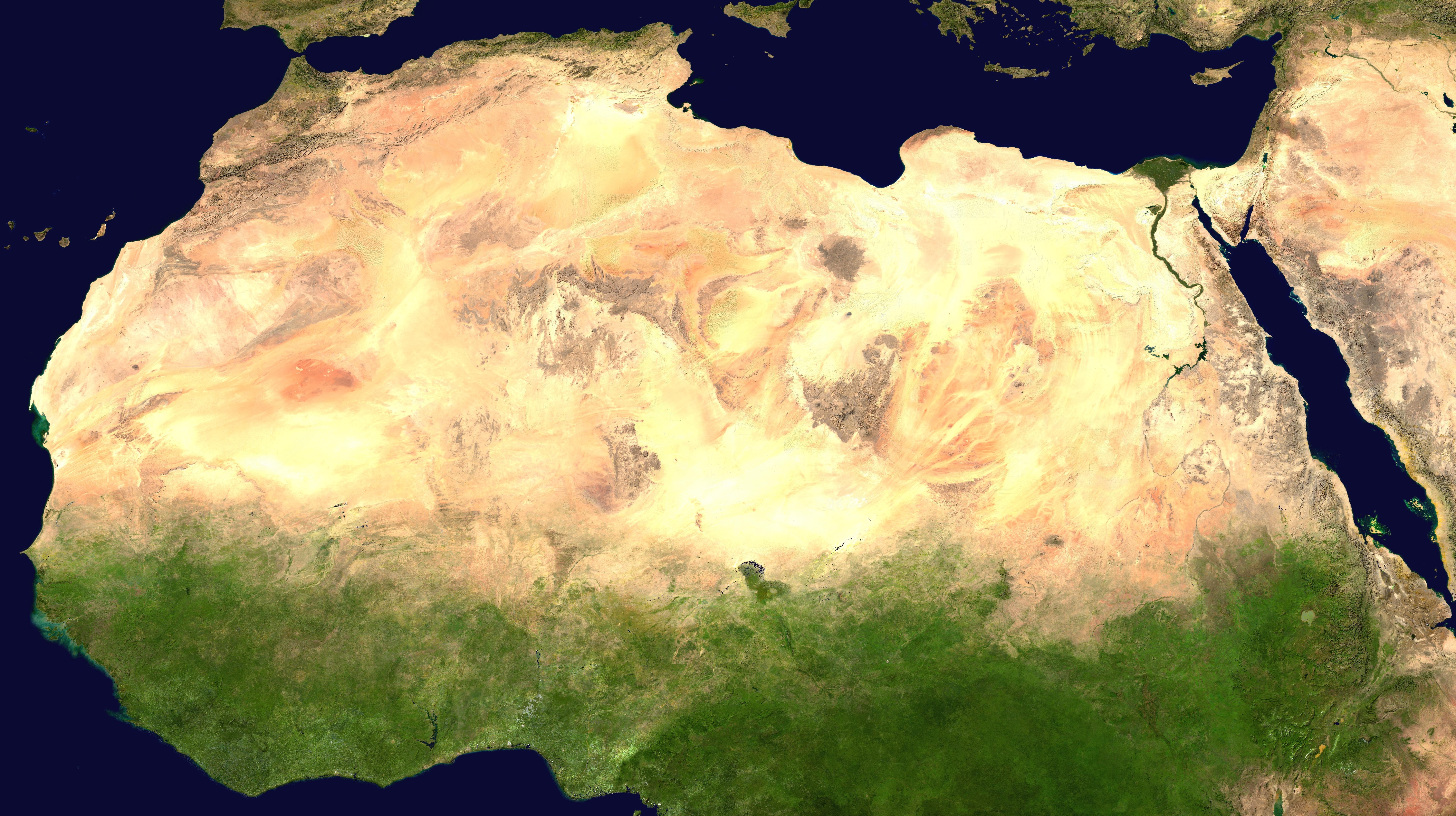
The African humid period (AHP) (also known by other names) is a climate period in Africa during the late Pleistocene and Holocene geologic epochs, when northern Africa was wetter than today. The covering of much of the Sahara desert by grasses, trees and lakes was caused by changes in Earth's orbit around the Sun; changes in vegetation and dust in the Sahara which strengthened the African monsoon; and increased greenhouse gases. During the preceding Last Glacial Maximum, the Sahara contained extensive dune fields and was mostly uninhabited. It was much larger than today, but its lakes and rivers such as Lake Victoria and the White Nile were either dry or at low levels. The humid period began about 14,600–14,500 years ago at the end of Heinrich event 1, simultaneously to the Bølling–Allerød warming. Rivers and lakes such as Lake Chad formed or expanded, glaciers grew on Mount Kilimanjaro and the Sahara retreated. Two major dry fluctuations occurred; during the Younger Dr ... [...More Info...] [...Related Items...] OR: [Wikipedia] [Google] [Baidu] |
Lake Logipi
Lake Logipi is a saline, alkaline lake that lies at the northern end of the arid Suguta Valley in the northern Kenya Rift. It is separated from Lake Turkana by the Barrier Volcano, Barrier volcanic complex, a group of young volcanoes that last erupted during the late 19th century or early 20th century. Saline hot springs discharge on the northern shoreline of Lake Logipi and at Cathedral Rocks near its southern limit, and help to maintain water at times of extreme aridity. During the rainy season, the lake is also recharged from the Suguta River which flows northward along the Suguta Valley, periodically forming a temporary lake (Lake Alablab) that unites with Logipi. Lake Logipi has a maximum depth of 3 to 5 m, and is about 6 km wide by 3 km long. Its waters are of sodium bicarbonate composition with a pH of 9.5-10.5 and salinity (total dissolved salts) that varies from less than 20 g/L to greater than 50 g/L. Efflorescence, Efflorescent salt crusts (trona) are present a ... [...More Info...] [...Related Items...] OR: [Wikipedia] [Google] [Baidu] |
Great Rift Valley, Kenya
The Great Rift Valley is part of an intra-continental ridge system that runs through Kenya from north to south. It is part of the Gregory Rift, the eastern branch of the East African Rift, which starts in Tanzania to the south and continues northward into Ethiopia. It was formed on the "Kenyan Dome" a geographical upwelling created by the interactions of three major tectonics: the Arabian, Nubian, and Somalian plates. In the past, it was seen as part of a " Great Rift Valley" that ran from Madagascar to Syria. Most of the valley falls within the former Rift Valley Province. The valley contains the Cherangani Hills and a chain of volcanoes, some of which are still active. The climate is mild, with temperatures usually below . Most rain falls during the March–June and October–November periods. The Tugen Hills to the west of Lake Baringo contain fossils preserved in lava flows from the period 14 to 4 million years ago. The relics of many hominids, ancestors of humans, have ... [...More Info...] [...Related Items...] OR: [Wikipedia] [Google] [Baidu] |
Lake Turkana
Lake Turkana (), formerly known as Lake Rudolf, is a lake in the Kenyan Rift Valley, in northern Kenya, with its far northern end crossing into Ethiopia. It is the world's largest permanent desert lake and the world's largest alkaline lake. By volume it is the world's fourth-largest salt lake after the Caspian Sea, Issyk-Kul, and Lake Van (passing the shrinking South Aral Sea), and among all lakes it ranks 24th. Lake Turkana is now threatened by the construction of Gilgel Gibe III Dam in Ethiopia due to the damming of the Omo river which supplies most of the lake's water. Although the lake commonly has been —and to some degree still is— used for drinking water, its salinity (slightly brackish) and very high levels of fluoride (much higher than in fluoridated water) generally make it unsuitable, and it has also been a source of diseases spread by contaminated water. Increasingly, communities on the lake's shores rely on underground springs for drinking water. The sam ... [...More Info...] [...Related Items...] OR: [Wikipedia] [Google] [Baidu] |
Barrier Volcano
The Barrier is an active shield volcano located in the north of Kenya. It is last known to have erupted in 1921. Description The Barrier was given its name because it forms a barrier about long across the Kenyan Rift Valley. It has a width of and separates Lake Turkana to the north and the Suguta Valley and the small Lake Logipi to the south. The volcanic complex consists of four distinct volcanoes. From west to east these are Kalolenyang, Kakorinya, Likaiu West and Likaiu East. The foundation rocks are mainly basalt. About 90% of the volume is trachyte. Kakorinya is the youngest of the group and forms the center of the complex, with a well-preserved circular crater that has not been breached. The wide summit caldera of Kakorinya was formed about 92,000 years ago. Much of the floor of the caldera is filled with trachytic and phonolitic lava domes and flows that recently erupted within the caldera and along its ring fracture. There are scoria cones and lava flows from the e ... [...More Info...] [...Related Items...] OR: [Wikipedia] [Google] [Baidu] |
Mount Ngiro
Mount Ng'iro is a mountain in the north of Kenya overlooking the Suguta Valley, part of the Great Rift Valley, to the west. The mountain is surrounded by desert, but is forested on its upper slopes. It lies in the territory of the Samburu people. Some subclans under the Lmasula phratry cultivate bees on the mountain, and as bee-keepers claim exclusive rights to the land and water. See also * List of Ultras of Africa This is a list of all the Ultra prominent peaks (with topographic prominence greater than 1,500 metres) in Africa. Also shown is Mount Catherine in Sinai, Egypt which is not geographically part of Africa. Not listed here are the 5 Ultras of the Can ... References Sources * * * {{Kenya-geo-stub Great Rift Valley Ngiro ... [...More Info...] [...Related Items...] OR: [Wikipedia] [Google] [Baidu] |
Losiolo Escarpment
The Losiolo Escarpment is an escarpment on the east side of the Great Rift Valley, Kenya. Rising above the Suguta Valley floor on the east side near Maralal Maralal is a small hillside market town in northern Kenya, lying east of the Loroghi Plateau within Samburu County, of which it is the capital. It is the administrative headquarters of Samburu county. The town has an urban population of 16,281 (19 ..., the escarpment provides one of the most dramatic views of the Kenyan rift valley. The escarpment, which is also known as 'World's End', is the longest vertical drop in the Rift Valley. References Sources * * Escarpments of Kenya Great Rift Valley {{Kenya-geo-stub ... [...More Info...] [...Related Items...] OR: [Wikipedia] [Google] [Baidu] |
Baragoi
Baragoi is a market town in Kenya, lying north of Maralal and east of the Suguta Valley. It is located in Samburu County. The entire Baragoi division has a population of nearly 20,000 (1999 census) comprising mostly people from the Samburu and Turkana tribes. The main access road to Baragoi is the A4 road from Rumuruti-Maralal-Baragoi, which as of 2019 was being tarmaced from Rumuruti up to Maralal. The stretch of 108 km from Maralal to Baragoi is still unpaved. See also *Baragoi Clashes In November 2012, a series of ethnic clashes between the Samburu and Turkana tribes of Kenya's Samburu County resulted in the deaths of at least 46 people including police officers sent to quell the violence. Cause of conflict Tribal rivalry a ... References Populated places in Samburu County {{RiftValleyKE-geo-stub ... [...More Info...] [...Related Items...] OR: [Wikipedia] [Google] [Baidu] |
Great Rift Valley
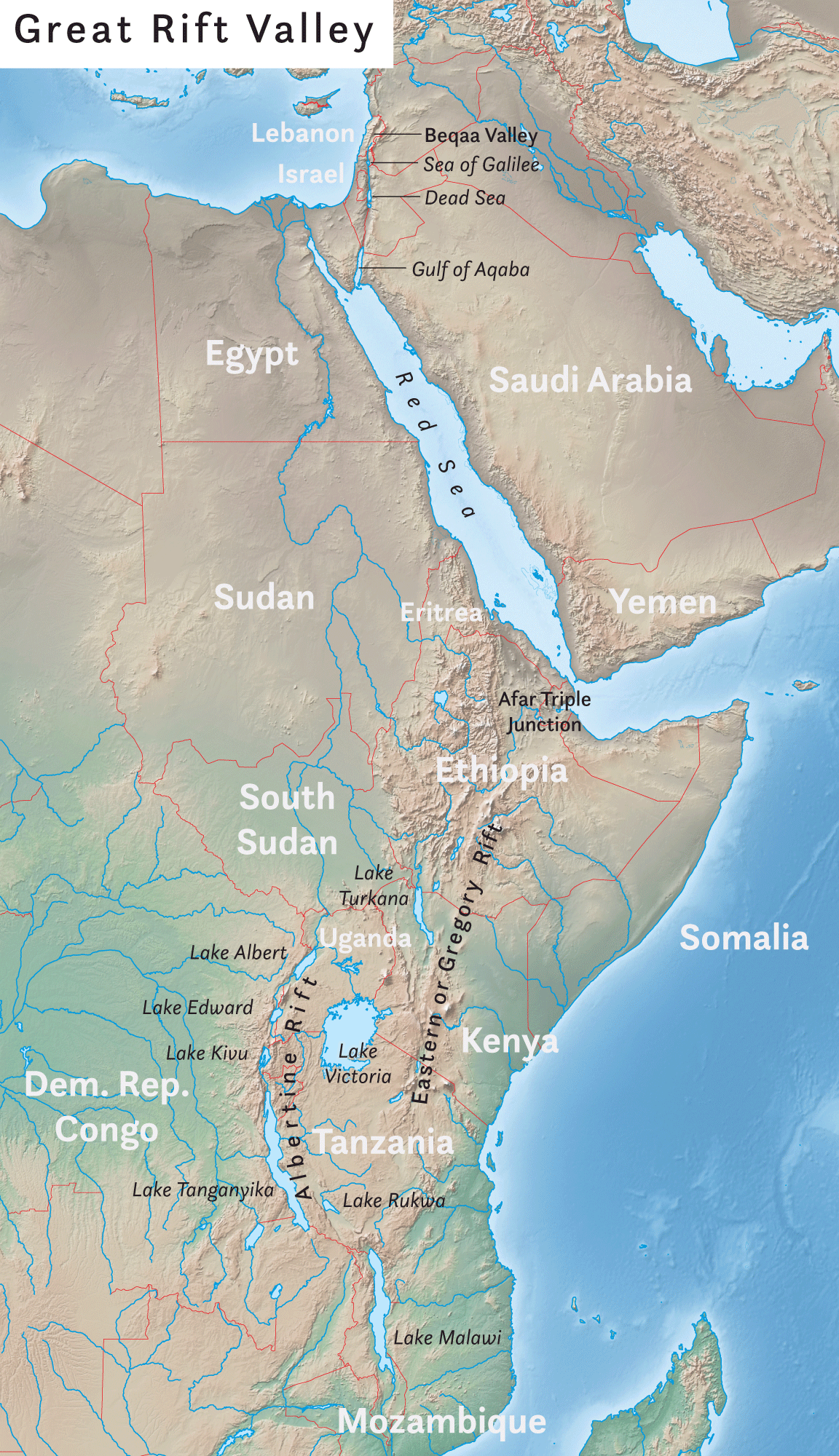
The Great Rift Valley is a series of contiguous geographic trenches, approximately in total length, that runs from Lebanon in Asia to Mozambique in Southeast Africa. While the name continues in some usages, it is rarely used in geology as it is considered an imprecise merging of separate though related rift and fault systems. This valley extends northward for 5,950 km through the eastern part of Africa, through the Red Sea, and into Western Asia. Several deep, elongated lakes, called ribbon lakes, exist on the floor of this rift valley: Lakes Malawi, Rudolf and Tanganyika are examples of such lakes. The region has a unique ecosystem and contains a number of Africa's wildlife parks. The term Great Rift Valley is most often used to refer to the valley of the East African Rift, the divergent plate boundary which extends from the Afar Triple Junction southward through eastern Africa, and is in the process of splitting the African Plate into two new and separate plates. Geolo ... [...More Info...] [...Related Items...] OR: [Wikipedia] [Google] [Baidu] |


