|
St. Briavels
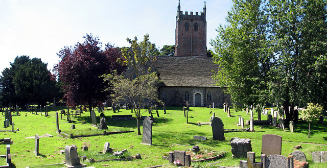
St Briavels (pronounced ''Brevels'', once known as 'Ledenia Parva' (Little Lydney)), is a medium-sized village and civil parish in the Royal Forest of Dean in west Gloucestershire, England; close to the England-Wales border, and south of Coleford. It stands almost above sea level on the edge of a limestone plateau above the valley of the River Wye, above an ancient meander of the river. To the west, Cinder Hill drops off sharply into the valley. It is sheltered behind the crumbling walls of the 12th century St Briavels Castle. History Little is known about the origin of St Briavels. The name is thought to be from a much-travelled early Christian missionary, Brioc, whose name also appears in places as far afield as Cornwall and Brittany. Later King Offa of Mercia built Offa's Dyke from the mouth of the River Wye near Chepstow to Prestatyn and local remains can still be seen in the nearby Hudnalls Wood. The Normans thought it an ideal site for one of the many castles built fro ... [...More Info...] [...Related Items...] OR: [Wikipedia] [Google] [Baidu] |
Forest Of Dean (UK Parliament Constituency)
Forest of Dean is a constituency in Gloucestershire represented in the House of Commons of the UK Parliament since 2005 by Mark Harper, a Conservative who has served as Secretary of State for Transport since 2022. Boundaries 1885–1918: The Sessional Divisions of Coleford, Lydney, Newent, and Newnham. 1918–1950: The Urban Districts of Awre, Coleford, Newnham, and Westbury-on-Severn, the Rural Districts of East Dean and United Parishes, Lydney, Newent, and West Dean, and part of the Rural District of Gloucester. 1997–2010: The District of Forest of Dean, and the Borough of Tewkesbury wards of Haw Bridge and Highnam. 2010–present: The District of Forest of Dean, and the Borough of Tewkesbury ward of Highnam with Haw Bridge. The constituency boundaries remained unchanged. History This seat was created for the 1885 general election (replacing the two-seat constituency of West Gloucestershire under the Redistribution of Seats Act 1885), was redrawn for the 1918 gene ... [...More Info...] [...Related Items...] OR: [Wikipedia] [Google] [Baidu] |
Cornwall
Cornwall (; kw, Kernow ) is a historic county and ceremonial county in South West England. It is recognised as one of the Celtic nations, and is the homeland of the Cornish people. Cornwall is bordered to the north and west by the Atlantic Ocean, to the south by the English Channel, and to the east by the county of Devon, with the River Tamar forming the border between them. Cornwall forms the westernmost part of the South West Peninsula of the island of Great Britain. The southwesternmost point is Land's End and the southernmost Lizard Point. Cornwall has a population of and an area of . The county has been administered since 2009 by the unitary authority, Cornwall Council. The ceremonial county of Cornwall also includes the Isles of Scilly, which are administered separately. The administrative centre of Cornwall is Truro, its only city. Cornwall was formerly a Brythonic kingdom and subsequently a royal duchy. It is the cultural and ethnic origin of the Cornish dias ... [...More Info...] [...Related Items...] OR: [Wikipedia] [Google] [Baidu] |
St Briavels (hundred)
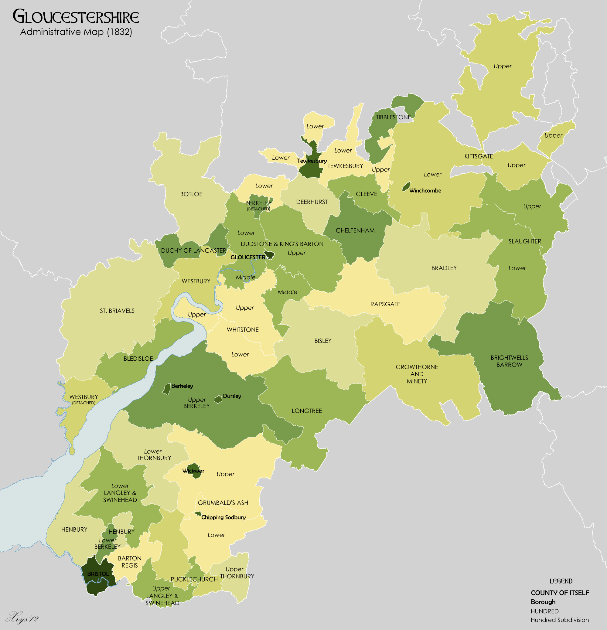
St Briavels was an ancient hundred of Gloucestershire, England. It comprised the extra-parochial area of the Forest of Dean, and the ancient parishes of *Abenhall *English Bicknor *St Briavels *Littledean * Flaxley *Hewelsfield *Mitcheldean * Newland *Ruardean * Staunton *Lea (part) The hundred was created at some time between 1086 and 1220 to provide a structure for the administration of the Forest of Dean. The meeting place was St Briavels Castle St Briavels Castle is a moated Norman castle at St Briavels in the English county of Gloucestershire. The castle is noted for its huge Edwardian gatehouse that guards the entrance. St Briavels Castle was originally built between 1075 and 1129 a .... References External links The National Gazetteer of Great Britain and Ireland (1868) Hundreds of Gloucestershire Forest of Dean {{Gloucestershire-geo-stub ... [...More Info...] [...Related Items...] OR: [Wikipedia] [Google] [Baidu] |
Hundred (division)
A hundred is an administrative division that is geographically part of a larger region. It was formerly used in England, Wales, some parts of the United States, Denmark, Southern Schleswig, Sweden, Finland, Norway, the Bishopric of Ösel–Wiek, Curonia, the Ukrainian state of the Cossack Hetmanate and in Cumberland County in the British Colony of New South Wales. It is still used in other places, including in Australia (in South Australia and the Northern Territory). Other terms for the hundred in English and other languages include ''wapentake'', ''herred'' (Danish and Bokmål Norwegian), ''herad'' ( Nynorsk Norwegian), ''hérað'' (Icelandic), ''härad'' or ''hundare'' (Swedish), ''Harde'' (German), ''hiird'' ( North Frisian), ''satakunta'' or ''kihlakunta'' (Finnish), ''kihelkond'' (Estonian), ''kiligunda'' (Livonian), '' cantref'' (Welsh) and ''sotnia'' (Slavic). In Ireland, a similar subdivision of counties is referred to as a barony, and a hundred is a subdivision of a p ... [...More Info...] [...Related Items...] OR: [Wikipedia] [Google] [Baidu] |
Shire
Shire is a traditional term for an administrative division of land in Great Britain and some other English-speaking countries such as Australia and New Zealand. It is generally synonymous with county. It was first used in Wessex from the beginning of Anglo-Saxon settlement, and spread to most of the rest of England in the tenth century. In some rural parts of Australia, a shire is a local government area; however, in Australia it is not synonymous with a "county", which is a lands administrative division. Etymology The word ''shire'' derives from the Old English , from the Proto-Germanic ( goh, sćira), denoting an 'official charge' a 'district under a governor', and a 'care'. In the UK, ''shire'' became synonymous with ''county'', an administrative term introduced to England through the Norman Conquest in the later part of the eleventh century. In contemporary British usage, the word ''counties'' also refers to shires, mainly in places such as Shire Hall. In regions with ... [...More Info...] [...Related Items...] OR: [Wikipedia] [Google] [Baidu] |
Gloucester
Gloucester ( ) is a cathedral city and the county town of Gloucestershire in the South West of England. Gloucester lies on the River Severn, between the Cotswolds to the east and the Forest of Dean to the west, east of Monmouth and east of the border with Wales. Including suburban areas, Gloucester has a population of around 132,000. It is a port, linked via the Gloucester and Sharpness Canal to the Severn Estuary. Gloucester was founded by the Romans and became an important city and '' colony'' in AD 97 under Emperor Nerva as '' Colonia Glevum Nervensis''. It was granted its first charter in 1155 by Henry II. In 1216, Henry III, aged only nine years, was crowned with a gilded iron ring in the Chapter House of Gloucester Cathedral. Gloucester's significance in the Middle Ages is underlined by the fact that it had a number of monastic establishments, including: St Peter's Abbey founded in 679 (later Gloucester Cathedral), the nearby St Oswald's Priory, Glo ... [...More Info...] [...Related Items...] OR: [Wikipedia] [Google] [Baidu] |
St Mary
Mary; arc, ܡܪܝܡ, translit=Mariam; ar, مريم, translit=Maryam; grc, Μαρία, translit=María; la, Maria; cop, Ⲙⲁⲣⲓⲁ, translit=Maria was a first-century Jewish woman of Nazareth, the wife of Joseph and the mother of Jesus. She is a central figure of Christianity, venerated under various titles such as virgin or queen, many of them mentioned in the Litany of Loreto. The Eastern and Oriental Orthodox, Church of the East, Catholic, Anglican, and Lutheran churches believe that Mary, as mother of Jesus, is the Mother of God. Other Protestant views on Mary vary, with some holding her to have considerably lesser status. The New Testament of the Bible provides the earliest documented references to Mary by name, mainly in the canonical Gospels. She is described as a young virgin who was chosen by God to conceive Jesus through the Holy Spirit. After giving birth to Jesus in Bethlehem, she raised him in the city of Nazareth in Galilee, and was in Jerusalem a ... [...More Info...] [...Related Items...] OR: [Wikipedia] [Google] [Baidu] |
Redbrook Redbrook is a village in Gloucestershire, England, adjoining the border with Monmouthshire, Wales. It is located on the River Wye and is within the Wye Valley Area of Outstanding Natural Beauty. History Both Upper and Lower Redbrook were mentioned in the Domesday Book of 1086 as lying within the hundred of Bromsash and they were both listed under Gloucestershire and Herefordshire. At that time neither place was recorded as having any population. Redbrook was historically an important industrial centre with many industrial sites including mills, an ironworks, tinplate works and copper works. The oldest site is the King's Mill, which was a corn mill first recorded in 1434 and which remained in use until 1925. The Redbrook Copper Works used ore brought from Cornwall via Chepstow and worked until 1740 when it closed down and the buildings were leased for the manufacturer of tinplate. It is from the iron ore that the village got its name – the brook running down the valley thro ... [...More Info...] [...Related Items...] OR: [Wikipedia] [Google] |


.jpg)
_drawn_and_engraved_under_the_direction_of_Edward_Wedlake_Brayley.jpg)
