|
Springholm
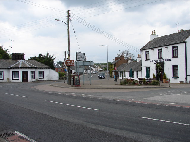
Springholm is a village in the historical county of Kirkcudbrightshire in Dumfries and Galloway, Scotland. It is located west of Dumfries on the A75. The village has a primary school, which also serves for the local village of Kirkpatrick Durham. Springholm and Crocketford ( to the north-east) are the only two settlements that are not bypassed by the A75. The village is located in the historical county of Kirkcudbrightshire Kirkcudbrightshire ( ), or the County of Kirkcudbright or the Stewartry of Kirkcudbright is one of the historic counties of Scotland, covering an area in the south-west of the country. Until 1975, Kirkcudbrightshire was an administrative county .... References Villages in Dumfries and Galloway {{DumfriesGalloway-geo-stub ... [...More Info...] [...Related Items...] OR: [Wikipedia] [Google] [Baidu] |
Kirkcudbrightshire
Kirkcudbrightshire ( ), or the County of Kirkcudbright or the Stewartry of Kirkcudbright is one of the historic counties of Scotland, covering an area in the south-west of the country. Until 1975, Kirkcudbrightshire was an administrative county used for local government. Since 1975, the area has formed part of Dumfries and Galloway for local government purposes. Kirkcudbrightshire continues to be used as a registration county for land registration. A lower-tier district called Stewartry covered the majority of the historic county from 1975 to 1996. The area of Stewartry district is still used as a lieutenancy area. Dumfries and Galloway Council also has a Stewartry area committee. Kirkcudbrightshire forms the eastern part of the medieval lordship of Galloway, which retained a degree of autonomy until it was fully absorbed by Scotland in the 13th century. In 1369, the part of Galloway east of the River Cree was placed under the control of a steward based in Kirkcudbright and so t ... [...More Info...] [...Related Items...] OR: [Wikipedia] [Google] [Baidu] |
A75 Road
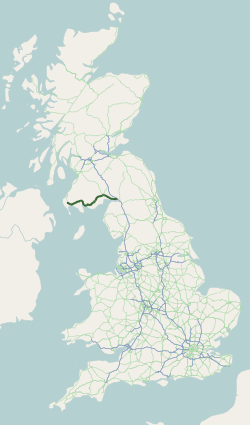
The A75 is a primary trunk road in Scotland, linking Stranraer and its ferry ports at Cairnryan with the A74(M) at Gretna, close to the border with England and the M6 motorway. Route Heading west along the south coast of Scotland from its junction with the A74(M) motorway at Gretna it continues past Eastriggs, Annan, Dumfries, Castle Douglas, Gatehouse of Fleet, Newton Stewart, Kirkcowan and Glenluce before ending at Stranraer. The majority of the road is of single-carriageway standard, although a few short dual carriageway sections exist, including a one-mile section past Gretna, a section past Collin (just east of Dumfries,) a two-mile section just west of Dumfries and a 1-mile section at Barlae (Between Glenluce and Newton Stewart). The road is widely felt to be unfit for the current large volumes of freight using it, but successive Westminster and laterly Scottish Governments have repeatedly shelved previously planned substantive upgrades, and delayed much needed, meani ... [...More Info...] [...Related Items...] OR: [Wikipedia] [Google] [Baidu] |
Crocketford
Crocketford (, also frequently ) also known as Ninemile Bar ( gd, Ath Crogaid), as it is approximately equidistant between Castle Douglas and Dumfries, is a village in the historical county of Kirkcudbrightshire in the Dumfries and Galloway council area near the boundary between Scotland and England. It is located on the A75 road around 9 miles west of Dumfries. Crocketford is one of only two settlements that are not bypassed by the A75 (along with Springholm which is around 2 miles to the south-west). The Buchanites were the followers of Elspeth Buchan, (1738-1791) who claimed to be the Woman Clad with the Sun from the Book of Revelation The Book of Revelation is the final book of the New Testament (and consequently the final book of the Christian Bible). Its title is derived from the first word of the Koine Greek text: , meaning "unveiling" or "revelation". The Book of R .... After expulsion from Dumfriesshire they eventually settled at Newhouse in the village. A ... [...More Info...] [...Related Items...] OR: [Wikipedia] [Google] [Baidu] |
Dumfries And Galloway
Dumfries and Galloway ( sco, Dumfries an Gallowa; gd, Dùn Phrìs is Gall-Ghaidhealaibh) is one of 32 unitary council areas of Scotland and is located in the western Southern Uplands. It covers the counties of Scotland, historic counties of Dumfriesshire, Kirkcudbrightshire, and Wigtownshire, the latter two of which are collectively known as Galloway. The administrative centre and largest settlement is the town of Dumfries. The second largest town is Stranraer, on the North Channel (Great Britain and Ireland), North Channel coast, some to the west of Dumfries. Following the 1975 reorganisation of local government in Scotland, the three counties were joined to form a single regions and districts of Scotland, region of Dumfries and Galloway, with four districts within it. The districts were abolished in 1996, since when Dumfries and Galloway has been a unitary local authority. For lieutenancy areas of Scotland, lieutenancy purposes, the area is divided into three lieutenancy a ... [...More Info...] [...Related Items...] OR: [Wikipedia] [Google] [Baidu] |
Dumfries And Galloway (UK Parliament Constituency)
Dumfries and Galloway is a county constituency in the House of Commons of the Parliament of the United Kingdom. It was first used in the 2005 general election, and replaced Galloway and Upper Nithsdale and part of Dumfries. It elects one Member of Parliament (MP) by the first past the post system of election. Constituency profile This is a large and rural seat with significant farming and forestry sectors, including the Galloway Forest Park. Dumfries is an economic hub for south Scotland and Stranraer was formerly a port for connections to Ireland. Boundaries As created by the Fifth Review of the Boundary Commission for Scotland the constituency is one of six covering the Dumfries and Galloway council area, the Scottish Borders council area and the South Lanarkshire council area. The other five constituencies are: Berwickshire, Roxburgh and Selkirk, Dumfriesshire, Clydesdale and Tweeddale, East Kilbride, Strathaven and Lesmahagow, Lanark and Hamilton East and Rutherglen ... [...More Info...] [...Related Items...] OR: [Wikipedia] [Google] [Baidu] |
Galloway And West Dumfries (Scottish Parliament Constituency)
Galloway and West Dumfries is a constituency of the Scottish Parliament ( Holyrood) covering part of the council area of Dumfries and Galloway. It elects one Member of the Scottish Parliament (MSP) by the plurality (first past the post) method of election. It is also one of nine constituencies in the South Scotland electoral region, which elects seven additional members, in addition to the nine constituency MSPs, to produce a form of proportional representation for the region as a whole. Created for the 2011 Scottish Parliament election, it comprises areas that were previously part of the old Dumfries and Galloway and Upper Nithsdale constituencies, which were abolished. The seat has been held by Finlay Carson of the Conservatives since the 2016 Scottish Parliament election. Electoral region The other eight constituencies of the South Scotland region are Ayr, Carrick, Cumnock and Doon Valley, Clydesdale, Dumfriesshire, East Lothian, Ettrick, Roxburgh and Berwicks ... [...More Info...] [...Related Items...] OR: [Wikipedia] [Google] [Baidu] |
Dumfries
Dumfries ( ; sco, Dumfries; from gd, Dùn Phris ) is a market town and former royal burgh within the Dumfries and Galloway council area of Scotland. It is located near the mouth of the River Nith into the Solway Firth about by road from the Anglo-Scottish border and just away from Cumbria by air. Dumfries is the county town of the historic county of Dumfriesshire. Before becoming King of Scots, Robert the Bruce killed his rival the Red Comyn at Greyfriars Kirk in the town on 10 February 1306. The Young Pretender had his headquarters here during a 3-day sojourn in Dumfries towards the end of 1745. During the Second World War, the bulk of the Norwegian Army during their years in exile in Britain consisted of a brigade in Dumfries. Dumfries is nicknamed ''Queen of the South''. This is also the name of the town's professional football club. People from Dumfries are known colloquially in Scots language as ''Doonhamers''. Toponymy There are a number of theories on the etymo ... [...More Info...] [...Related Items...] OR: [Wikipedia] [Google] [Baidu] |
Kirkpatrick Durham
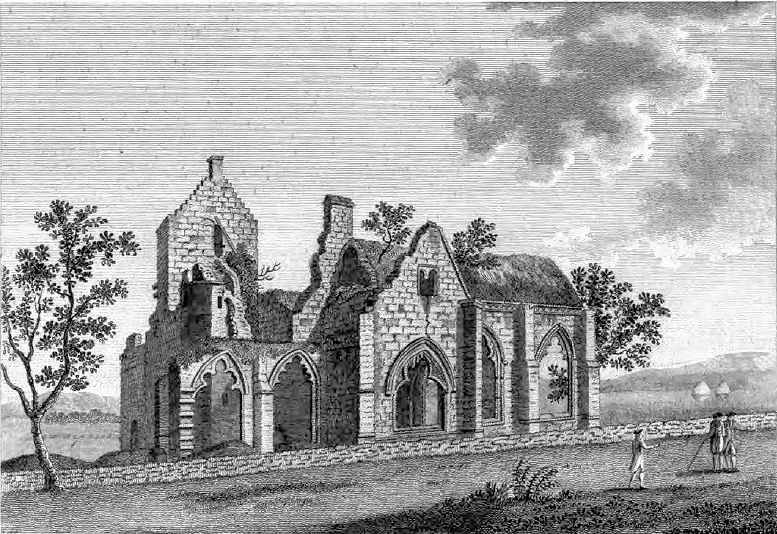
Kirkpatrick Durham (Scottish Gaelic: Cill Phàdraig) is a village and parish in the historical county of Kirkcudbrightshire, Dumfries and Galloway, south-west Scotland. It is located north of Castle Douglas. History An old church dedicated to St Patrick gives the first element of the name: Kirk Patrick. The name Durham indicates barren land and distinguishes the village from another Kirkpatrick in the area. The village lay in the parish of Kilpatrick and was developed from 1785 by Rev David Lamont on his own ground and named Kirkpatrick Durham operating as a handloom weaving centre. The present church was built in 1850 by Dumfries-based architect Walter Newall.Colvin, Howard, (1978) ''A Biographical Dictionary of British Architects, 1600–1840'', John Murray, pp.697-699 Notable residents * William MacMorine born here in 1756. Served as Moderator of the General Assembly of the Church of Scotland in 1812. * David Lamont was minister of the parish from 1774 to 1837 and served a ... [...More Info...] [...Related Items...] OR: [Wikipedia] [Google] [Baidu] |
.jpg)


