|
Kirkcudbrightshire
Kirkcudbrightshire ( ) or the County of Kirkcudbright or the Stewartry of Kirkcudbright is one of the Counties of Scotland, historic counties of Scotland, covering an area in the south-west of the country. Until 1975, Kirkcudbrightshire was an counties of Scotland, administrative county used for local government in Scotland, local government. Since 1975, the area has formed part of Dumfries and Galloway for local government purposes. Kirkcudbrightshire continues to be used as a registration county for land registration. A lower-tier districts of Scotland, district called Stewartry covered the majority of the historic county from 1975 to 1996. The area of Stewartry district is still used as a lieutenancy areas of Scotland, lieutenancy area. Dumfries and Galloway Council also has a Stewartry area committee. Kirkcudbrightshire forms the eastern part of the medieval lordship of Galloway, which retained a degree of autonomy until it was fully absorbed by Scotland in the 13th century. ... [...More Info...] [...Related Items...] OR: [Wikipedia] [Google] [Baidu] |
Dumfries And Galloway
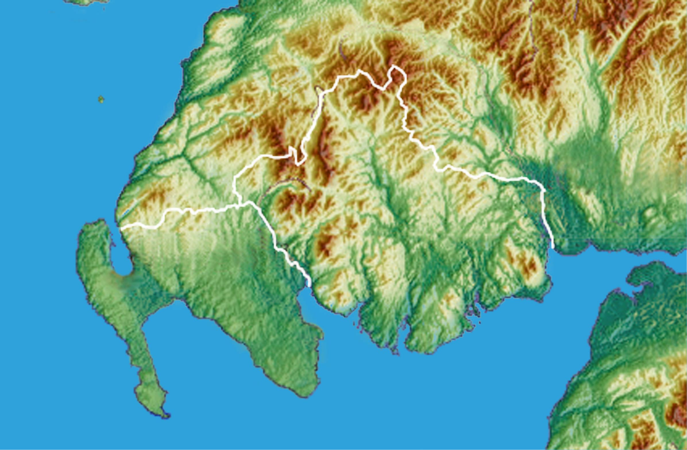
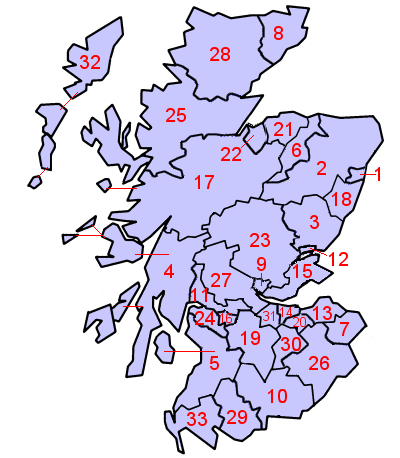
Dumfries and Galloway (; ) is one of the 32 unitary council areas of Scotland, located in the western part of the Southern Uplands. It is bordered by East Ayrshire, South Ayrshire, and South Lanarkshire to the north; Scottish Borders to the north-east; the English county of Cumbria, the Solway Firth, and the Irish Sea to the south, and the North Channel (Great Britain and Ireland), North Channel to the west. The administrative centre and largest settlement is the town of Dumfries. The second largest town is Stranraer, located to the west of Dumfries on the North Channel coast. Dumfries and Galloway corresponds to the counties of Scotland, historic shires of Dumfriesshire, Kirkcudbrightshire, and Wigtownshire, the last two of which are collectively known as Galloway. The three counties were combined in 1975 to form a single regions and districts of Scotland, region, with four districts within it. The districts were abolished in 1996, since when Dumfries and Galloway has been a ... [...More Info...] [...Related Items...] OR: [Wikipedia] [Google] [Baidu] |
Kirkcudbright
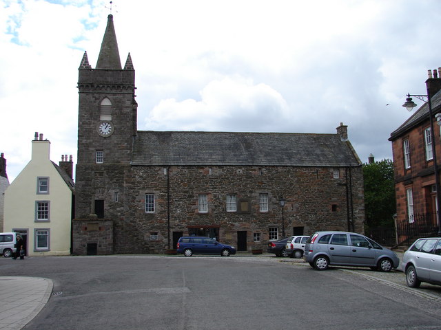
Kirkcudbright ( ; ) is a town at the mouth of the River Dee, Galloway, River Dee in Dumfries and Galloway, Scotland, southwest of Castle Douglas and Dalbeattie. A former royal burgh, it is the traditional county town of Kirkcudbrightshire. History An early rendition of the name of the town was Kilcudbrit; this derives from the Scottish Gaelic, Gaelic ''Cille Chuithbeirt'' meaning "chapel of Cuthbert", the saint whose mortal remains were kept at the town between their exhumation at Lindisfarne and reinterment at Chester-le-Street. John Spottiswoode, in his account of religious houses in Scotland, mentions that the Franciscans, or Grey Friars, had been established at Kirkcudbright from the 12th century. John I de Balliol, John Balliol was in possession of the ancient castle at Castledykes in the late 13th century and Edward I of England is said to have stayed here in 1300 during his war against Scotland. In 1455 Kirkcudbright became a royal burgh. About a century later, the mag ... [...More Info...] [...Related Items...] OR: [Wikipedia] [Google] [Baidu] |
Stewartry
Stewartry was a local government district from 1975 until 1996 within the Dumfries and Galloway region in south-west Scotland. Under the name the Stewartry of Kirkcudbright the area of the former district is still used as a lieutenancy area. Dumfries and Galloway Council has a Stewartry area committee which approximately covers the same area, subject to some adjustments where ward boundaries no longer follow the pre-1996 district boundary. The Stewartry covers the majority of the historic county of Kirkcudbrightshire, and derives its name from the county's alternative name of "The Stewartry of Kirkcudbright". History Stewartry district was created on 16 May 1975 under the Local Government (Scotland) Act 1973, which established a two-tier structure of local government across Scotland comprising upper-tier regions and lower-tier districts. Stewartry district was one of four districts created within the region of Dumfries and Galloway. The district covered the majority of the form ... [...More Info...] [...Related Items...] OR: [Wikipedia] [Google] [Baidu] |
Galloway
Galloway ( ; ; ) is a region in southwestern Scotland comprising the counties of Scotland, historic counties of Wigtownshire and Kirkcudbrightshire. It is administered as part of the council areas of Scotland, council area of Dumfries and Galloway. Galloway is bounded by sea to the west and south, the Galloway Hills to the north, and the River Nith to the east; the border between Kirkcudbrightshire and Wigtownshire is marked by the River Cree. The definition has, however, fluctuated greatly in size over history. A native or inhabitant of Galloway is called a Gallovidian. The region takes its name from the ''Gall-Gàidheil'', or "stranger Gaels", Norse–Gaels, a people of mixed Gaelic and Norse descent who seem to have settled here in the 10th century. Galloway remained a Gàidhealtachd area for much longer than other regions of the Scottish Lowlands and a Galwegian Gaelic, distinct local dialect of the Scottish Gaelic language survived into at least the 18th century. A hardy ... [...More Info...] [...Related Items...] OR: [Wikipedia] [Google] [Baidu] |
Wigtownshire
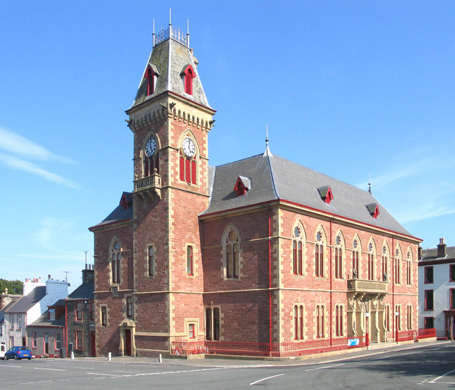
Wigtownshire or the County of Wigtown (, ) is one of the Counties of Scotland, historic counties of Scotland, covering an area in the south-west of the country. Until 1975, Wigtownshire was an counties of Scotland, administrative county used for local government in Scotland, local government. Since 1975 the area has formed part of Dumfries and Galloway for local government purposes. Wigtownshire continues to be used as a territory for land registration, being a registration county. The historic county is all within the slightly larger Wigtown Area, which is one of the lieutenancy areas of Scotland and was used in local government as the Wigtown Districts of Scotland, District from 1975 to 1996. Wigtownshire forms the western part of the medieval lordship of Galloway, which retained a degree of autonomy until it was fully absorbed by Scotland in the 13th century. In 1369, the part of Galloway east of the River Cree was placed under the control of a steward and so became known as t ... [...More Info...] [...Related Items...] OR: [Wikipedia] [Google] [Baidu] |
Counties Of Scotland
The counties or shires of Scotland () were historic subdivisions of Scotland. The shires were originally established in the Middle Ages for judicial purposes, being territories over which a Sheriff principal, sheriff had jurisdiction. They were distinct from the various older mormaerdoms, earldoms and other territories into which Scotland was also divided, which are collectively termed the provinces of Scotland by modern historians. The provinces gradually lost their functions, whereas the shires gradually gained functions. From the 16th century, the shires served as county constituency, constituencies, electing shire commissioners to the Parliament of Scotland. From 1667 each shire had Commissioners of Supply, commissioners of supply responsible for collecting local taxes; the commissioners of supply were subsequently given various local government functions as well. From 1797, the shires also served as areas for organising the militia, which was the responsibility of a lord-li ... [...More Info...] [...Related Items...] OR: [Wikipedia] [Google] [Baidu] |
Threave Castle
Threave Castle is situated on an island in the River Dee, west of Castle Douglas in the historical county of Kirkcudbrightshire in the Dumfries and Galloway region of Scotland. Built in the 1370s by Archibald the Grim, it was a stronghold of the "Black Douglases", Earls of Douglas and Lords of Galloway, until their fall in 1455. For part of this time, the castle and the lordship of Galloway were controlled by Princess Margaret, daughter of Robert III and widow of Archibald Douglas, 4th Earl of Douglas Archibald Douglas, 4th Earl of Douglas, Duke of Touraine (c. 1369 – 17 August 1424), was a Scotland, Scottish nobleman and warlord. He is sometimes given the epithet "Tyneman" (Old Scots: Loser), but this may be a reference to his great- .... In 1449 Threave was regained by William Douglas, 8th Earl of Douglas, Scotland's most powerful magnate, who controlled extensive lands and numerous castles. He fortified Threave with an "artillery house", a sophisticated defe ... [...More Info...] [...Related Items...] OR: [Wikipedia] [Google] [Baidu] |
Novantae
The Novantae were people of the Iron age, as recorded in Ptolemy's ''Geography'' (written c. 150AD). The Novantae are thought to have lived in what is now Galloway and Carrick, in southwesternmost Scotland. While the Novantae are assumed to be Celts, their specific ethnicity and culture have been the subject of debate for centuries. While Bede referred to a people called ''the Niduarian'' and suggested these were Picts, the Encyclopædia Britannica (11th ed.) described them as ''"a tribe of Celtic Gaels called Novantae or Atecott Picts."'' Scottish author Edward Grant Ries has identified the Novantae (along with other early tribes of southern Scotland) as a Brythonic-speaking culture. Modern archeological excavations at Rispain Camp, near Whithorn, suggest that a large fortified farmstead was occupied between 100 BC and 200 AD, indicating that the people living in the area at that time were engaged in agriculture. More recently, the name "Novantae" has been used by a group ... [...More Info...] [...Related Items...] OR: [Wikipedia] [Google] [Baidu] |
Dumfriesshire
Dumfriesshire or the County of Dumfries or Shire of Dumfries () is a Counties of Scotland, historic county and registration county in southern Scotland. The Dumfries lieutenancy areas of Scotland, lieutenancy area covers a similar area to the historic county. In terms of historic counties it borders Kirkcudbrightshire to the west, Ayrshire to the north-west, Lanarkshire, Peeblesshire and Selkirkshire to the north, and Roxburghshire to the east. To the south is the coast of the Solway Firth, and on the other side of the border between Scotland and England the England, English county of Cumberland. Dumfriesshire has three traditional subdivisions, based on the three main valleys in the county: Annandale, Dumfries and Galloway, Annandale, Eskdale, Scotland, Eskdale and Nithsdale. These had been independent provinces of Scotland, provinces in medieval times but were gradually superseded as administrative areas by the area controlled by the sheriff principal, sheriff of Dumfries, or ... [...More Info...] [...Related Items...] OR: [Wikipedia] [Google] [Baidu] |
Lieutenancy Areas Of Scotland
The lieutenancy areas of Scotland are the areas used for the ceremonial lord-lieutenants, the British monarch, monarch's representatives, in Scotland. The lord-lieutenants' titles chosen by the British monarch, monarch and his legal advisers are mainly based on placenames of the traditional counties of Scotland. In 1794, permanent lieutenancies were established by Warrant (law), Royal Warrant. By the Militia Act 1797 (37 Geo.3, C.103), the lieutenants appointed "for the Counties, Stewartries, Cities, and Places" were given powers to raise and command County Militia Units. While in their lieutenancies, lord lieutenants are among the few individuals in Scotland officially permitted to fly Royal Banner of Scotland, a banner of the Royal Arms of Scotland, the "Lion Rampant" as it is more commonly known. Lieutenancy areas are different from the current local government of Scotland, local government council areas and their committee areas. They also differ from other subdivisions of Sc ... [...More Info...] [...Related Items...] OR: [Wikipedia] [Google] [Baidu] |


