|
Spital, Derbyshire
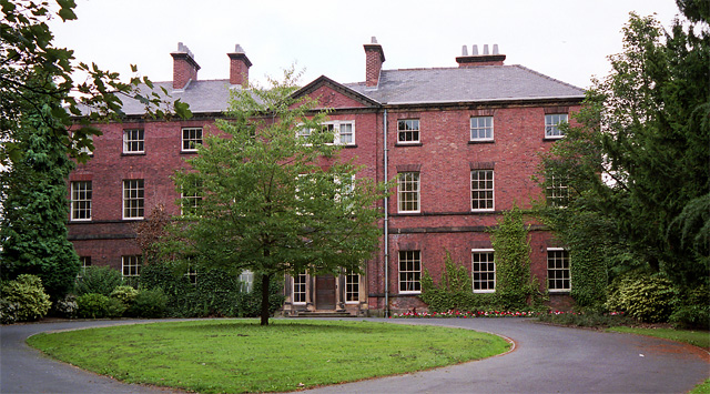
Spital is a suburb of the town of Chesterfield, Derbyshire, Chesterfield in the Borough of Chesterfield, Derbyshire, England. It is situated towards the east of Chesterfield town centre. The main road here is Spital Lane. With new estates being built, businesses include the Co-op, formerly the Spital Pub and Willbond(formally, Spital Tile Co.). Spital also has 2 parks one located at the top of Valley Road the other is along Spital Lane heading towards Calow Lane. Spital also has a cemetery. The Cemetery being one of the oldest walled garden cemeteries in Derbyshire. Spital Cemetery Situated three quarters of a mile from the town centre, Spital Cemetery was in 1857 the first public cemetery to be opened in Chesterfield, Derbyshire, Chesterfield to serve the local communities of Chesterfield and Tapton, Derbyshire, Tapton. The cemetery provides approximately 10.5 acres (4.25 hectares) of burial space. There are two entrances, both off the A632 road at Hady Hill. The lodge at the ... [...More Info...] [...Related Items...] OR: [Wikipedia] [Google] [Baidu] |
Chesterfield, Derbyshire
Chesterfield is a market town, market and industrial town in the county of Derbyshire, England. It is north of Derby and south of Sheffield at the confluence of the River Rother, South Yorkshire, Rivers Rother and River Hipper, Hipper. In 2011, the built-up-area subdivision had a population of 88,483, making it the second-largest settlement in Derbyshire, after Derby. The wider Borough of Chesterfield had a population of 103,569 in the 2021 Census. In 2021, the town itself had a population of 76,402. It has been traced to a transitory Ancient Roman architecture, Roman fort dated to approximately AD 80-100. The name of the later Anglo-Saxons, Anglo-Saxon village comes from the Old English ''ceaster'' (Roman fort) and ''feld'' (pasture). It has a sizeable street market three days a week. The town sits on an old coalfield, but little visual evidence of mining remains since the closure of the final town centre mine nicknamed “The Green Room”. The main landmark is the crooked sp ... [...More Info...] [...Related Items...] OR: [Wikipedia] [Google] [Baidu] |
Borough Of Chesterfield
The Borough of Chesterfield is a non-metropolitan district with borough status in Derbyshire, England. It is named after the town of Chesterfield, its largest settlement, and also contains the town of Staveley and the large village of Brimington. In 2022 it had a population of 104,110. The borough borders the North East Derbyshire district to the north, west and south, and the Bolsover district to the east. History The town of Chesterfield had been an ancient borough. It was reformed to become a municipal borough in 1836 under the Municipal Corporations Act 1835, governed by a corporate body called "the mayor, aldermen and burgesses of the borough of Chesterfield", generally known as the corporation or town council. The modern district was formed on 1 April 1974 under the Local Government Act 1972 as one of nine non-metropolitan districts within Derbyshire. The new district covered the area of two former districts and a single parish from a third, which were all abolished ... [...More Info...] [...Related Items...] OR: [Wikipedia] [Google] [Baidu] |
Derbyshire
Derbyshire ( ) is a ceremonial county in the East Midlands of England. It borders Greater Manchester, West Yorkshire, and South Yorkshire to the north, Nottinghamshire to the east, Leicestershire to the south-east, Staffordshire to the south and west, and Cheshire to the west. Derby is the largest settlement, and Matlock is the county town. The county has an area of and a population of 1,053,316. The east of the county is more densely populated than the west, and contains the county's largest settlements: Derby (261,400), Chesterfield (88,483), and Swadlincote (45,000). For local government purposes Derbyshire comprises a non-metropolitan county, with eight districts, and the Derby unitary authority area. The East Midlands Combined County Authority includes Derbyshire County Council and Derby City Council. The north and centre of Derbyshire are hilly and contain the southern end of the Pennines, most of which are part of the Peak District National Park. They include Kinde ... [...More Info...] [...Related Items...] OR: [Wikipedia] [Google] [Baidu] |
Parks
A park is an area of natural, semi-natural or planted space set aside for human enjoyment and recreation or for the protection of wildlife or natural habitats. Urban parks are green spaces set aside for recreation inside towns and cities. National parks and country parks are green spaces used for recreation in the countryside. State parks and provincial parks are administered by sub-national government states and agencies. Parks may consist of grassy areas, rocks, soil and trees, but may also contain buildings and other artifacts such as monuments, fountains or playground structures. Many parks have fields for playing sports such as baseball and football, and paved areas for games such as basketball. Many parks have trails for walking, biking and other activities. Some parks are built adjacent to bodies of water or watercourses and may comprise a beach or boat dock area. Urban parks often have benches for sitting and may contain picnic tables and barbecue grills. The large ... [...More Info...] [...Related Items...] OR: [Wikipedia] [Google] [Baidu] |
Cemetery
A cemetery, burial ground, gravesite, graveyard, or a green space called a memorial park or memorial garden, is a place where the remains of many death, dead people are burial, buried or otherwise entombed. The word ''cemetery'' (from Greek language, Greek ) implies that the land is specifically designated as a burial ground and originally applied to the Ancient Rome, Roman catacombs. The term ''graveyard'' is often used interchangeably with cemetery, but a graveyard primarily refers to a burial ground within a churchyard. The intact or cremated remains of people may be interred in a grave, commonly referred to as burial, or in a tomb, an "above-ground grave" (resembling a sarcophagus), a mausoleum, a columbarium, a niche, or another edifice. In Western world, Western cultures, funeral ceremonies are often observed in cemeteries. These ceremonies or rites of passage differ according to culture, cultural practices and religion, religious beliefs. Modern cemeteries often inclu ... [...More Info...] [...Related Items...] OR: [Wikipedia] [Google] [Baidu] |
Spital - Cemetery Chapel - From West
Spital or Spittal may refer to: Places Austria *Spital (Weitra), a hamlet in the Waldviertel, Lower Austria, notable for being the origin of some of Adolf Hitler's family * Spital am Pyhrn, a municipality in Upper Austria *Spital am Semmering, a municipality in Styria, in the southeast * , a hamlet of the municipality of Schäffern in Styria, in the southeast *Spittal an der Drau, a town in Carinthia, in the southwest * Bezirk Spittal an der Drau, an administrative district (''Bezirk'') in the state of Carinthia, whose main city is Spittal an der Drau Bermuda * Spittal Pond Nature Reserve United Kingdom England * Spital, Berkshire, a part of Windsor *Spital, Derbyshire, part of Chesterfield * Spittal, East Riding of Yorkshire, a location *Spitalfields, an area in London *Spital-in-the-Street, a hamlet in Lincolnshire * Spital, Merseyside, on the Wirral Peninsula ** Spital railway station *Spittal, Northumberland, a seaside resort *Spital, Tamworth, a Ward of Tamworth Borough ... [...More Info...] [...Related Items...] OR: [Wikipedia] [Google] [Baidu] |
Tapton, Derbyshire
Tapton is a suburb of Chesterfield, in the county of Derbyshire, England. It is located along the Brimington Road B6543, between Chesterfield town centre, and Brimington (where the population is included in the Brimington South Ward). It became a suburb of Chesterfield in the 1920s. The buildings along Brimington road, which runs through the centre of Tapton, are testament to this fact. Consisting of semi-detached houses in a style typical of the 20s and 30s. The district is also home to Tapton House, in Tapton Woods, the woods being the former grounds of the house, now a Municipal park. Tapton Lock Visitor Centre is located on the Chesterfield Canal to the north of Tapton Park. History Located in the grounds of the House, is a large mound or hill, once the moat, of Chesterfield Castle or Tapton Castle as it was sometimes also known. The castle at least dates as far back as the Norman Conquest and later fell into the hands of the Crown, becoming a Crown Fortress. During t ... [...More Info...] [...Related Items...] OR: [Wikipedia] [Google] [Baidu] |
England
England is a Countries of the United Kingdom, country that is part of the United Kingdom. It is located on the island of Great Britain, of which it covers about 62%, and List of islands of England, more than 100 smaller adjacent islands. It shares Anglo-Scottish border, a land border with Scotland to the north and England–Wales border, another land border with Wales to the west, and is otherwise surrounded by the North Sea to the east, the English Channel to the south, the Celtic Sea to the south-west, and the Irish Sea to the west. Continental Europe lies to the south-east, and Ireland to the west. At the 2021 United Kingdom census, 2021 census, the population was 56,490,048. London is both List of urban areas in the United Kingdom, the largest city and the Capital city, capital. The area now called England was first inhabited by modern humans during the Upper Paleolithic. It takes its name from the Angles (tribe), Angles, a Germanic peoples, Germanic tribe who settled du ... [...More Info...] [...Related Items...] OR: [Wikipedia] [Google] [Baidu] |
Wales
Wales ( ) is a Countries of the United Kingdom, country that is part of the United Kingdom. It is bordered by the Irish Sea to the north and west, England to the England–Wales border, east, the Bristol Channel to the south, and the Celtic Sea to the south-west. , it had a population of 3.2 million. It has a total area of and over of Coastline of Wales, coastline. It is largely mountainous with its higher peaks in the north and central areas, including Snowdon (), its highest summit. The country lies within the Temperate climate, north temperate zone and has a changeable, Oceanic climate, maritime climate. Its capital and largest city is Cardiff. A distinct Culture of Wales, Welsh culture emerged among the Celtic Britons after the End of Roman rule in Britain, Roman withdrawal from Britain in the 5th century, and Wales was briefly united under Gruffudd ap Llywelyn in 1055. After over 200 years of war, the Conquest of Wales by Edward I, conquest of Wales by King Edward I o ... [...More Info...] [...Related Items...] OR: [Wikipedia] [Google] [Baidu] |


